Community group Buxton Town Team have drafted the first sustainable travel plan for the High Peak spa town, including proposed actions on accessibility and movement through the town by walking, cycling, cars and goods vehicles.
The document can be viewed at their Buxton on the Move page, or directly as a PDF here, and the group are keen to collect residents and visitors views on what should be a priority going forward.
Consultation links are included in the document at the end of each section, but for ease here are the links:
- Sections 1 and 2: Accessibility and Inclusion, Movement Through the Town
- Section 3: Active Travel – Walking and Cycling
- Sections 4, 5 and 6: Travel to School, Cars and Car Parking
- Section 7: Public Transport
- Sections 8, 9 and 10: Goods Deliveries, Electric Vehicles and Ongoing Awareness Raising
It’s well worth providing input into an endeavour like this to ensure it really focuses on important, progressive ideas to make a difference to how people can move around a town like Buxton.
Despite sitting in its well-known “bowl” of the landscape, Buxton appears quite a self-sufficient town for everyday life which a good range of shops, services, leisure and work. While the centre does still suffer from heavy through motor traffic, it’s likely that a lot of residents still make unnecessary, short car journeys around this relatively compact town. And then there are the day-trippers driving right into the centre to park or right through, to the Peak District.
Looking at Buxton’s cycle network — or lack of — perhaps it’s hard to blame them. The town recently missed out on funding from the government’s Emergency Active Travel Fund, as Derbyshire County Council (DCC) instead chose to go with a single scheme in Chesterfield.
And while projects for Buxton (including links into the railway station) sit as top priorities on DCC’s list of future Key Cycle Network schemes, there’s no public record of any progress being made on these.
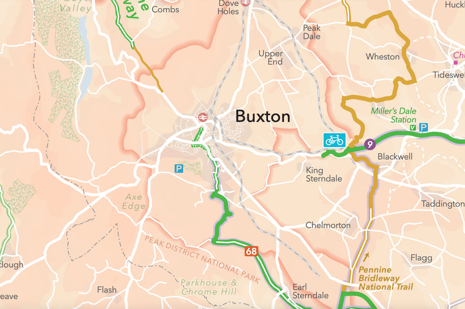
Well done to Buxton Town Team, then, for taking the matter into their own hands. For cycling, they also previously published a map of blue-sky proposals for potential cycle routes around the town as a “safer walk and ride network”.
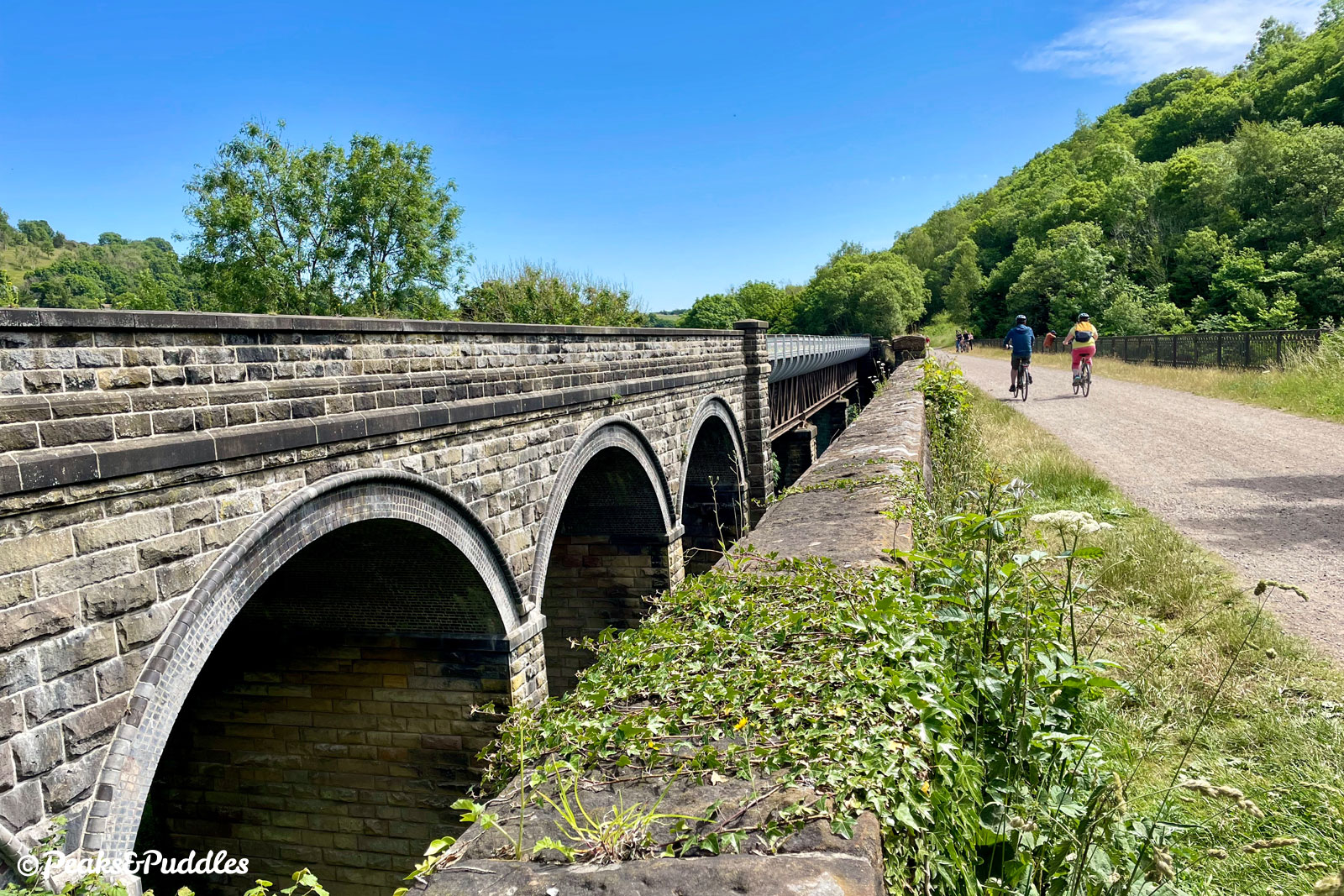
The latest development in that work is a consultation on the potential for new routes between Buxton and Matlock. The thinking on this seems to be partly as a “back up plan” in case the Monsal Trail is re-opened as a railway, but also to relieve pressure on that very route, which can be so busy to be almost unusable on peak weekends.
But, perhaps, a better priority might just be to push to at least get the actual existing trail connected into Buxton, something else DCC have failed to achieve in over a decade, which would make any re-opening as a railway so incredibly unlikely that it doesn’t even need to be worried about.
At the same time, while Buxton does have incredibly poor access out to the leisure trails on its fringes, what it really needs to get anywhere with “sustainable travel” is at least a core spine of safer cycling routes around the town itself, and better priority for pedestrians.
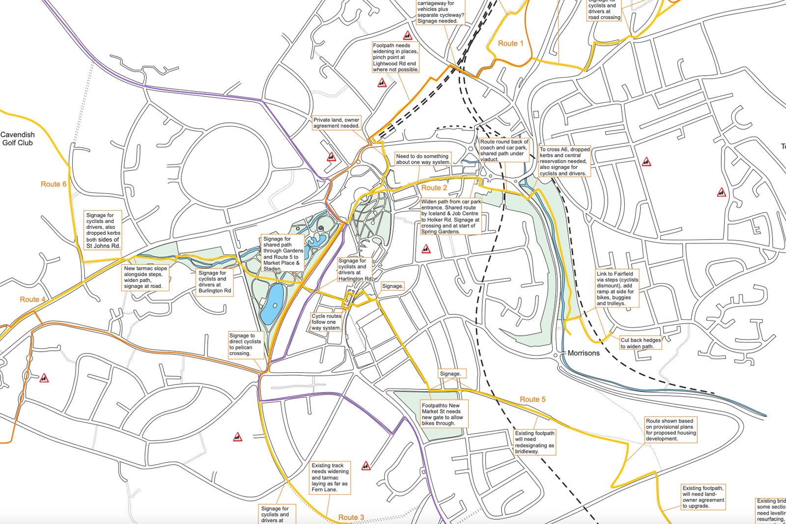
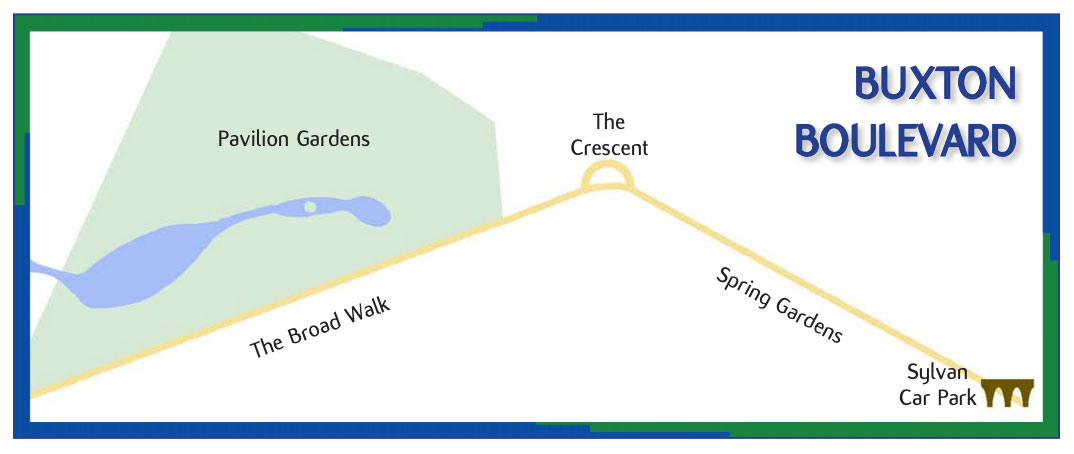
A key proposal in the “On the Move” draft is for a “Buxton Boulevard”, a largely uninterrupted liner route across the town through the Spring Gardens shopping area, past the recently re-opened Crescent and alongside Pavilion Gardens. This is a good idea on paper, but could present issues as a shared space, particularly through the busy shopping area.
The plan is realistic, however, that most of Buxton’s roads are too narrow for separate protected cycle lanes and that shared paths may prove the only option. Yet it might be beneficial to look more at the types of schemes being promoted by Greater Manchester’s hyper-local WalkRide groups. In a built-up area, having 20mph limits, filtered streets, “active” neighbourhoods and new crossings are just as important to help people walk and cycle more.
Amongst a rich selection of proposals, the draft does also have ideas for park and ride sites, e-cargo bikes for last mile deliveries, cycle parking, an “onward travel hub” created around the railway station and working closely with schools. Do take a look and give them your thoughts on what should be prioritised.