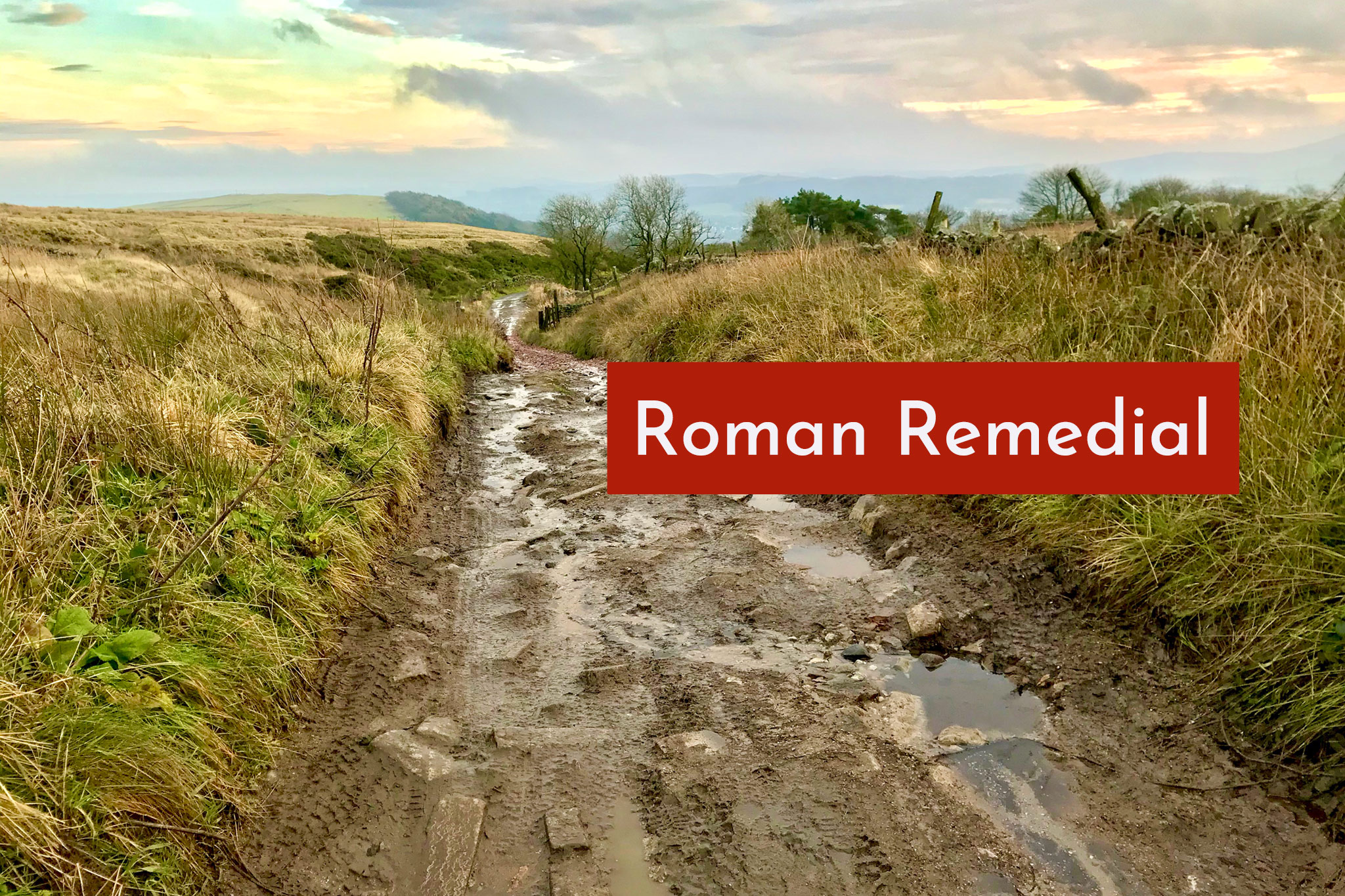
The old Roman Road around Combs Moss north of Buxton will be closed for up to two months to improve a notoriously deteriorated section of the signposted Pennine Cycleway and Midshires Way.
Derbyshire County Council has filed a path closure order for Buxton BOAT 28, the old Roman Road which runs higher (and of course, straighter) up above the A5004 Long Hill.
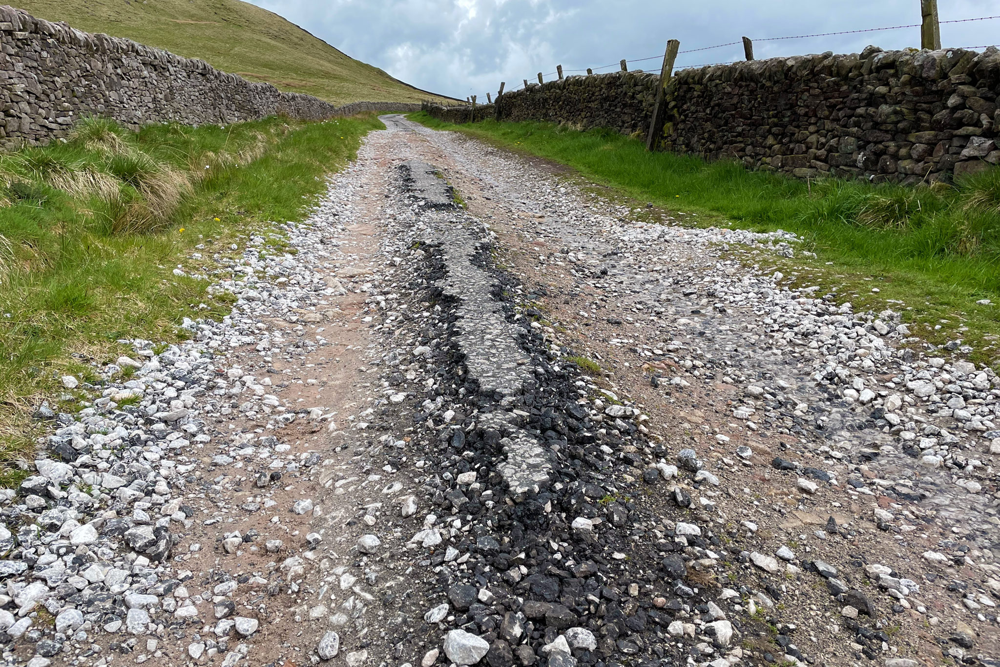
“Maintenance and improvement” work will be carried out on the sharp hill from the summit down to Brookfield Cottage, which has been severely damaged and eroded over the past decade or more. Even if Sustrans have now delisted this part of the signposted NCN 68 ‘Pennine Cycleway’, it’s regularly an unwelcome surprise for people still attempting the route and Derbyshire continues to suggest it as part of their key cycle network.
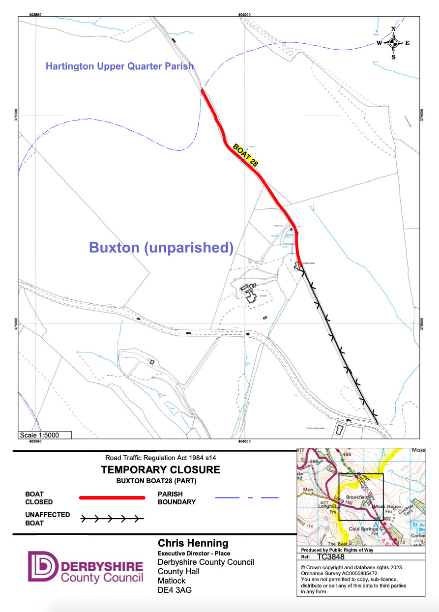
The closure will be from 4th March to 3rd June 2024, but may end sooner if works are completed. The notice says access will be reasonably maintained whenever possible, but there’s no official diversion route (nor an easy suggestion — the other side of Combs to Dove Holes, or avoid Buxton altogether and head up the Goyt Valley and over Axe Edge).
Funding for the work comes from a Safer Roads Fund grant for the A5004 Long Hill, with one of the council’s aims being to improve options for cycling and walking. The proposals were consulted on over a year ago with no news since, so it’s good to see something actually going ahead.
Although, with Derbyshire’s usual lack of communication, there’s nothing public to say what these works will actually entail. I’m sure I’d read somewhere the repair will be of a looser gravel type, which wouldn’t bode well for longevity given the incline and off-road motoring encouraged by the BOAT status, but we’ll see.
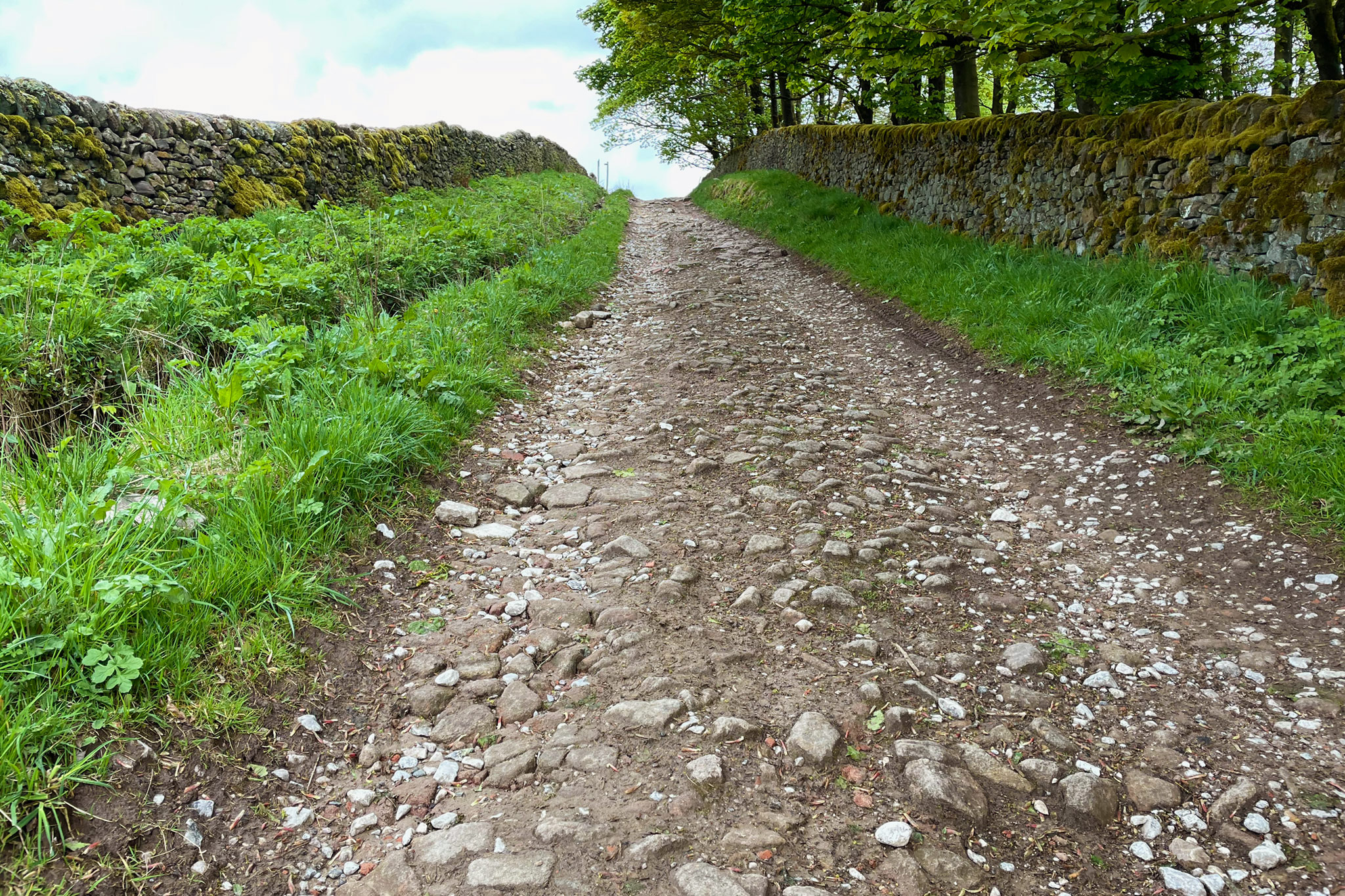
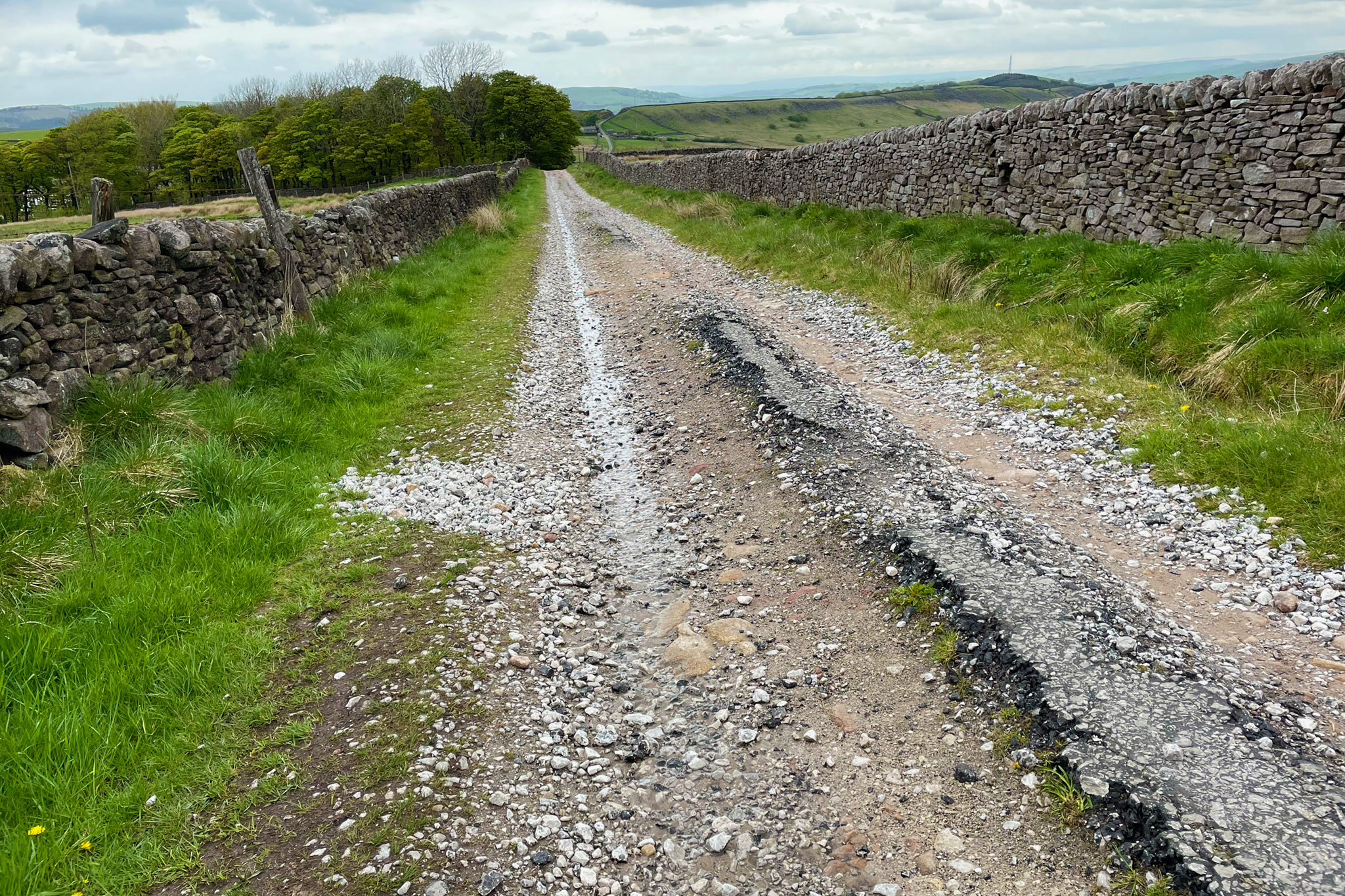
With the Safer Roads Fund aim presumably being to provide a general-use cycle route, just focusing on this section isn’t enough. The sharp climb up from the White Hall Centre further north has degraded over the past decade, from generally rideable to large, loose stones. Over the top, now only a tiny bit of tarmac from a past life remains — sometimes just a few centimetres in the middle.
Last year’s consultation plans showed the whole route with a red dashed line to indicate “maintenance work proposed to assist safe passage for cyclists”.
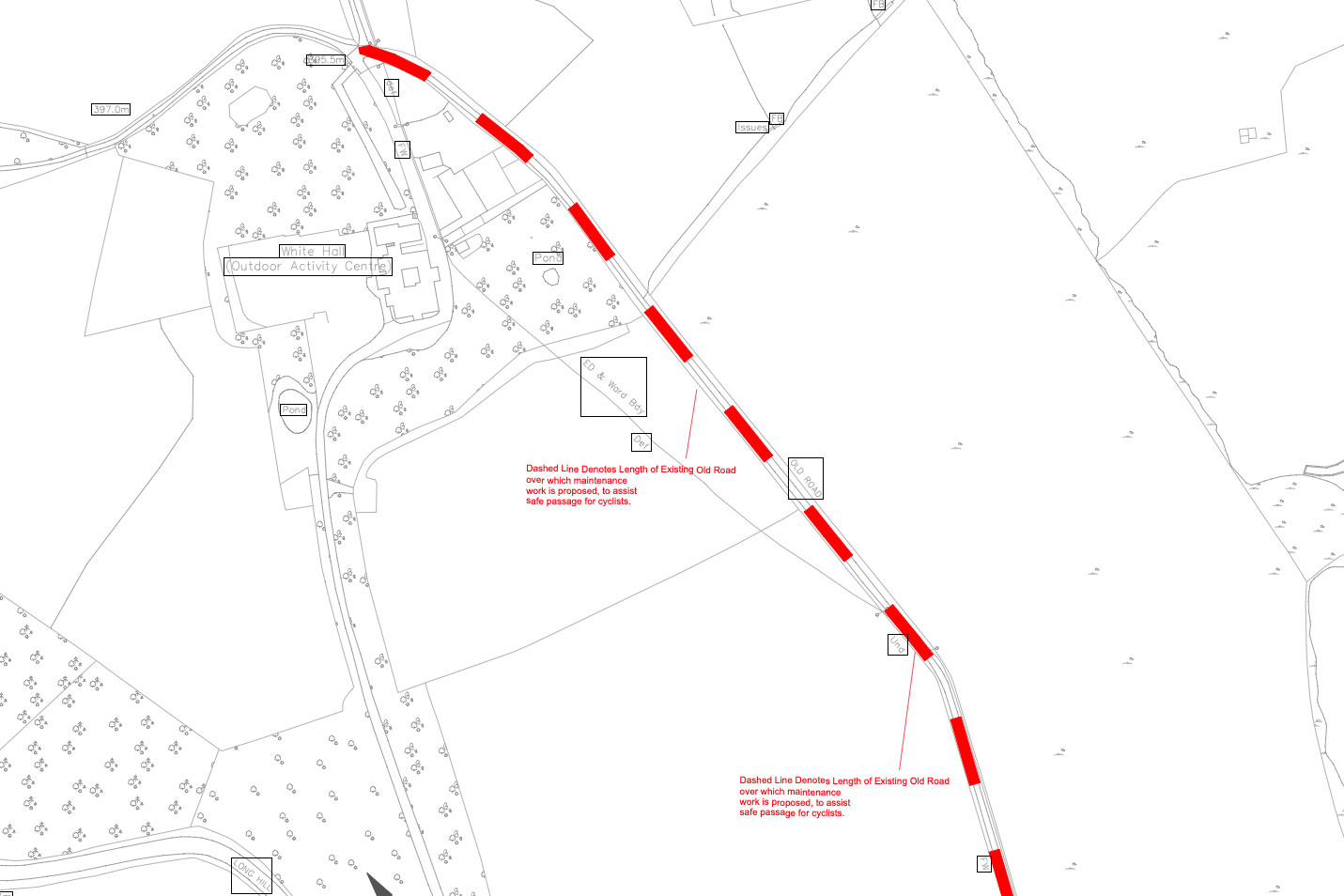
On one hand, and at the risk of upsetting those who think this route should be left to decay for a bit of bumpy fun, I say hopefully that will happen*. On the other, as I said at the time, there’s a question over how this would affect the track’s use as a Byway Open to All Traffic.
Would a smoother route encourage more drivers trying it for fun, or actually turn away the off-roaders seeking thrills, leading to more peace for everyone else? Solutions (unlikely to happen) would be to downgrade to a restricted byway, and/or install a single-point closure to through four-wheeled traffic.
(*It’s maybe also a shame that councils don’t think a little more out of the box for routes like this. So it should be improved, but does the whole 3-4 metre width need resurfacing? Let’s have a bumpy half for mountain biking and an easy half for everyone else! Is that too silly an idea? Maybe not possible while four-wheeled vehicles are still welcome, mind.)
Another part of the project will apparently be to provide a shared use pavement on the A5004 out of Buxton, “on the Manchester Road section”. In the consultation plans, this seemed to abruptly end a good way before the bad right-turn onto this old road.
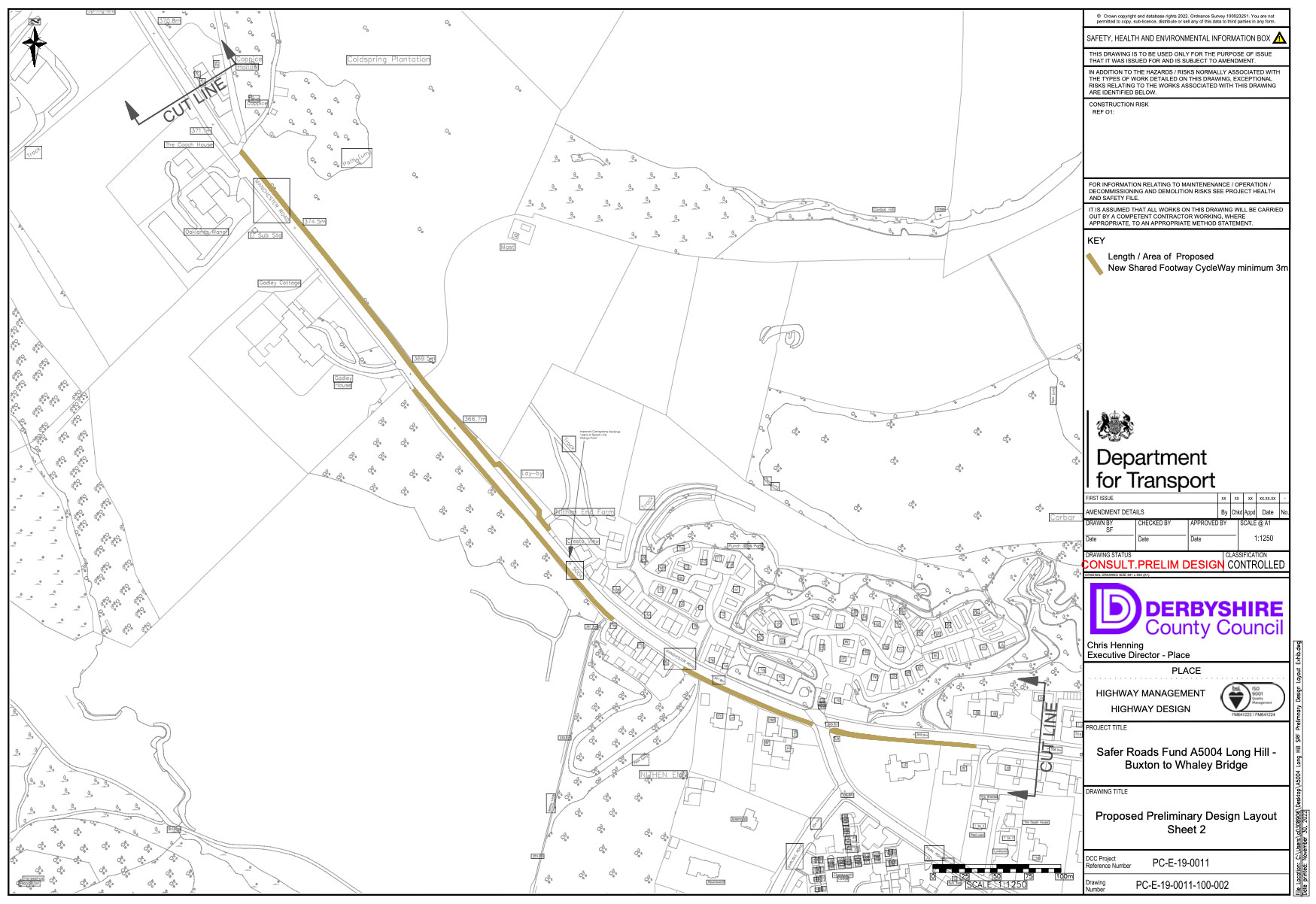
This may be a case of simply doing what they can with the available funding — and it is a very good thing they’re spending on cycling and walking, instead of the original proposal to straighten a bend on Long Hill (while also adding average speed cameras!). But I’m not yet convinced this will make a safe, widely rideable and useful link between Whaley Bridge and Buxton unless these gaps in surface and safety are also closed.
Even then, large parts are on very narrow single track lanes shared with some through traffic. Although Roman-straight and certainly direct, it’s an absolutely leg-busting climb especially north to south. So, is it the best option? Longer term, the Peak Forest Tramway and Dove Holes/A6 corridor would probably make a more sensible general utility cycle route to Buxton; hopefully we will see a little progress with that idea soon.