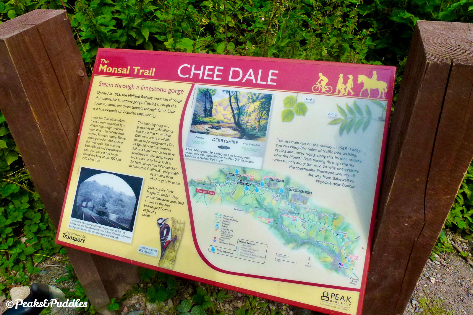
Through limestone hills and across picture-perfect dales, the Monsal Trail is the jewel of Peak District cycling for all the family. Long, atmospheric tunnels and impressive viaducts thread nine miles of the former Midland Railway along the dramatic Wye valley to Millers Dale, Hassop and Bakewell.
Route details
- Distance
 19.2 miles / 30.9 km
 - Elevation Gain
 141 m / 462 ft
 - Time allow 1 hour 45 minutes
- Difficulty
 Gentle
 - Suited to
 All Bikes
  Gravel Bikes
  Mountain Bikes
  Non-Standard Cycles
 - Notes Non-Standard Cycles: must start from Millers Dale, Hassop or Bakewell stations; stage 1 of route description from Wyedale to Blackwell Mill will likely not be accessible, requiring a steep gravel slope to join or leave the main trail.
- Suggested Start SK17 9TE SK 1030 7245
- Places Bakewell, Chee Dale, Cressbrook, Derbyshire, Derbyshire Dales, Great Longstone, Hassop, Litton Mill, Millers Dale, Monsal Dale, Monsal Head, Topley Pike, Wye Dale
- Attributes Bridges, Car parking, Cycle hire, Dales, Family-friendly, Industrial heritage, Museums and visitor centres, National Cycle Network, Out and back, Pubs and cafés, Railways, Reasonably flat, Rivers, Suitable for older kids, Suitable for young kids, Towns and villages, Tunnels, Views of hills and peaks, Views of open countryside, Woodlands and forests
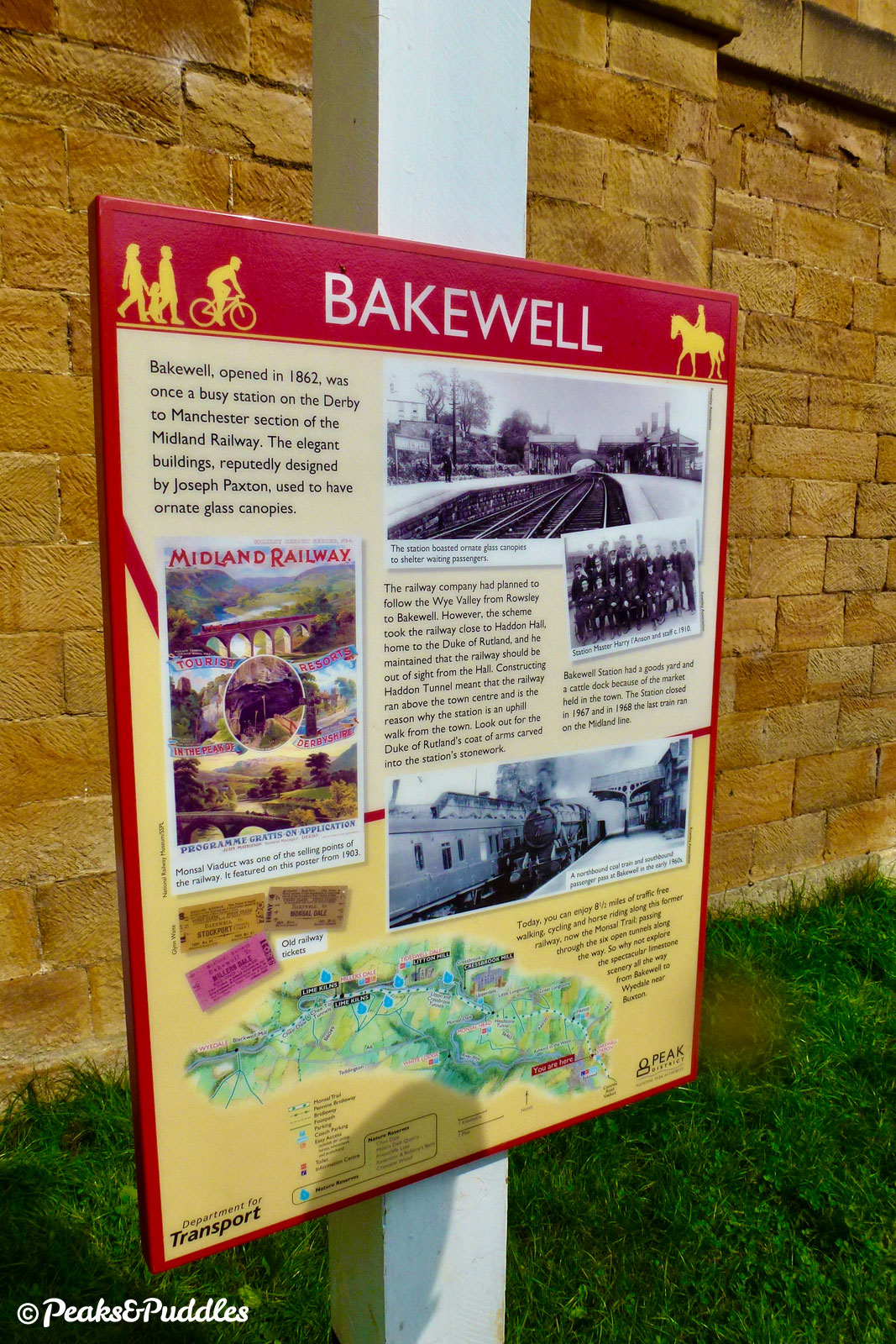
The year was 1863 and all at once, the Peak’s spa town of Buxton was changed forever, welcoming two different railways, leading to two new stations, built by two separate companies. But why?
The long rivalry of the London & North Western Railway and Midland Railway had seen each trying to reach the town first. One from the north, the other from the south. There was, at least, one compromise: both stations were nearly identical, with regal fan windows at their buffer stops designed by Joseph Paxton, famed for the nearby gardens at Chatsworth.
For the Midland Railway, it had been an arduous journey. Desperate to make inroads from Derby towards Manchester, it had subsumed the confidently-titled “Manchester, Buxton, Matlock & Midlands Junction Railway” formed in the 1840s. Using their existing route through Matlock, it eventually pressed ahead with a route cutting inconceivably right through the peaks and dales of the Wye valley, requiring numerous viaducts, difficult limestone cuttings and lengthy tunnels.
The L&NWR’s grip on the landscape north of Buxton meant the Midland’s main line had to veer off soon after Millers Dale, which became an unlikely major hub, with only a branch line connecting to the spa town. The first route into Manchester, via Chinley and New Mills, opened in 1867. Eventually, the Midland’s legendary route spanned from Manchester Central to London St Pancras.
Despite the toil it had taken to build, post-war rationalisation of the railways saw several of the minor stations shuttered before, eventually, the entire line was closed and lifted in 1968. Express trains were largely diverted to the Hope Valley line, while Buxton lost its easy links to the south and Bakewell lost its railway altogether.
Some time later, as it did with the Tissington Trail and High Peak Trail, the Peak District National Park stepped in to take over the trackbed, opening much of it as a walking route from 1981. However, the four longest tunnels remained sealed, with narrow footpaths having to divert steeply over and around them.
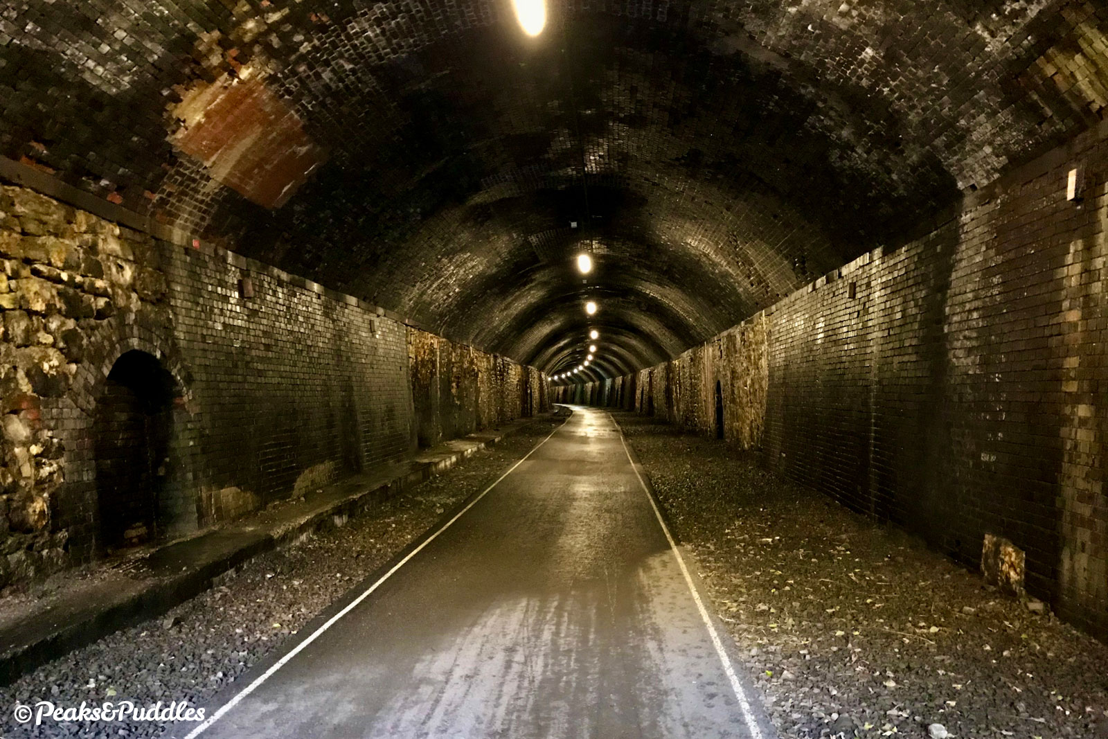
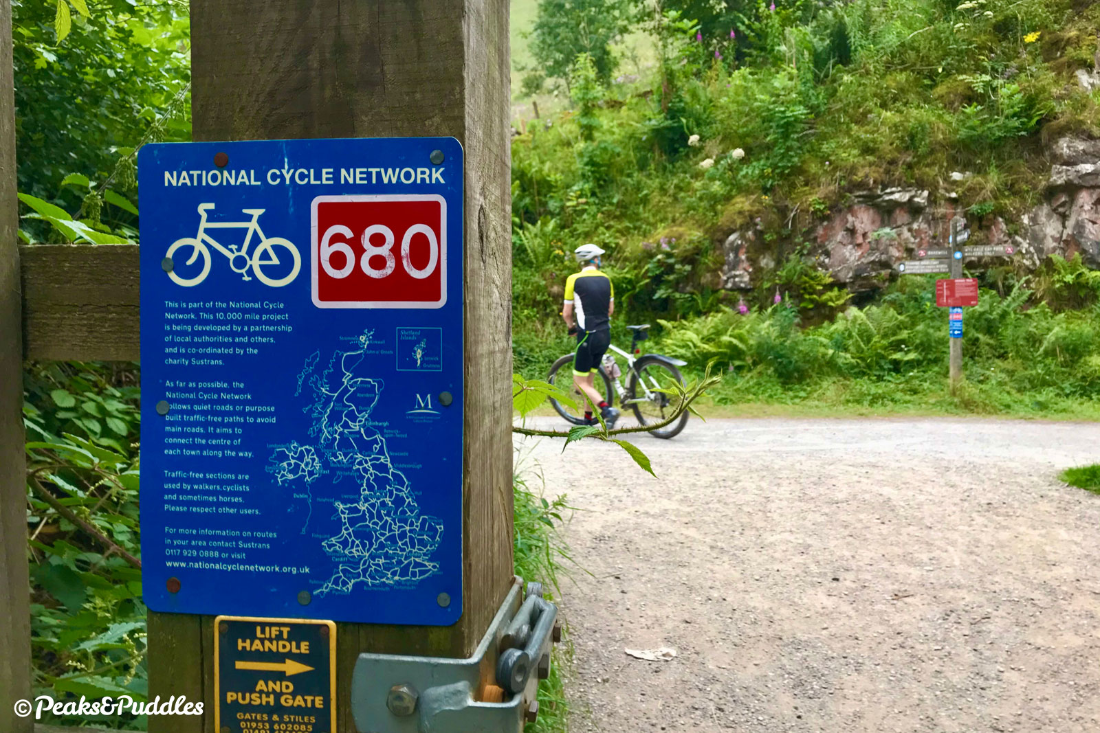
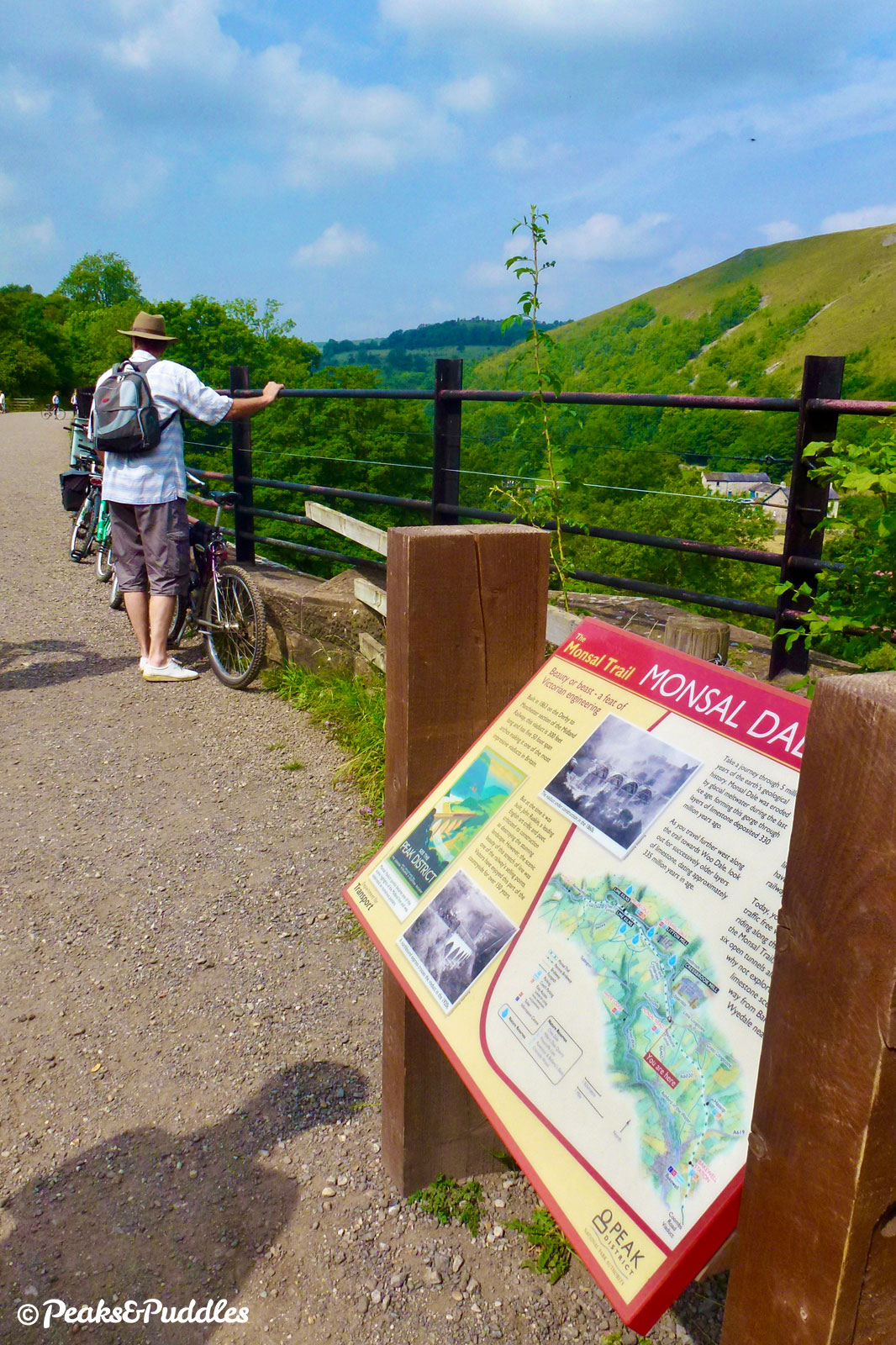
The Monsal Trail therefore enjoyed a relatively quiet existence until May 2011, when a quite extraordinary multi-million pound project by the National Park Authority saw all of its remaining tunnels opened to the public. Suddenly it was possible to walk and ride right the way through the long Headstone, Cressbrook, Litton and Chee Tor tunnels, with lighting provided, creating a near 9 mile (14 km) continuous, level route of world-class beauty.
Today, the trail is an incredibly popular asset for local tourism, recording over 300,000 visits per year. Improvements have continued with the refurbishment of the former Millers Dale station to welcome a café and re-roofing its goods shed to provide an indoor visitor space.
Proposals to link the trail into Buxton at the north and Rowsley in the south haven’t yet been so successful. This leaves the route isolated, hard to get to and somewhat useless in a cycle network sense, besides its run through Bakewell. Pure novelty you might say, but a brilliant novelty all the same.
But for how long? Talk rumbles around every few years of re-opening the line, perhaps somehow running freight trains next to the trail, or re-routing it entirely. The Peak Authority are against it, perhaps surprisingly given it could be a sustainable transport link into the National Park — but at what cost? No train carriage can match the complete 360-degree panorama afforded by a bike for one thing, nor the peace.
“The valley is gone, and the Gods with it; and now, every fool in Buxton can be in Bakewell in half an hour,” Victorian art critic John Ruskin lamented in 1864, about the Headstone Viaduct’s impact on Monsal Dale. What’s left for us today is arguably the payoff: a spectacular, safe, magically level cycle route through limestone dales for everyone to enjoy, that never would have existed otherwise. Now if only every fool in Buxton could actually get to it, by bike alone… imagine that.
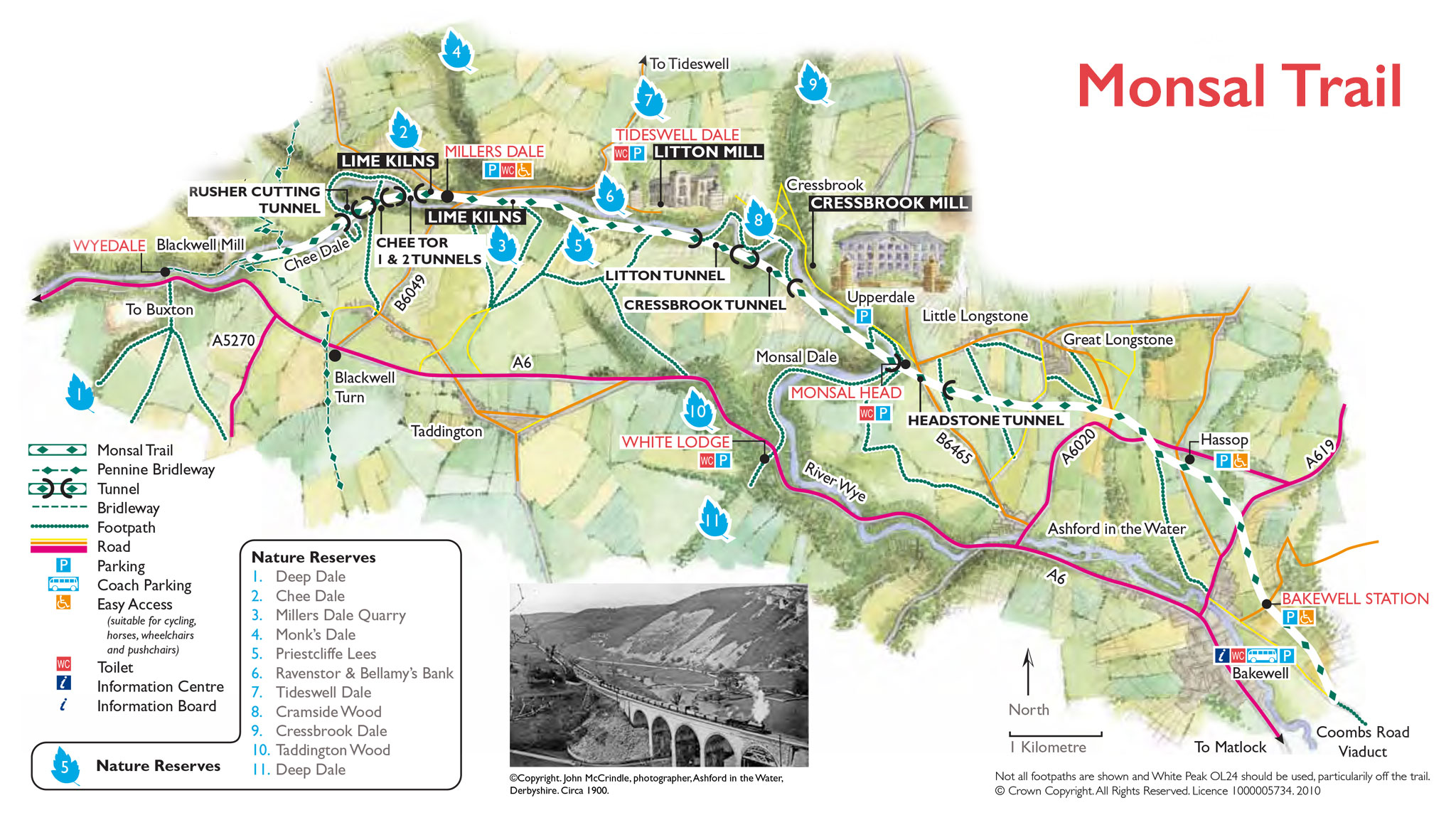
Route map
Where to start
At the Buxton end, the Monsal Trail officially starts some 4 km (2.5 miles) outside the town at Topley Pike, Wye Dale. However, it’s truly only advised to start here if you’re driving in (see below for Monsal Trail car parks): the narrow and twisting A6 at the bottom of the valley is awful for cycling and should be avoided at all costs. There is, shamefully, no good, safe cycle link to Buxton, and no sign of that changing any time soon.
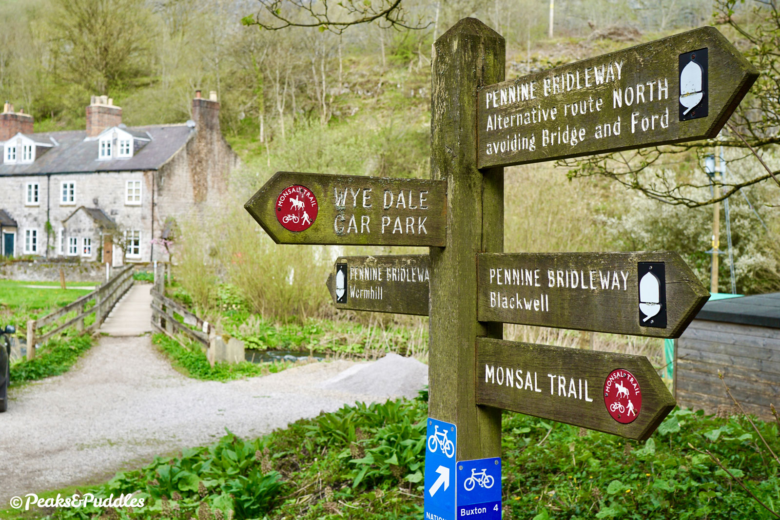
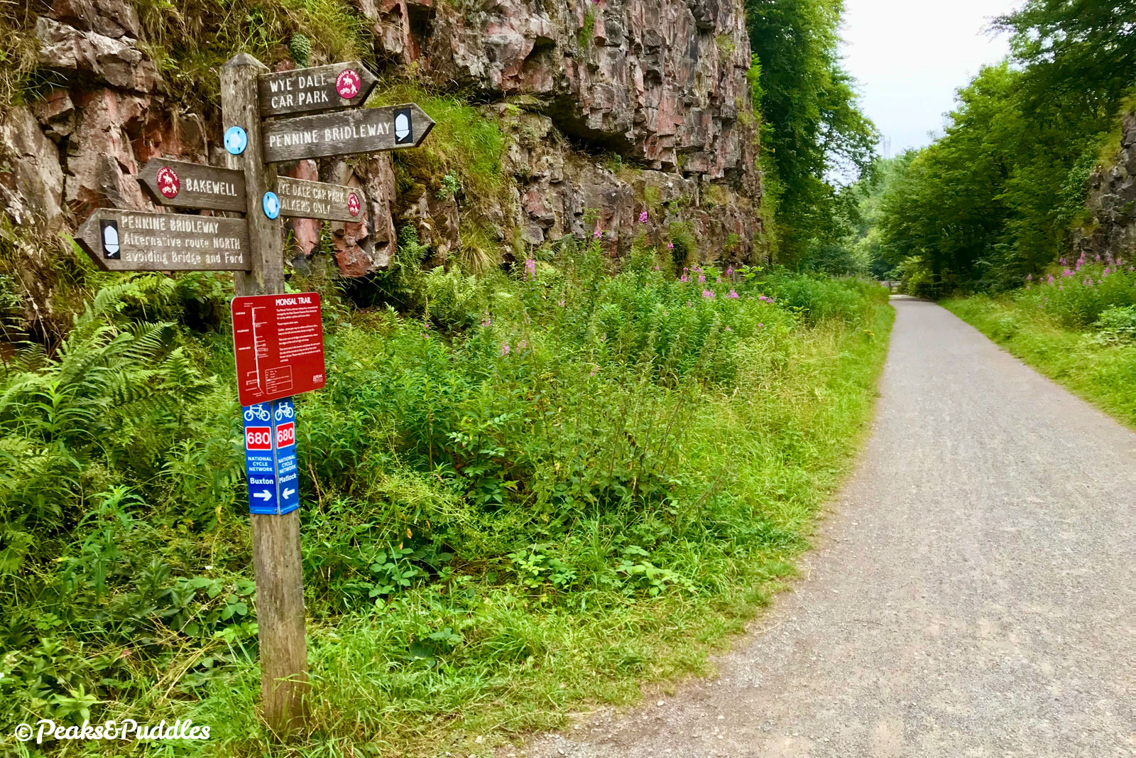
One option for the more adventurous (with a mountain bike and good skills) is the Pennine Bridleway, which drops in via the hillside above Blackwell Mill, just where the actual converted railway trail begins.
Otherwise, for road cycling from the north and west, Millers Dale is the best place to join with Wormhill the route favoured by many. It’s even possible to trace a route almost following the old Midland line from Dove Holes through Peak Dale. Getting back out of the Wye valley again makes it a very strenuous round trip, though.
Hassop is one of the most popular places to start, shrewdly offering car parking, cycle hire, a bookshop and cafe in one. At Bakewell, the former station up a short, quiet hill from the busy town is a great starting point. The lane continuing steeply up past the golf club also leads to and from the Chatsworth Estate.
Further south, Derbyshire County Council have built a new shared path along the heritage railway from Matlock to Rowsley as part of their incomplete White Peak Loop, but this doesn’t yet link seamlessly into the Monsal Trail. The only possible connection is by crossing the A6, turning right into Church Lane and following the lengthy, bumpy bridleway of Park Lane to Coombs Road, where a steep ramp leads up to the current end of the trail.
By train: Nope, none of these here! The nearest station to the west is Buxton over three miles away (and an ambitious ride, see above). It’s possible to link from Matlock, following the White Peak Loop mostly off-road (see above). While Bakewell is served by numerous buses, the only option for the rest of the route is a very infrequent service stopping at Topley Pike (for Wye Dale and Blackwell Mill) and the bottom of Millers Dale.
By car: Given all of the above challenges, it’s no surprise car parks for the Monsal Trail can get very busy, so either avoid weekends altogether or go very early or later the afternoon. (Some are free after 6pm too.) Closest to Buxton is the small Wyedale car park just off the A6 at Topley Pike, followed by the larger Millers Dale car park off the B6049. There’s then a large gap without easy cycle access before Hassop Station, a private cafe, shop and cycle hire centre with its own large pay and display parking. The final, small Peak District car park is at Bakewell station. You can also park at the Bakewell Agricultural Business Centre and access the trail via its very end on Coombs Road (steep ramp).
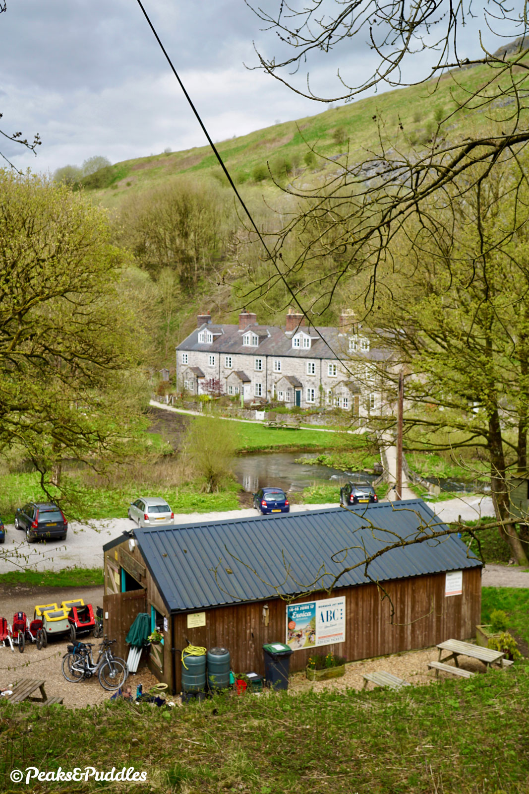
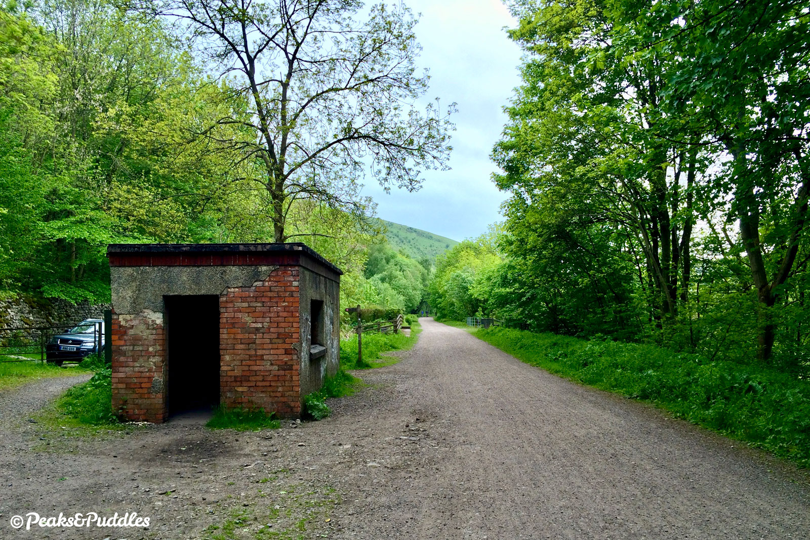
Cycle hire: There’s no official Peak District centre on this trail, but two popular local businesses offering their own bike hire options. Blackwell Mill Cycle Hire is close to Buxton down the narrow lane at Wyedale which begins the trail. Hassop Station is larger but sometimes a rather hectic place to be on summer weekends.
Things to note
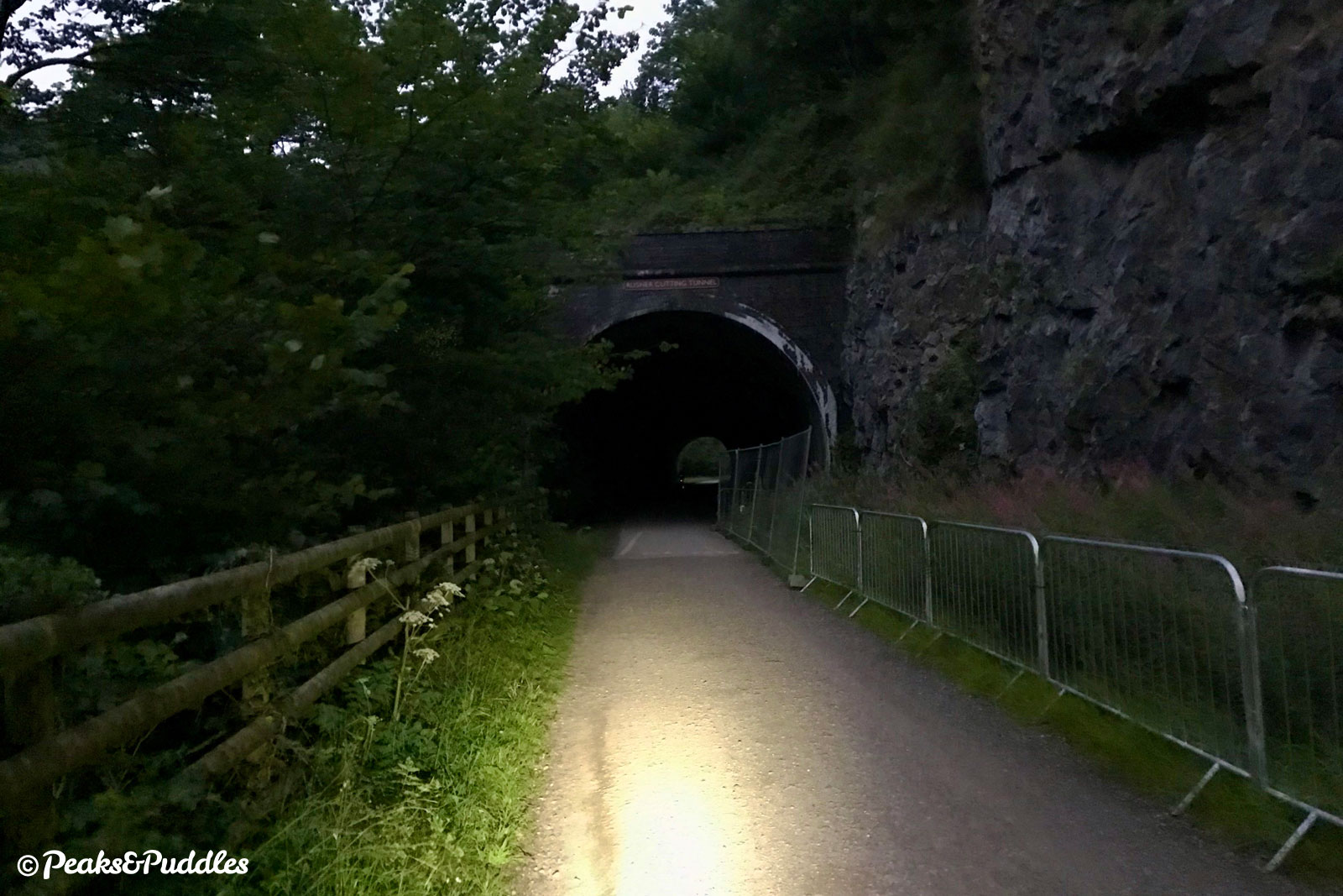
- The four longer (of six) tunnels are lit, so there’s no need to have your own lights, but do remove any sunglasses in advance! However, lighting is turned off at dusk/nightfall: if you plan to be riding the trail late, absolutely ensure you’re carrying good lights, just in case you get caught out — the darkness is like nothing else!
- The surface of the trail is good, if sometimes slightly coarse, compacted stone. The tunnels have a tarmac surface.
- A victim of its own success, the Monsal Trail gets incredibly busy on weekends and particularly Sundays, plus school holidays to a lesser degree. And then, from about 5pm, everyone disappears. Ride it early or later, if you can, or avoid these days entirely for a far more enjoyable experience.
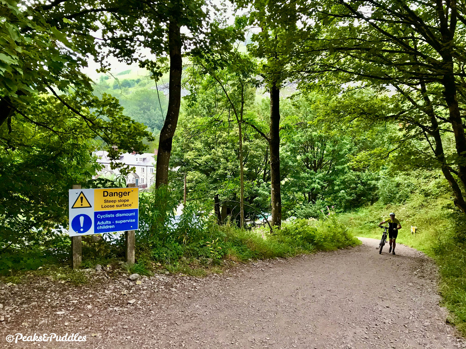
- If riding the Wye Dale end of the route closest to Buxton (described in stage 1 below), note that this is a potholed track shared with the occasional car and has a steep, loose stone ramp up onto the railway trail itself at Blackwell Mill. It’s scenic enough in its own right, but if you’re starting anywhere other than the Wye Dale car park, you won’t miss much by skipping it.
- It’s important to have a bell (or friendly voice) on this popular trail. Keep to the left in the tunnels and ride single file to pass if necessary. See Tips for Cycling on Shared Paths for more advice.
- With no annoying barriers along its length, the Monsal Trail is accessible for all kinds of non-standard cycles, once you’re on it: for that, access is best at Millers Dale or Bakewell station car parks, which have level, barrier-free entry onto the trail. Hassop only has step-free access via a single, narrower gate at the rear of the car park.
- Route planners and trackers sometimes don’t understand the viaducts and tunnels of the Monsal Trail: sorry, you haven’t really climbed 500 metres! It’s an incredibly level, easy route, though does have a very slight gradient heading north, so bear this in mind.
- There are public toilets at Millers Dale.
Route description
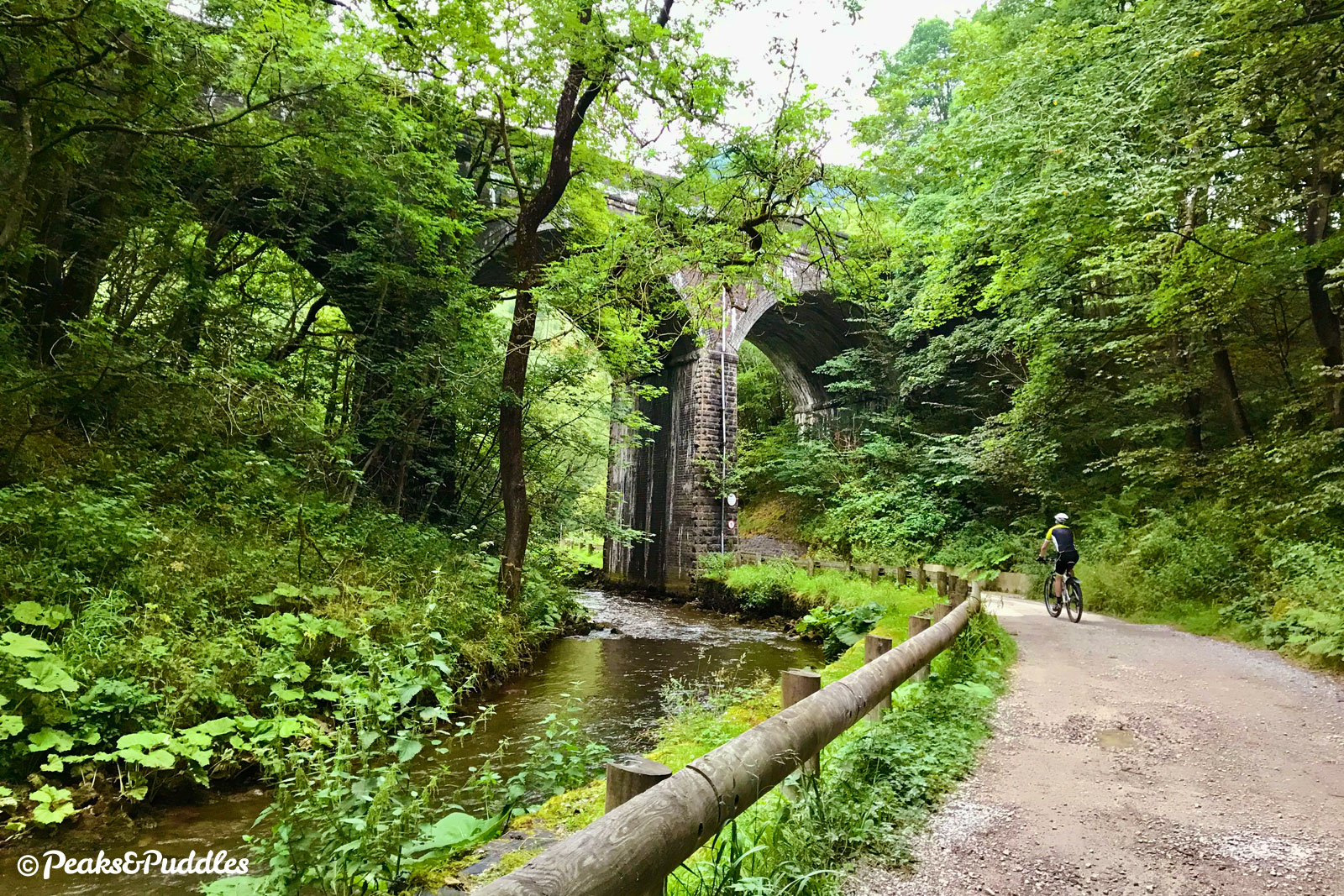
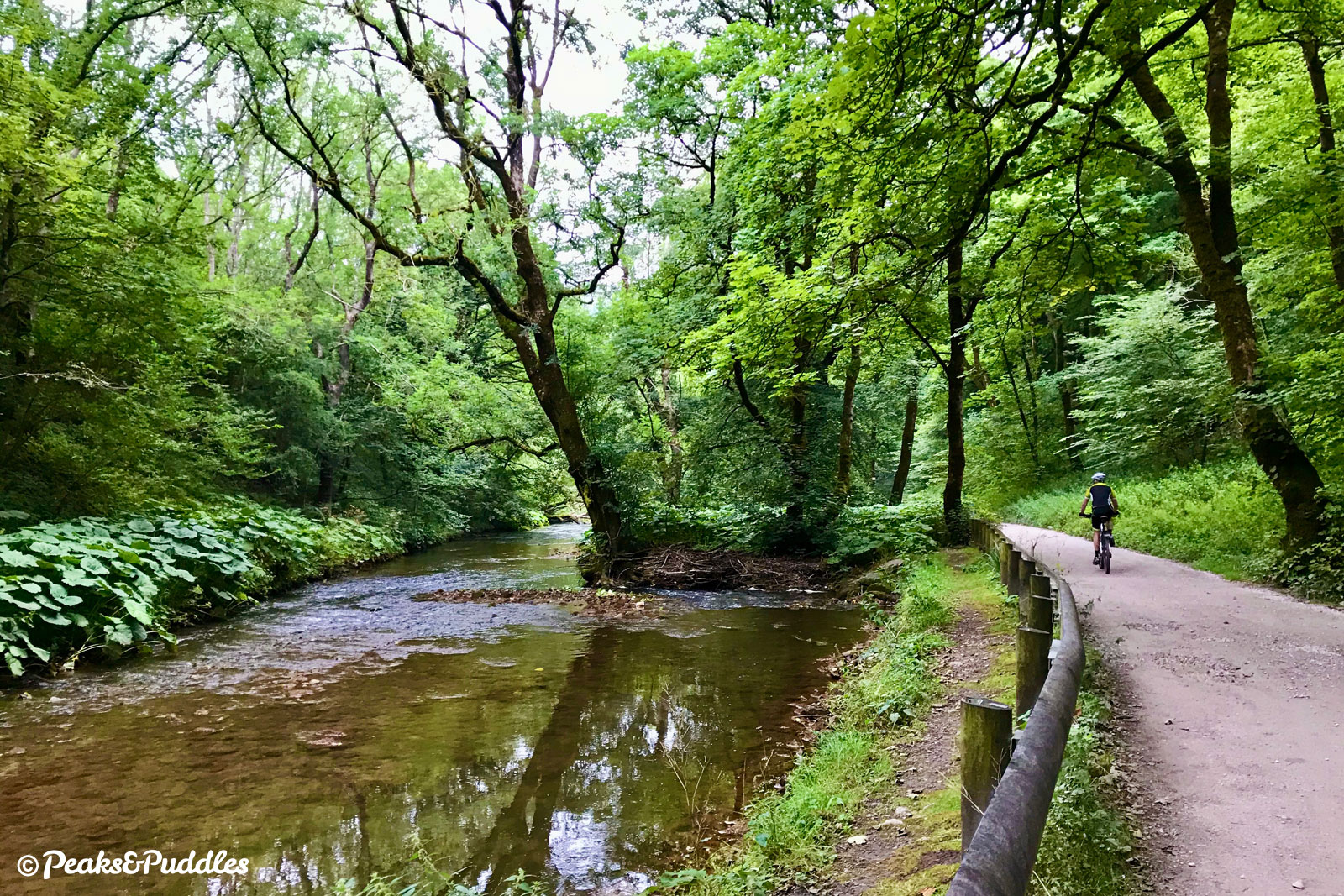
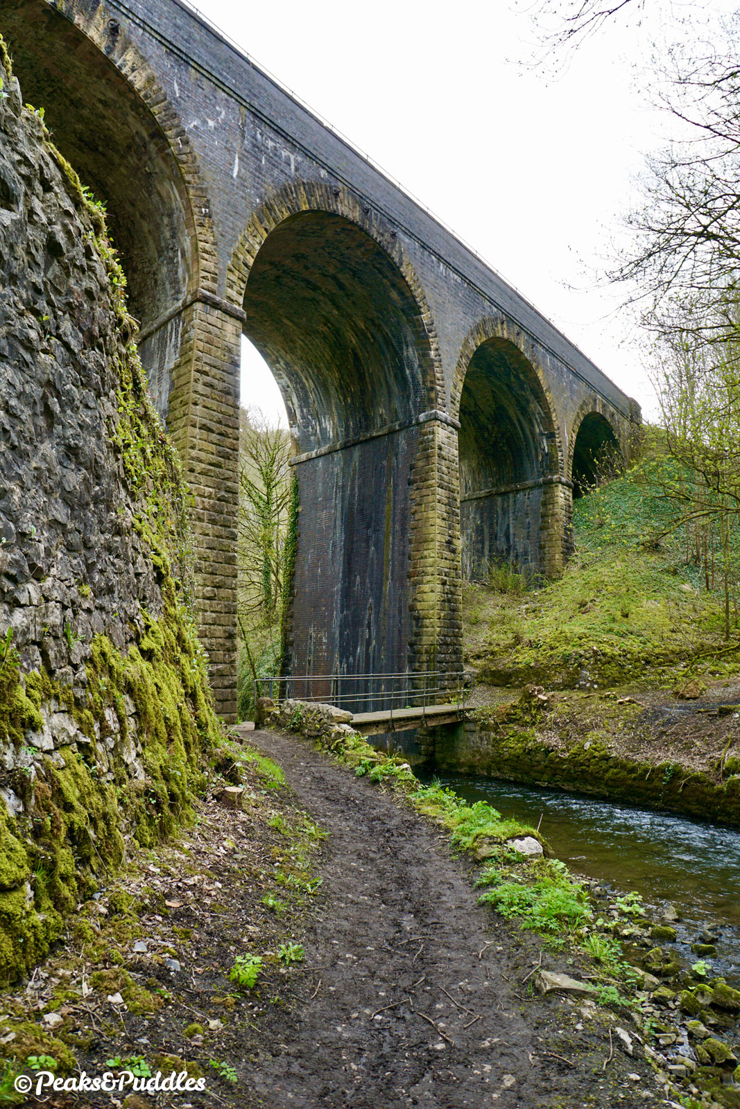
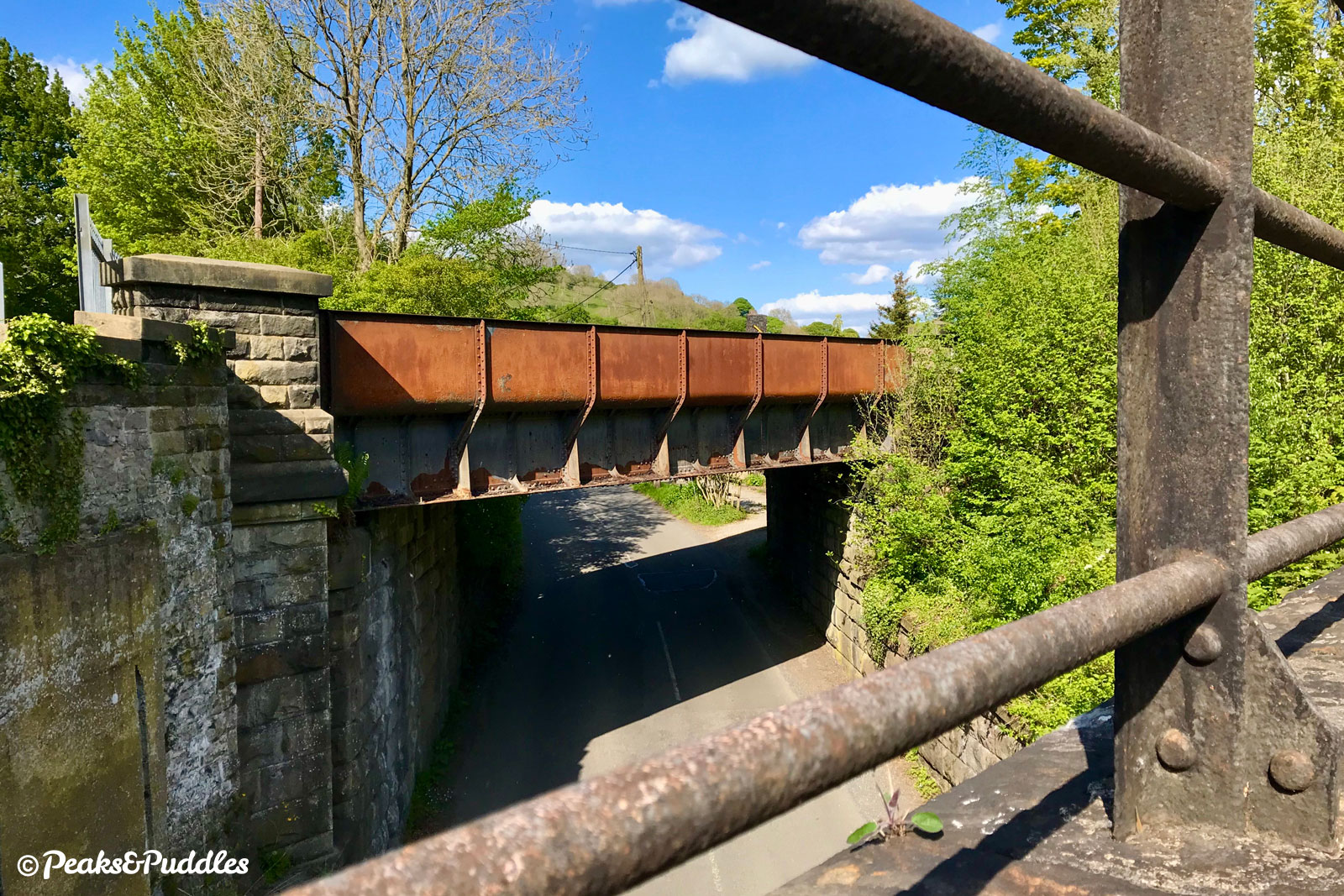
- From Wye Dale beside the A6, begin the route through an open gate at the end of the car park onto a stony track. The trail begins not on a railway line but some distance below it, level alongside the River Wye itself. This interesting 1.1 km (0.7 mile) preamble isn’t seen by most visitors to the Monsal Trail proper but takes you beneath no less than three impressive railway viaducts on its short length. The line above is still in use as the Great Rocks freight line, connecting the huge limestone quarry at Tunstead through to the Buxton line.
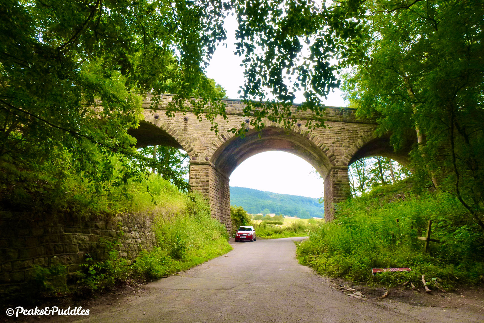
Approaching Blackwell Mill, the track passes under a third, disused viaduct which would’ve connected the Monsal line to Buxton. Unfortunately, the surface all along here, shared with vehicles accessing the quaint row of cottages ahead beside the river, is very badly potholed in places and clearly overlooked for maintenance compared to the main trail. Passing the cycle hire hut, bear right on the loose and difficult gravel. The Monsal Trail is through the gate at the top of the steep incline (signs advise to dismount).
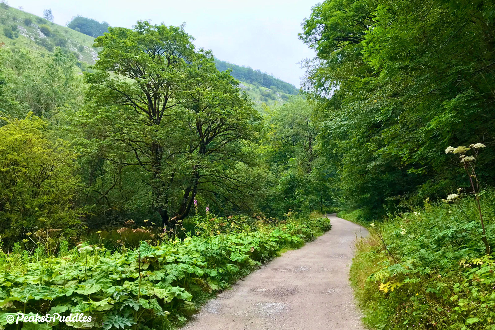
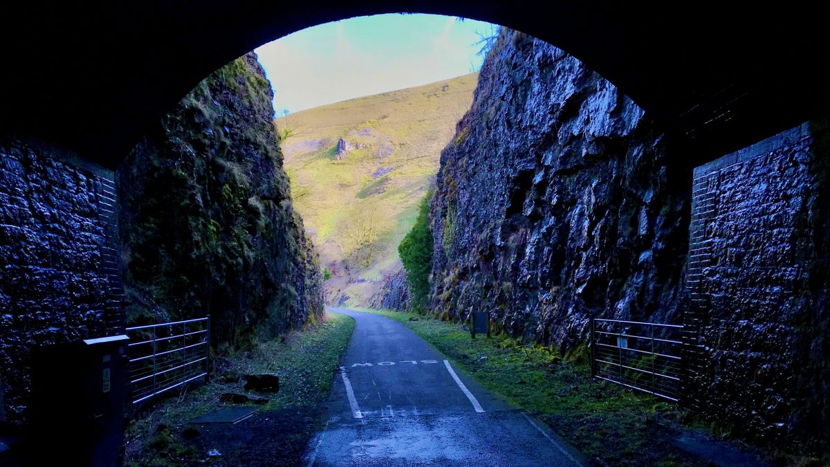
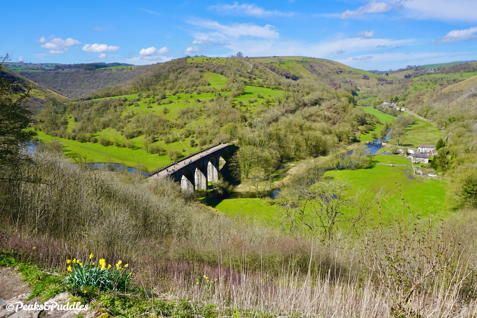
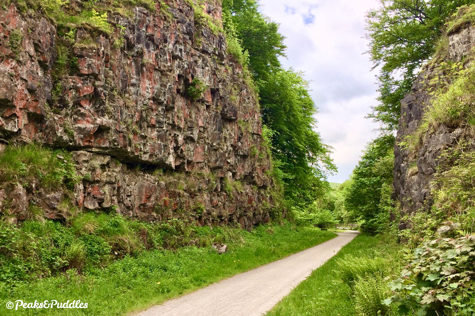
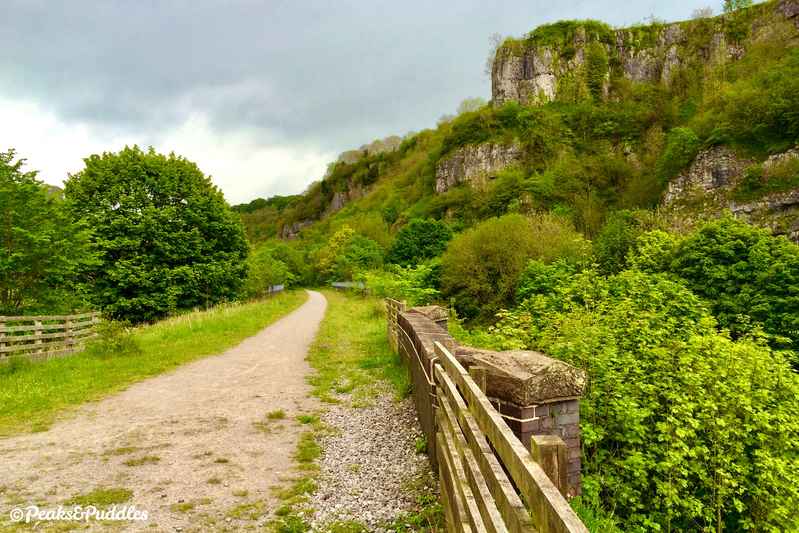
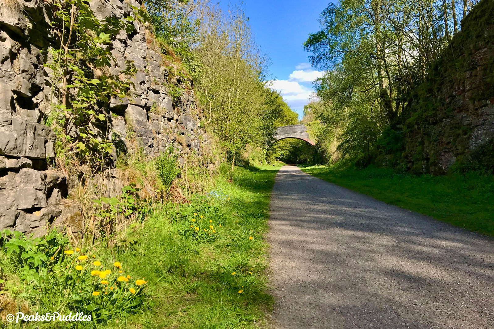
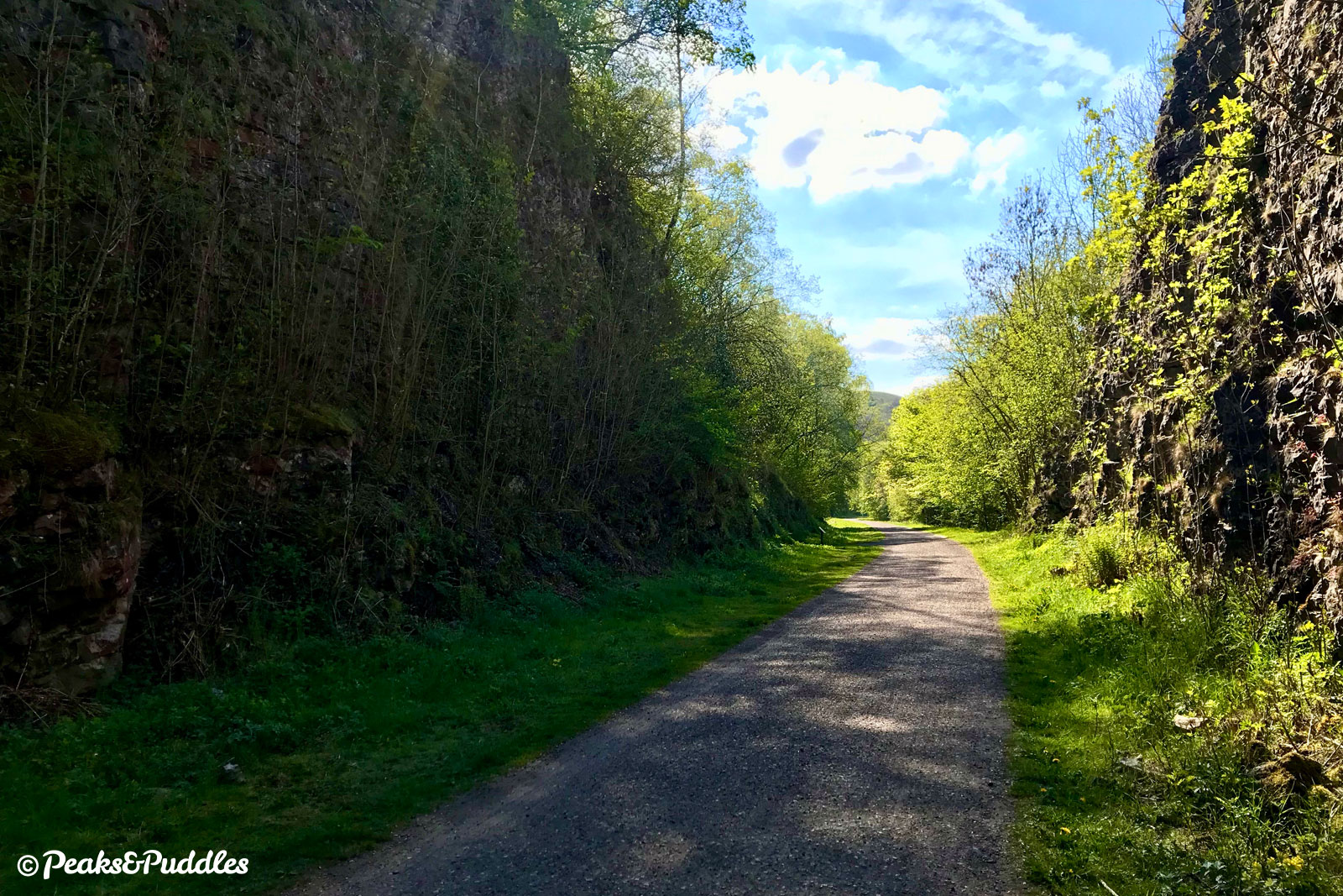
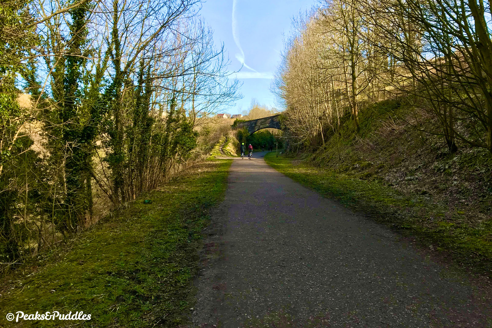
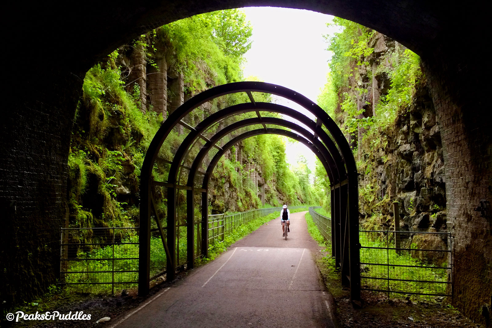
- Turn left and you’re now on the Monsal Trail proper. The character and excitement of this railway “through the Peak” is immediately clear, slicing into limestone cliffs topped with all kinds of precious flora. Heading under the first historic overbridge, which now carries the Pennine Bridleway route, it feels as if an express train to London could come thundering through at any moment. This section ahead above the magical Chee Dale is just spectacular: clinging to ledges above the river, traversing three viaducts and three tunnels through an almost Jurassic landscape. It sometimes seems as if many visitors starting from the south turn back before this section, much to their loss.
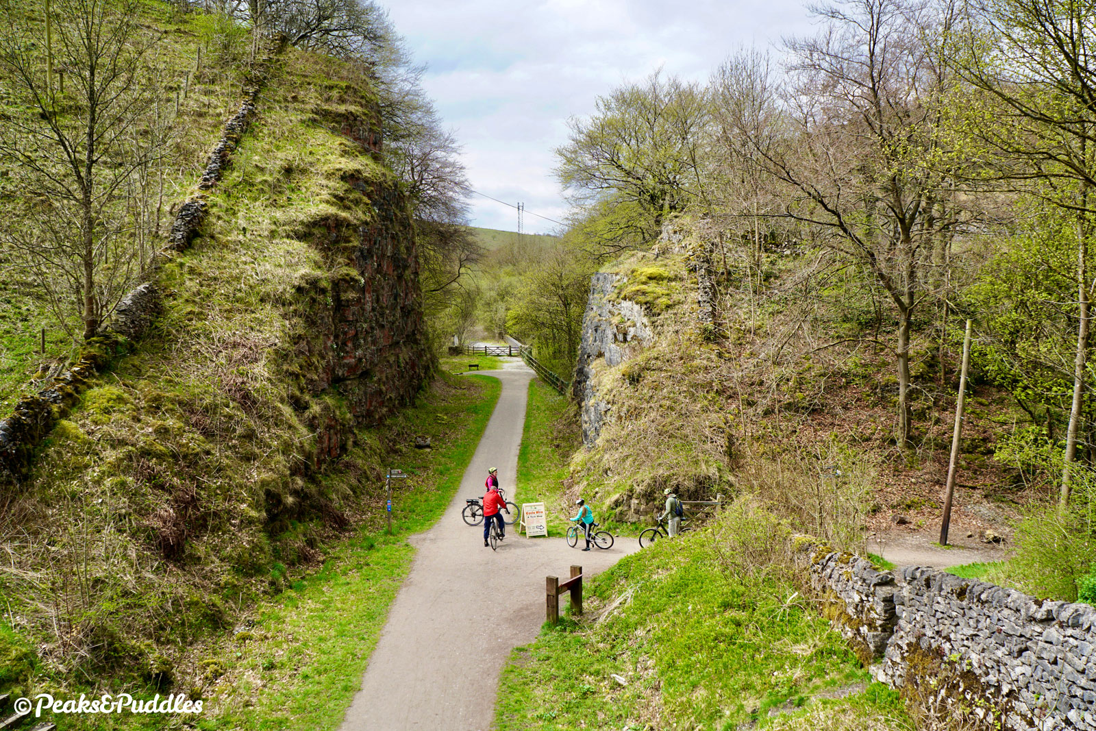
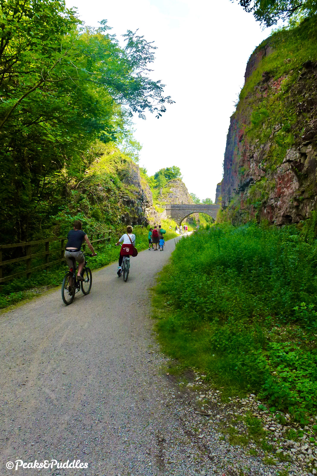
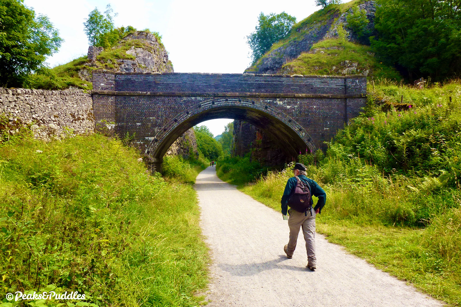
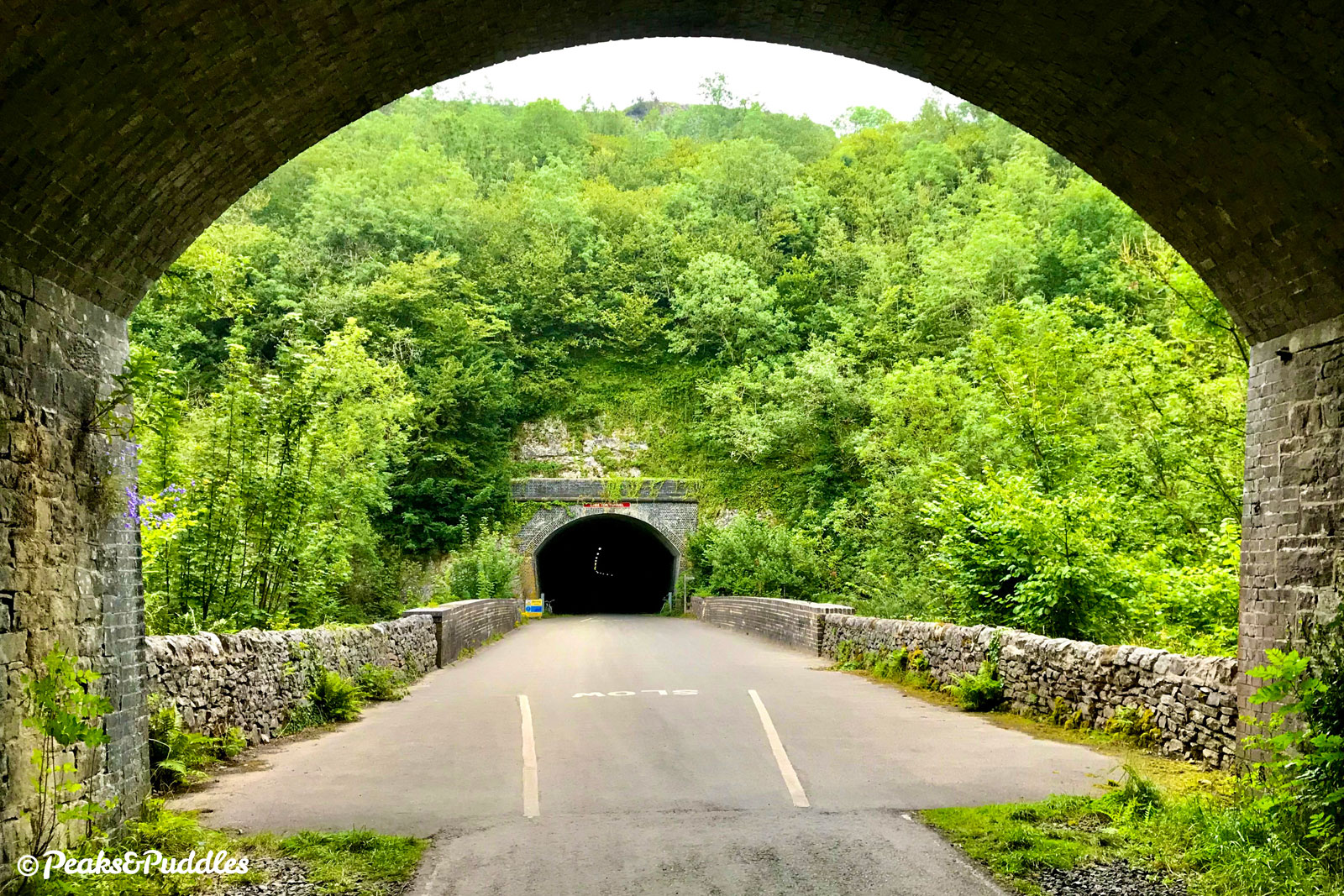
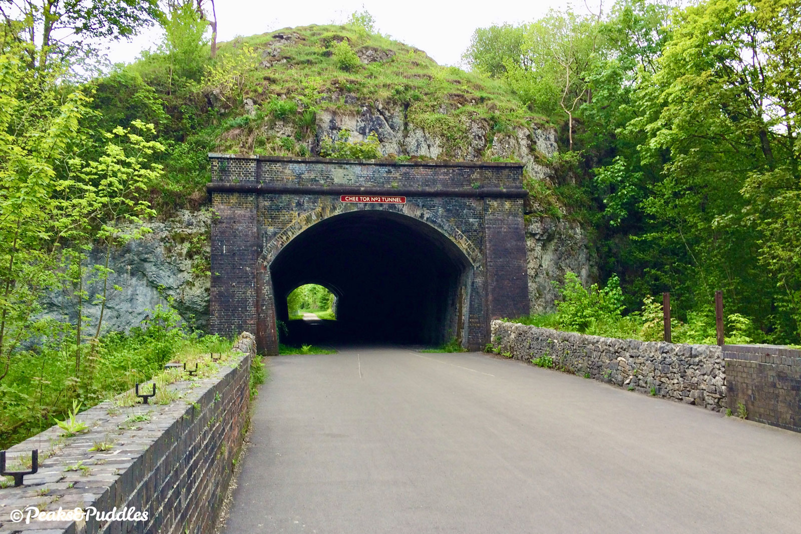
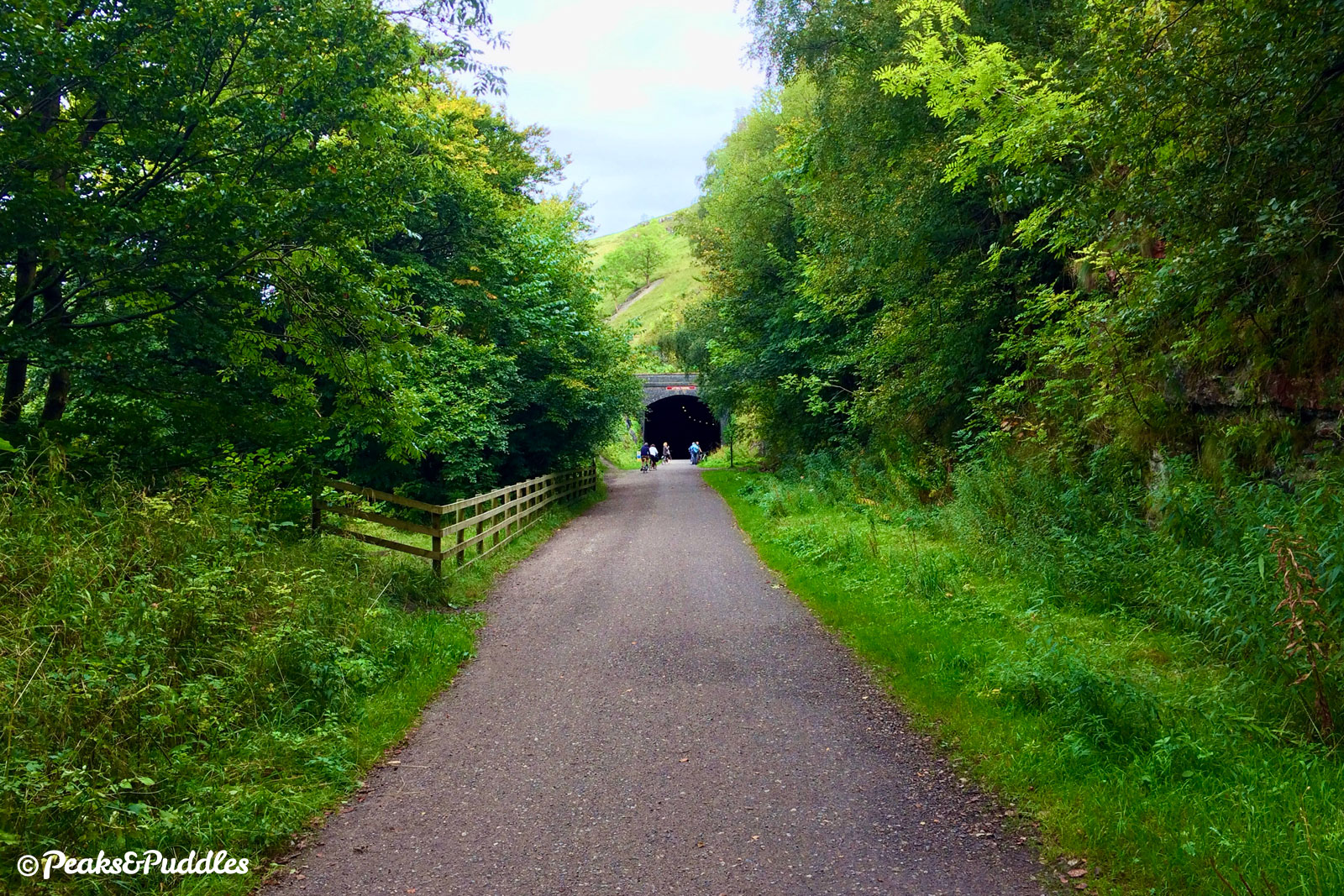
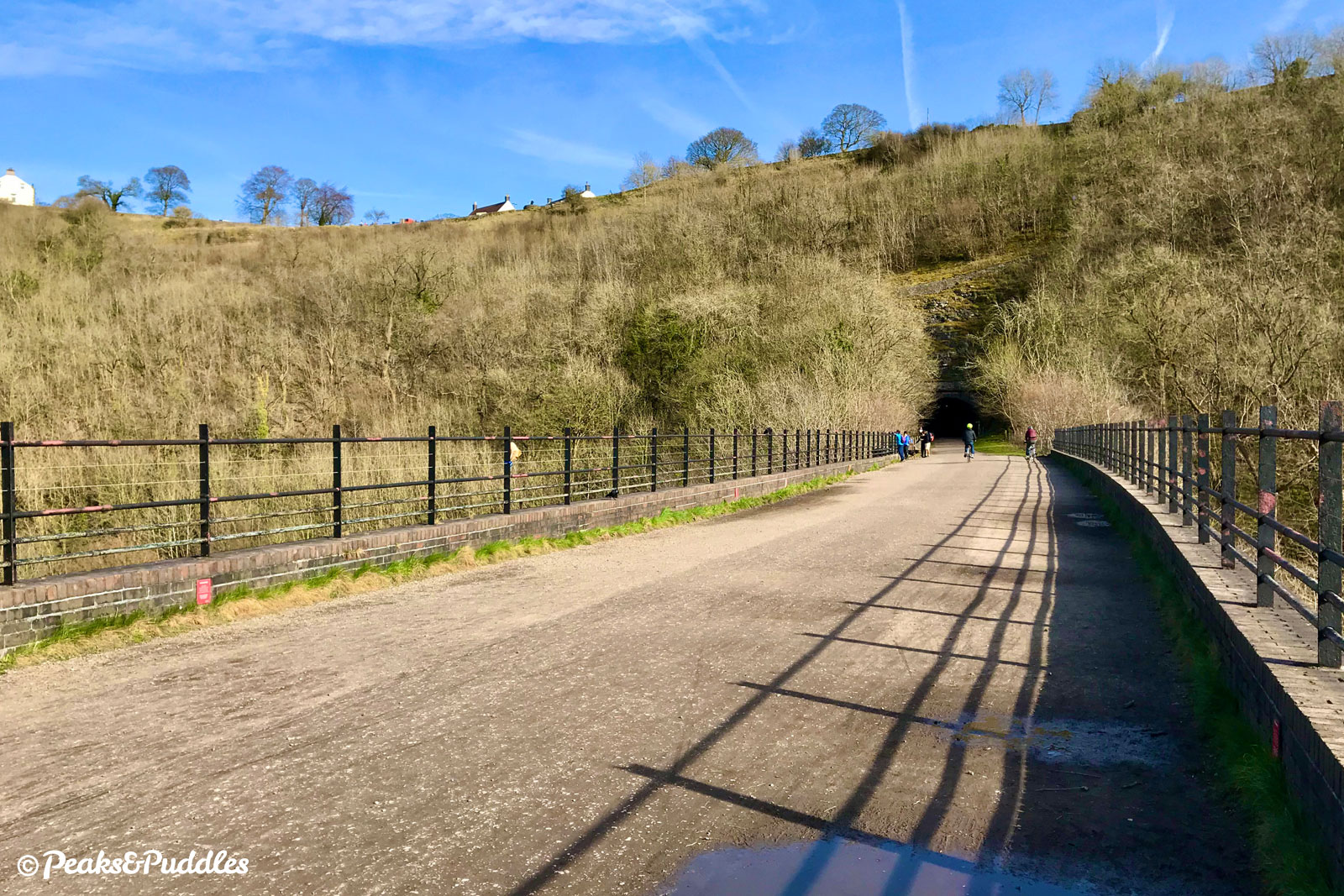
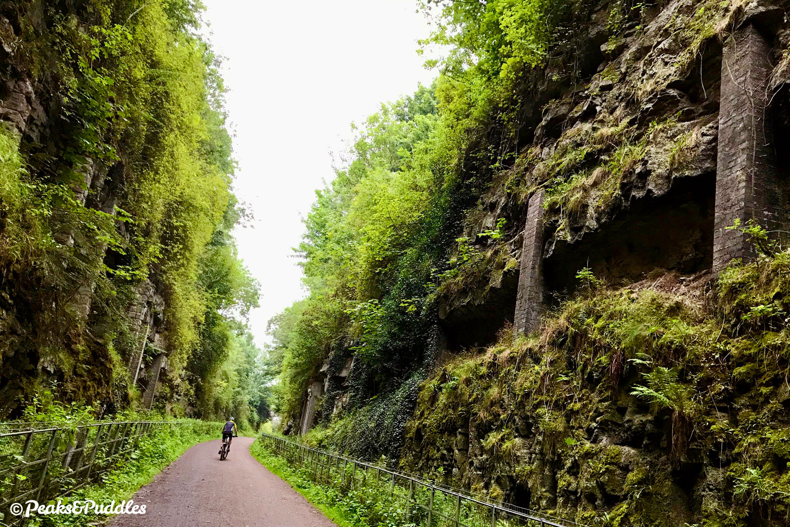
Rusher Cutting Tunnel is first, relatively short at just 111 metres (121 yards), followed by the tiny 86 metre (94 yard) Chee Tor No.2 Tunnel, both open as footpaths long before the 2011 re-opening project. In a dazzling moment, the line then emerges out onto a viaduct only to plunge immediately back into the curving Chee Tor No.1 Tunnel for 367 metres (401 yards). Taking you beneath the 90 metre (300 ft) cliff face above, this is the first long, lit tunnel of four.
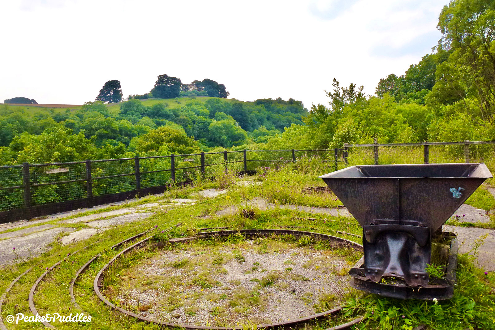
Another viaduct then leads past the apocalyptic structure of East Buxton Lime Kilns. This monstrous hive of industry operated from 1880 to 1944, using coal brought in by train to burn limestone from the quarry behind, now a nature reserve, into quick lime, shipping out 50 tons a day at its peak. As well as walking inside one of the kilns, you can follow a steep path up one side to stand on top, beside a limestone wagon, and look out across the quarried dale ahead.

- Where the path forks, bear right to arrive between the platforms of Millers Dale station. Intended as a halt to serve the tiny hamlet below, this station ballooned into a five-platform affair; an important interchange with trains from the Buxton branch line and through expresses, every one of which stopped in this unlikely hub. Sadly much was lost but one station building, without its canopies, miraculously survived. In 2019 the building was renovated to house a new café, while work is underway to provide an interactive learning space in the former goods shed, which has had its roof restored after more than half a century.
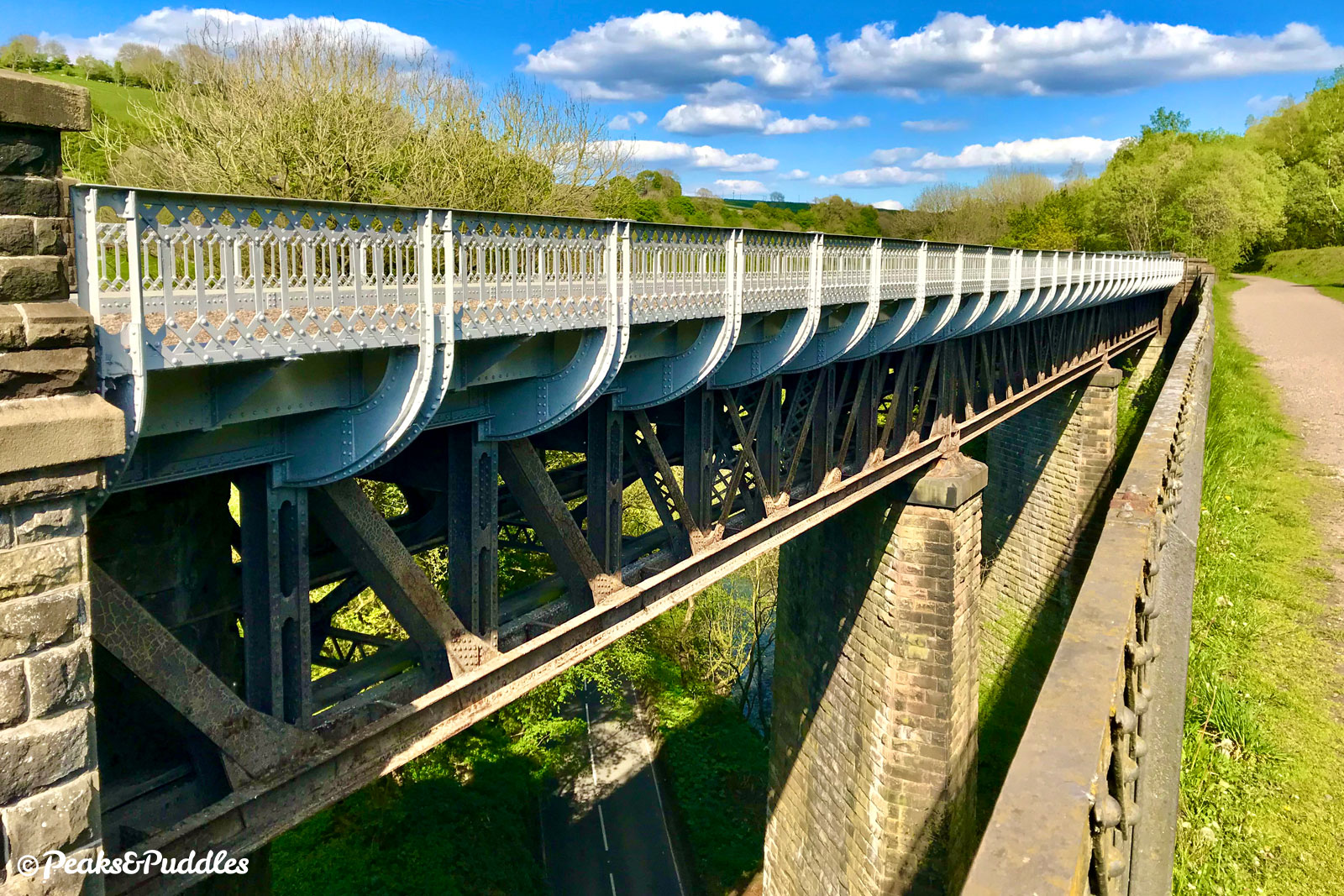
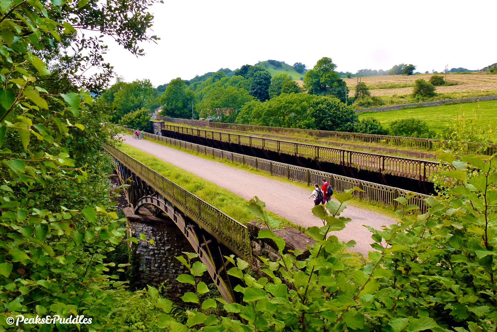
From the former platforms, the line immediately crosses a road then heads straight out over striking twin viaducts. Surprisingly, it’s the original Millers Dale South Viaduct which carries the trail at a skew high over the river, on its beautiful wrought iron arched lattice girders. The later North Viaduct, completed in 1905 for the station’s expansion, has been refurbished but remains closed off. Further lime kilns, fed by a quarry high above, can be found on the other side.
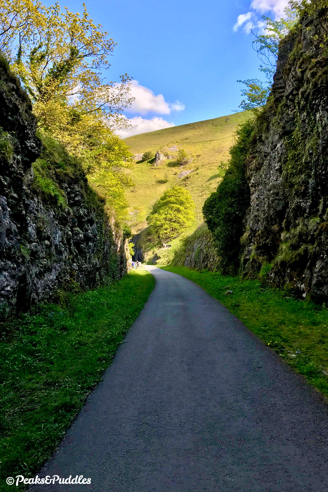
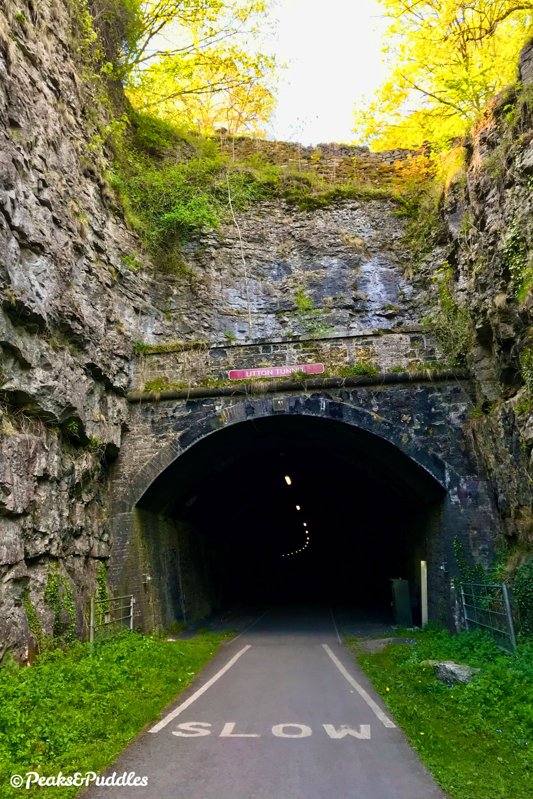
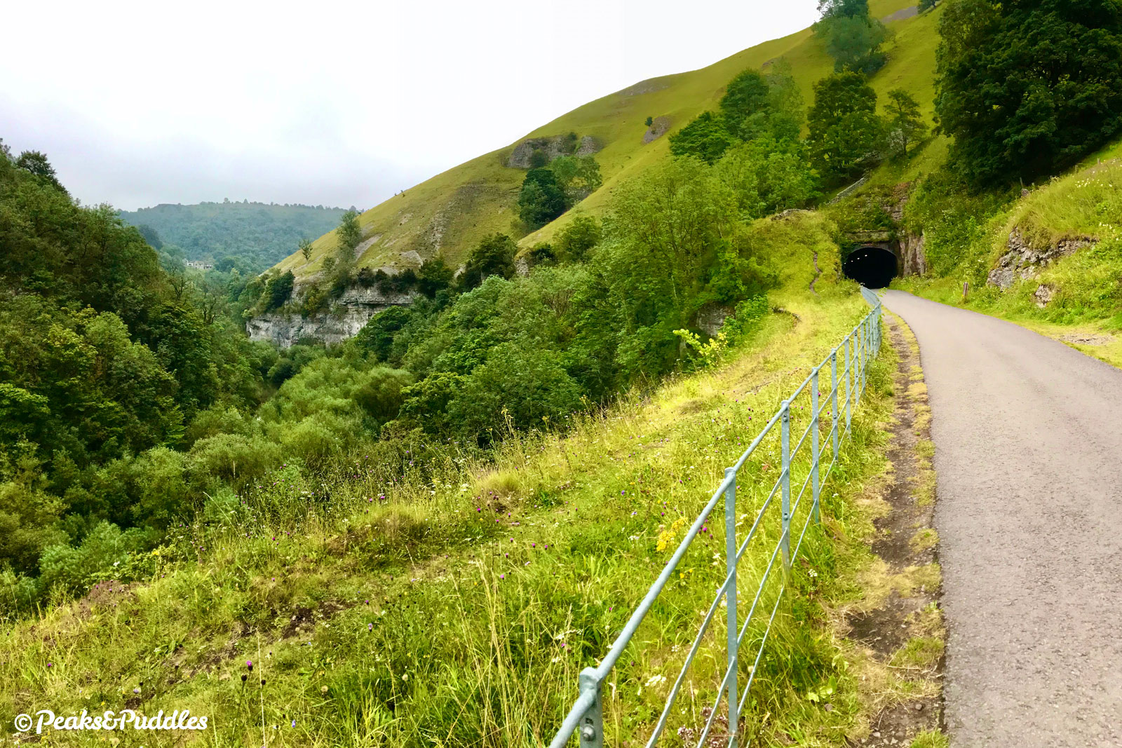
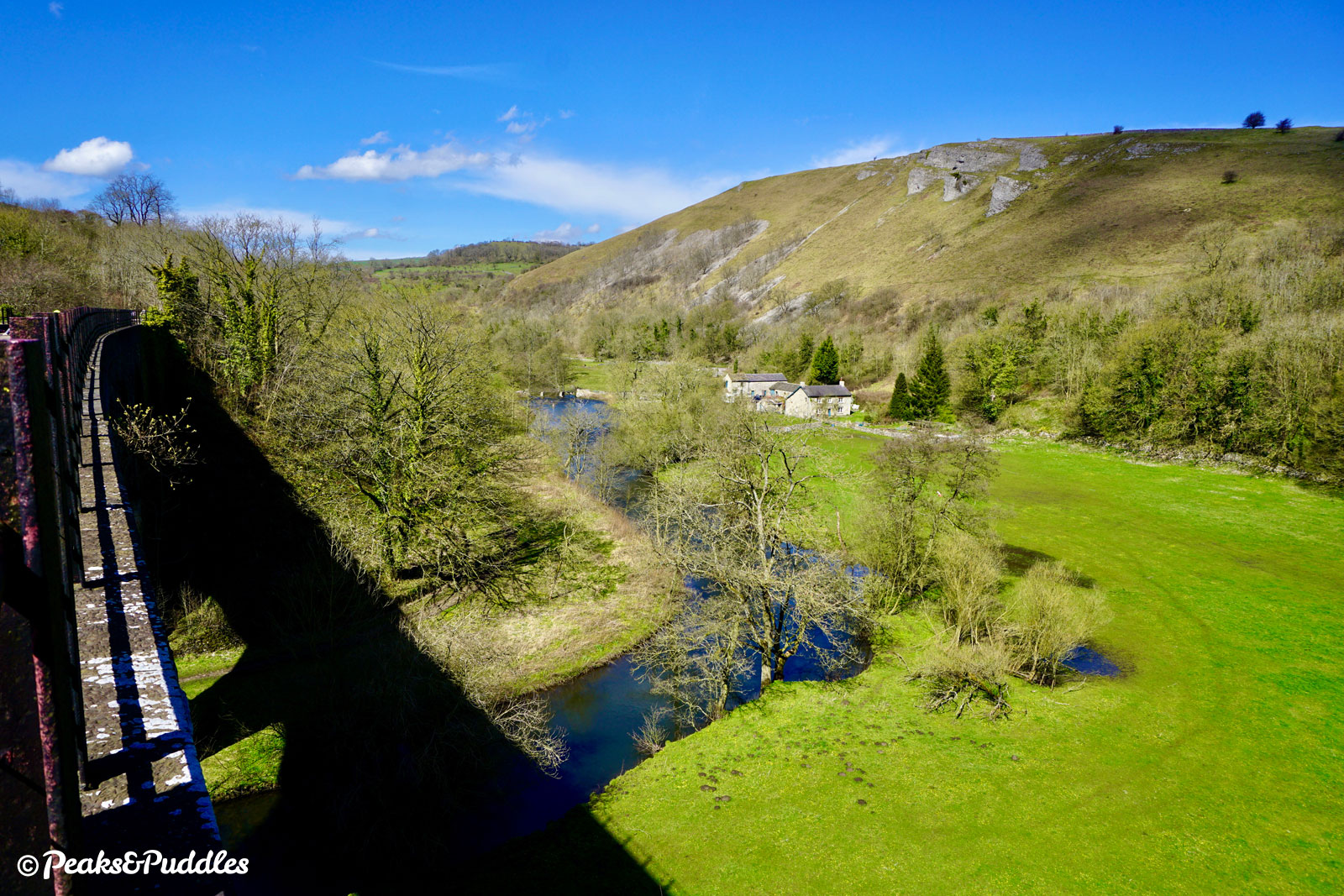
- The line now ambles along steadily and railway-like, plotting a very gradual downhill gradient through thick tree cover as it remains strung along the valley side. But not for long — above Litton Mill, a former water-powered textile mill turned apartments, the mouth of Litton Tunnel takes you underground for 471 metres (515 yards). The air inside the damp and atmospheric tunnels is often much chillier than that outside.
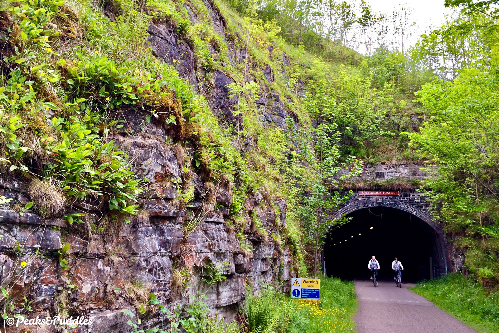
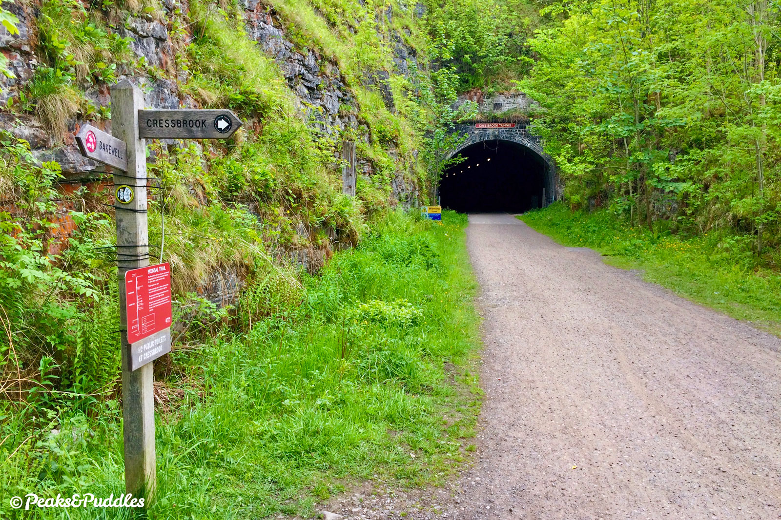
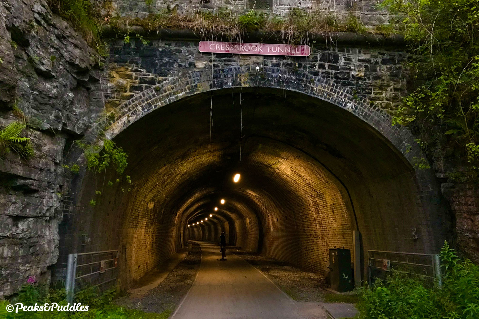
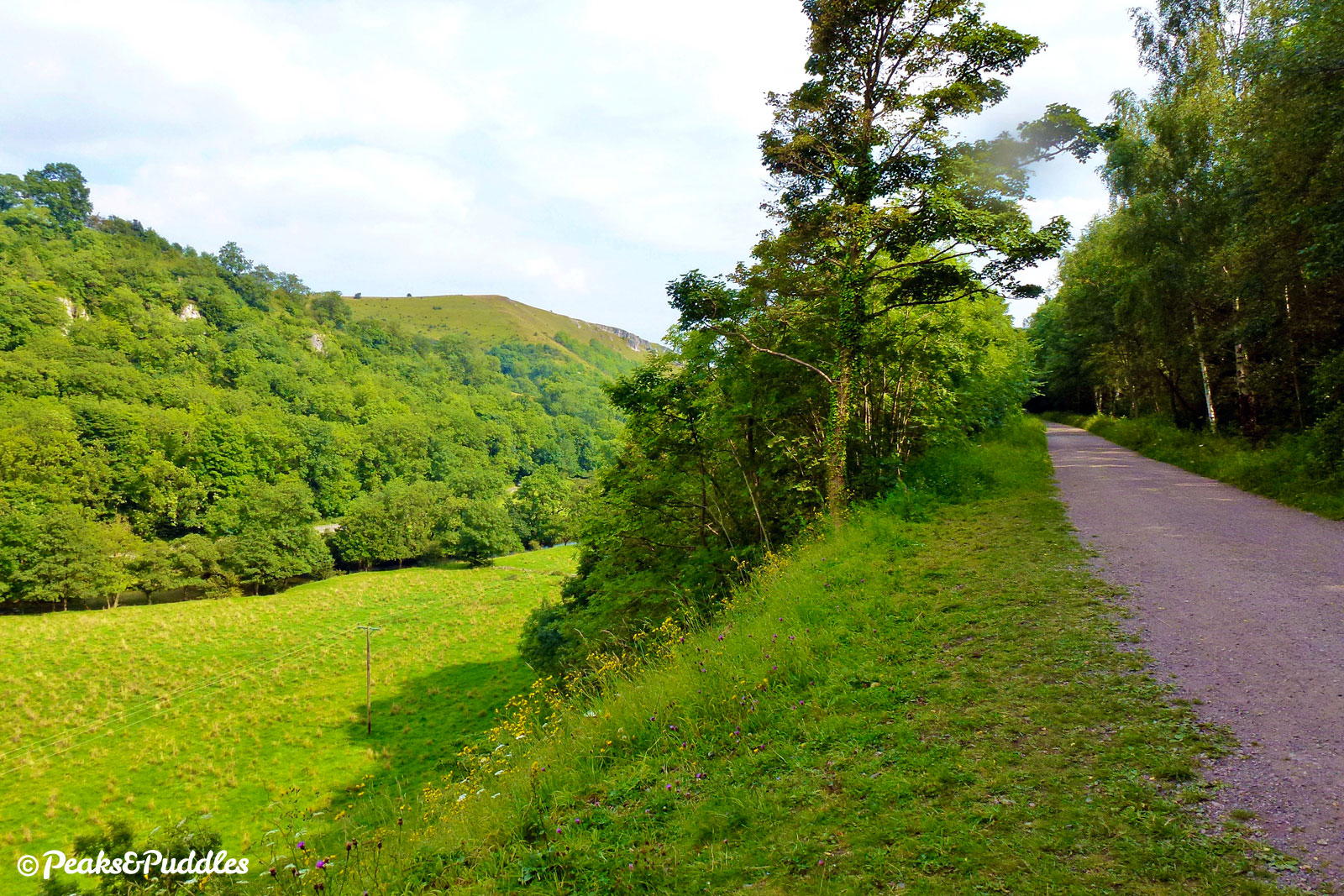
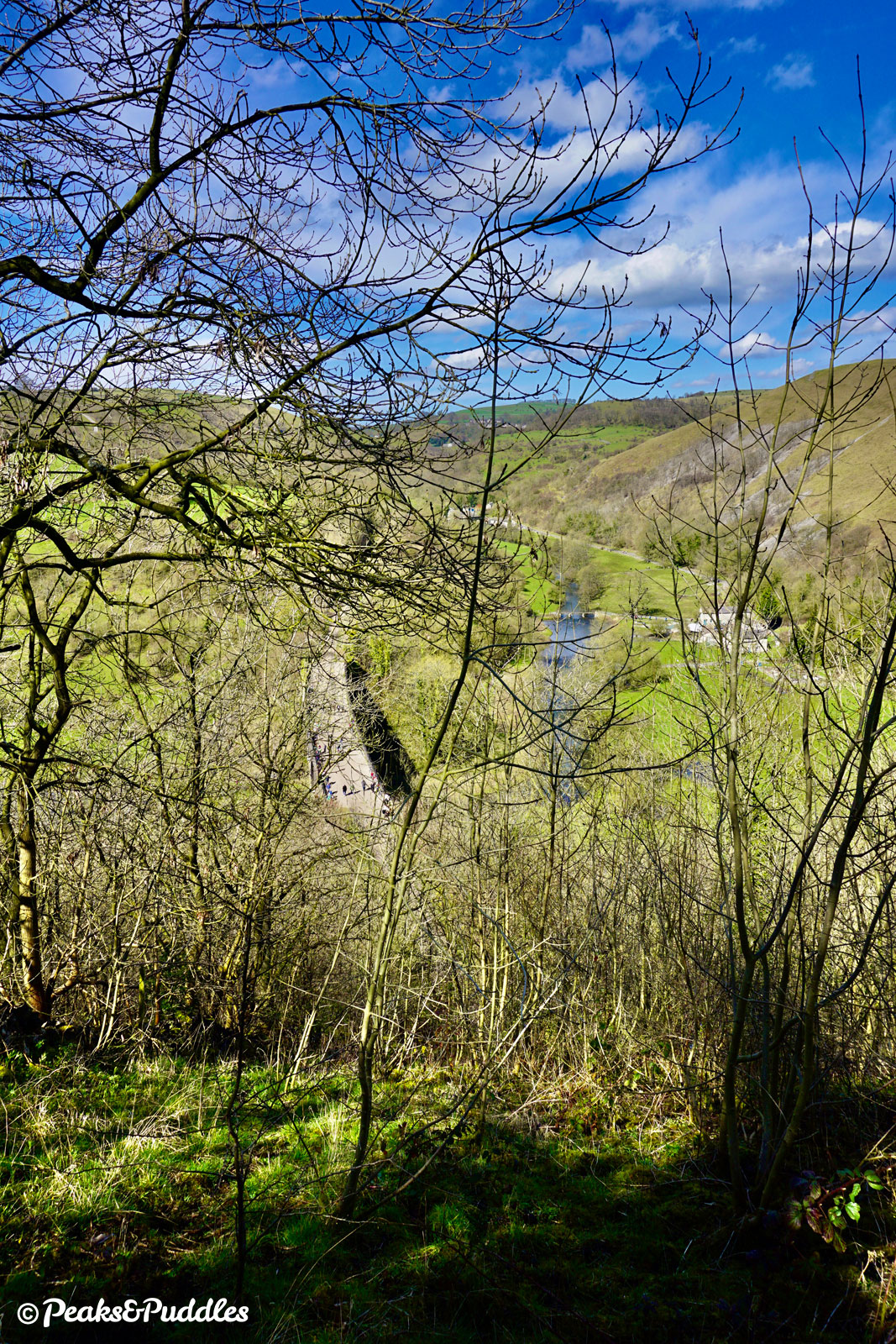
A dramatic, narrow rock cutting on the other side shields for a moment one of the Peak District’s most awe-inspiring spaces: on an otherwise inaccessible man-made ledge high above a bend in the river, a fantastical panorama over the lost world of Water-cum-Jolly Dale. As if desperate to leave travellers breathless, the route disappears again into Cressbrook Tunnel, 431 metres (471 yards) long.
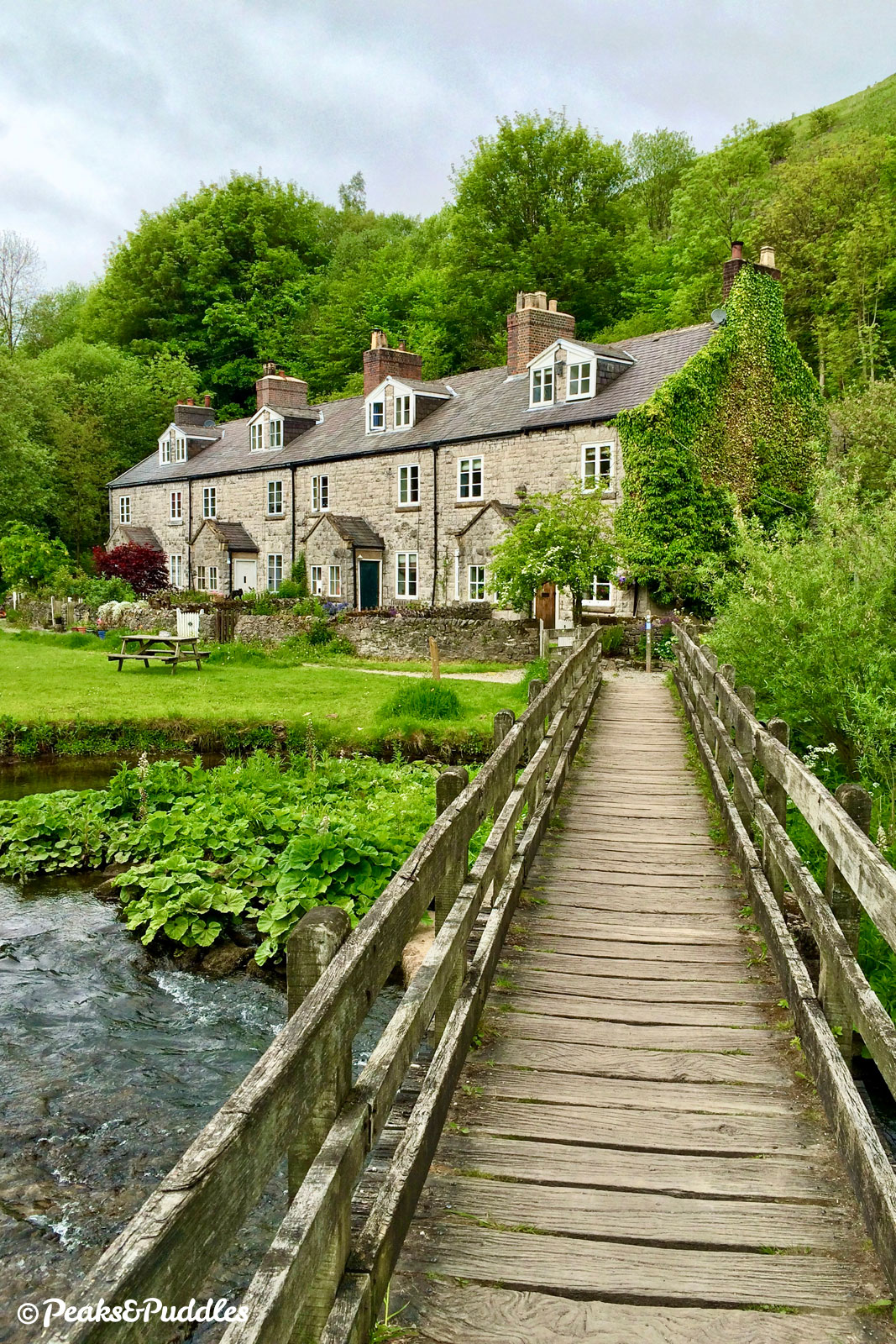
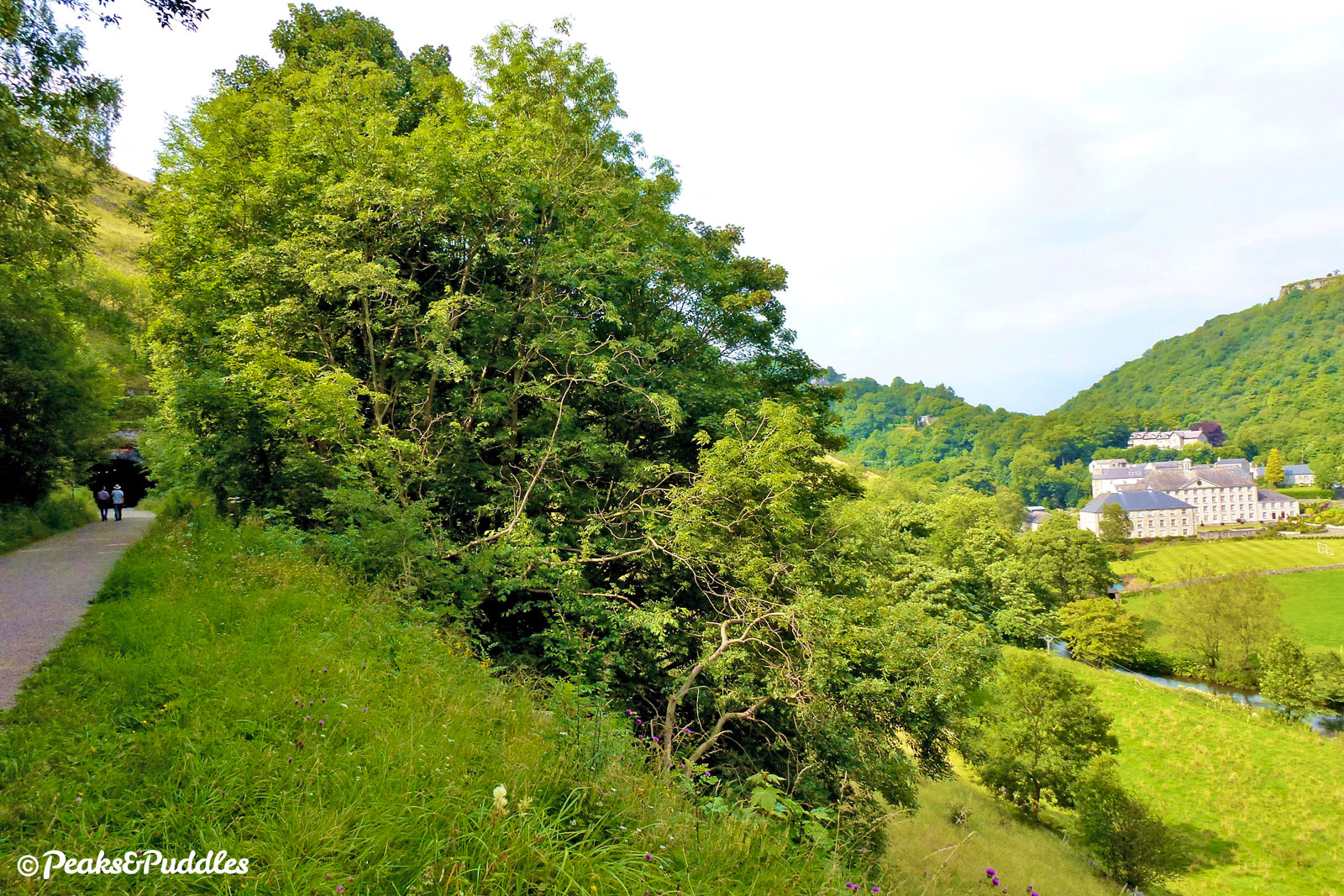
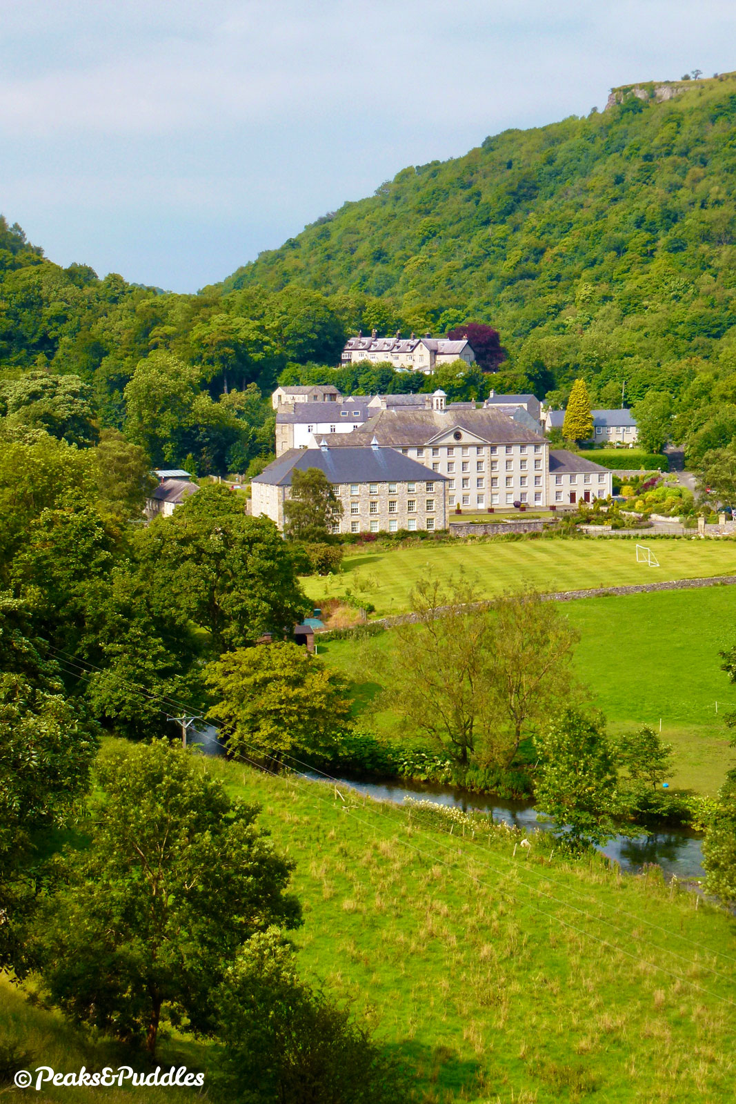
Leaving the darkness on the other side, the view across the river to Cressbrook Mill looks worthy of a postcard, but like Litton Mill this was once a hellish workhouse, treating child orphans as slaves in a gruelling and dangerous life.
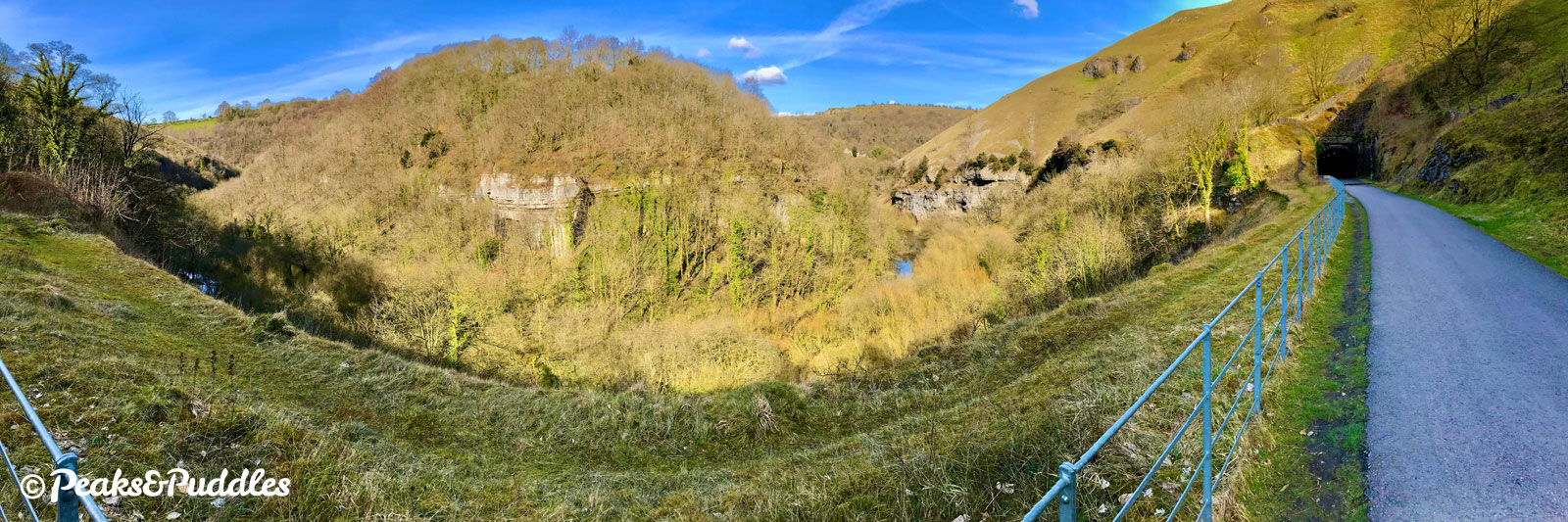
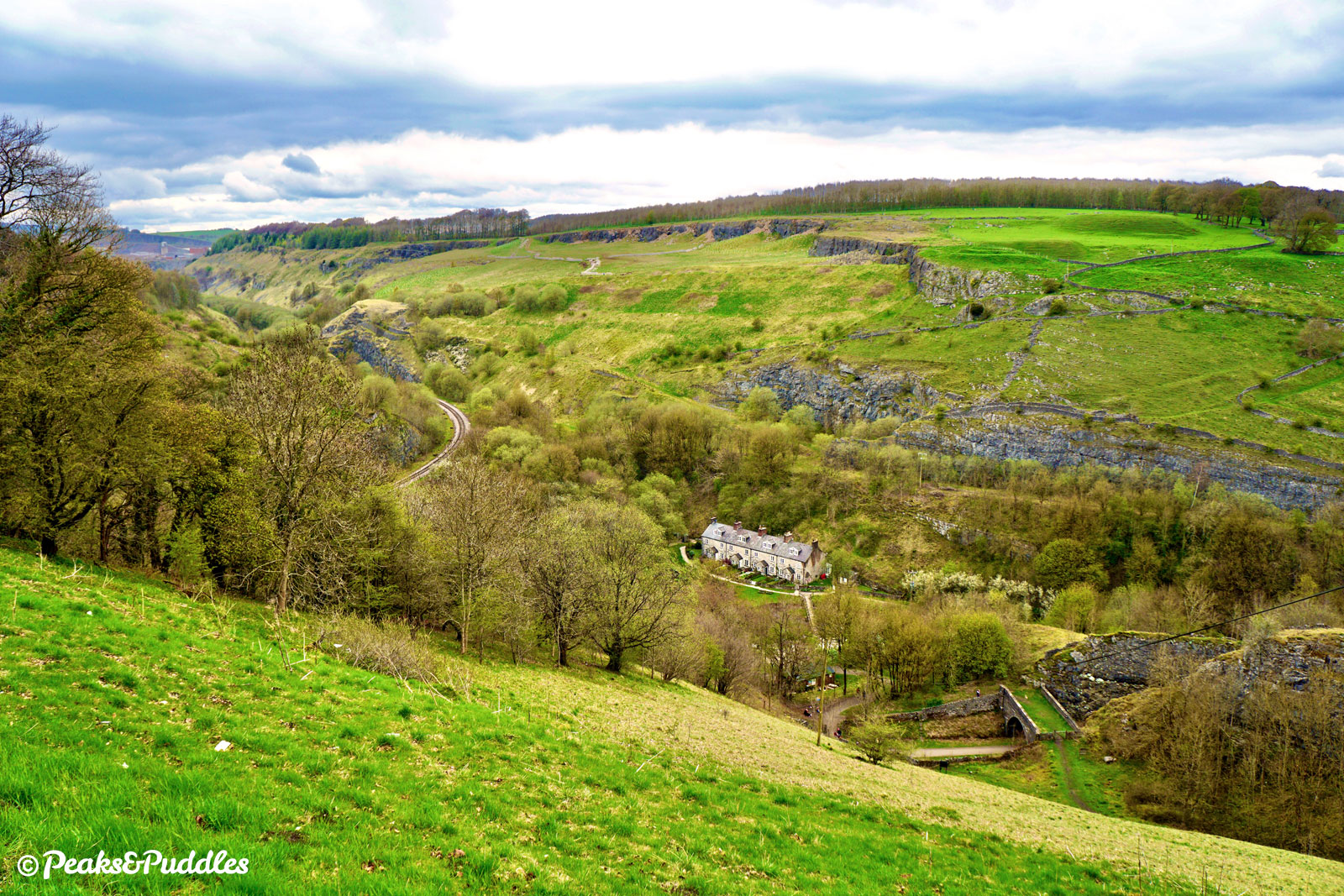
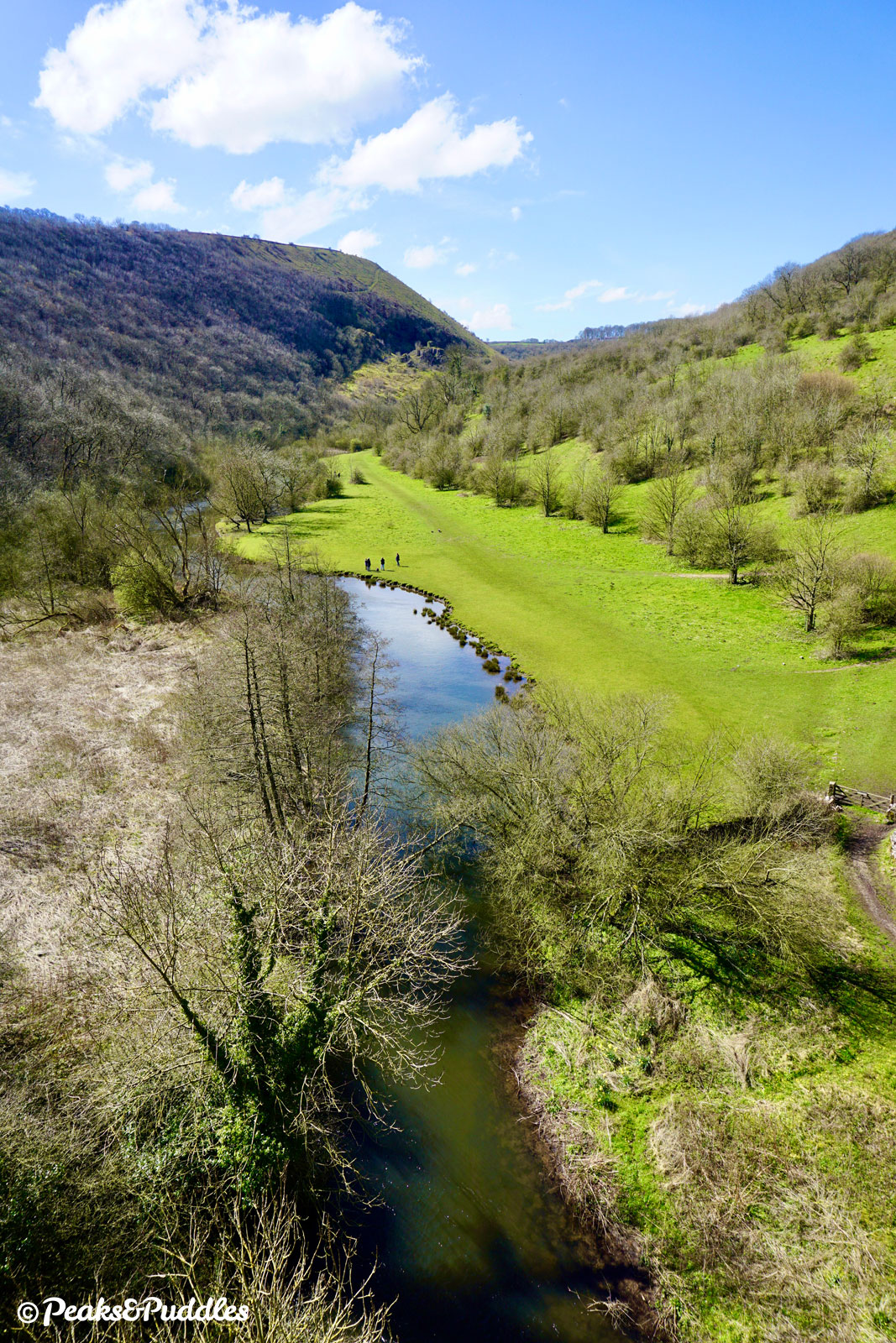
- Along Upperdale, the trail continues another modest descent as it enters perhaps the most famous length of the route. Monsal Dale station was built partly to serve the villages and mills around Cressbrook but became a ramblers’ favourite as travelling into the Peak for leisure took off. And yet it closed to regular services long before the line itself, in 1959. One overgrown platform remains, though the other, a timber structure clinging to the side of the bank, is long gone. As the line passes over a lane which lead to the station then approaches a stone overbridge, the cliff top tourist hotspot of Monsal Head can be spotted.
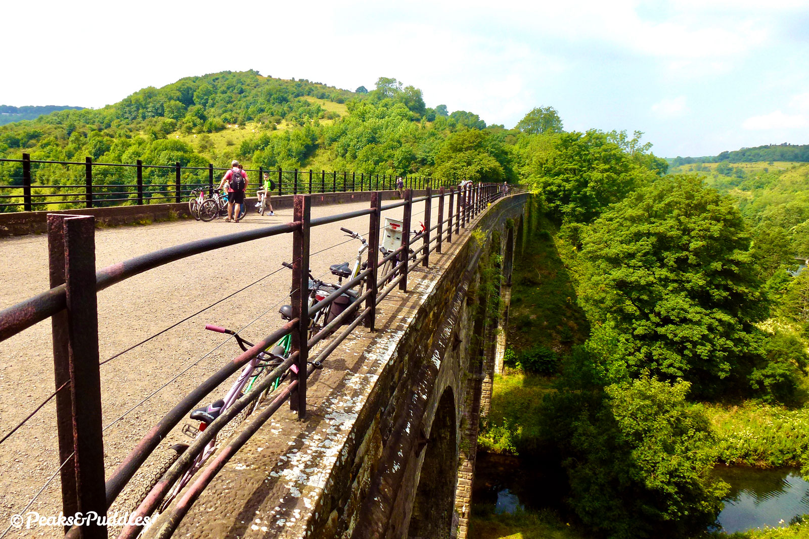
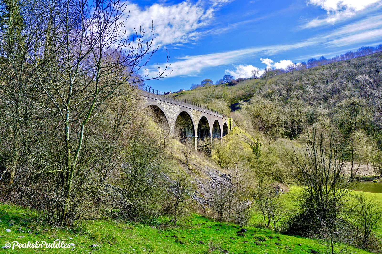
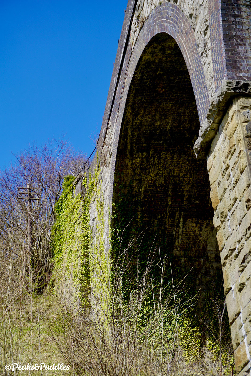
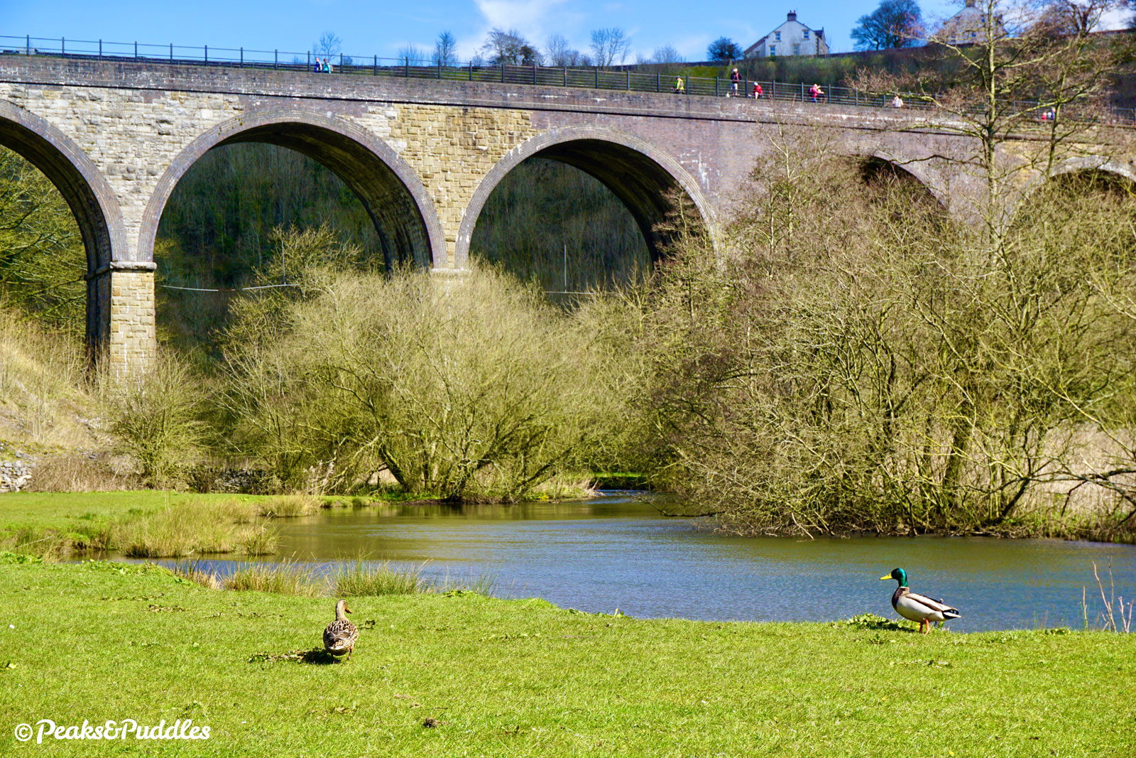
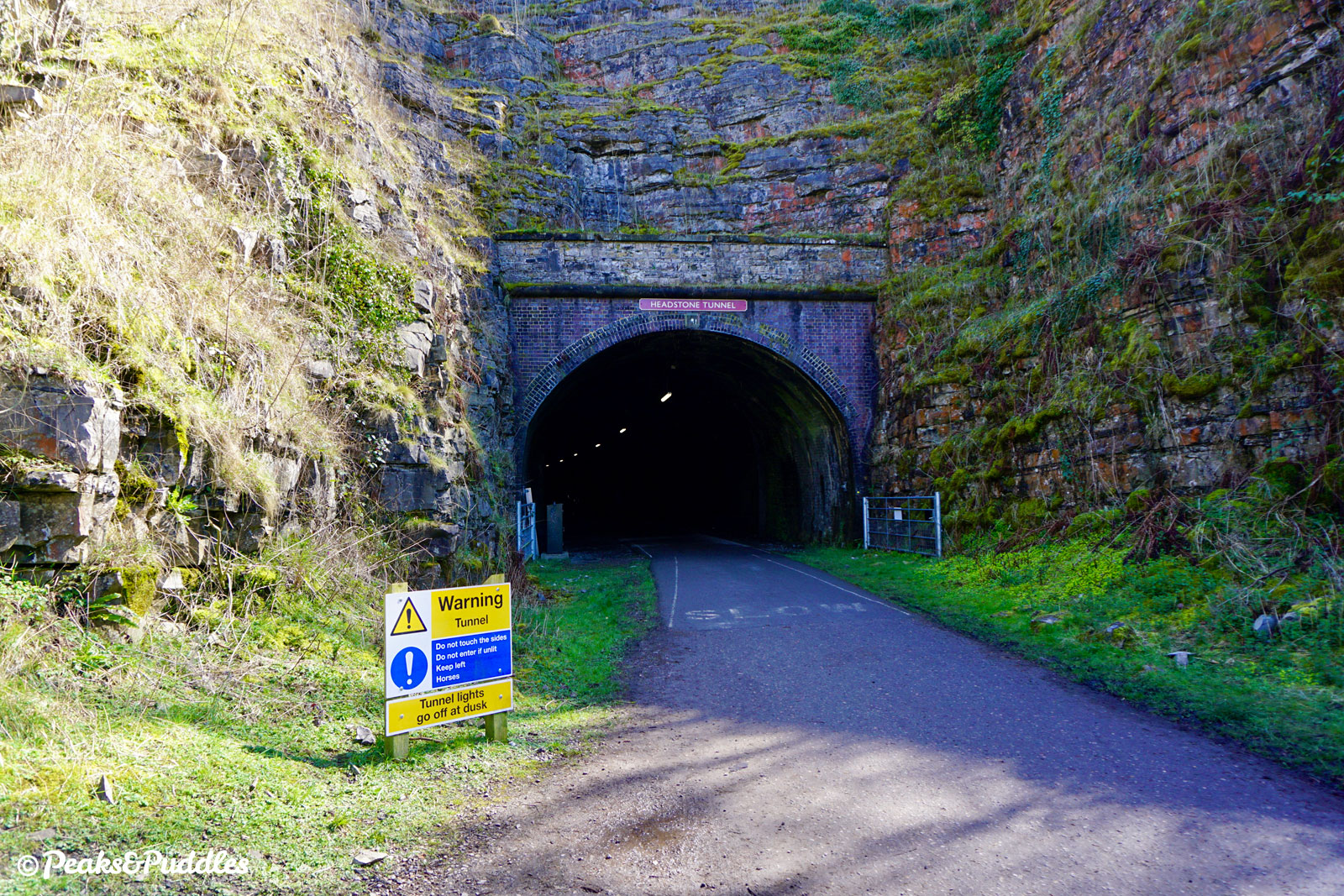
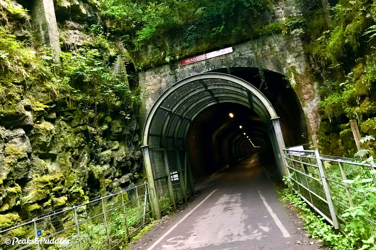
Soon enough, the line drops down onto Headstone Viaduct itself. In viaduct terms, it’s perhaps nothing special: 25 metres (82 ft) high, five arches. What elevates it is the huge L-shaped sweep of Monsal Dale and the River Wye underneath it, and the impending rock face up ahead. Where now? Into it, of course: Headstone Tunnel at 487 metres (533 yards) is the longest on the Monsal Trail. Imagine the excitement of bursting out of here, directly onto the viaduct, with that view from an express train. Well, you can pretty much recreate it on the return trip.
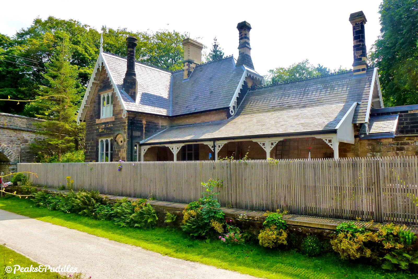
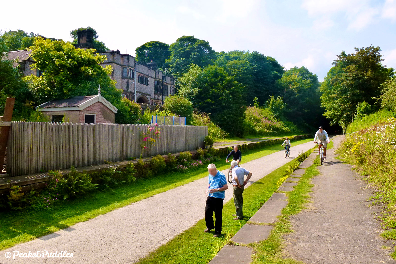
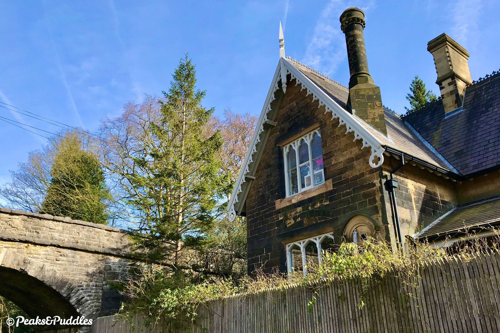
- On the other side of Headstone, daylight gradually resumes through a dramatic deep cutting, its sides covered in vertical hanging gardens of ferns and ivy. The route now slips into a laid-back traditional railway trail, with views of rolling dales as it passes under two bridges and into a cutting approaching the villages of Little Longstone and Great Longstone. Their station, titled simply Longstone then later Great Longstone for Ashford (it’s around 1.3 km from the honeypot village of Ashford-on-the-Water), is remarkably intact.
While the quaint English station building is now a private, fenced house, it’s the far grander hall-like building set back from the platform beside it that gathers attention here. This was built by George Marples, the wealthy owner of neighbouring Thornbridge Hall at the time, purely as his own private waiting room. It’s now part of the estate’s outdoor activity centre. Despite closing in 1962, one train a day continued to stop in each direction following the campaign of a determined Mrs A Boardman, to allow her to travel to work at Buxton hospital.
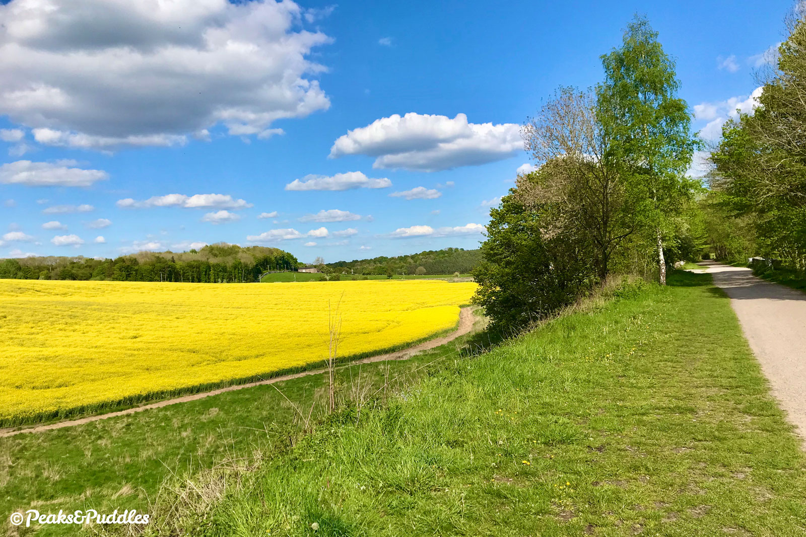
- Continuing through a cutting then out beside open, rolling fields, the trail now passes close to the busy A6020 at Rowdale. Originally a turnpike road requiring a fee, the Toll Bar House still sits alone across the fields. Hassop station is isolated too, and sitting so close between its neighbouring halts it’s assumed it was built with the hope of serving the Duke of Devonshire and traffic to his nearby Chatsworth Estate. As it happened, it’s reported he preferred to use Rowsley further south. The ornate stone building, far above the modest structures most country halts enjoyed, has served the route well, though. Despite being the first to close of those on the trail in 1942 and becoming an industrial premises for many years, it has now been rescued as a bustling café, book shop, bike hire and repair centre, the starting point and destination for many visitors. On a busy weekend, bursting with more people than it ever saw in its railway days.
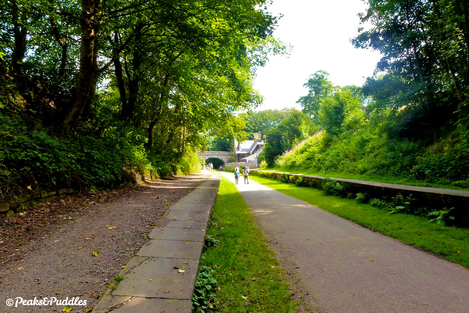
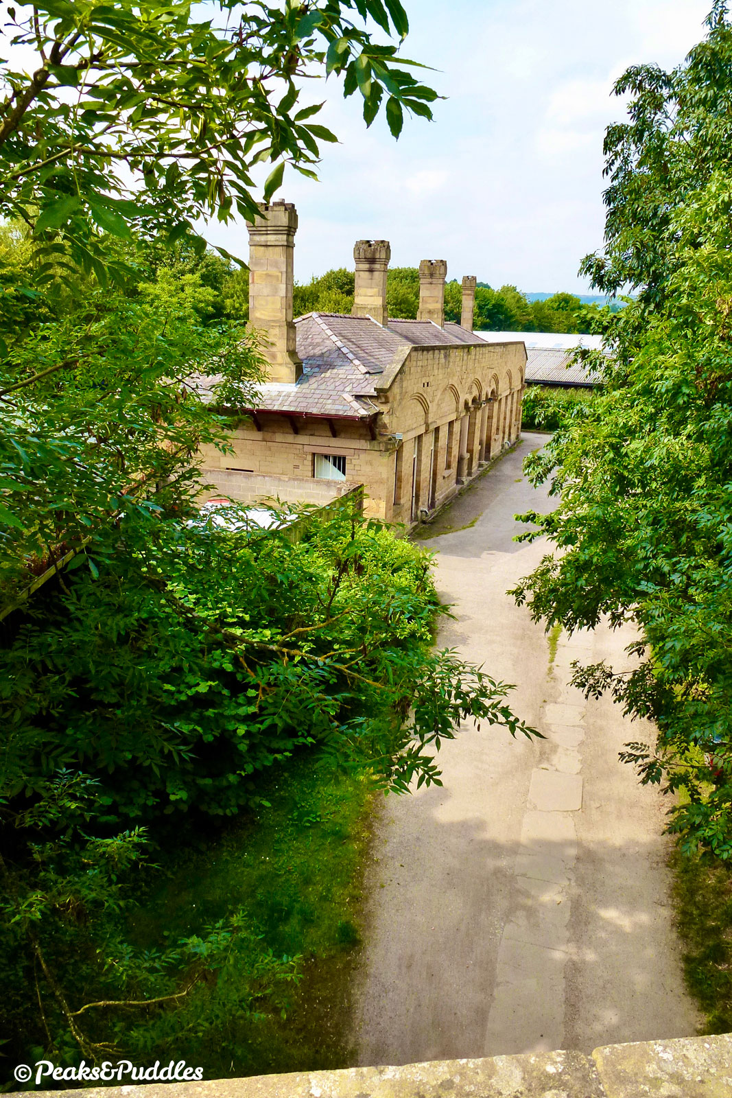
- With a brief view of Manners Wood on the ridge ahead, the line now quickly approaches the outskirts of Bakewell. The busy Baslow Road crosses on a bridge overhead, followed by urban back gardens alongside the trail. It’s soon obvious that the railway is staying put some distance above the market town, and the same River Wye last seen at Monsal Dale. Industrial units now take up the former sidings before Bakewell station itself, where the track bed has been infilled to make a wide level surface between the platforms. Like Hassop and Millers Dale, the platform canopies are sadly gone, leaving two stone buildings either side.
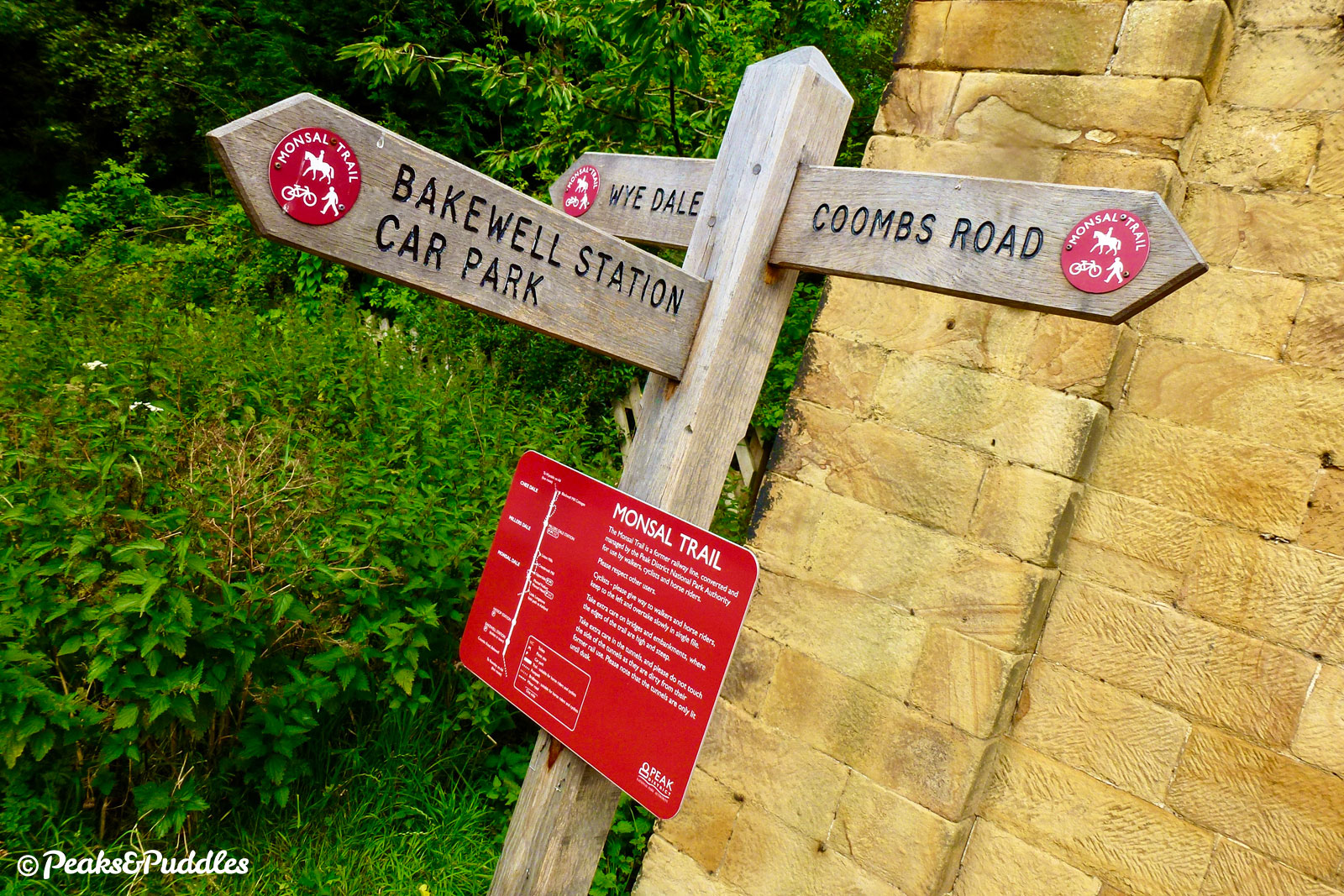
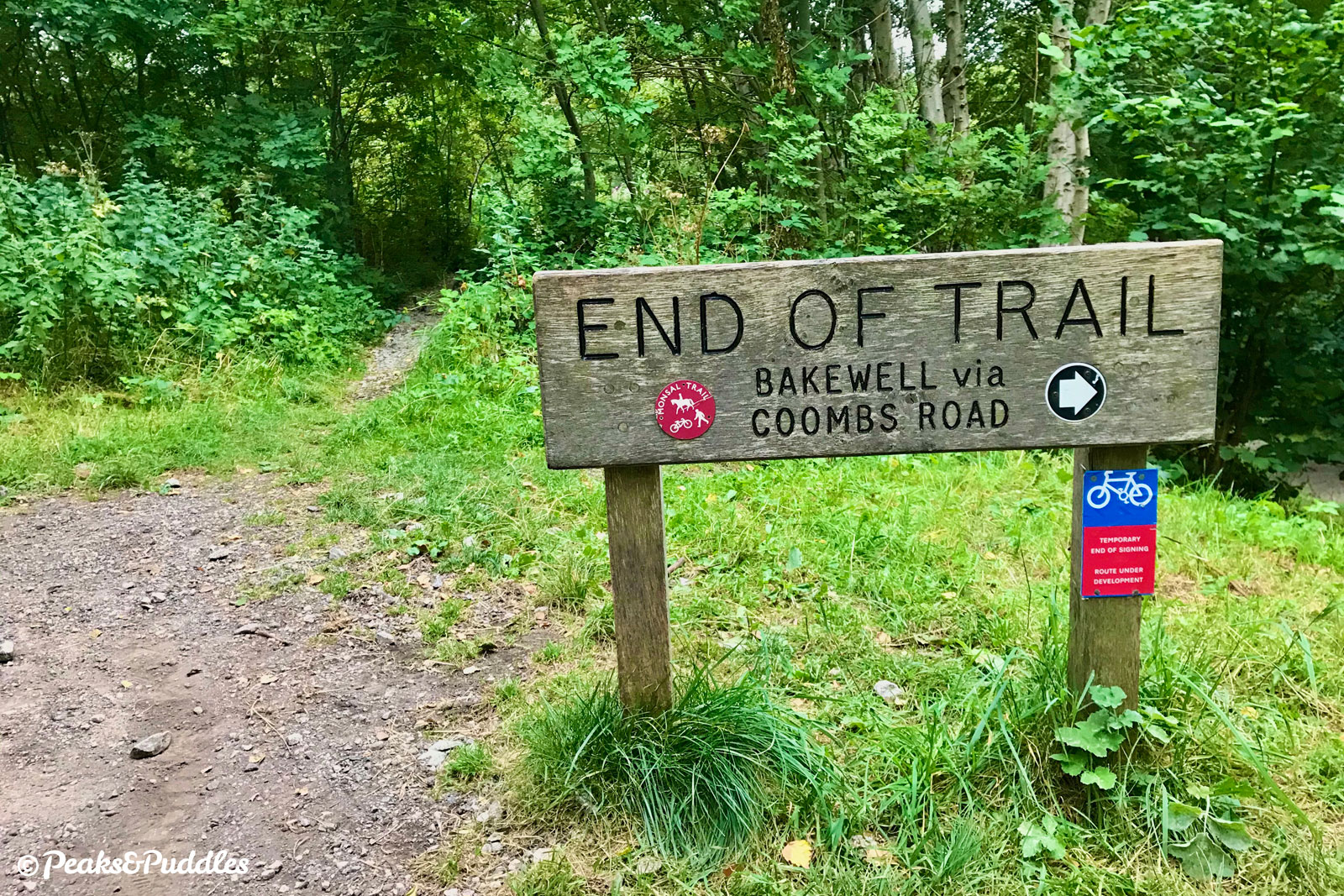
- South of Bakewell, the trail continues for a further 1.3 km (0.8 miles) but feels largely uneventful compared to the wonders further north, with trees lining the route. Near a bench and information board, a good view does open up over the market town and its impressive All Saints Church. Just before Coombs Road Viaduct, the trail stutters to an end with a wistful “end of trail” sign. The only consolation is that all its magic can now be enjoyed again, in reverse.
More to explore
- Bakewell
Besides its famous puddings (not tarts), this epitome of a Derbyshire market town has a good array of interesting shops, cafés and pubs, turned into a heaving mecca on summer weekends and particularly during its annual agricultural show.
From Bakewell station on the Monsal Trail, head down the hill on Station Road, turn left and cross the historic bridge. Or leave at the end of the trail onto Coombs Road for a gentler route (once you’ve walked the steep ramp down). - Monsal Head
The instantly recognisable viewpoint over Monsal Dale and Headstone Viaduct is up a sharp, narrow footpath from the side of the tunnel below. The lane from Upperdale in the bottom of the valley across the river up to Monsal Head is a famous, challenging cycling climb; you can get to it from the trail by dropping down on a stone track from the former Monsal Dale station, 700 metres (0.4 miles) north west of Headstone Tunnel. The good news is, there’s often ice cream at the top. - Chee Dale
One of the Peak District’s most magical landscapes, the incredible gorge of Chee Dale can be explored by an almost impossible footpath which winds its way beside the river, over bridges and stepping stones — but very liable to completely flooding in wet weather.
Access the footpath from either Blackwell Mill or near the viaduct closest to East Buxton Lime Kilns. The best place to lock bikes while you explore on foot is Millers Dale station, about 650 metres (0.4 miles) east. - Chatsworth
The Duke of Devonshire’s stately home is world renowned, its opulent, gold leaf-topped stone facades above the majestic River Derwent crammed with history, artwork and sculpture. The gardens are equally magnificent, with their towering Emperor Fountain, while the estate also boasts shops and dining, children’s farmyard and separate farm shop and café.
An easy route between Monsal Trail and Chatsworth is another obvious missing link, but one option from Bakewell is to follow the hill up Station Road, over the bridge beside the station, which leads steeply through woods to the estate’s Ballcross Farm. From here, you can either drop down a bumpy byway to the right straight to Edensor and the house itself or stay left for Pilsley and the farm shop. Either way, it’s a fair climb back too and be warned that the main B roads through the estate can be unpleasant for cycling.
Further reading

Then & Now: The Monsal Trail & The Railway from Matlock to Buxton by Alistair Lofthouse
If you’ve been captivated by the trail and just want one book on it, make it this one. Each page is a fascinating then-and-now comparison using the fabulous old photographs of E.R. Morten.

Ambergate to Buxton: including Peak Rail (Country Railway Routes) by Vic Mitchell and Keith Smith
Covering the entire route in photographs, history and detail from Ambergate junction in the south right through to Buxton, including the current Peak Rail heritage line.

Through Limestone Hills: The Peak Line Ambergate to Chinley by Bill Hudson
Hailed as the definitive book about the line, this tells the evocative story of the Midland building through limestone hills, accompanied by photographs and incomparable detail.

Over the Peak: Part 2: Peak Dale to Millers Dale by J. M. Bentley
Focusing purely on the middle of the Midland’s route over the Peak, this classic collection of railway photography includes Millers Dale when it was a major hub and the line through Chee Dale.

Railways in the Peak District: A History by Christopher Nicholson and Peter Barnes
A wider complete history of all the railways in the Peak District, past and present, this 96 page book naturally includes the full story of the legendary Midland line.

Lost Railways of Derbyshire by Geoffrey Kingscott
Providing an excellent 160-page potted history of all Derbyshire’s lost railways, 20 pages of which are dedicated to the Midland line.
Original photography, words and design by Anthony Sheridan unless indicated otherwise. Found this guide helpful? Buy me a coffee to help keep the wheels turning!
The all-important disclaimer: While great care and attention has been put into gathering these routes, ensuring details are accurate and determining their suitability, all information should be used as a guide only and is not a replacement for using your own judgement or research when setting out on new adventures. Peaks & Puddles/the author cannot be held responsible for any issues that may arise from the riders own decision to ride a section of indicated route.
Always ensure your equipment is safe and legal for use and that you are well prepared, carrying everything necessary including access to a good map. Follow the Highway Code and the Countryside Code at all times. Respect the landscape, the wildlife and the people you encounter. And after all that, have fun!