
Cheshire East’s new £53m Poynton Relief Road will open exclusively for walking, cycling and wheeling for one weekend only, before opening to general motor traffic from Monday, 6th March.
The three kilometre road connects the A523 south of Poynton with the large gyratory junction on the A555 south of Bramhall, planned in anticipation of this road.
A ceremony on Friday, 3rd March will mark completion of the road (helpfully they didn’t confirm a time in the press release, but apparently 10.30am-12pm), before the main carriageways are then open to the public — car-free — for the rest of the day and all day on Saturday 4th and Sunday 5th.
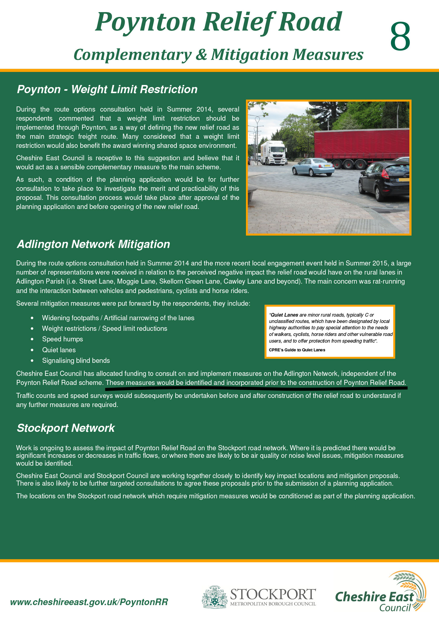
When those drivers do arrive, the road will at least have a generous 3.5 metre shared foot/cycleway along its length — a very welcome 1 metre wider than the not-quite-adequate A555 path. Though you have to wonder, with all that space to play with, why pedestrians and cycles couldn’t be separated. And is it really suitable and “safe” with no barrier beside a 50 mph road?
This new path could potentially create some useful new links, however cycling connections at the outset look decidedly poor.
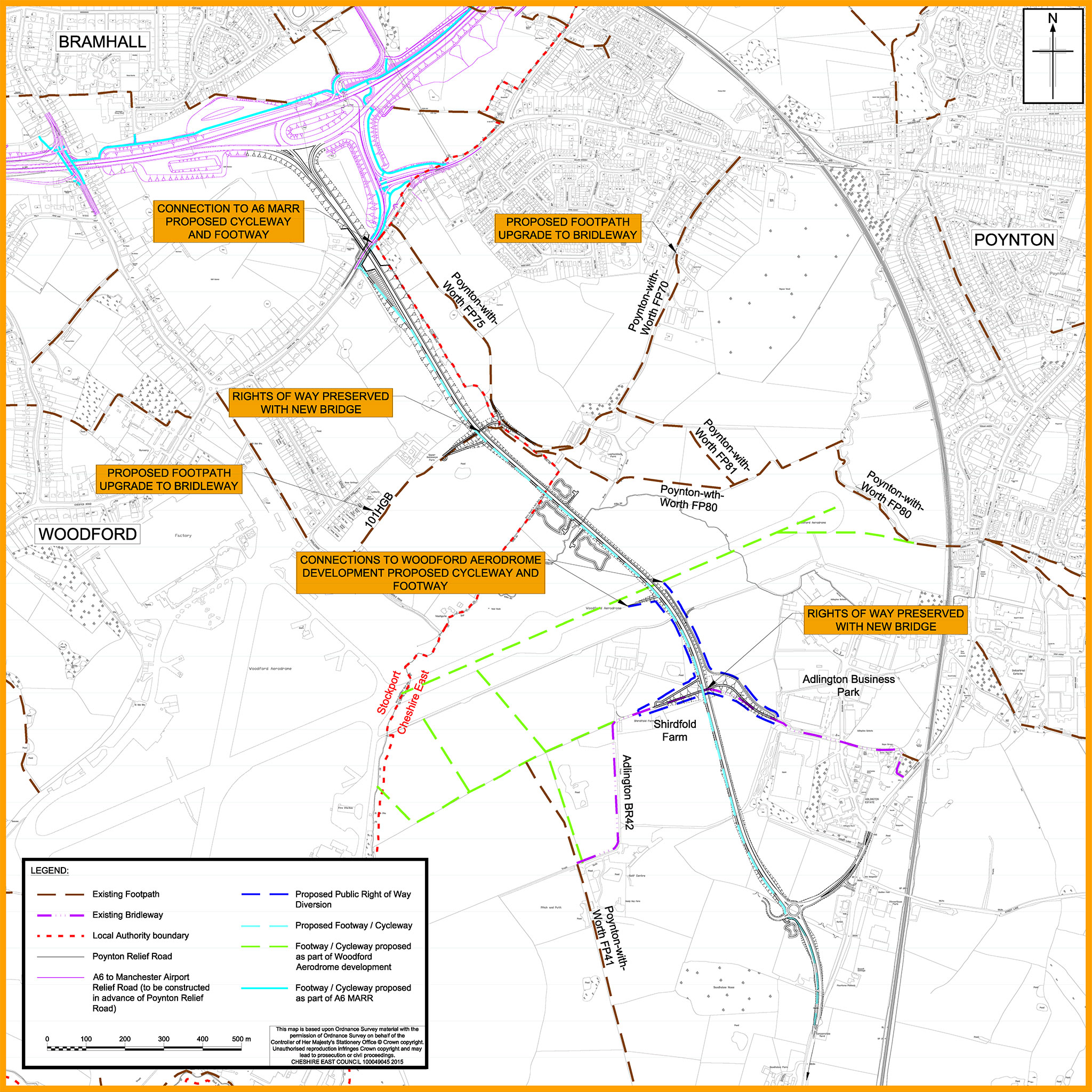
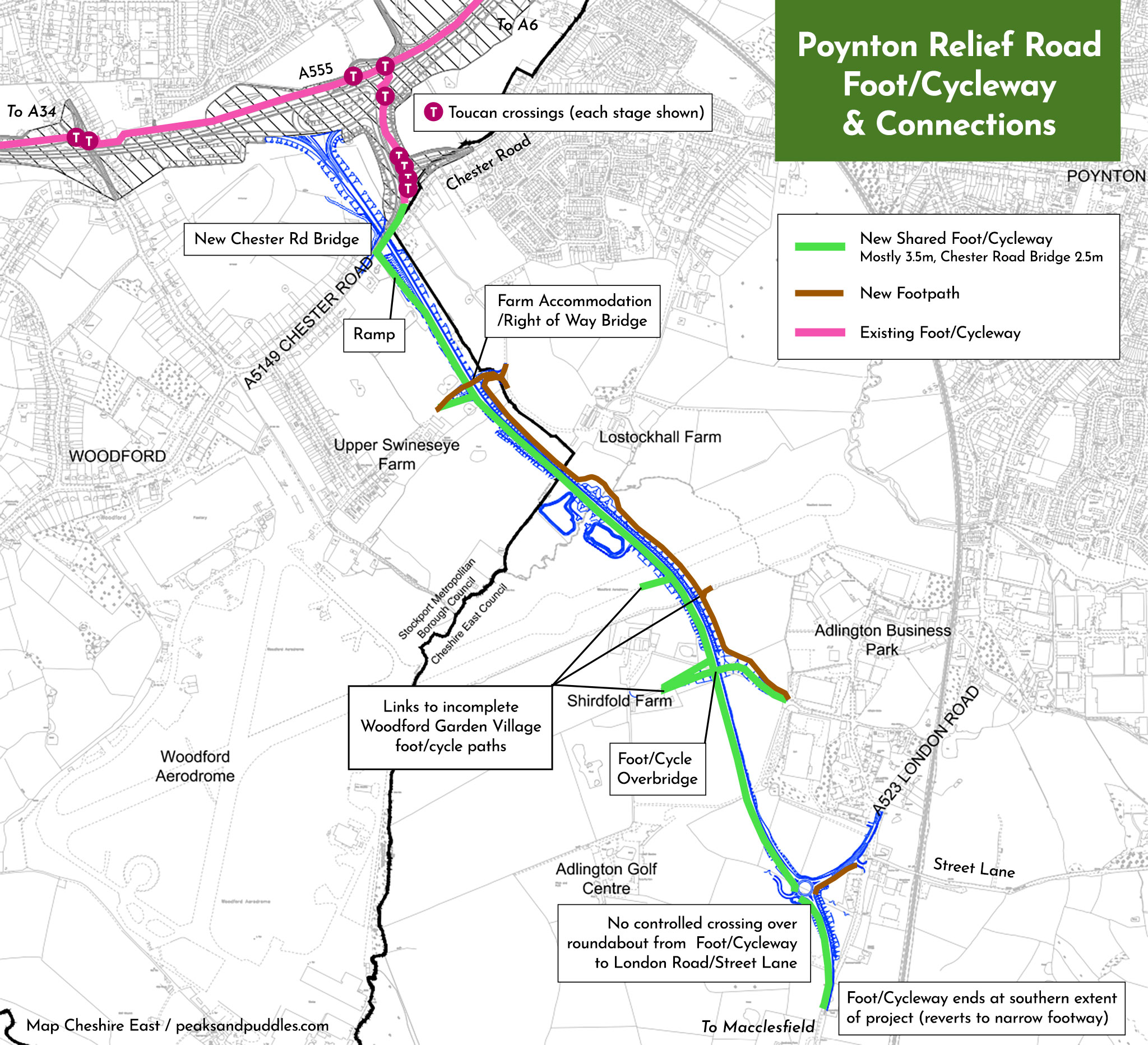
At the northern end, it can only be reached from the A555 by multi-stage toucan crossings to Chester Road, with no safe or protected link into Poynton itself here.
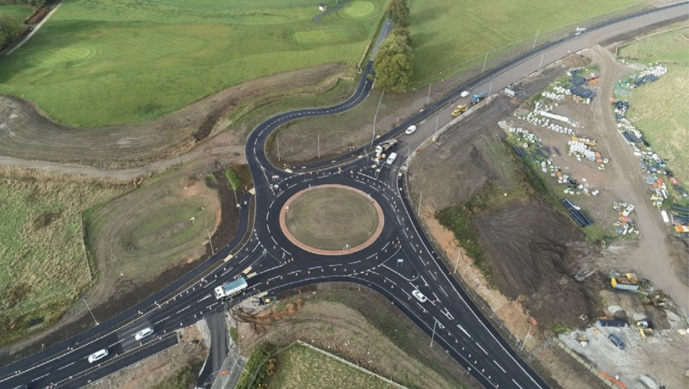
At the southern end, the shared path literally whimpers away beyond the new roundabout — there’s no continued cycle route alongside the A523 down to Macclesfield. This is despite huge sums being spent on widening the A523 junctions at Adlington (Mill Lane, Brookledge Lane) and B5358 Bonis Hall Lane — both implemented without any new cycling infrastructure.
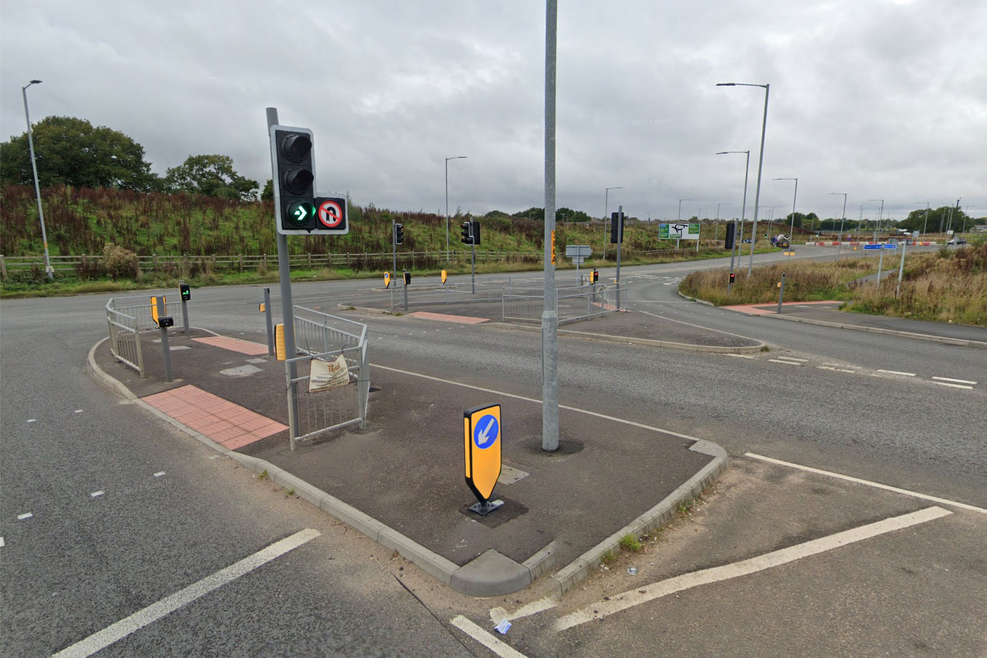
In fact, looking at plans and aerial photos, there’s not even a good link across the new roundabout at the end of the bypass into the south of Poynton or Street Lane (which leads up towards Middlewood Way) — you’ll be stuck trying to cross dual-lane roundabout slip roads on uncontrolled crossings.
Along the road… well, I’ll get back to you on that one. There are two new bridges (one a farm bridge and footpath, one a shared foot/cycleway to the business park), but how well these connect into actual usable routes isn’t particularly clear on paper.
Part of the problem here is that the huge Woodford Garden Village development to the west of the road, which promised new bridleways and cycle routes, is still very much a construction site.
Even so, given the two have been planned for years, alongside each other, it’s ridiculous that the residents of the supposedly idyllic, sprawling new “village” appear to be marooned no direct cycle link over the bypass to their nearest hub Poynton, with its actual supermarkets, shops and facilities.
The new 50 mph, single carriageway road is intended to remove through motor traffic from the centre of Poynton, with drivers instead signed west or east along the A555 then north to Manchester or Stockport respectively.
The road is to be named Roy Chadwick Way, after the engineer who designed the Lancaster bomber, a workhorse of the Second World War. Roy Chadwick led a team of engineers at Woodford before he was tragically killed during a test flight in 1947, aged 54. A memorial information board marking his death, and other crew members, has been unveiled and positioned near to the new road.
Cheshire East Council
However, although the town centre benefitted from a “shared space” scheme some years ago, no new changes will be made to the road network in Poynton itself. It’s truly disgraceful that the absurdly wide A523 north of the town will remain as-is despite it being bypassed at a cost of £53m, with Cheshire East having no plan in place for its downgrading nor the provision of safe cycle path to the Greater Manchester border.
Broken promises
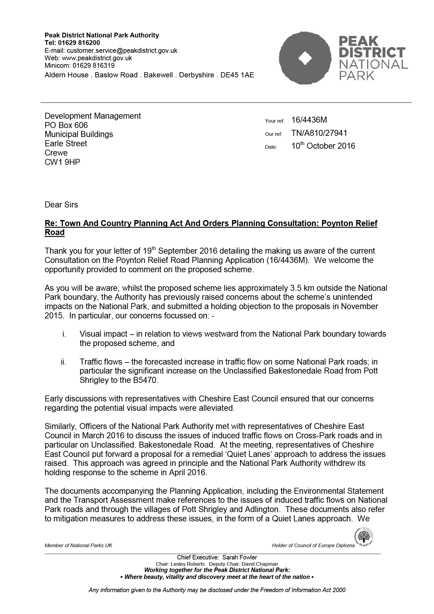
Cheshire East had promised — not just to the public but to the Peak District National Park, who originally opposed the relief road until agreeing only on this basis — that so-called “mitigation” measures like this would be put in place before the road’s opening.
With the new road potentially opening up a new east-west route from the High Peak avoiding the A6, some of these would be designed to protect lanes around Adlington and Pott Shrigley from increased and induced traffic (notably Bakestonedale Road — the beloved Brickworks).
But then in 2021, in classic CEC style, it quietly dropped the requirement.
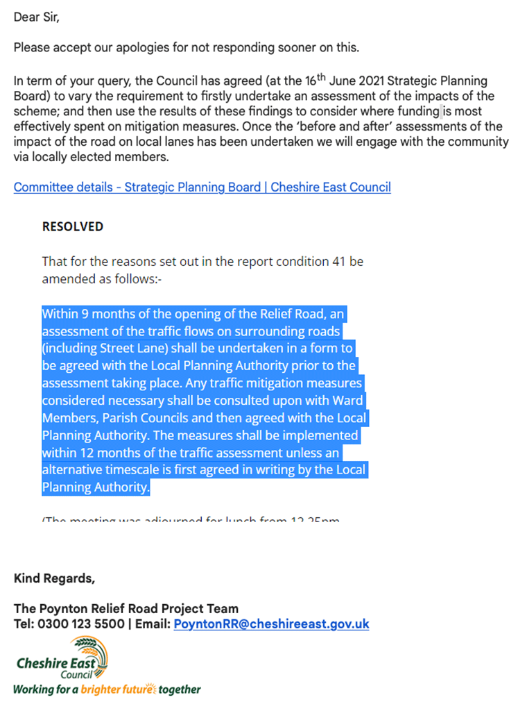
Now, the council is promising only that within nine months of opening an assessment of the traffic flows on surrounding roads will take place, to determine mitigation measures which will then be consulted on with ward members and parish councils.
Any measures will even then only be implemented within 12 months of that traffic assessment.
That’s up to 21 months after the opening of the new Poynton Relief Road to implement measures to protect these quiet local lanes loved by those cycling, horse-riding and walking. Or to do something about the soon-to-be-even-more monstrously oversized A523 London Road North.
Talk about shutting the stable door after the horse has bolted.