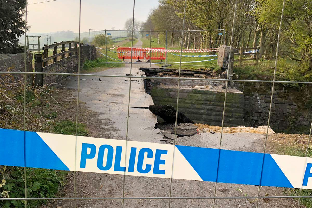
Derbyshire County Council are installing a permanent replacement for a High Peak Trail bridge destroyed by an HGV driver, requiring the multi-user path and road to be closed for four weeks.
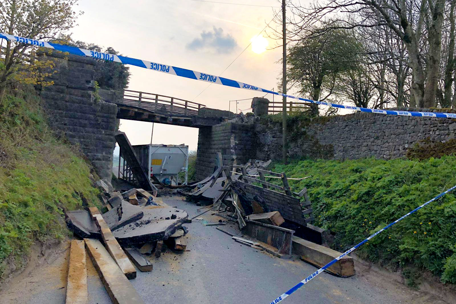
Spanning the B5056 road at Longcliffe near Brassington in the Derbyshire Dales, the bridge was struck by an oversized HGV on 17th April 2019.
The driver’s impact was so severe that half of the nearly 200-year-old, Grade II-listed bridge was immediately destroyed and the rest had to be demolished. Thankfully, nobody was on the bridge at the time and no one was injured in the incident.
Despite the devastation, Derbyshire County Council won well-deserved praise for getting a temporary bridge in place just five weeks later, allowing the trail to reopen.
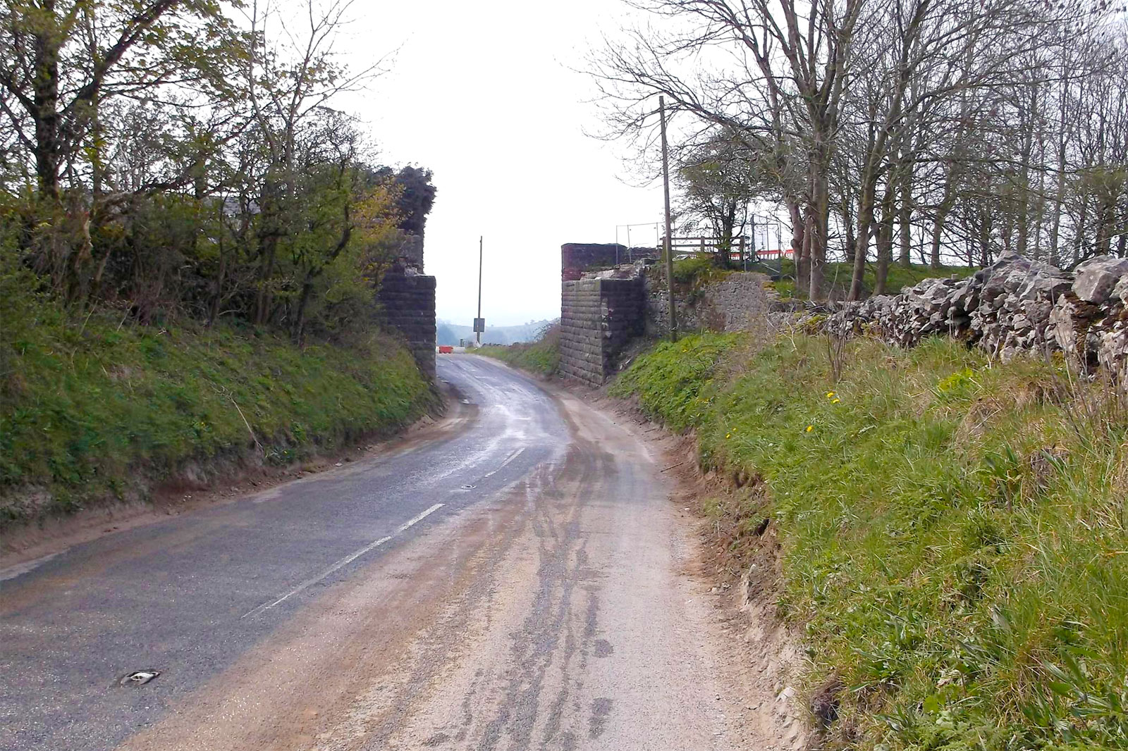
Now a permanent replacement is ready, which the council states will be mainly funded by an insurance claim and will be higher than the original by 5 feet to prevent future strikes (hopefully with gentler ramps than the temporary structure).
“One of the original cast iron girders that survived the collision will be positioned next to the trail, opposite the old station house, to preserve some heritage of the old structure.”
Derbyshire County Council
The closure is pencilled in from Monday 3rd October to Friday 28th October 2022.
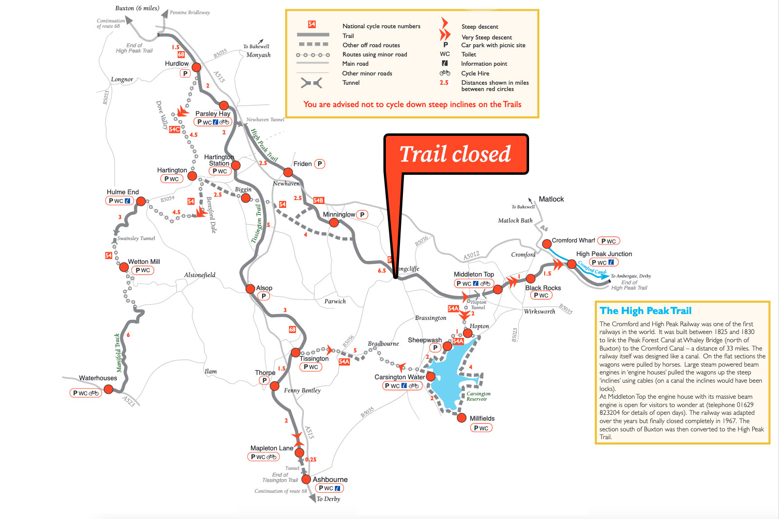
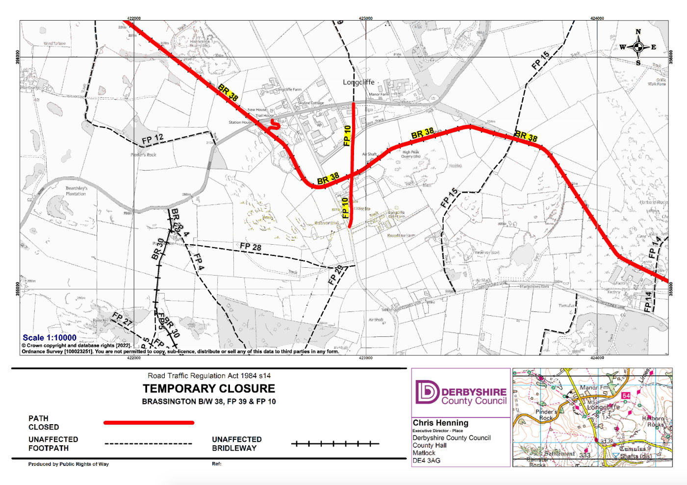
The council and Peak District National Park state diversions for both the road and trail are in place, yet haven’t been forthcoming with details. It’s not an easy gap in the former Cromford & High Peak Railway line to bridge, if you excuse the pun, with few alternative paths or even links to adjacent roads.
Derbyshire’s official path closure register shows “none recommended” for alternative routes.
I’ve contacted the parties involved asking if they can provide the official diversion route (or if not, make it much clearer the trail is cut in two). If they’re able to provide one, I’ll add it here and share it on Twitter @peaksandpuddles and Facebook.
Update 15/11/22: no-one ever provided a diversion route (I think I was correct in that there wasn’t one, and their communications were wrong), however the new bridge is now in place and the trail fully reopened, so the saga is complete. Well done to Derbyshire County Council dealing with this.
A guide to High Peak Trail is coming soon on Peaks & Puddles.