From Marple to Whaley Bridge, the Peak Forest Canal breaks spectacularly out into the hills as one of the most scenic stretches of waterway on the entire network. The towpath alongside forms a vital green link for seven miles, between the likes of Disley and New Mills, cutting almost right into the Peak District.
Route details
- Distance
 13.3 miles / 21.4 km
 - Elevation Gain
 17 m / 56 ft
 - Time allow 1 ½ hours
- Difficulty
 Gentle
 - Terrain 100% Off-Road Path Traffic-free trails, towpaths & cycleways 0% Road Quieter lanes, sometimes brief busier roads 0% Unpaved Bumpier tracks & bridleways
- Suited to
 All Bikes
  Gravel Bikes
  Mountain Bikes
 - Notes Reasonable surface throughout but parts are slighty bumpy and uneven, with tricky cobbles, tight widths under bridges and some puddles in wet weather.
- Suggested Start Marple SK6 6BN SJ 9614 8840
- Places Bridgemont, Buxworth, Cheshire, Cheshire East, Derbyshire, Disley, Furness Vale, Greater Manchester, High Peak, Marple, New Mills, Newtown, Stockport, Strines, Turf Lea, Whaley Bridge
- Attributes Accessible by train, Bridges, Canals, Car parking, Family-friendly, Industrial heritage, Out and back, Pubs and cafés, Reasonably flat, Suitable for older kids, Towns and villages, Views of hills and peaks, Views of open countryside, Woodlands and forests
It says something that being able to safely and directly cycle between these places today is only thanks to a 200-year old canal. A need to shift stone from the Derbyshire hills to the booming industrial workshop around Manchester saw plans for the Peak Forest Canal put forward in the late 18th Century by Samuel Oldknow, a cotton manufacturer who invested much of his wealth into industrialising the landscape around Marple.
Oldknow notably built the huge, lost Mellor Mill in the valley below the start of the upper canal and accompanied the waterway with numerous lime kilns to also turn the limestone into quicklime, used in construction and agriculture. Achieving the full feat of this canal, which at its upper level clings wondrously to the side of the valley above the River Goyt, was not particularly easy.
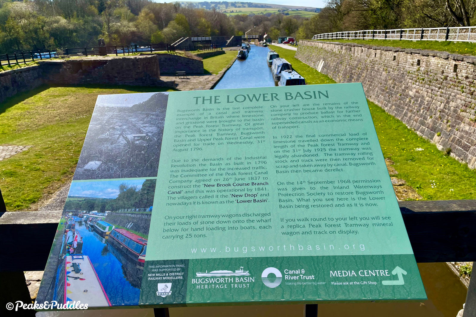
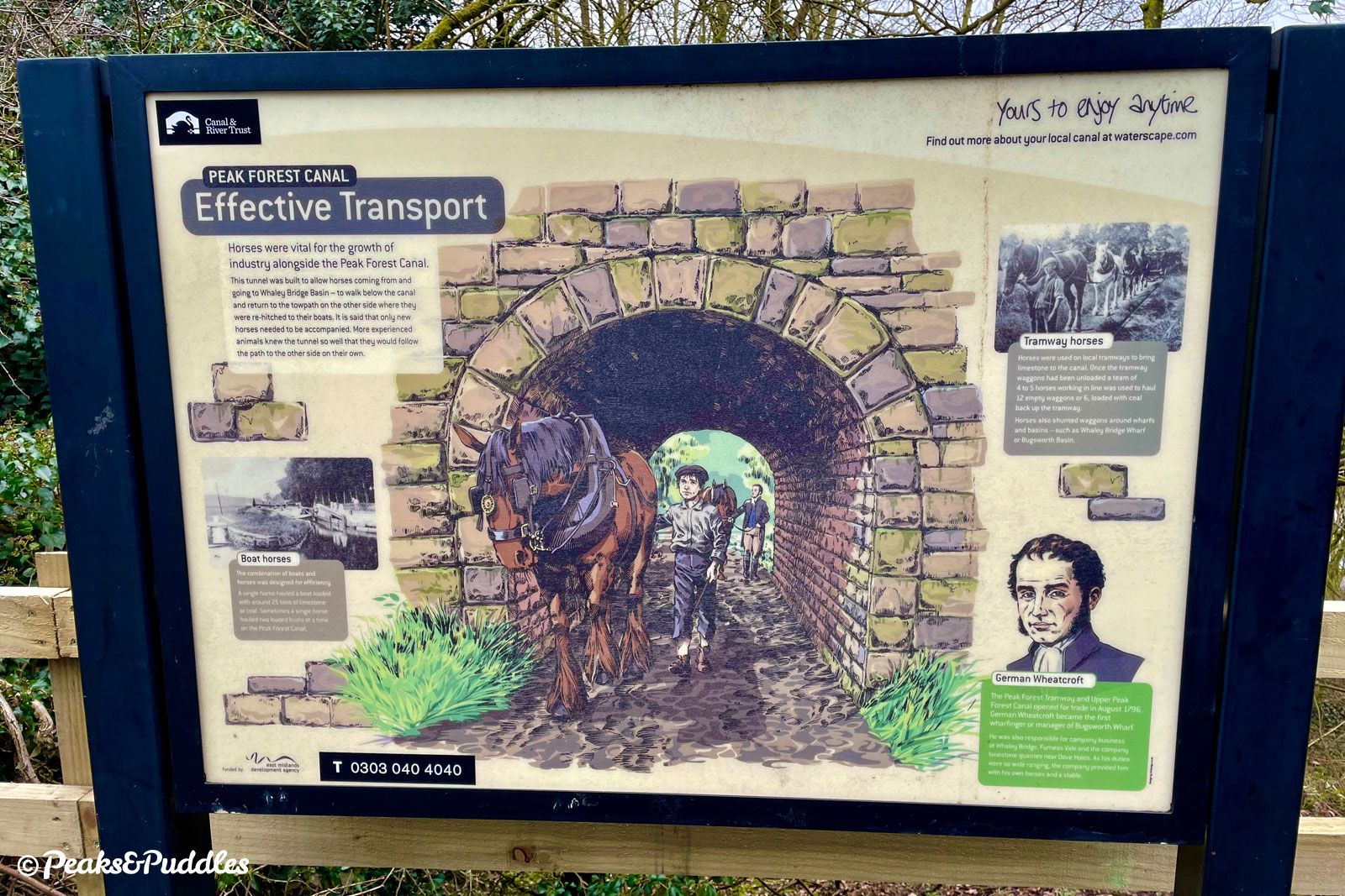
Authorised by an act of parliament in 1794, by 1796 both the upper and lower reaches were already largely finished, leaving just the minor problem of a flight of 16 locks, a 98 ft (30 metre) high aqueduct over the valley, a tunnel and a severe lack of money to connect them. Eventually the aqueduct was completed in 1799 and the canal fully operational by 1800. Yet still, until their completion in 1805, a temporary horse and gravity powered “tramway” ran parallel to the promised locks to make the connection.
At the upper end, another flight of locks to take the canal to the proposed terminus at Chapel Milton was cancelled entirely, with engineer Benjamin Outram instead extending the planned permanent tramway, bringing stone all the way from the quarries around Dove Holes to a major transhipment basin at Bugsworth. Part of that route is now preserved as the Peak Forest Tramway Trail.
Like many other canals, the Peak Forest fell victim to the competition of the railways from the late 19th Century. As the tramway to Bugsworth Basin fell into disuse in the 1920s, the impact of two world wars saw the lower canal and locks follow suit. It’s hard to believe now, but by the early 1960s these were silted up, overgrown, abandoned and completely impassable to boats; certain to be lost forever.
Instead, a national waterways revival and valiant campaign efforts saw the entire canal saved and restored to full use in the 1970s. It wasn’t until 2005 however that Bugsworth Basin, disused for half a century, was brought back to life by a similar effort, now a popular stopover for visiting boaters.
The two halves of the canal can easily be seen as separate waterways thanks to their unique character and surroundings. While the Lower Peak Forest Canal to Ashton-under-Lyne is more urban and industrial, but also heavily surrounded by woods, the upper canal truly feels like a dramatic, wide open gateway leading you out into the valleys of the Peak District hills — miraculously while staying perfectly level.
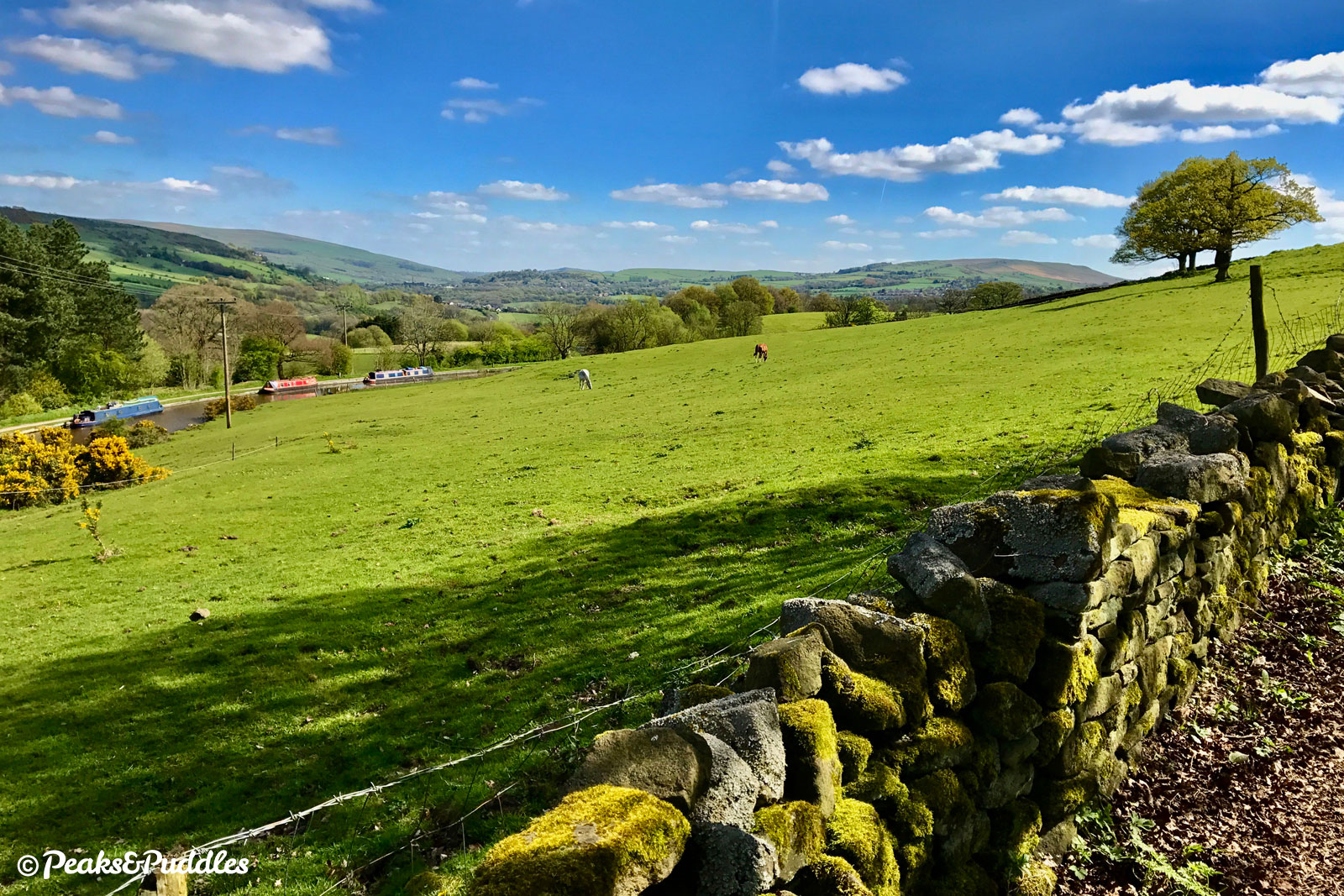
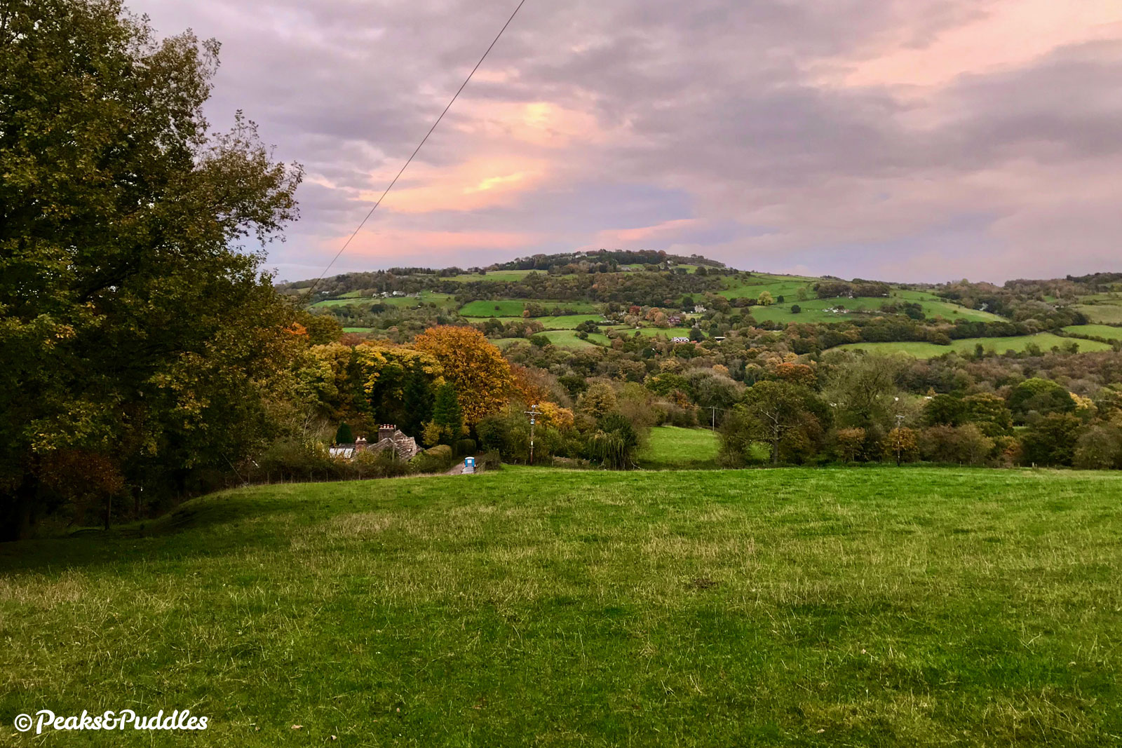
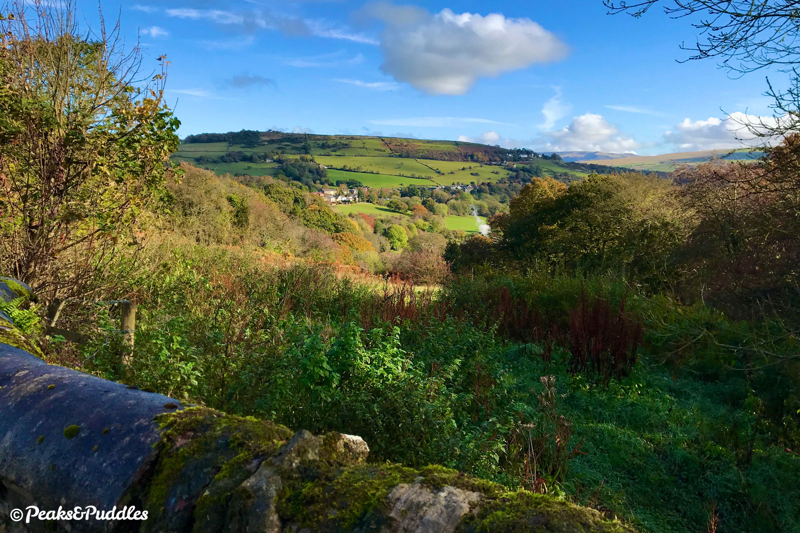
And yet this is still not a particularly rural canal. Passing by Disley, Newtown, New Mills and Furness Vale, you’re never far at all from busy roads and residential hubbub, some of it directly lining the canal. The real treat is the view across the valley to the peaks of Cobden Edge, Chinley Churn and, in several places, even Kinder Scout. The fact that the canal never actually touches the boundary of the National Park only goes to show that the notional magic of “the Peak District” can be enjoyed well outside its borders and far closer to civilisation than many think.
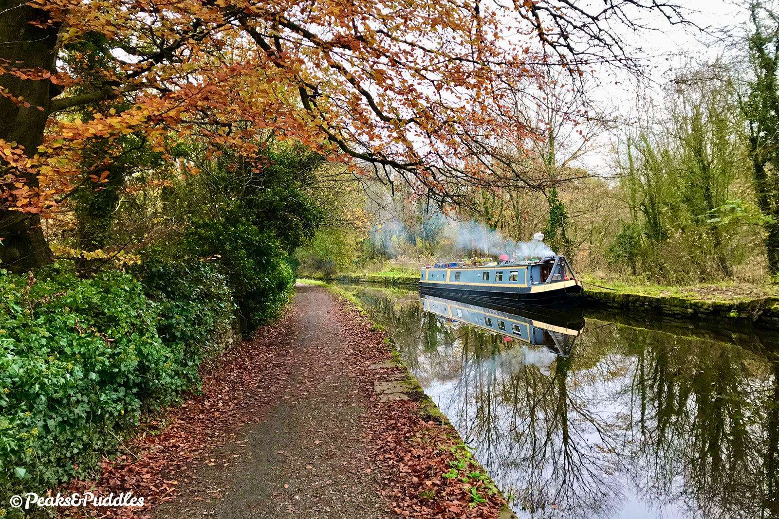
Following the Peak Forest Canal by bike is a brilliant way to explore it, giving constant interest, intrigue and beautiful views. There’s something new to see around every corner. Though narrow, and in some places often puddled, it is still one of the better semi-rural towpaths and most importantly allows you to avoid cycling horrors like the A6 to calmly and peacefully navigate a route into the hills.
Combined as one route, the full Peak Forest Canal is a 24 km (14.9 mile) ride from Bugsworth Basin to Dukinfield Junction. See the separate Lower Peak Forest Canal and Marple Locks cycle route guide to explore the rest of the route.
Route map
Getting there
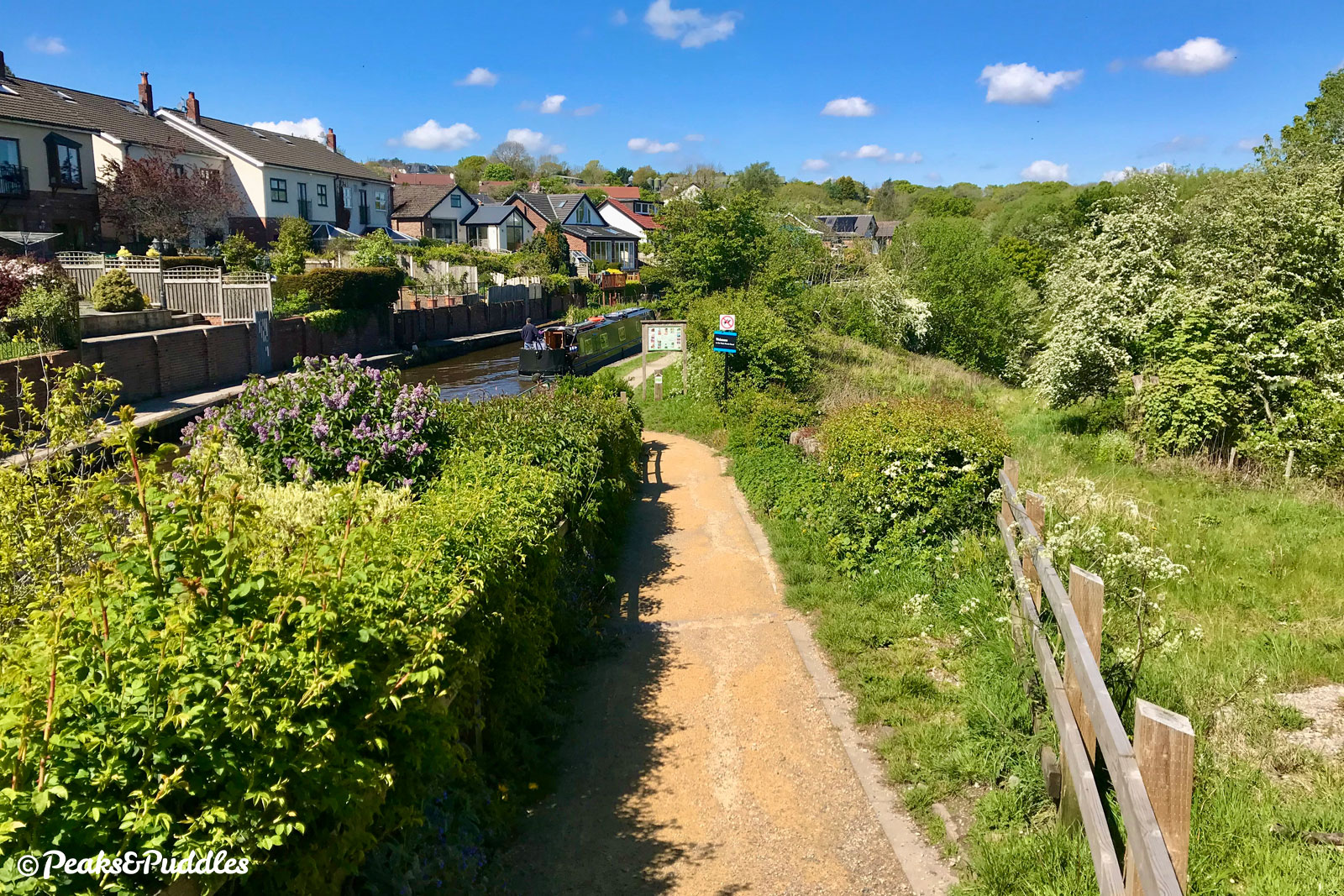
Marple Junction on Lockside is where the Upper Peak Forest Canal begins atop the Marple Lock Flight. The Lower Peak Forest Canal naturally links straight in from Romiley, Woodley, Hyde, Dukinfield and Ashton-under-Lyne, while the bumpier Macclesfield Canal links from High Lane.
To get here from elsewhere, absolutely avoid the main Stockport Road through Marple (unless you enjoy jostling with heavy traffic) and trace a route across the residential side roads to the north or south. From the Middlewood Way, see the quiet road route using Mount Drive and Woodville Drive mapped in the Lyme Loop cycle route guide. From the Alan Newton Way and central Stockport, stick to the north side of Marple, using Bowden Lane and Norbury Drive to access the canal at Lock 7 off Grosvenor Road.
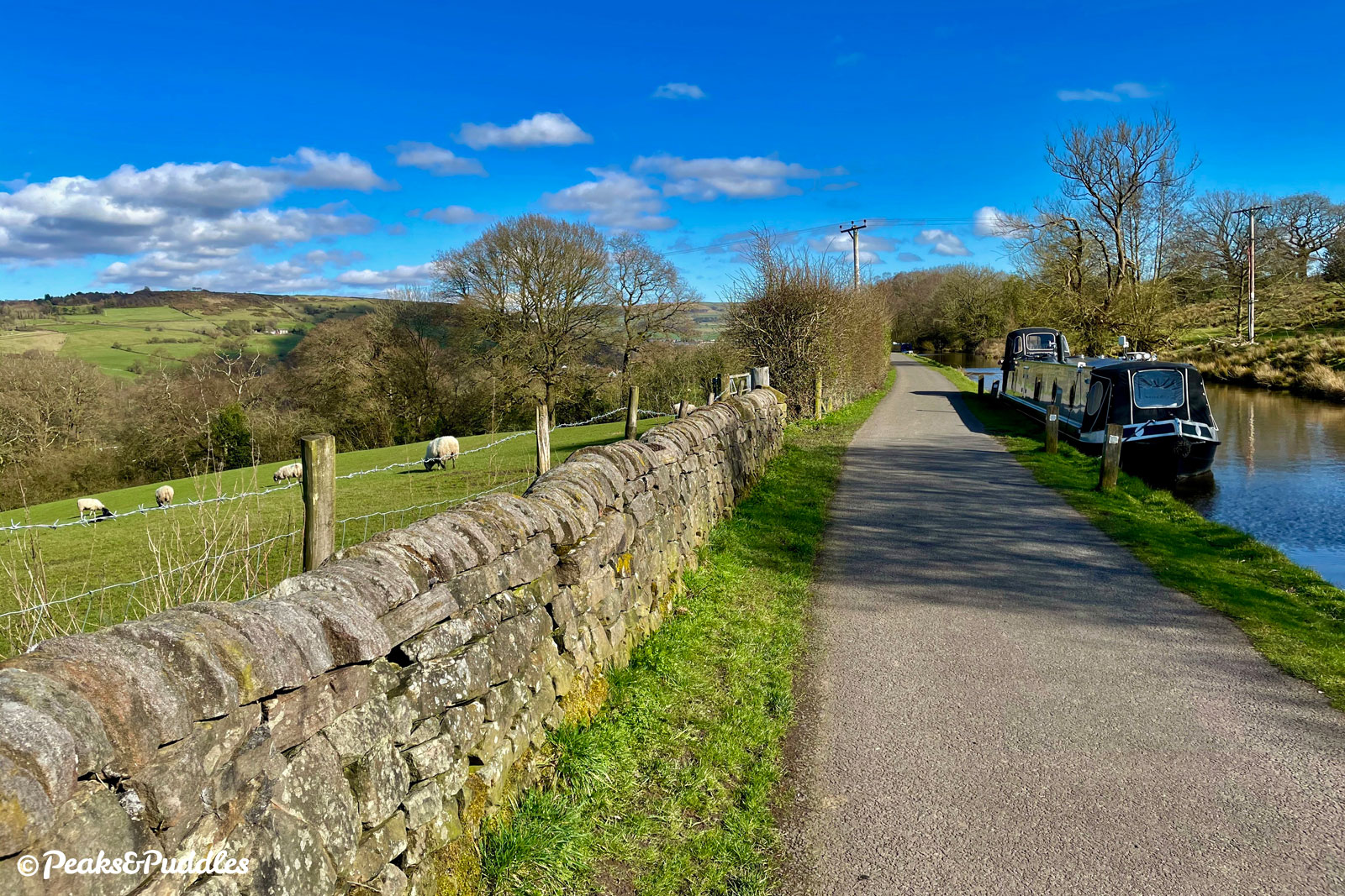
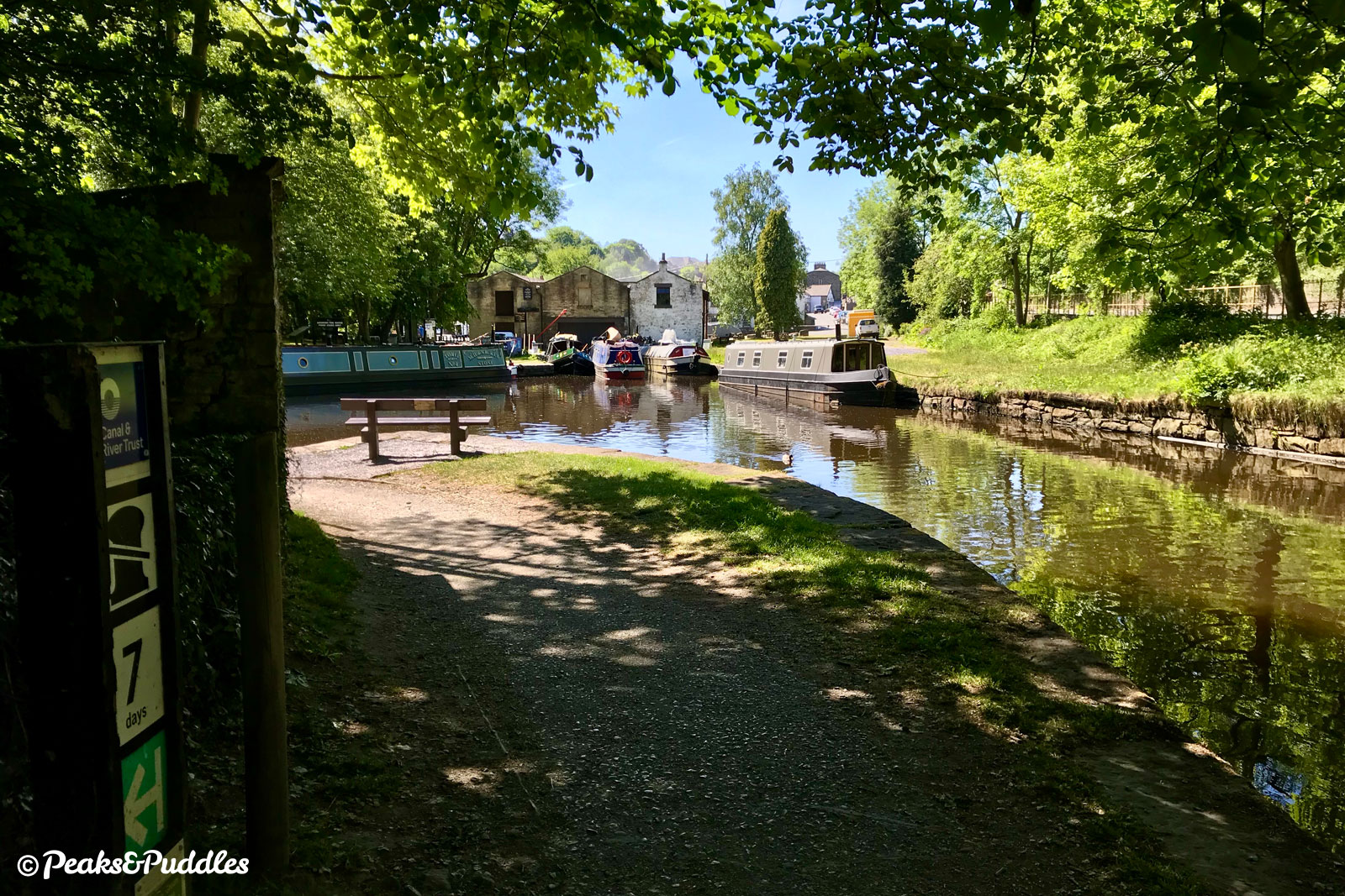
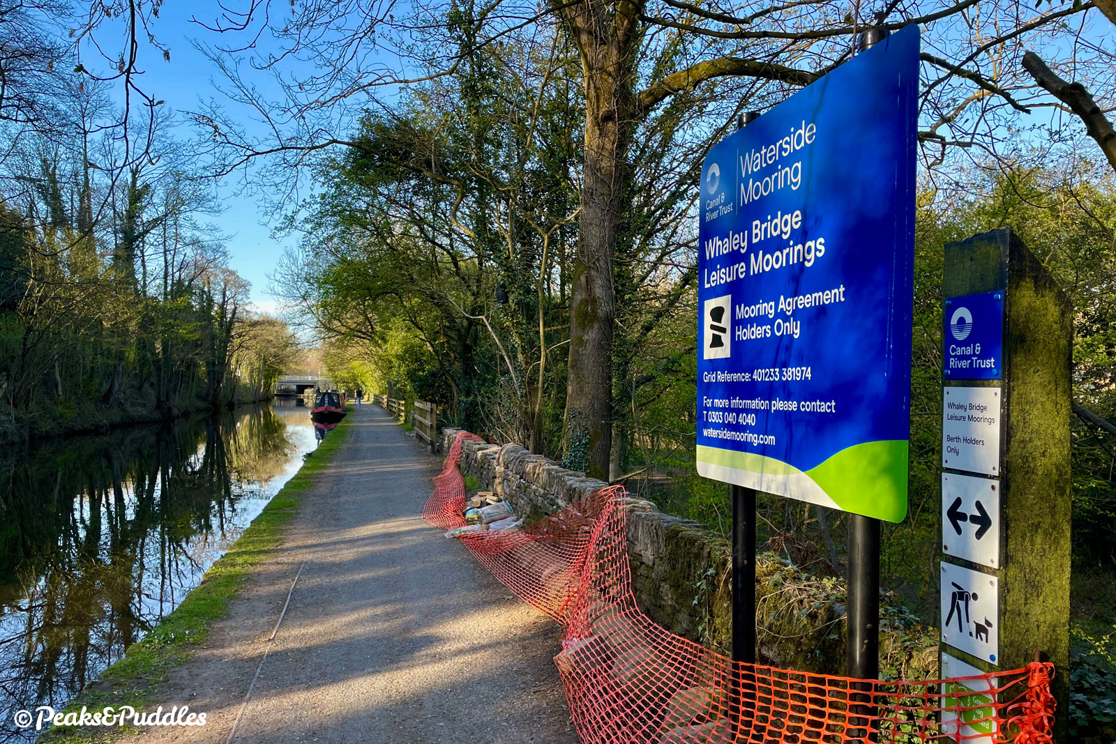
Plucksbridge Road in Strines, Hagg Bank Lane in Disley, Victoria Street in New Mills and the basin off Canal Street in Whaley Bridge are all key, level, unobstructed links onto the towpath, while Bugsworth Basin off Brookside is the ultimate terminus featured here, linking onto the short Peak Forest Tramway Trail. Note that any foray to or from the short Whaley Bridge arm requires steps or ramps at the junction (see ‘Things to note’).
By train: The Upper Peak Forest Canal is practically spoilt for railway access. Though Marple railway station is a short slog of a climb up Brabyns Brow (which you might prefer to walk) and half of the locks, Whaley Bridge railway station at the other end provides good access across to Canal Street and its basin. Furness Vale is convenient too, and New Mills Newtown isn’t too far, though on the wrong side of the canal.
By car: Space is at a premium around the canal in Marple, so best to use the council car parks at Trinity Street, Townley Terrace or Memorial Park. There’s no particularly ideal parking in Strines, Disley, New Mills or Furness Vale, so the best alternative is the small amount of informal parking space around Bugsworth Basin or the official Canal Wharf council car park or on-street parking in Whaley Bridge.
Things to note
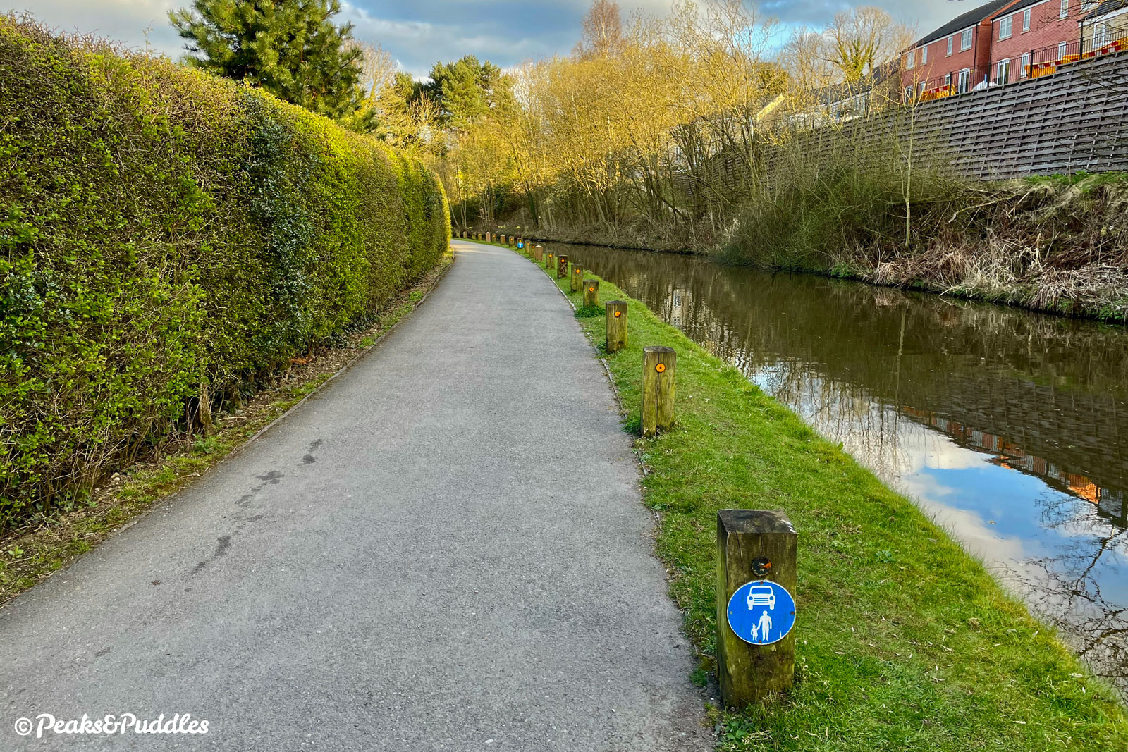
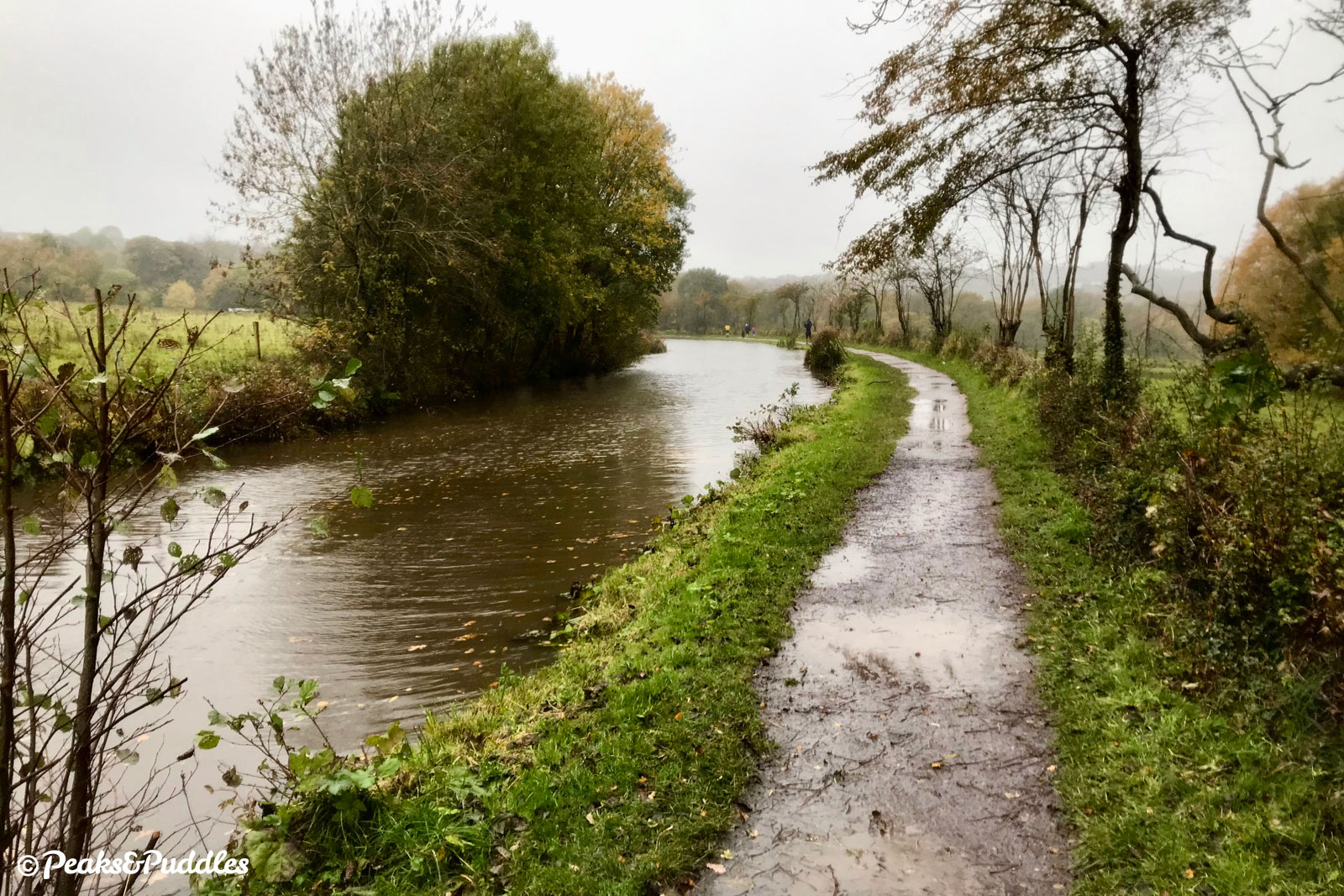
- The towpath surface varies greatly not just between each district but even between each bridge. Between Marple and New Mills it’s mostly compacted stone, but for almost a mile soon after leaving Marple this can be heavily puddled and unpleasant long after wet weather. Luckily many recent works by the Canal & River Trust and volunteers have mostly improved things beyond there. From New Mills to Whaley Bridge, the surface is tarmac though now showing its age and getting bumpy in places.
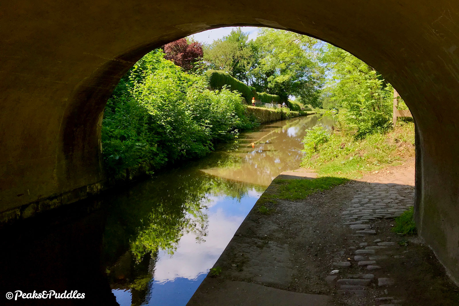
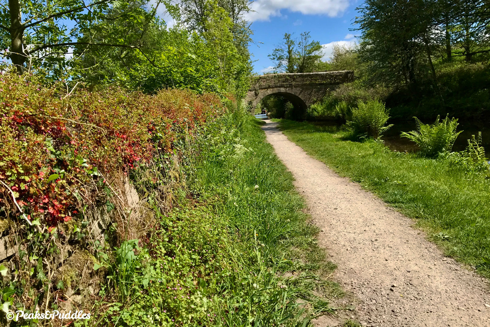
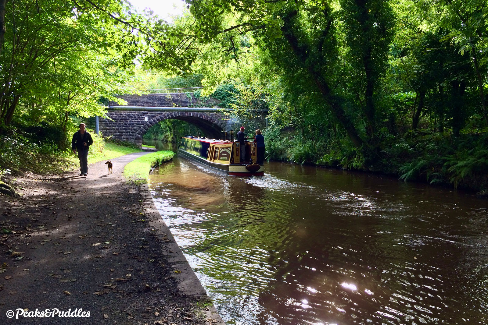
- Of the 16 bridges you’ll pass under on the way to Bugsworth Basin, luckily just 8 are the classic tightly arched kind (and one can be skirted around), narrowing the towpath precariously close to the water’s edge. It’s a good idea and good courtesy to slow right down and ring your bell on the approach to each, as the towpath is often hidden on the other side. Take care on the very uneven cobblestones underneath or if you’re really unsure at first, dismount.
- Access to the towpath is very good, with no annoying barriers and level, step-free access available at numerous places (see ‘Where to start’). There’s a slightly tricky curved cobbled ramp at the Marple end onto Brickbridge Road though, which is a shame.
- At Whaley Bridge Junction, to get to or from the Whaley Bridge arm requires carrying your bike over a very narrow footbridge with steep stone steps or going under the canal via two steep cobbled ramps built with horses, not bikes, in mind. A gentler but more complicated alternative to both is to use the stone path further back next to the A6 bridge (Bridge 36), then go under the canal, across the Tesco car park and to the right-hand corner of the supermarket, where a fairly tight footpath leads around the back and up an easy zig-zag ramp.
- See Tips for Cycling on Shared Paths for general advice about cycling on towpaths. When passing others: slow right down, ask to pass well in advance by bell or a friendly voice, wait until a signal that you’re welcome to pass. Pedestrians ultimately have priority. If it feels too narrow to pass, stop and/or wait. Canal towpaths often aren’t designated rights of way for cycling (or even walking) but the Canal & River Trust thankfully allow access with little restriction, so always be a gracious and courteous guest.
Found this guide helpful?
Please consider chipping in the price of a coffee to help pay the bills and support my work. Or become a Peaks & Puddles Plus supporter to get access to exclusive routes and pages in return.
Route stage-by-stage
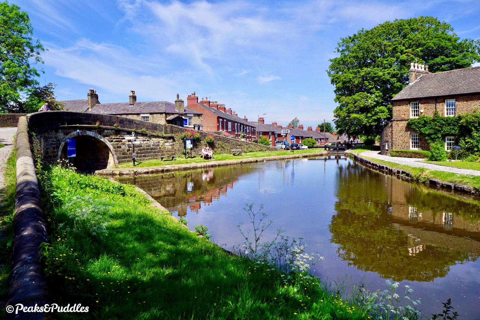
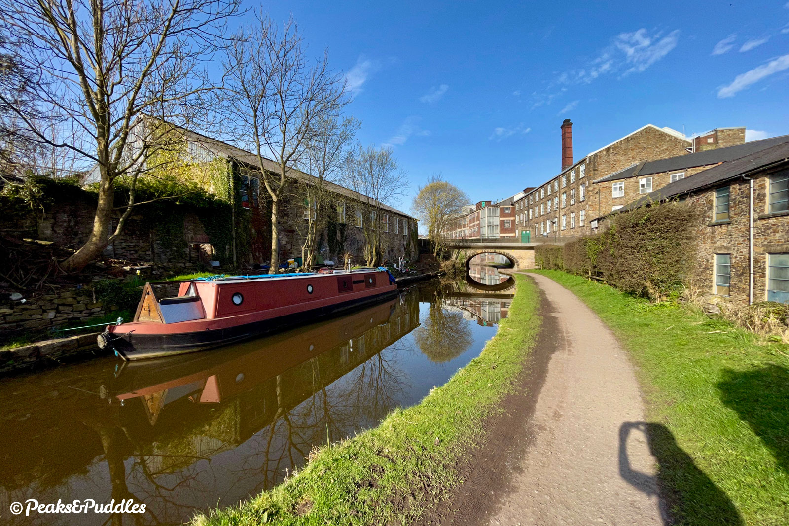
Atop the first bridge of the Macclesfield Canal, the view east from the top of the sixteen locks at Marple Junction is just a tease of what’s to come. The suburban redbrick houses are giving way to glimpses of the open valley across to Mellor and the picture-perfect gritstone Top Lock House stands proudly.
Now two houses, this was originally built by Samuel Oldknow for a boat-building yard to the right, operated until the 1930s by the Jinks family. Basins also served the lime kilns built into the banking, now all a marina for long term moorings, and a large Mineral Mill.
This junction forms one corner of the Cheshire Ring, a canal circuit including the Macclesfield, Lower Peak Forest, Ashton, Rochdale, Bridgewater and Trent & Mersey Canals — but not the Upper Peak Forest, which stands alone as a quiet and magical spur of the waterway network…
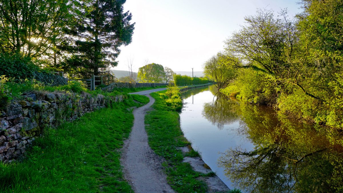
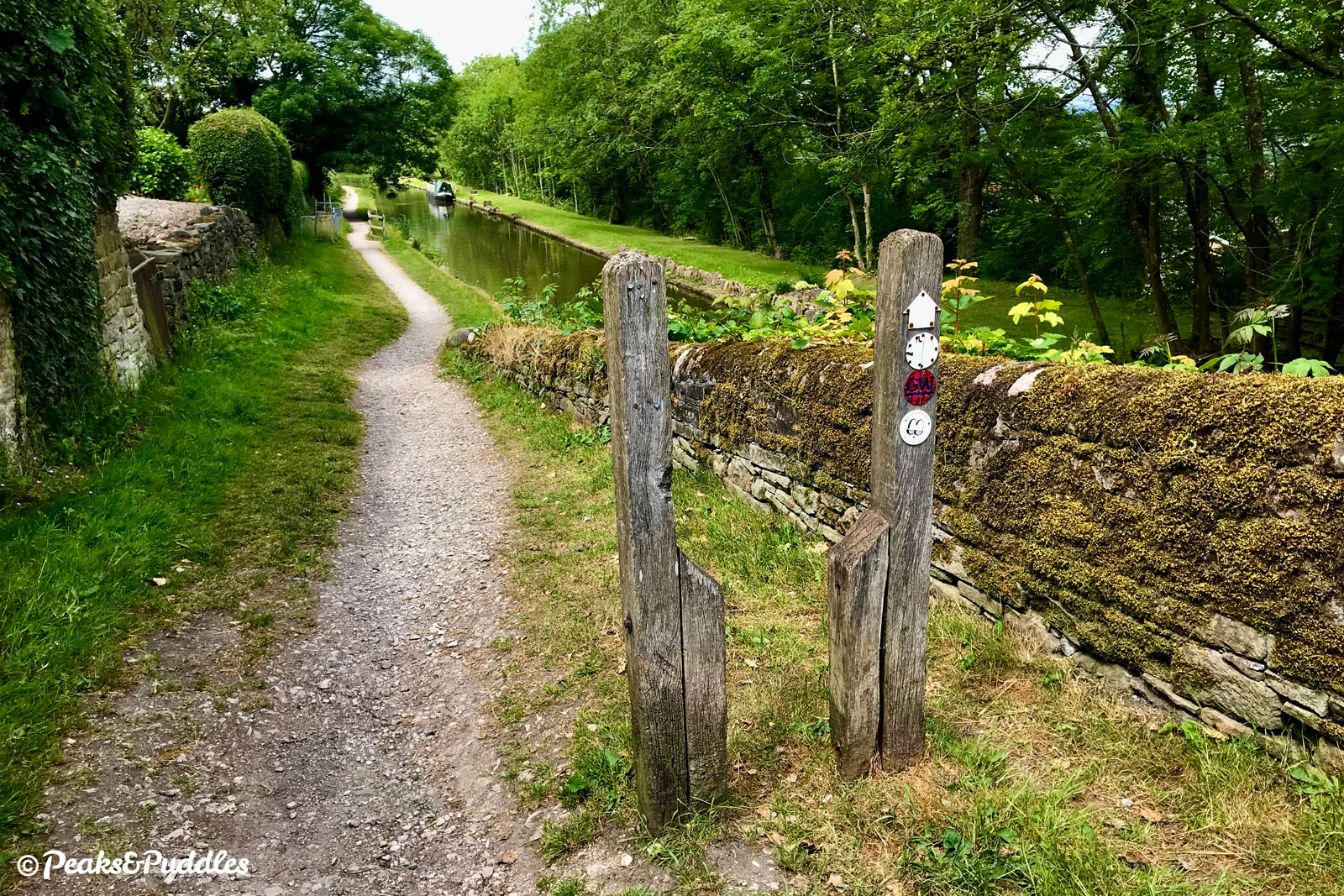
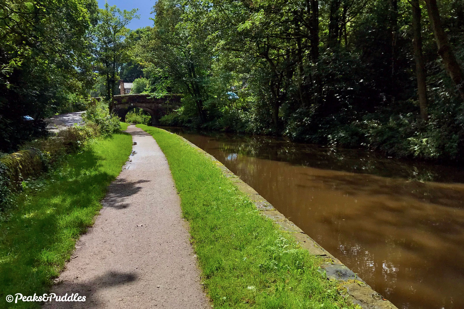
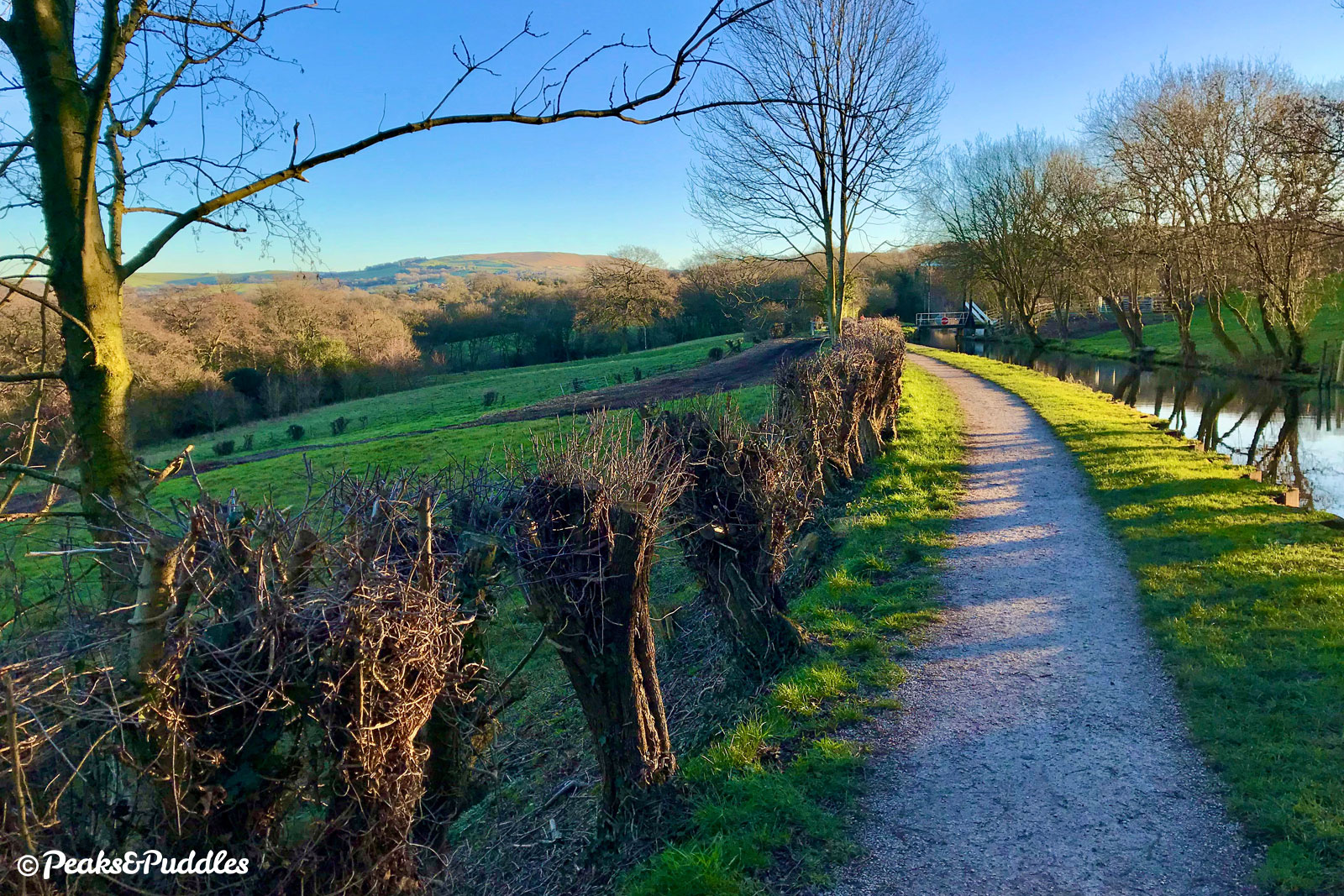
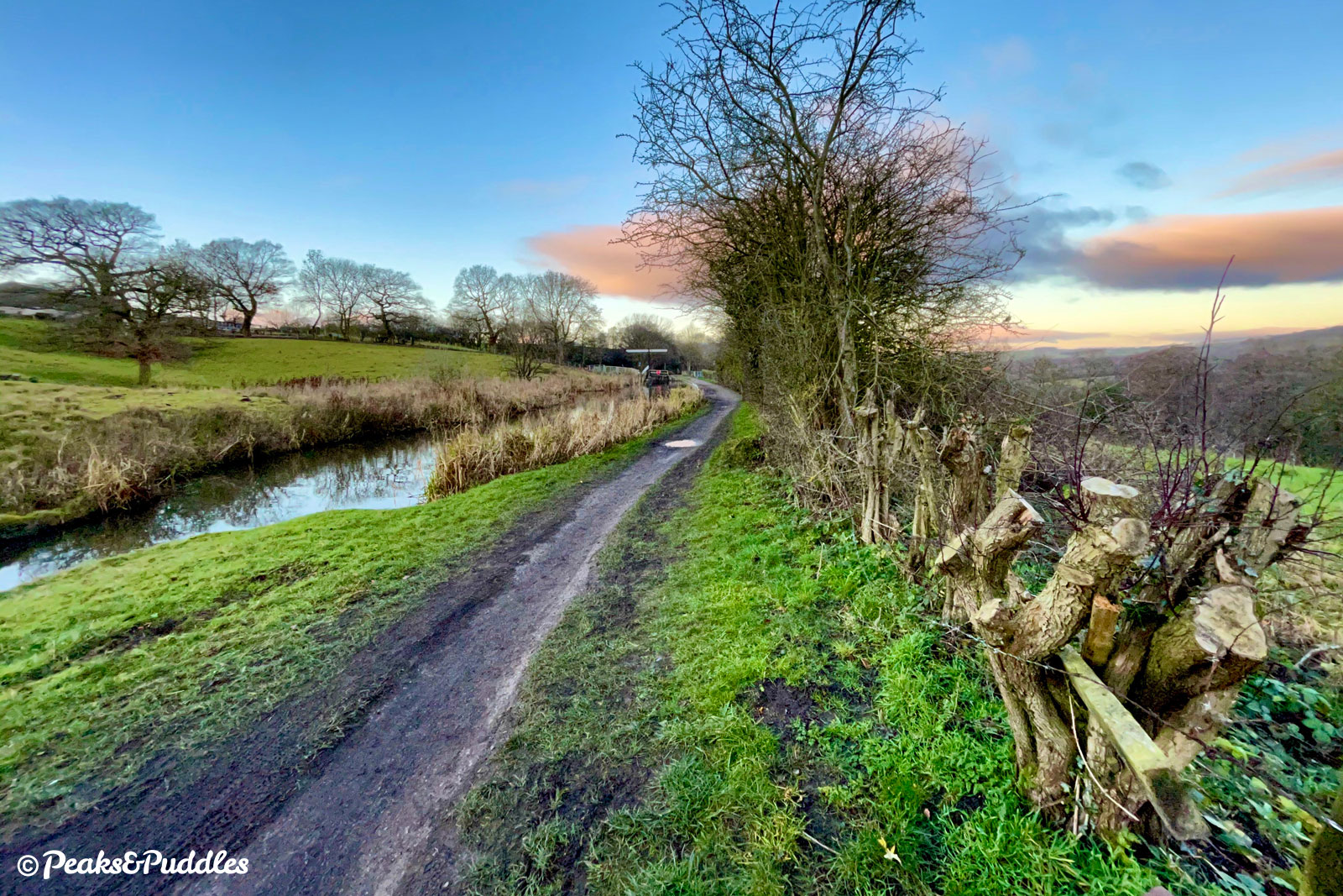
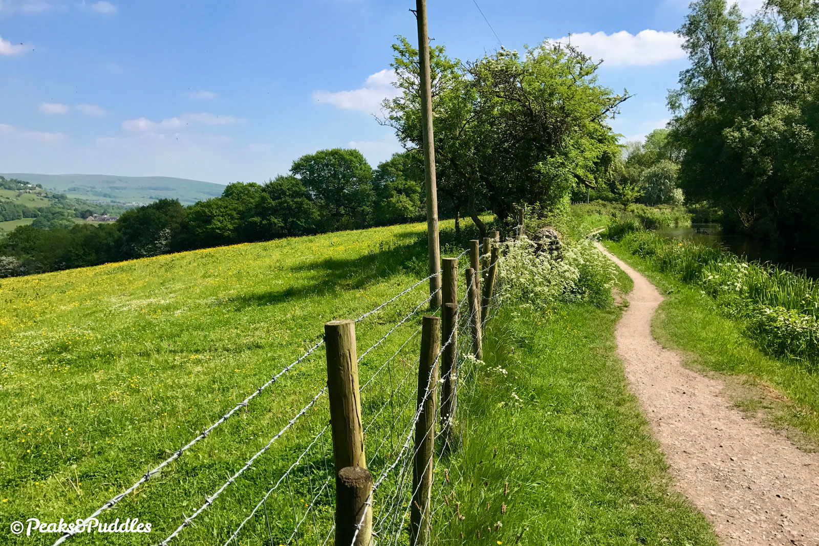
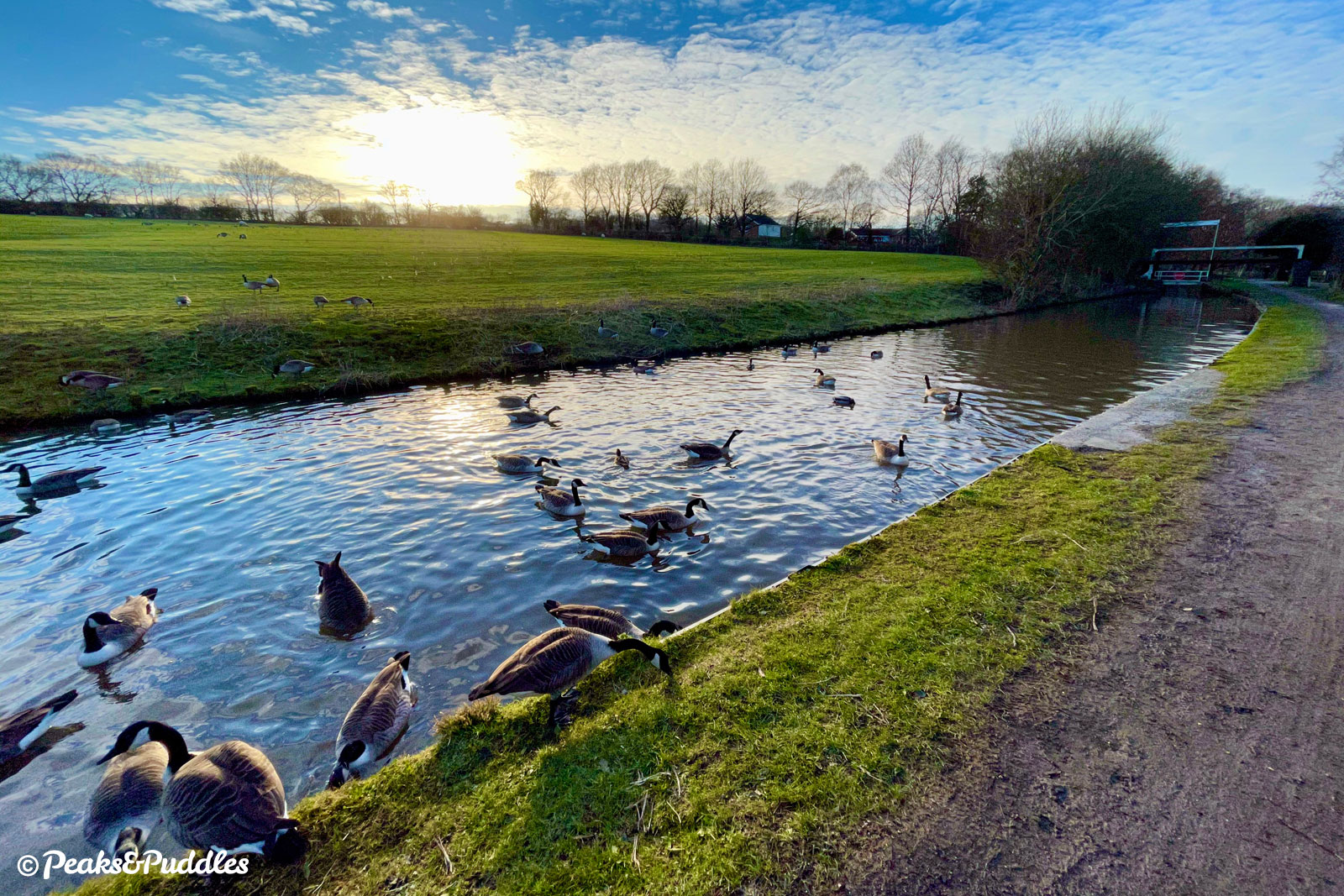
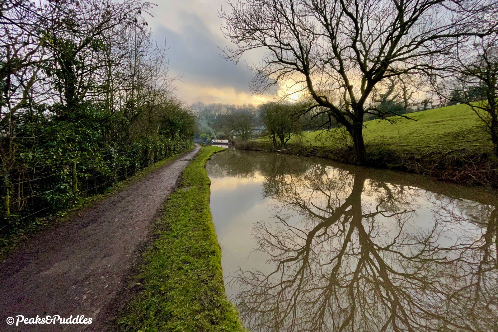
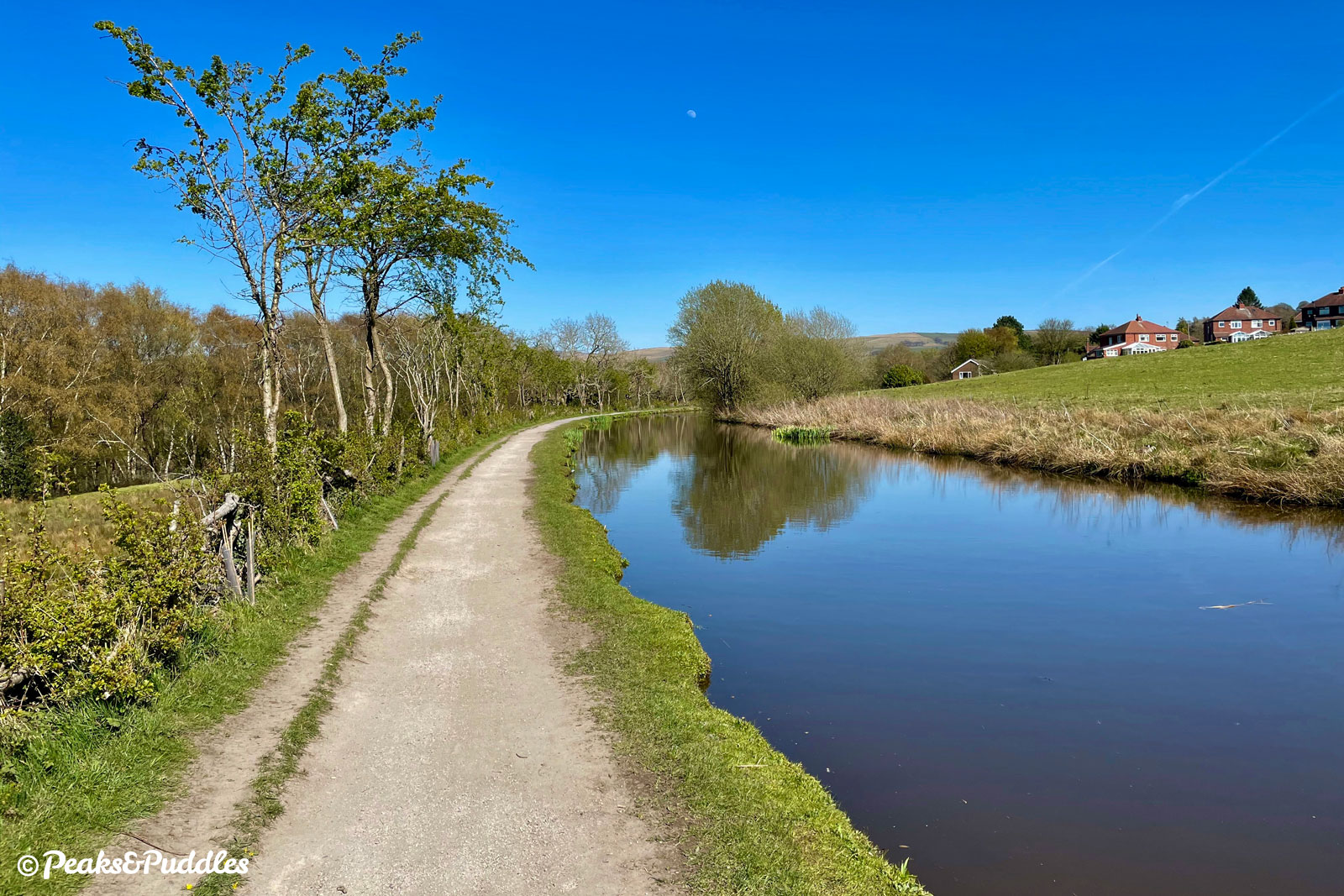
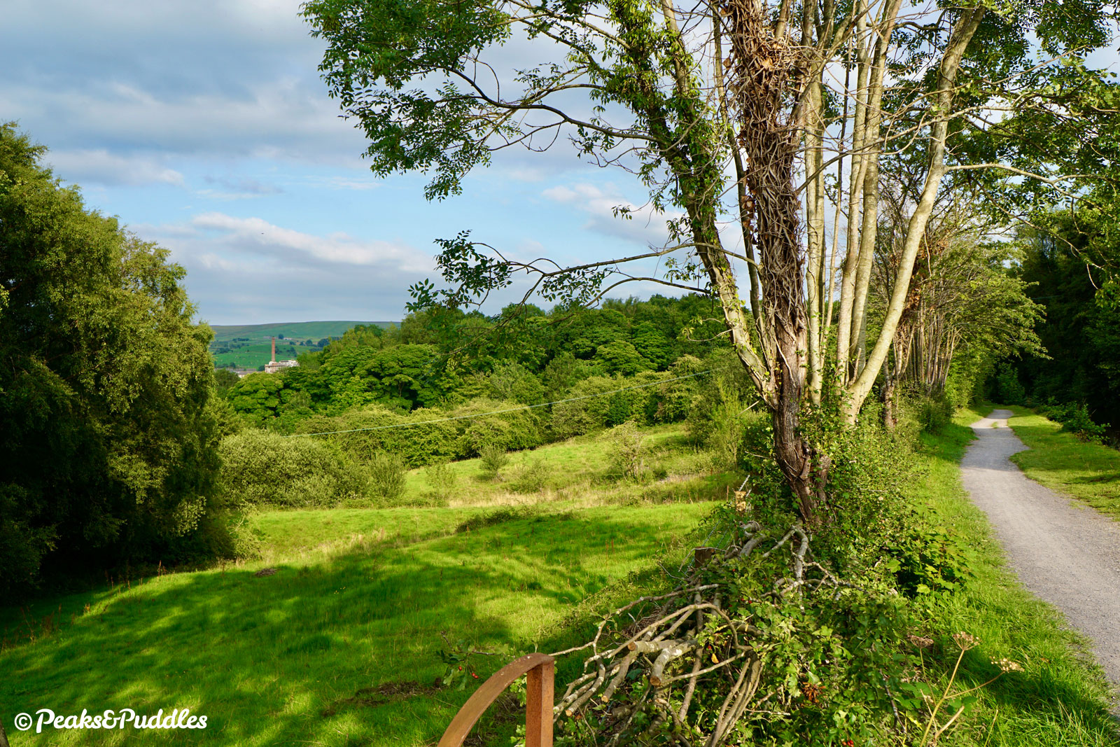
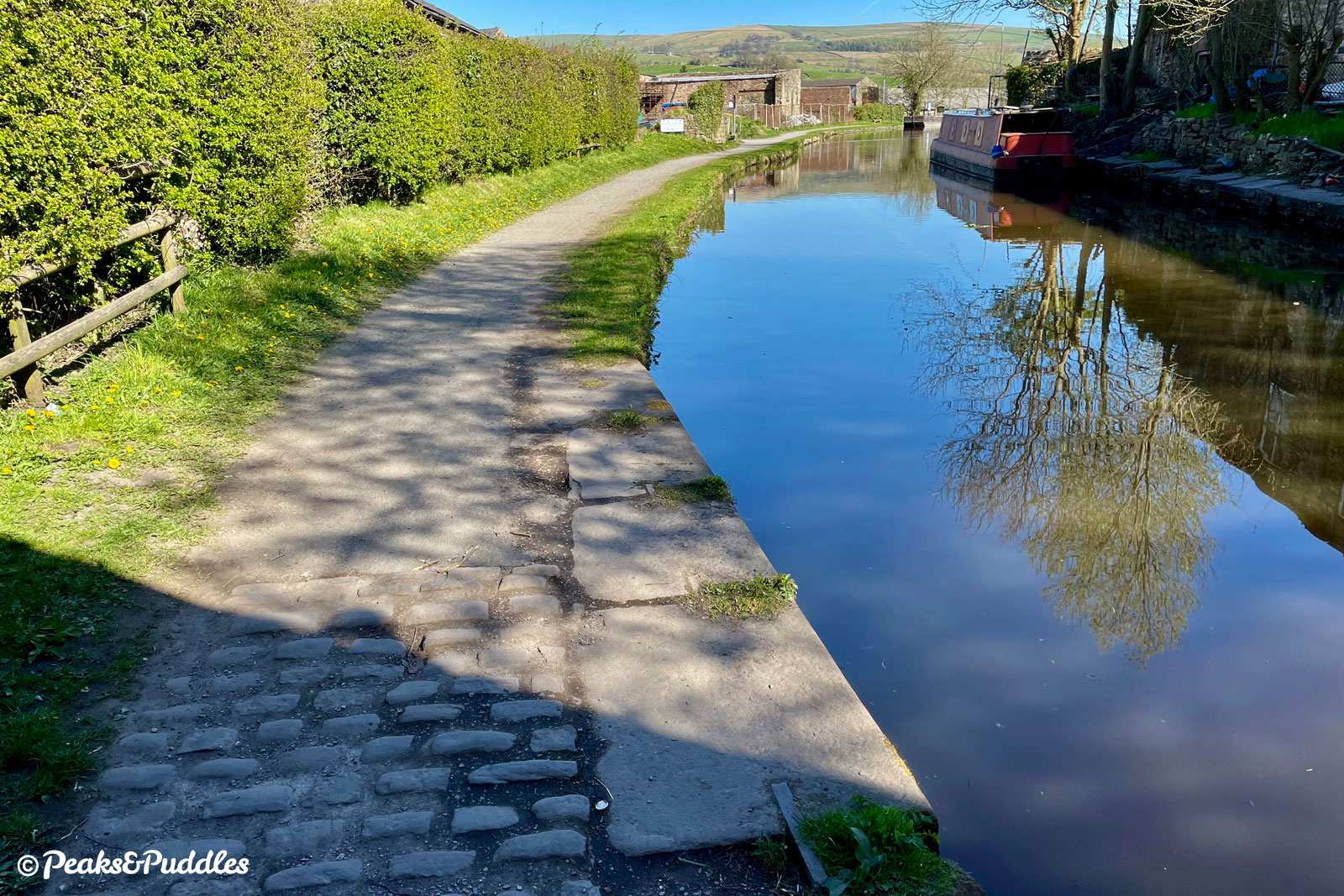
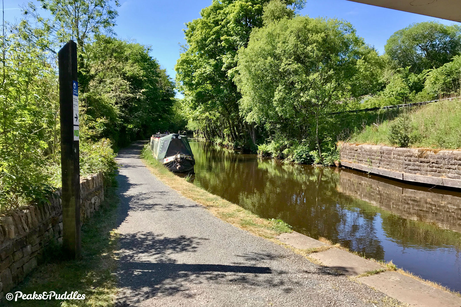
- Starting out down the cobbled slope, with the canal on your left, the towpath begins somewhat bumpily around a bank which seems determined to slip into the canal. At Bridge 19, Brick Bridge, unusually the only redbrick bridge on the canal, the path changes sides with a tricky “roving” cobbled ramp down the other side, which would’ve allowed horses pulling boats to continue without being untied. The canal is now close beside the B6101 Strines Road, which it follows distantly all the way to Disley, a twisty and fast road which many of the fellow cyclists you’ll pass will probably be using the canal to avoid. Instead, the towpath stays placid beneath a canopy of trees as views up the River’s Goyt wide valley begin to open out across detached rooftops and back gardens. Bridge 20 is now Hill Top Footbridge, but once had a swing bridge for farm use — spot where the canal still narrows. Beyond here to the next bridge is a brilliantly open stretch, with Marple Ridge climbing dramatically upwards on one side and the open valley on the other, spoilt perhaps by the huge puddles which the Canal & River Trust may now be slowly addressing.
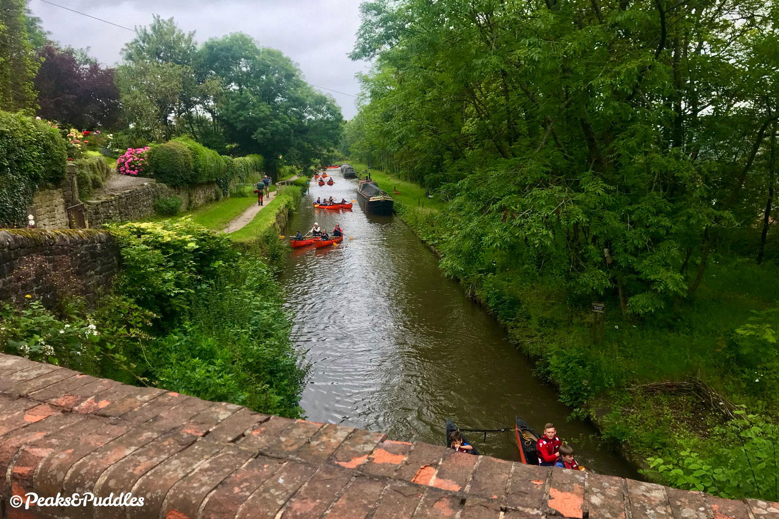
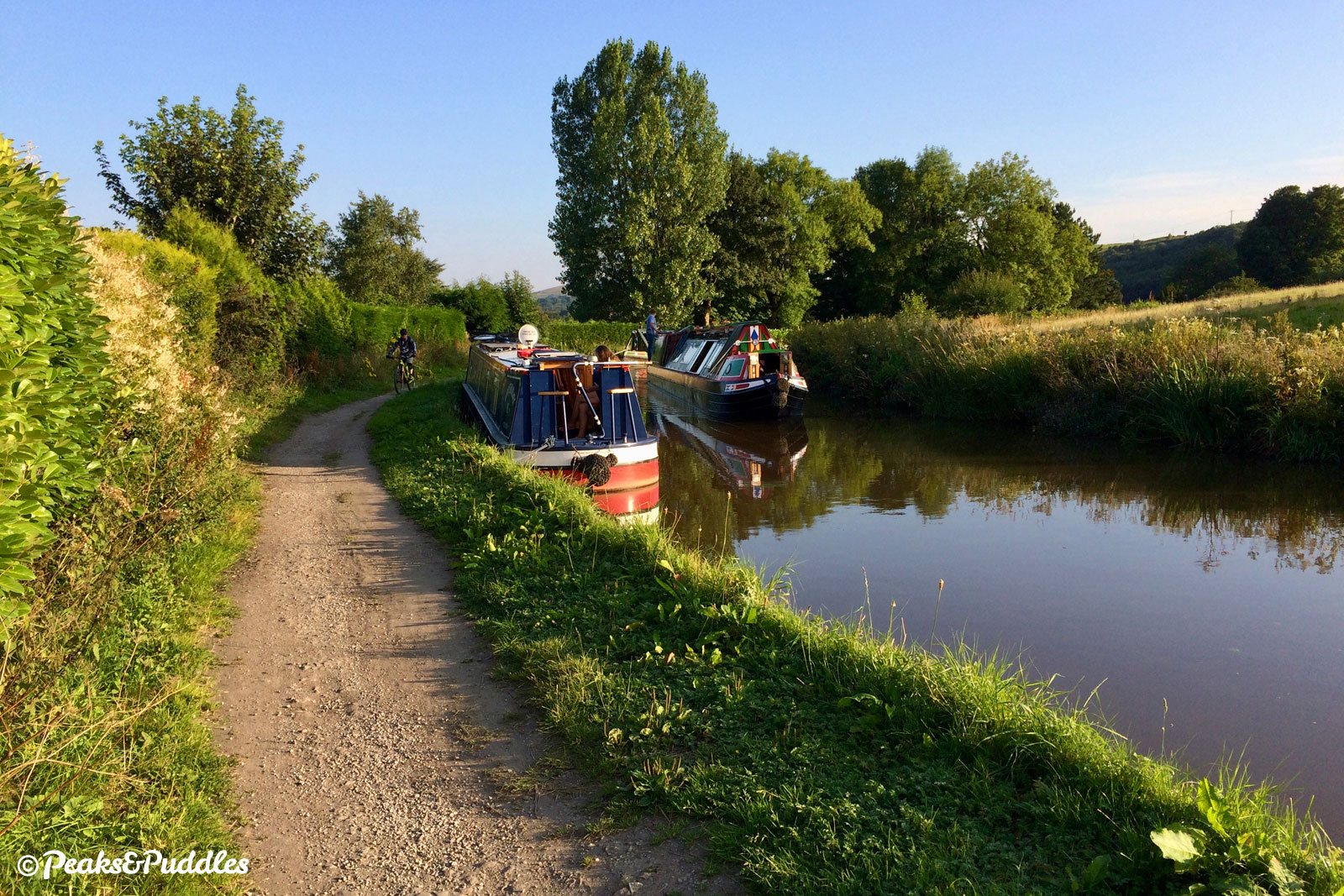
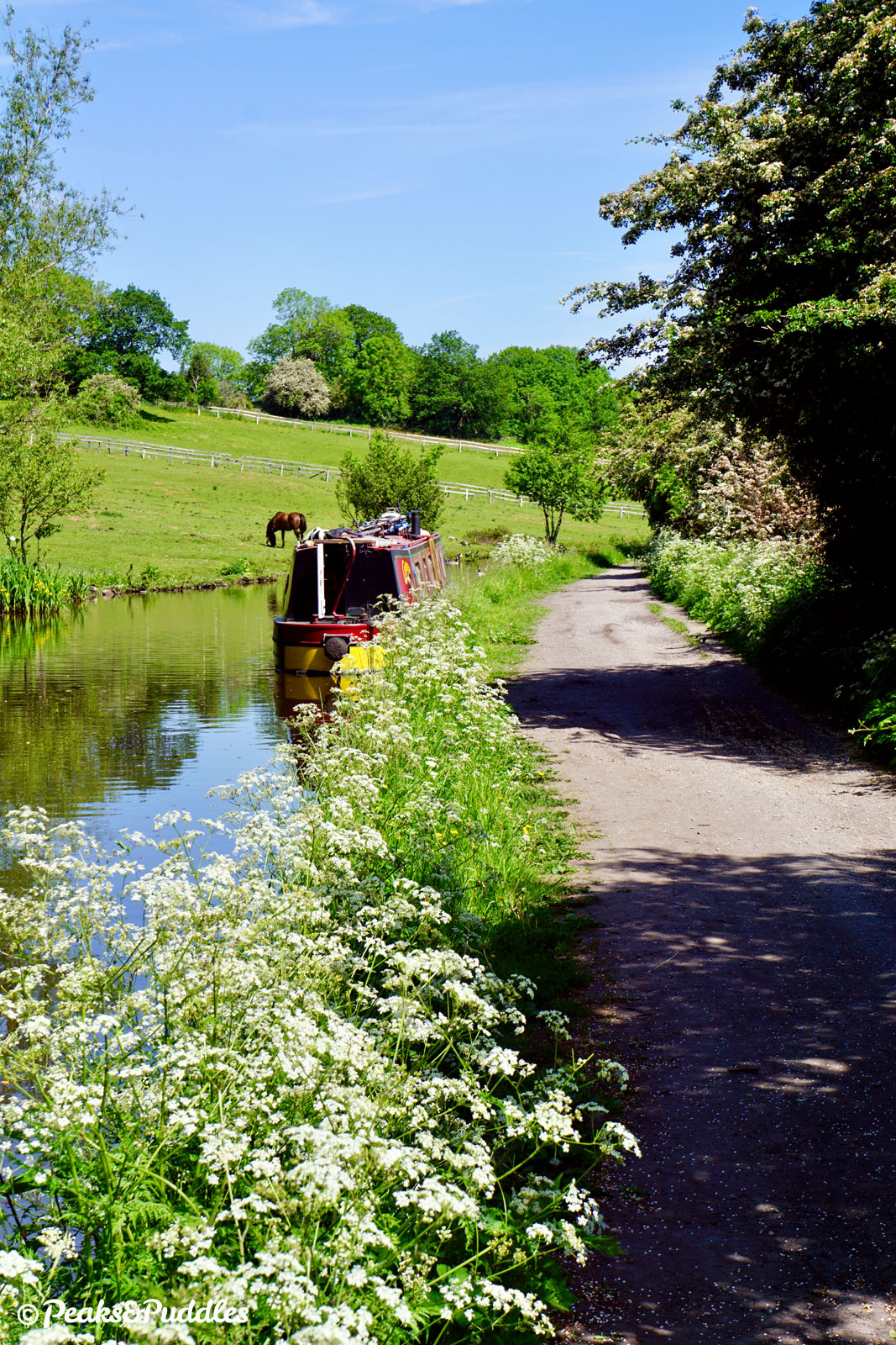
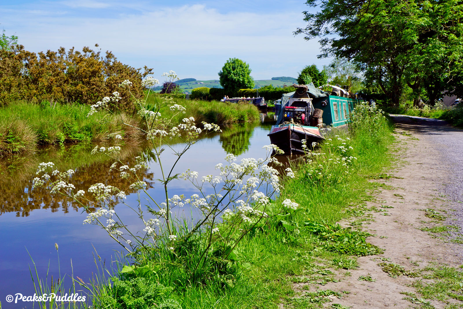
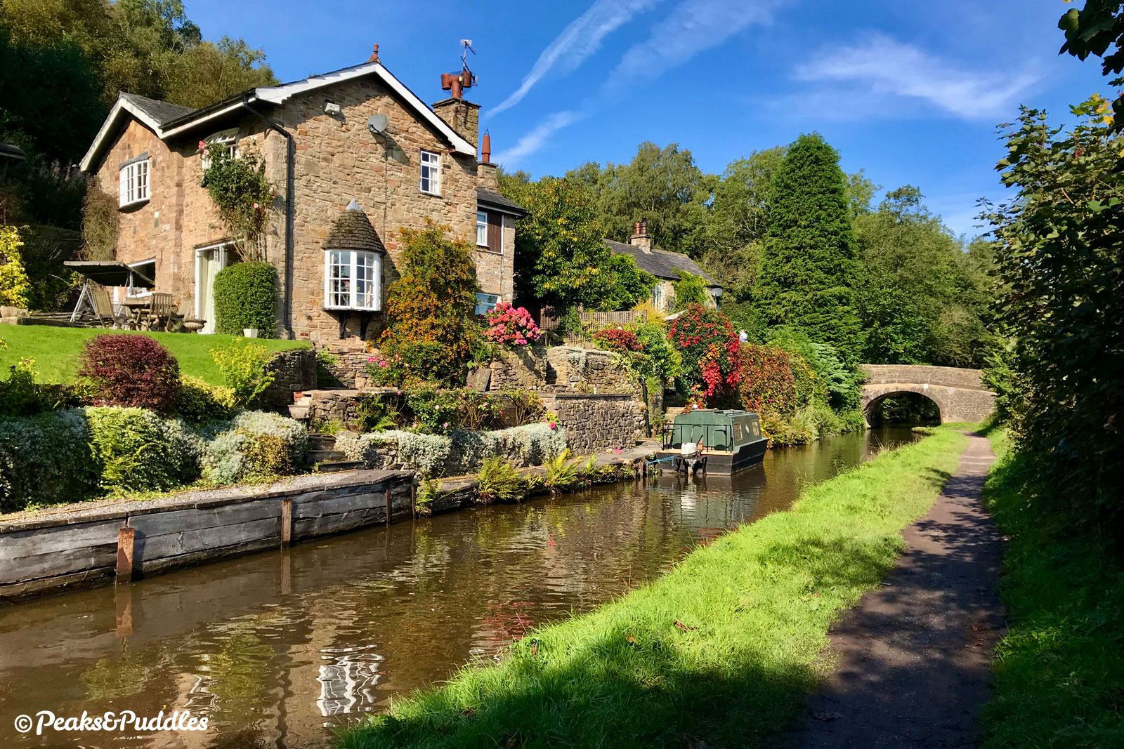
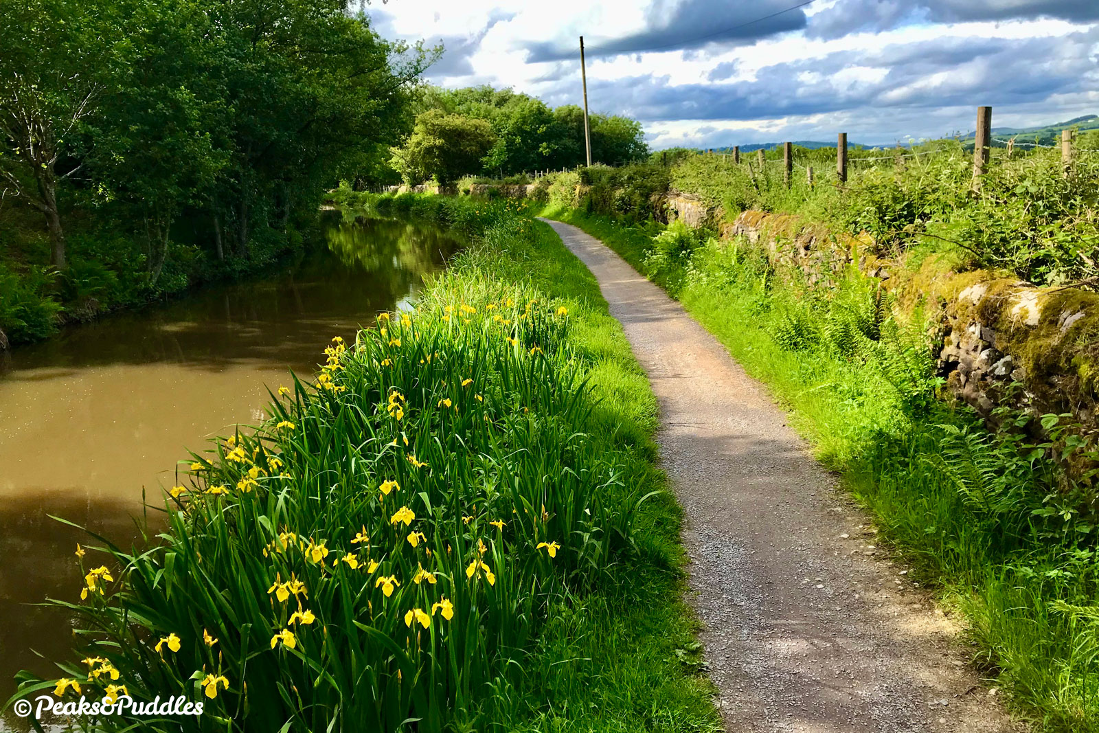
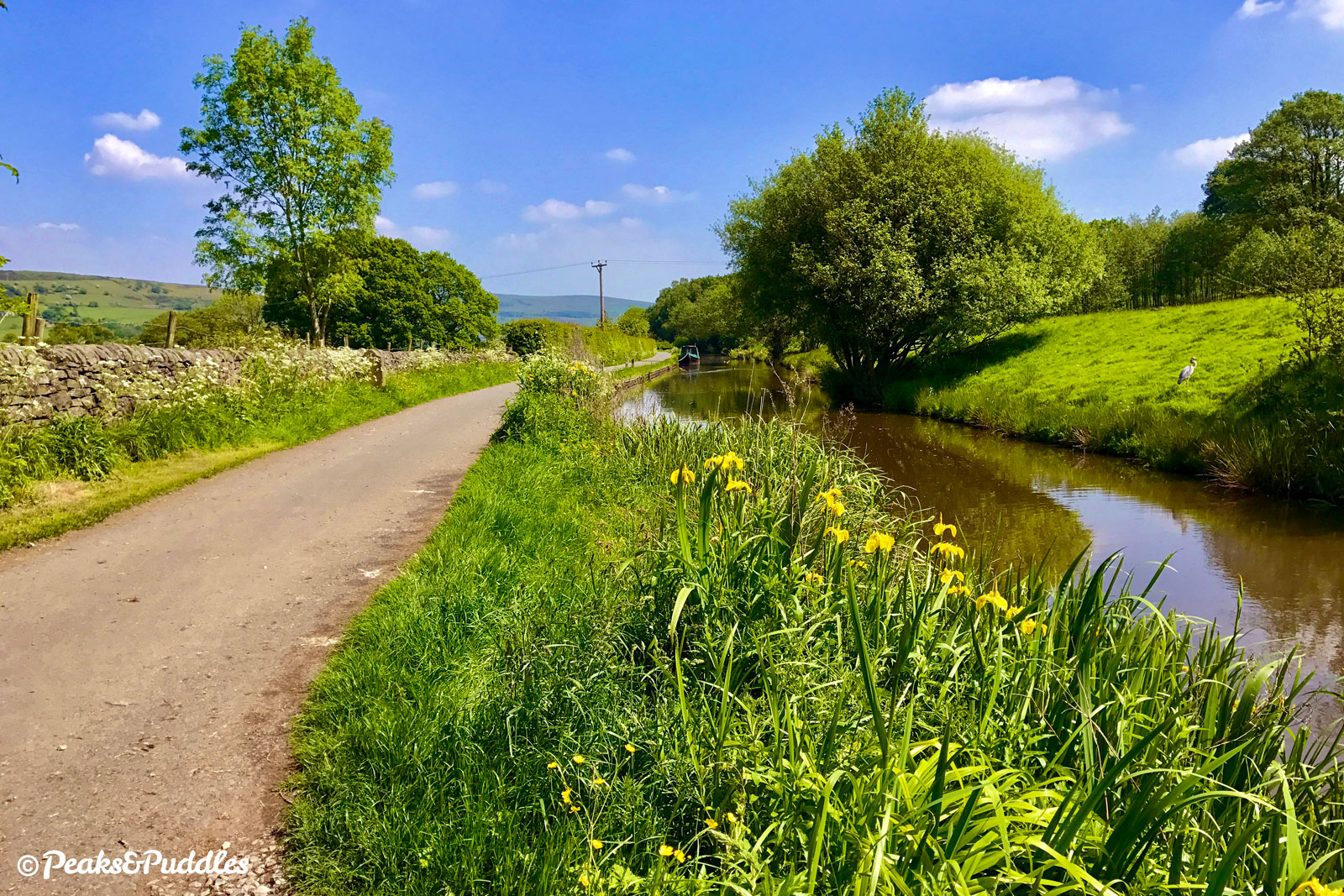
- Known officially as Rawton Walls Bridge, but perhaps better as Plucksbridge, Bridge 21 is a good junction for cycling with the traffic-free Hollinwood Road leading up to Marple Ridge on the right and Plucksbridge Road leading downhill to the left. This connects to a bridleway over the (18th Century) ‘Roman Bridge’ and to the site of Oldknow’s Mellor Mill via the Roman Lakes, which were also in fact just built as mill ponds. Fir trees line the canal as it begins perhaps its most beautiful and rural stretch, curving around alongside thick hawthorn hedgerows and opposite wooded banks until it reaches Bridge 22, Turf Lea Lift Bridge with some of the most stunning views across the valley. In summer, the canal banks here become natural show gardens of damp-loving plantlife, including vibrant yellow flag iris, teeming with wildlife. Strines Aqueduct is one of many often overlooked minor bridges on the network, though the way this two hundred year old stone structure clings to the hillside and retains a whole canal’s worth of water is worth stopping to admire. The lane here is a good route down to Strines, past the 1694 Peeres Cottages, and was used as a route to and from the Calico cotton printing works in the valley below, whose chimney was a local landmark right up until 2007. Two wharves, one with a large stone warehouse, one for unloading coal, were previously attached to the off-side of the aqueduct. Rounding a bend, almost dwarfed by vegetation in summer, the towpath then skirts the edge of the ancient Stanley Hall Wood, now seemingly miles from civilisation.
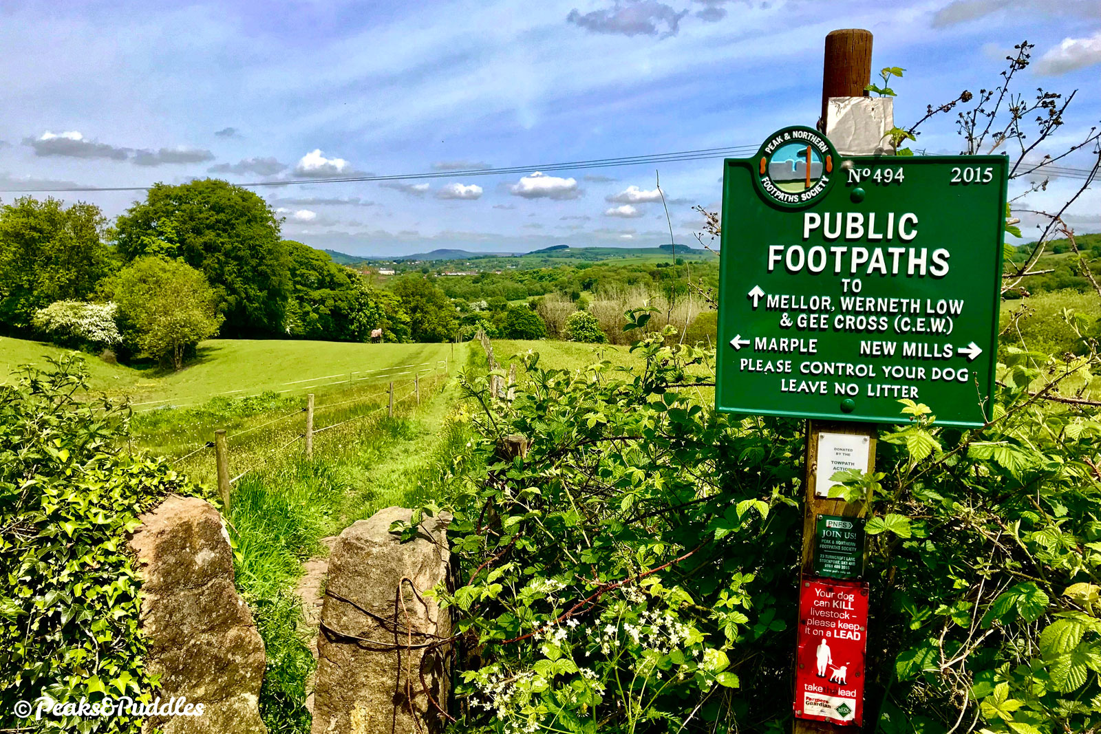
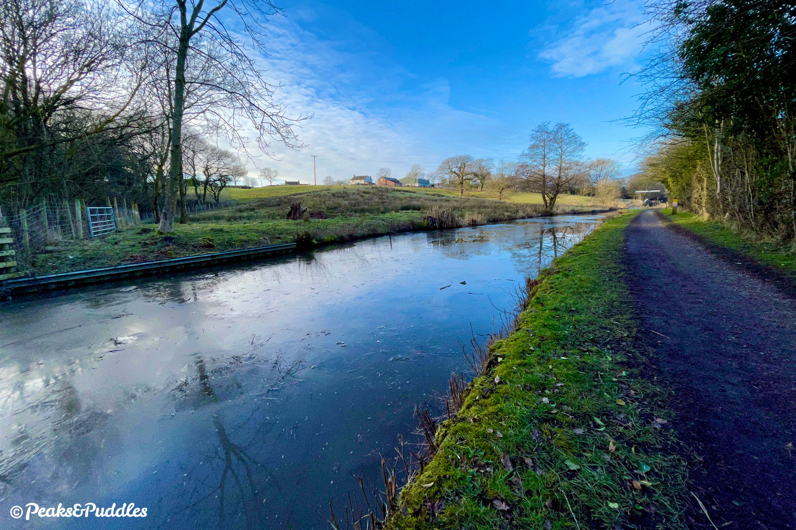
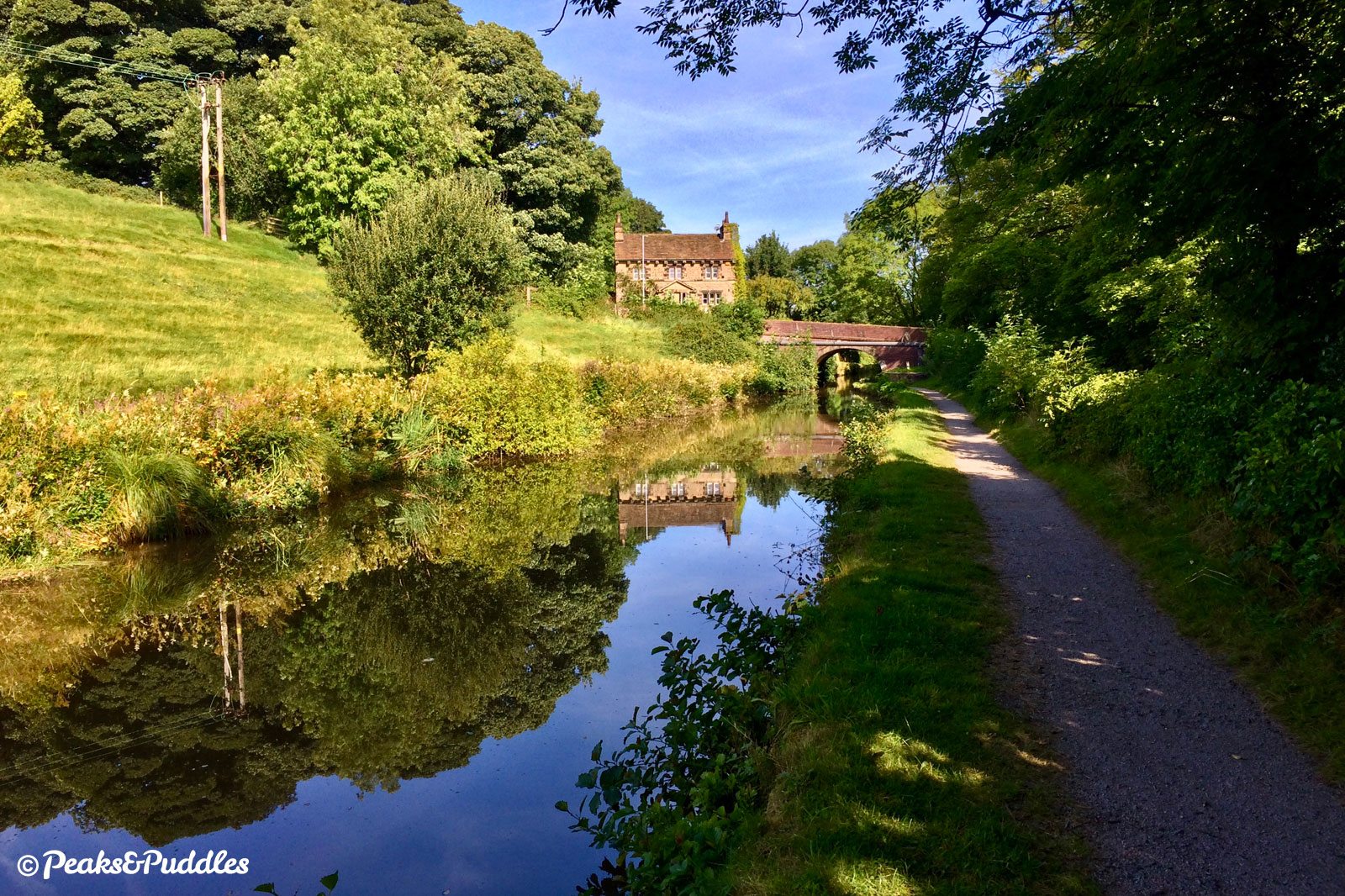
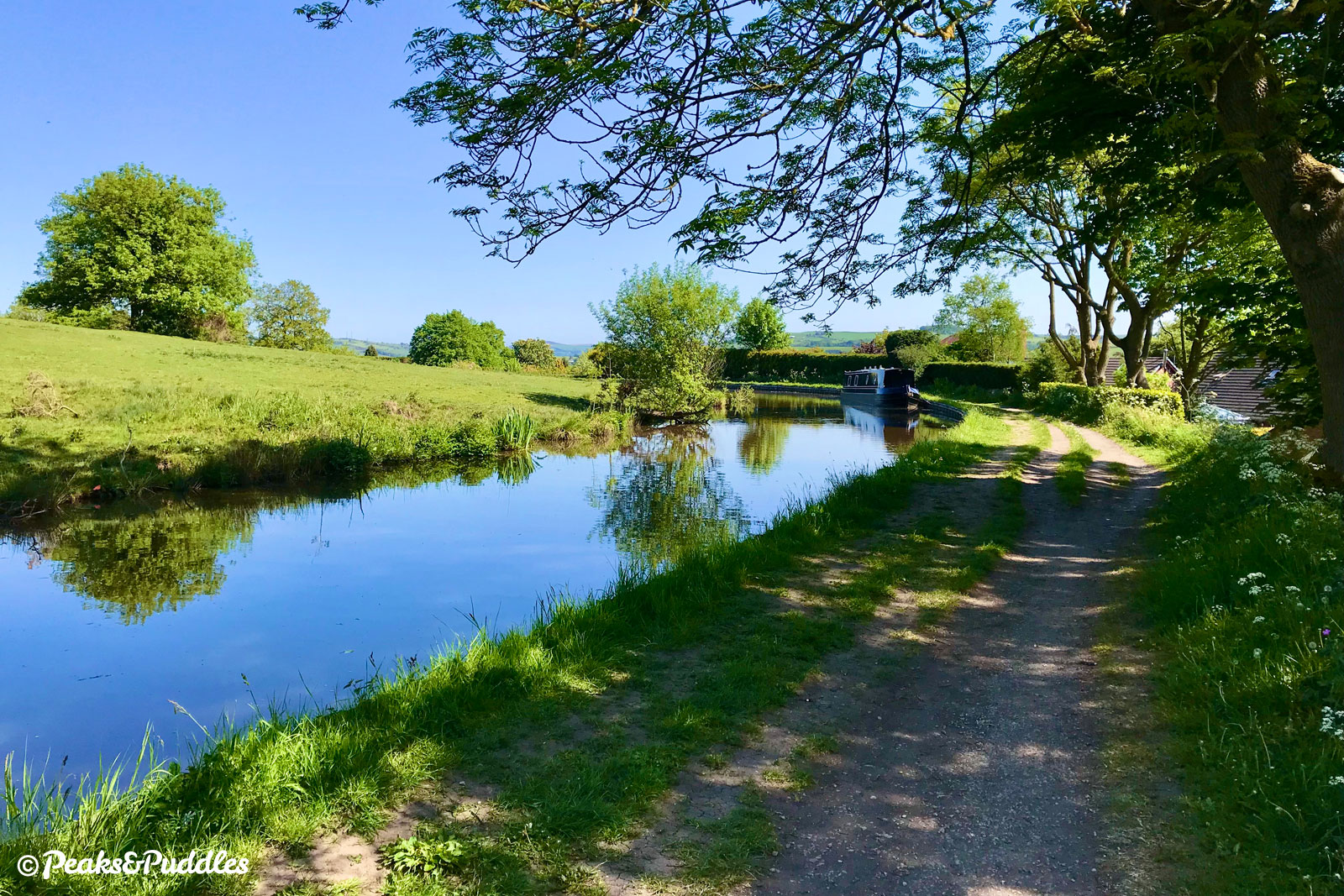
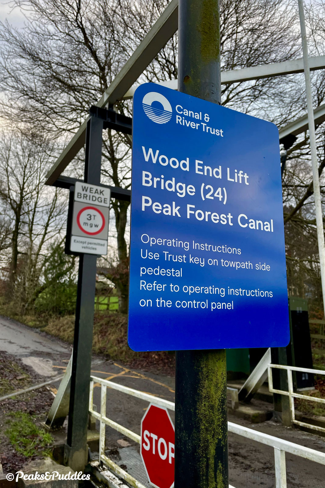
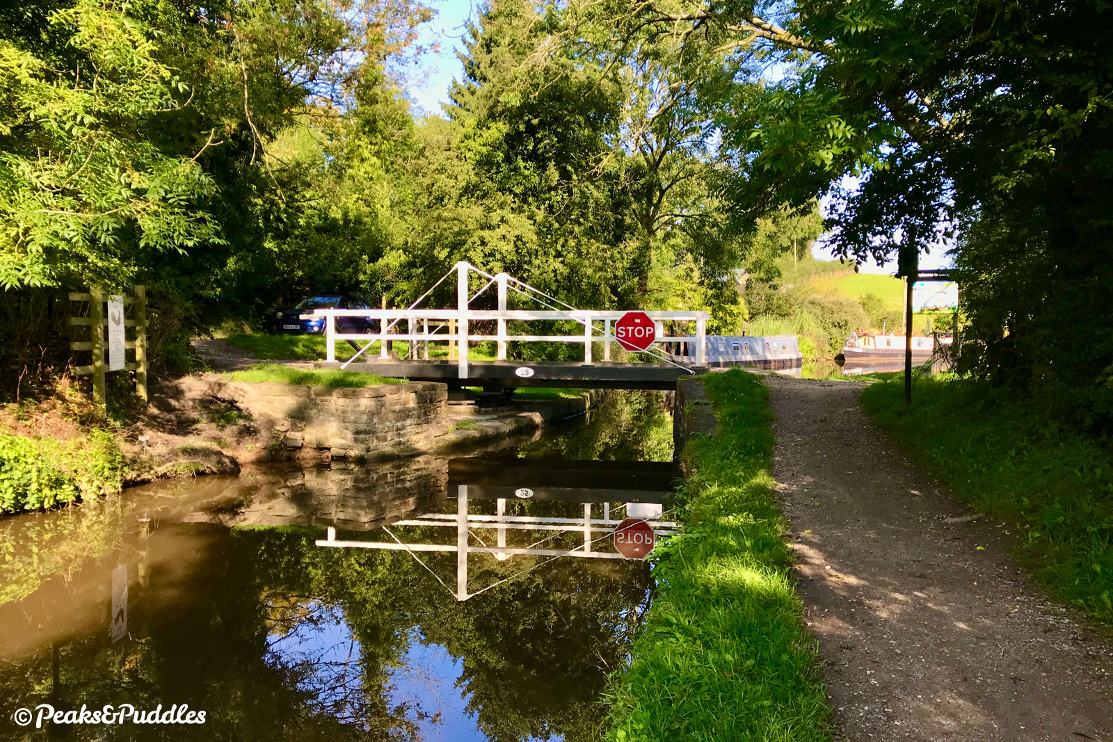
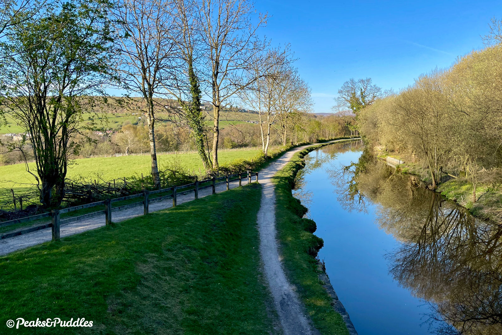
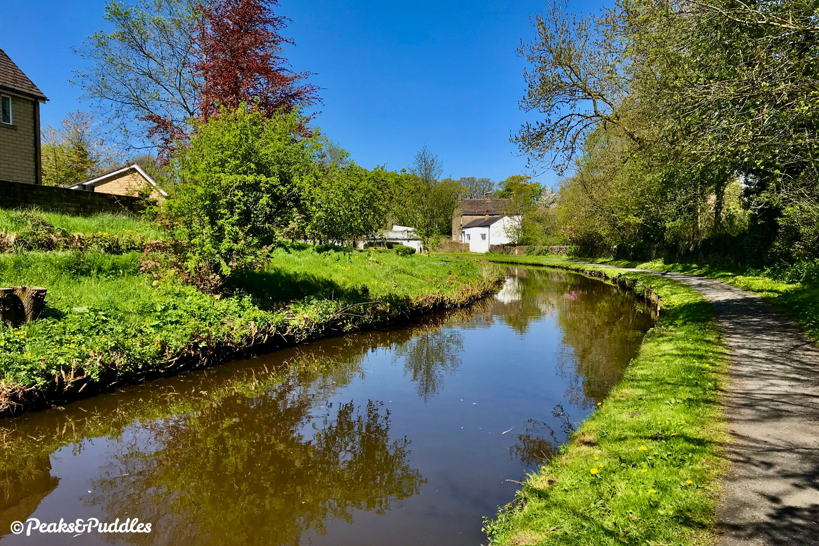
- The view through Bridge 23, Stanley Hall Bridge is perhaps the most evocative on the whole canal. Emerging from the sheltered woods, and crossing from Stockport to Cheshire East, the canal opens out suddenly again onto a long straight with views ahead to Chinley Churn and, to the left, perhaps the best complete view of Cobden Edge, the hilltop that has been shadowing the whole journey so far. The towpath here above Woodend is now suddenly wider and on smooth tarmac. Hagg Bank Lane is an access drive for vehicles to the single house on the left, which have to cross the now electric Wood End Lift Bridge ahead. New Mills remains hidden for now, but Hague Bar across the valley marks the start of Derbyshire. Around the next bend, the noise of another Oldknow mill, Waterside Mill, still permeates, now producing tissue. Time it right and you might also hear (though not see) the sudden rush of a train emerging from the Disley Tunnel below, an express line built by the Midland Railway to take trains more directly into Manchester. Remarkably, the other end of this 2.2 mile-long tunnel is way over alongside the now disused railway that forms Middlewood Way. As you cross a large overflow channel just before Bridge 25, Higgins Clough Swing Bridge, be sure to look out over the valley for a first sight of Kinder Scout. Across the bridge, Hagg Bank Lane leads into Disley and towards the National Trust deer park and mansion house at Lyme.
- You might want to hold tight around the next bend. While the pretty white cottage ahead is a well-known landmark of the waterway, it was once almost washed away entirely when this entire bend over a culvert collapsed in 1973, breaching the canal and dispensing so much water it flooded the wide plain of the Goyt valley below. Around Bridge 26, Dryhurst Bridge (Redhouse Lane) and until Bridge 27, Green’s Hall Bridge (Lower Greenshall Lane), things get almost suburban with modern houses fronting the water’s edge, many replacing a large factory, and the path merges onto a short private driveway again. A welcome green gap soon opens up, though no less than three railway lines are now strung along the valley as the Buxton line up above joins the Midland line and the Hope Valley line across the river. In an atmospheric, deeply wooded corner ahead, the canal’s course was even altered thanks to the newest, Midland line below. It’s worth stopping to venture into the trees, where a length of the old edge stones are still visible. The towpath here as you cross from Cheshire into Derbyshire at Newtown was only recently in a dreadful condition but has been improved by volunteers. Puddles remain alongside Brunswick Mill, once producing cotton but later repurposed by Swizzels Matlow who moved their production line out of London during the Blitz of 1940 and now fill the air of New Mills with the intoxicatingly sweet smell of Love Hearts, Refreshers and other childhood favourites.
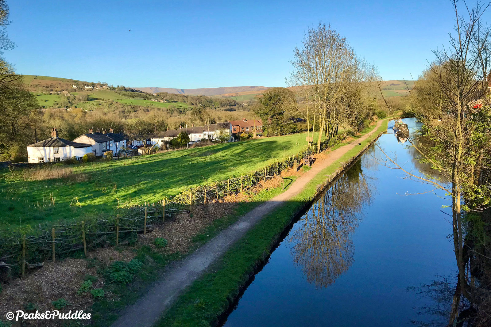
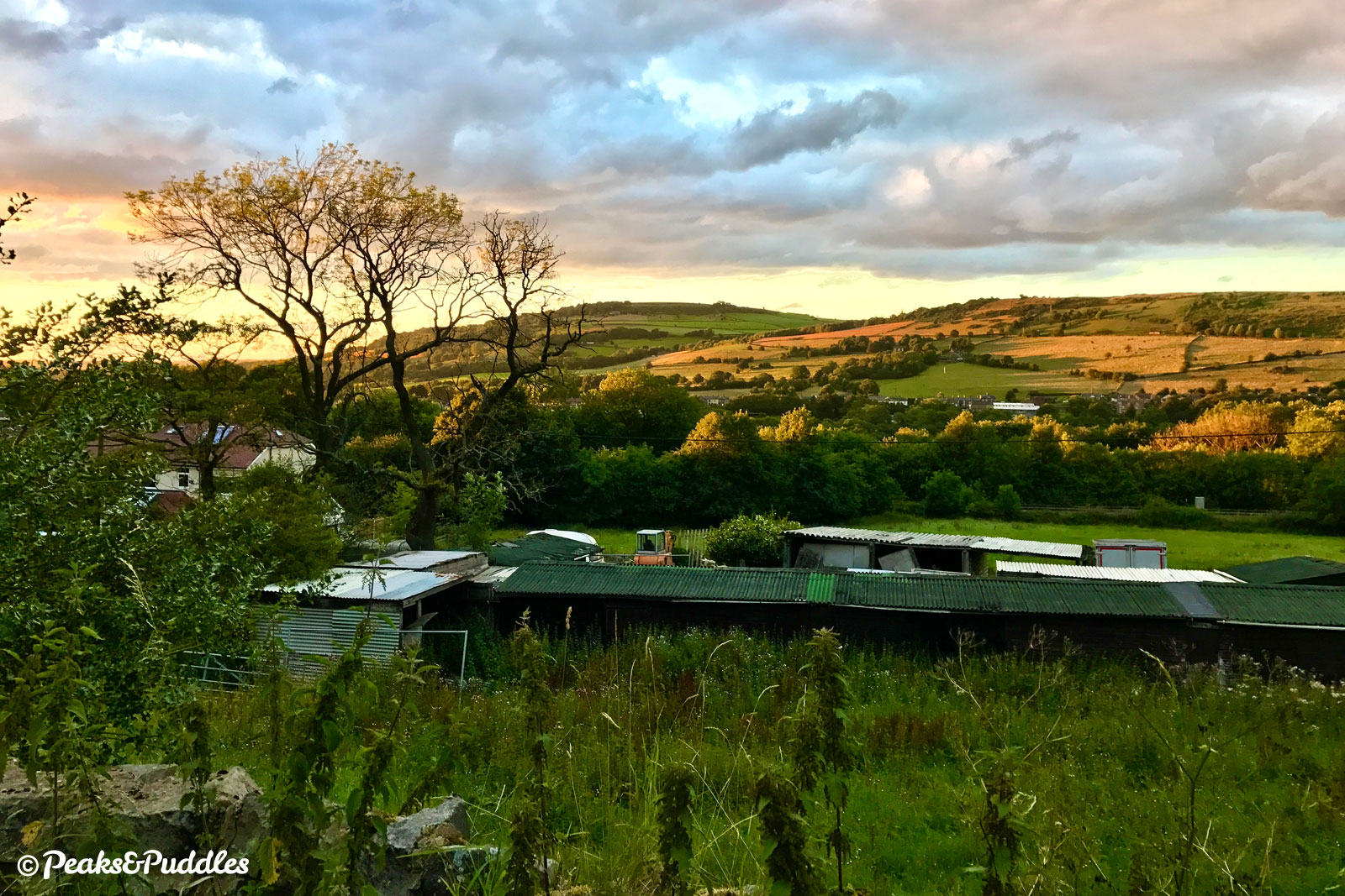
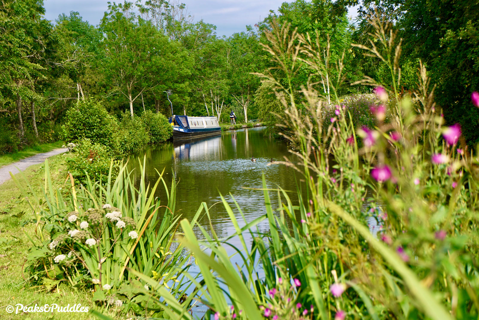
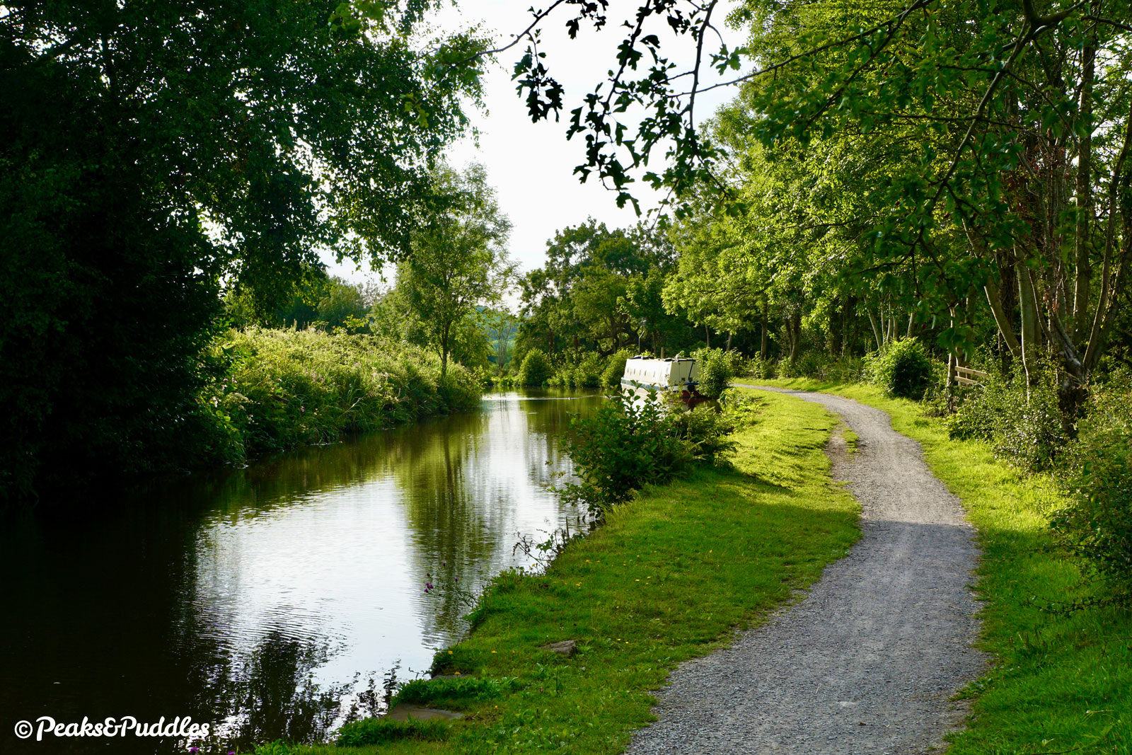
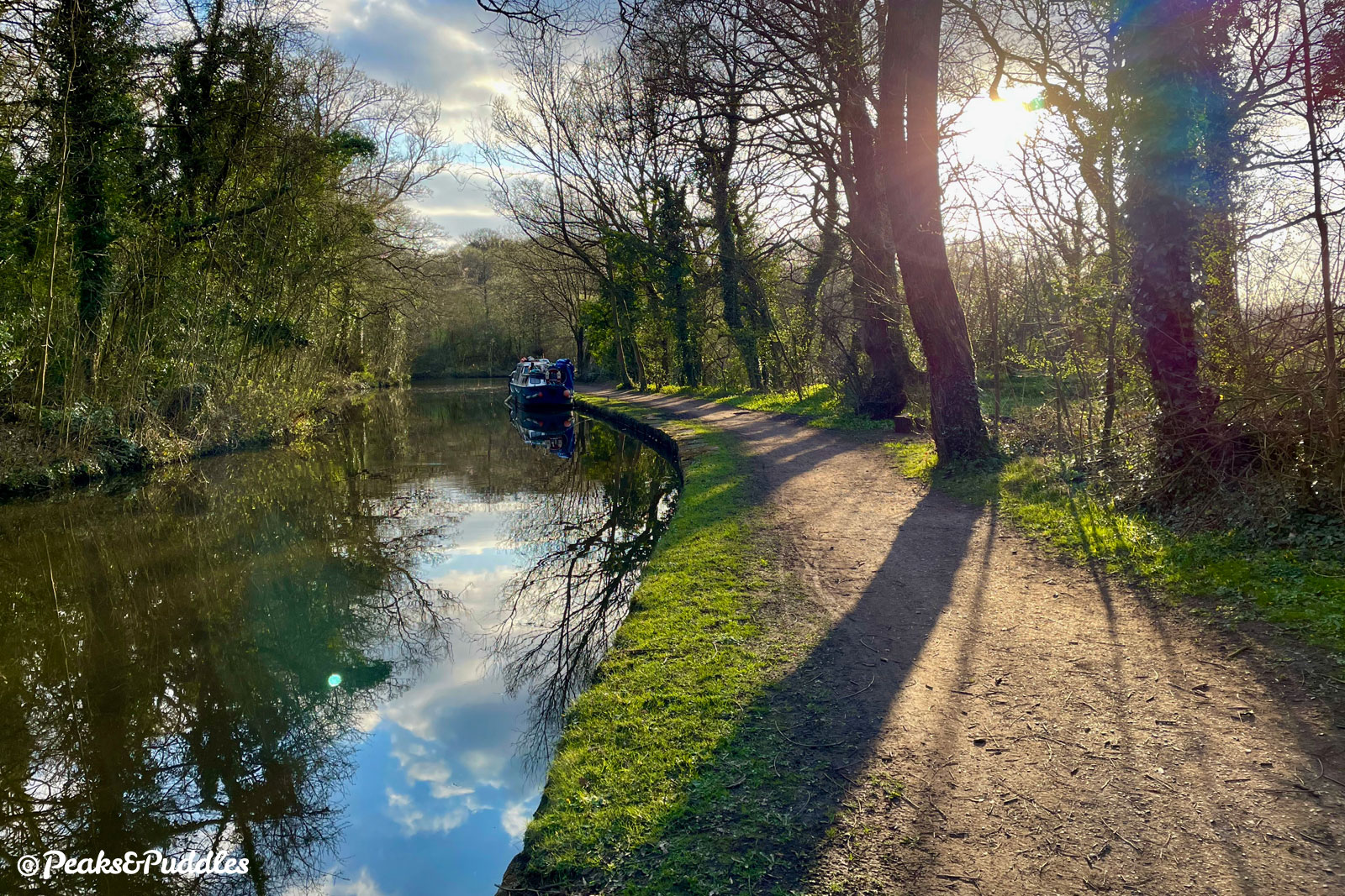

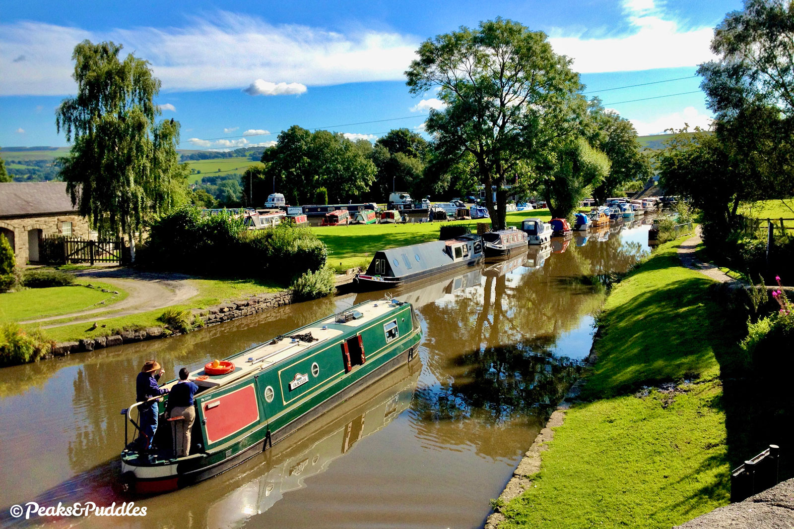
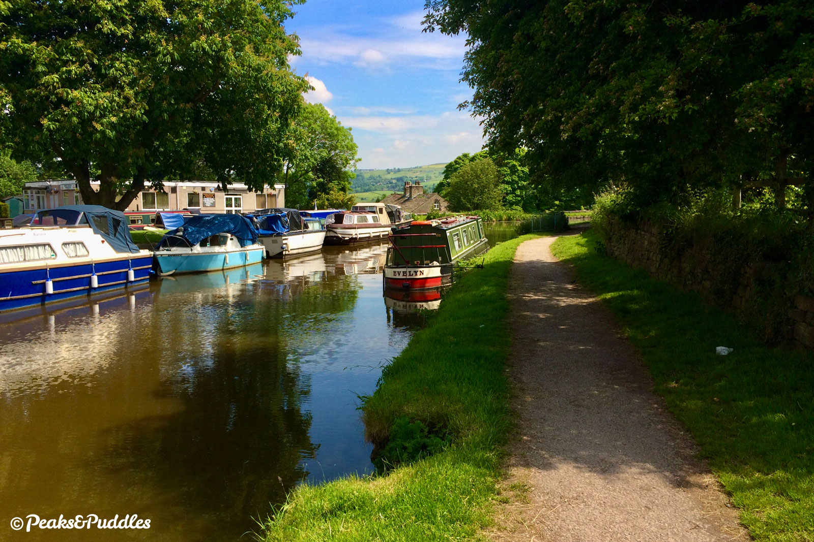
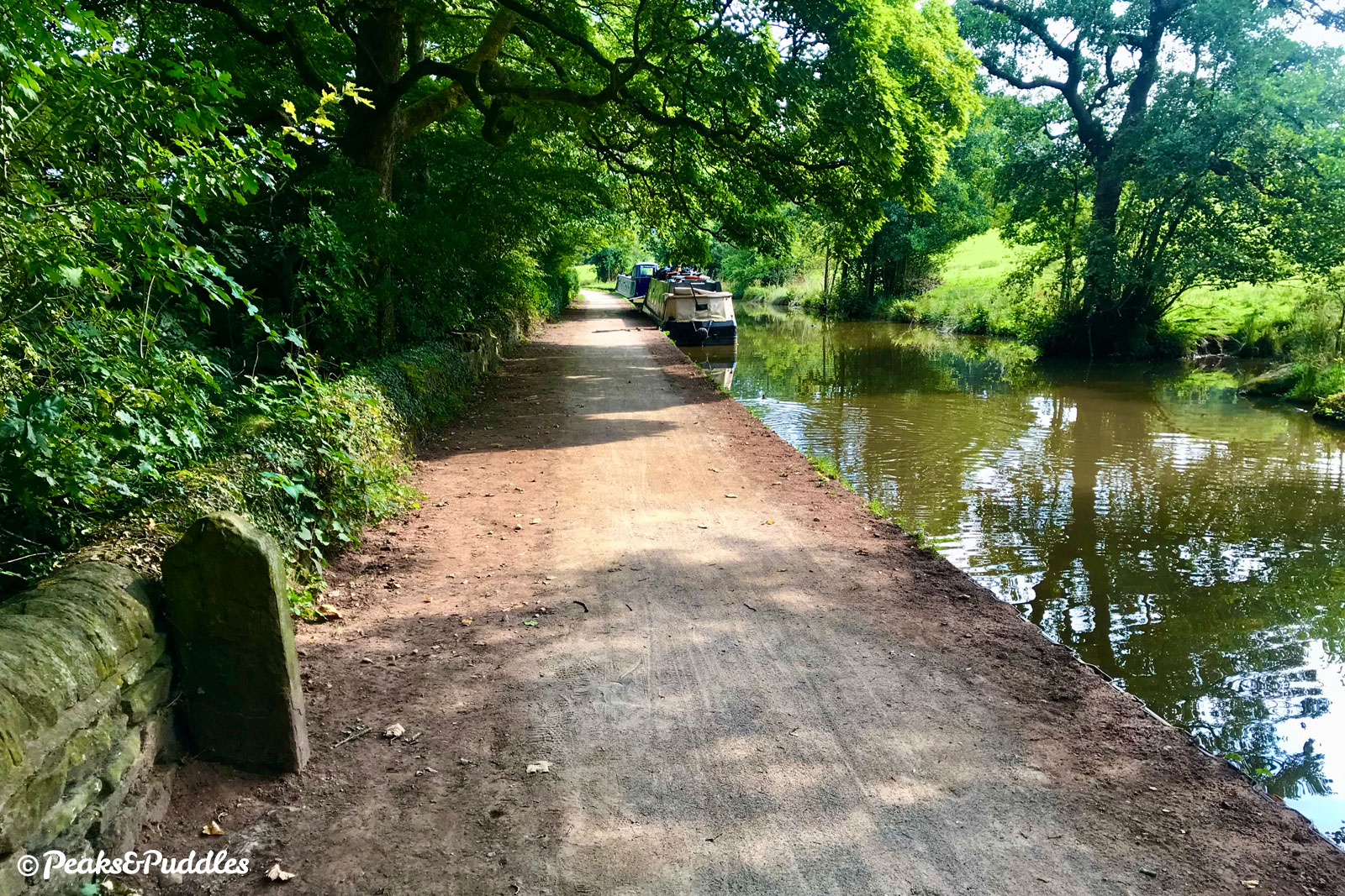
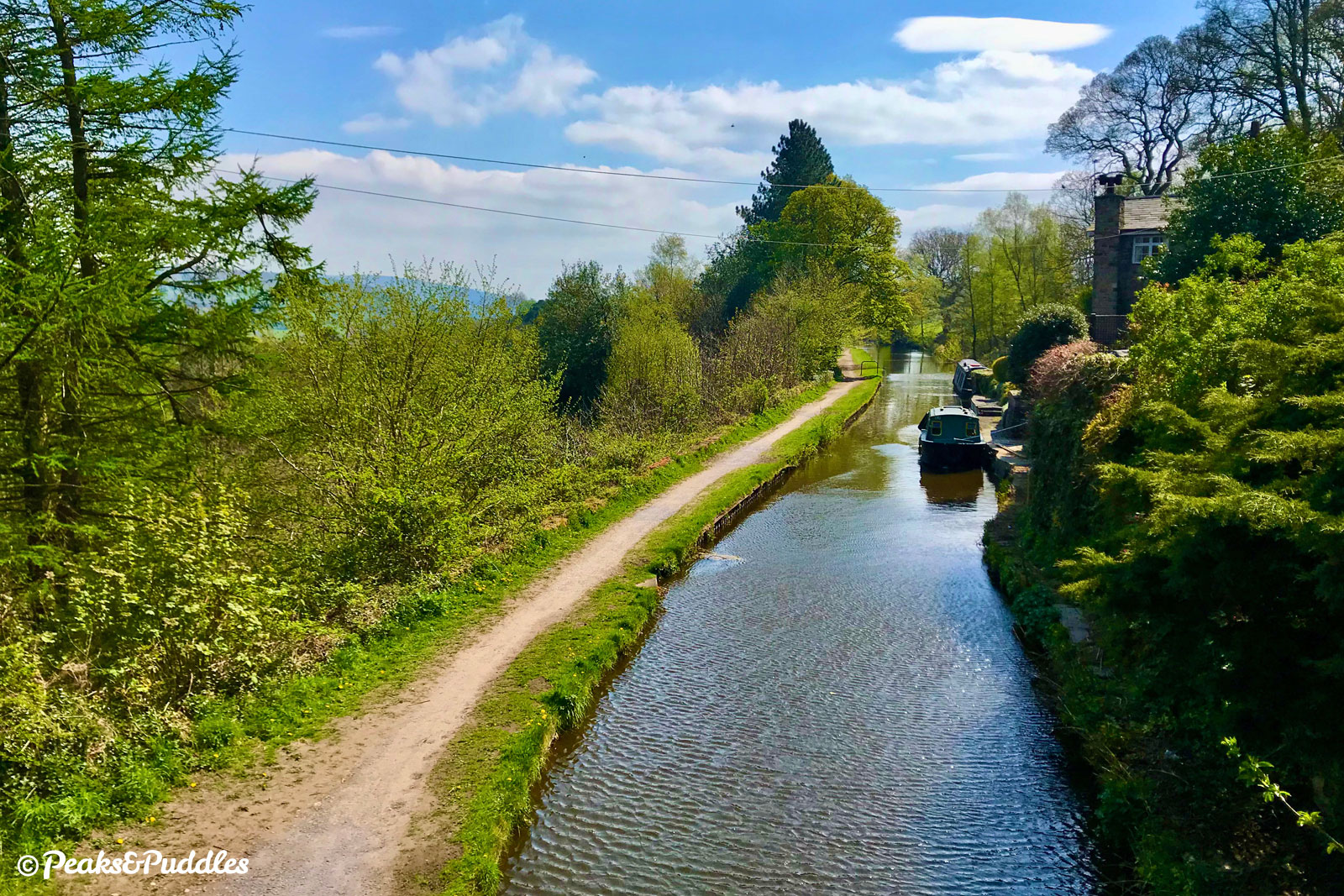
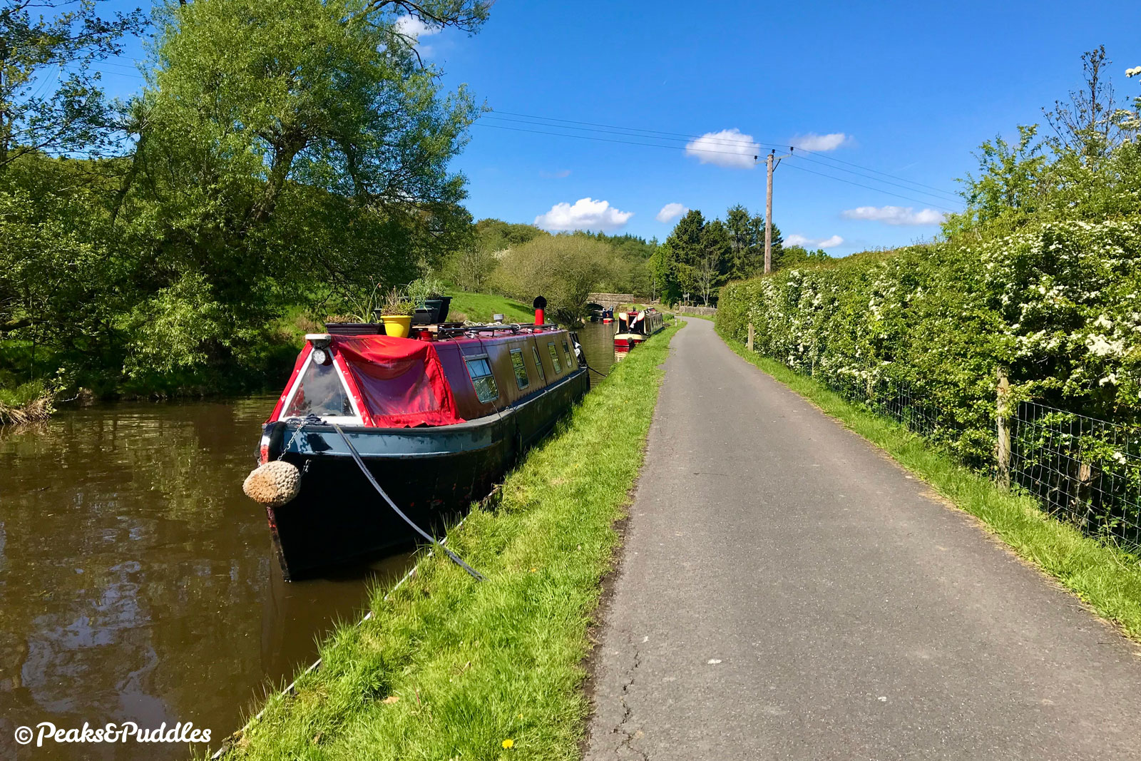
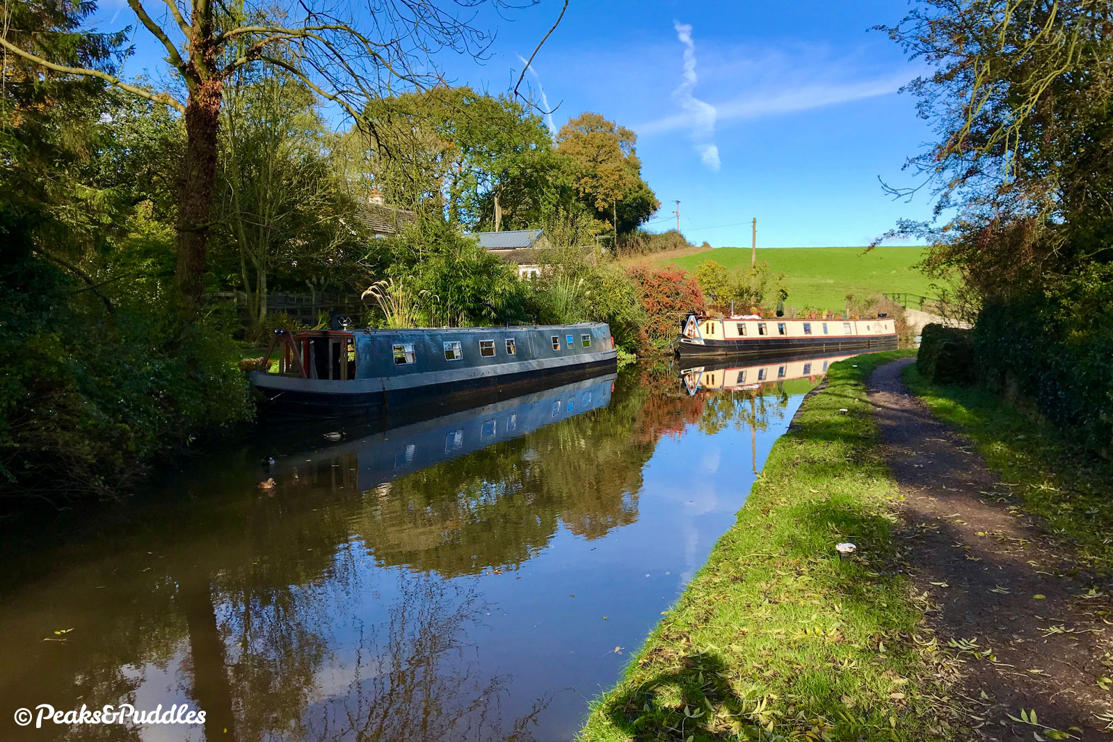
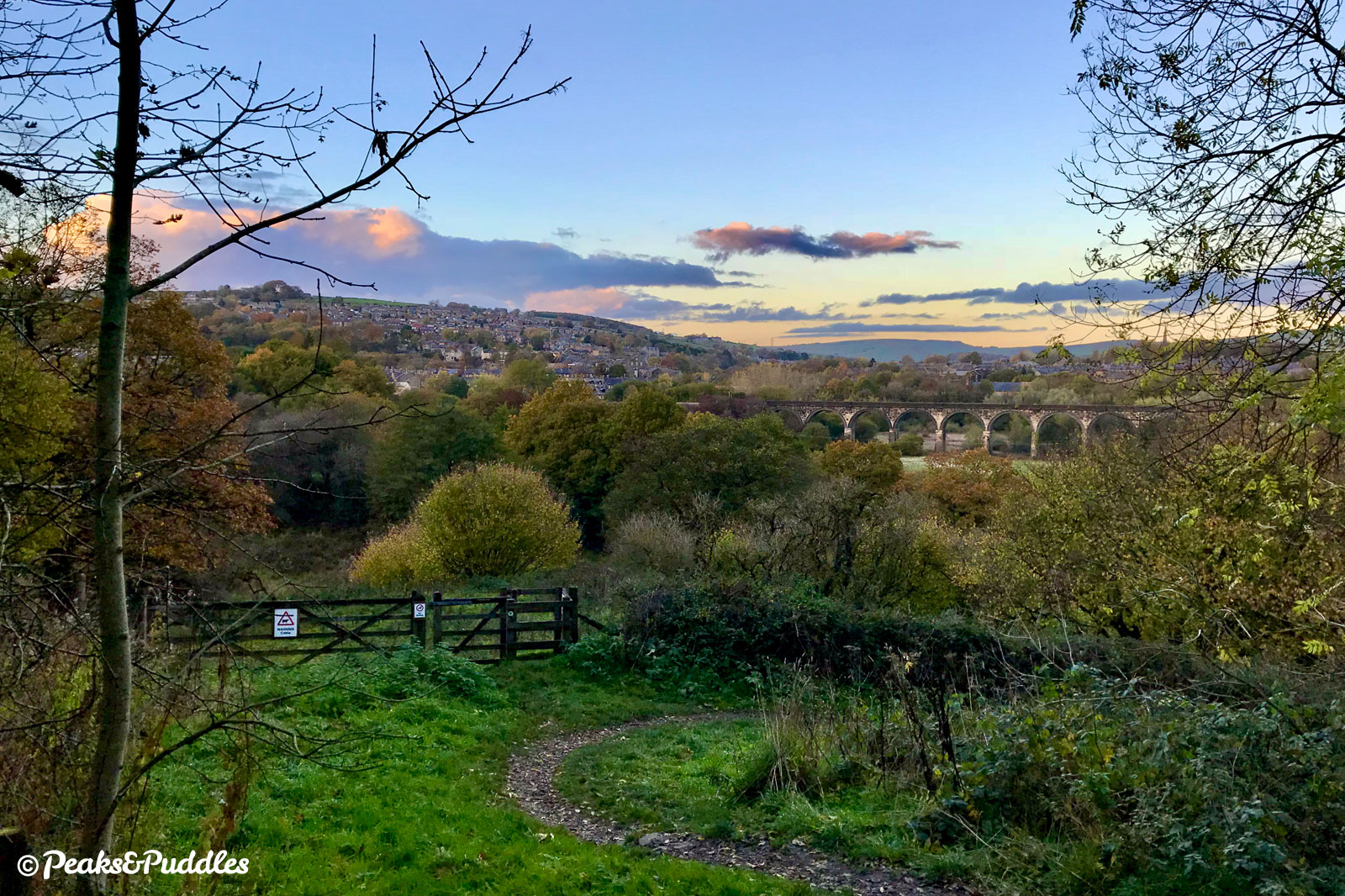
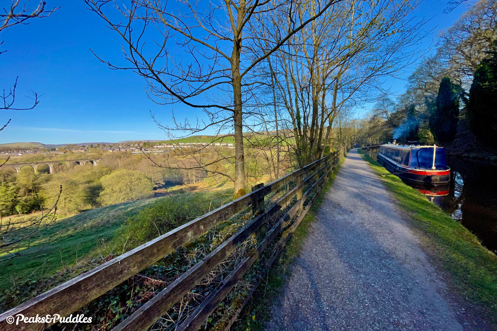
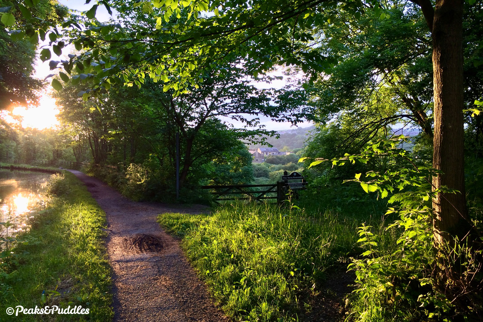
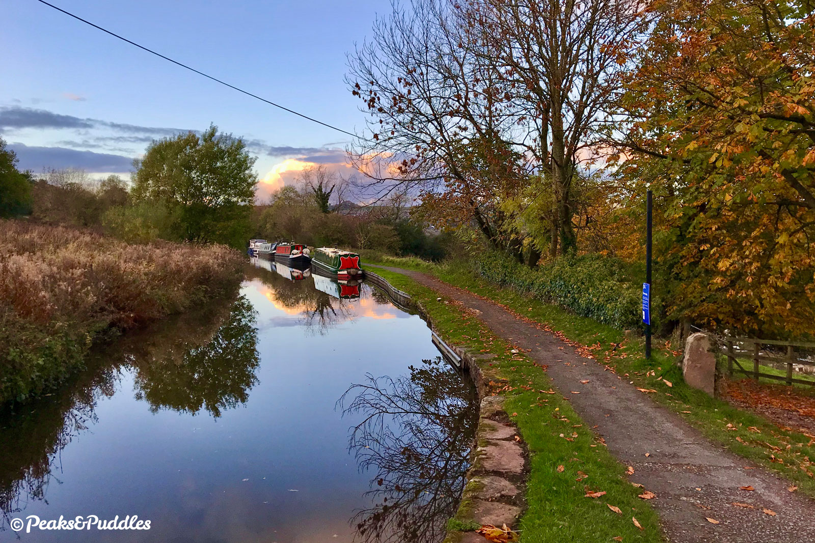
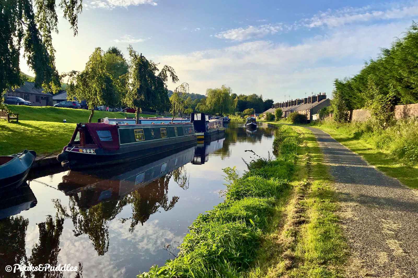
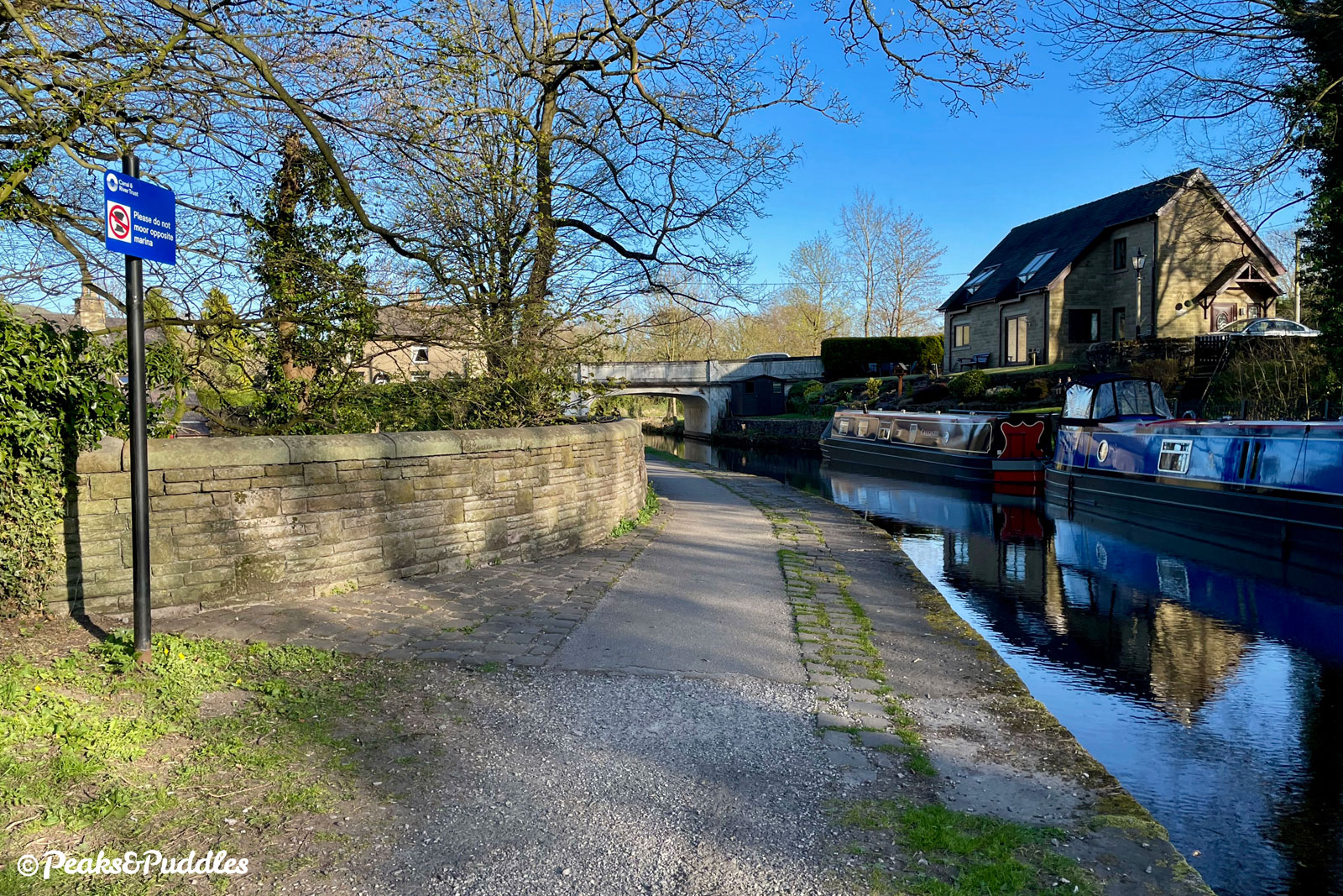
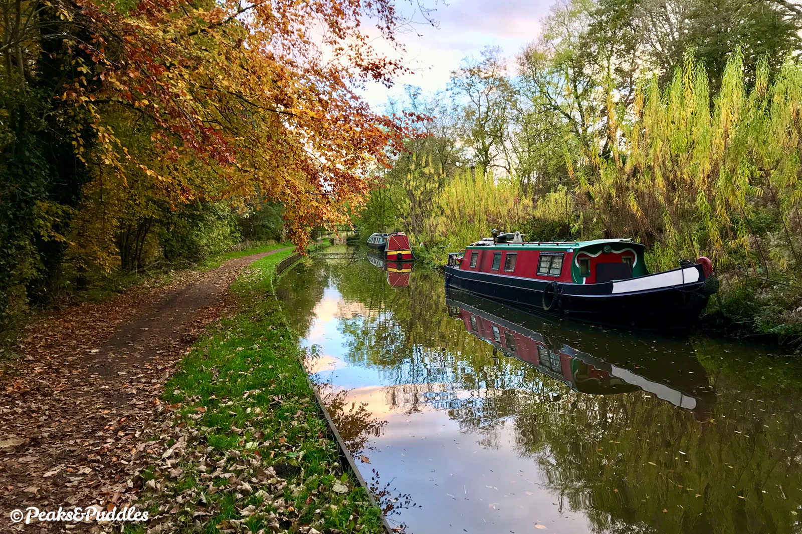
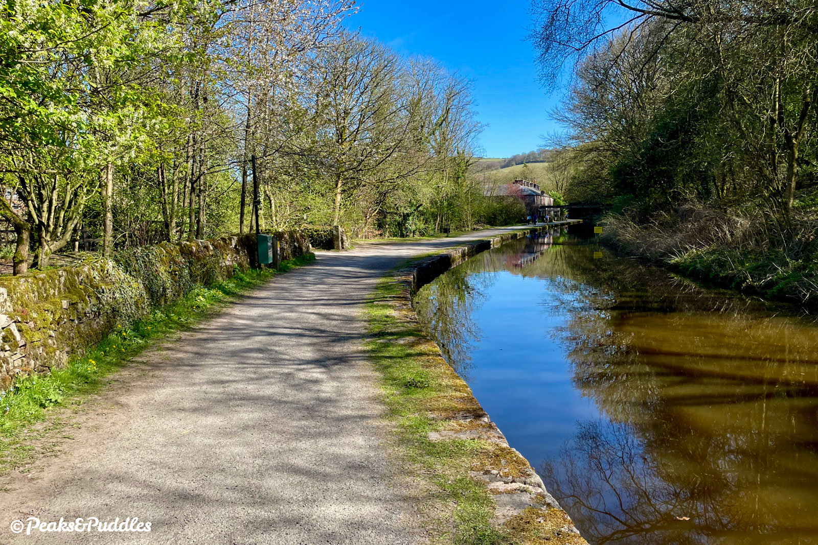
- Some of the trickiest cobbles on the canal can be found under Bridge 28, Thornsett Road Bridge (the main A6015 into New Mills), but then things improve dramatically as the towpath turns to wider tarmac from New Mills Marina onwards, first laid with European investment in 2011, though now rather bumpy in places. Victoria Street to the left provides access towards the quite distant town centre, though there’s no truly ideal route across the Goyt avoiding either busy roads or steep climbs. Various other industrial units dot the side of the canal until it breaks out again above Goytside Meadows, a lovely area of wild and publicly accessible fields with fabulous views of the thirteen-arch Midland Railway viaduct, Kinder Scout and New Mills itself. Bridge 29, Bank End Bridge sits next to a footpath which can be useful link down into the Torrs Riverside Park to see the town’s spectacular rocky gorge. Up ahead, the hillside of Chinley Churn within the Peak District National Park now sits across the valley, with popular canal moorings leading to Bridge 30, Carr Swing Bridge and into the large Furness Vale Marina, filled with narrowboats of every colour imaginable.

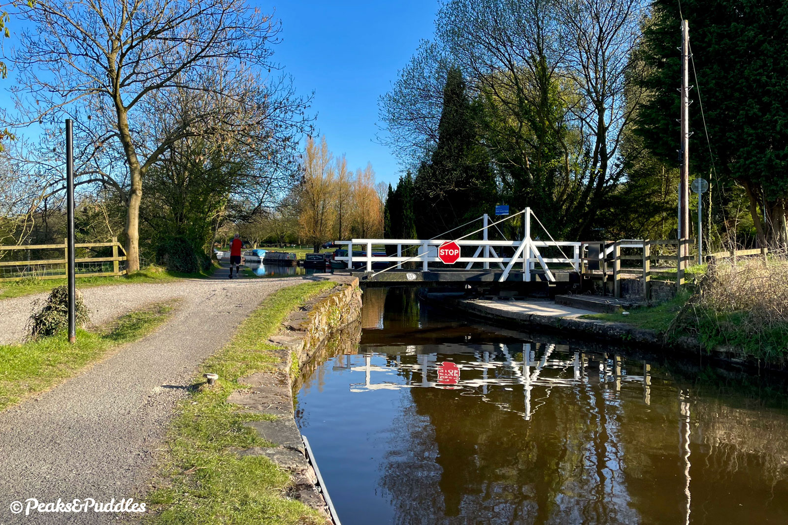
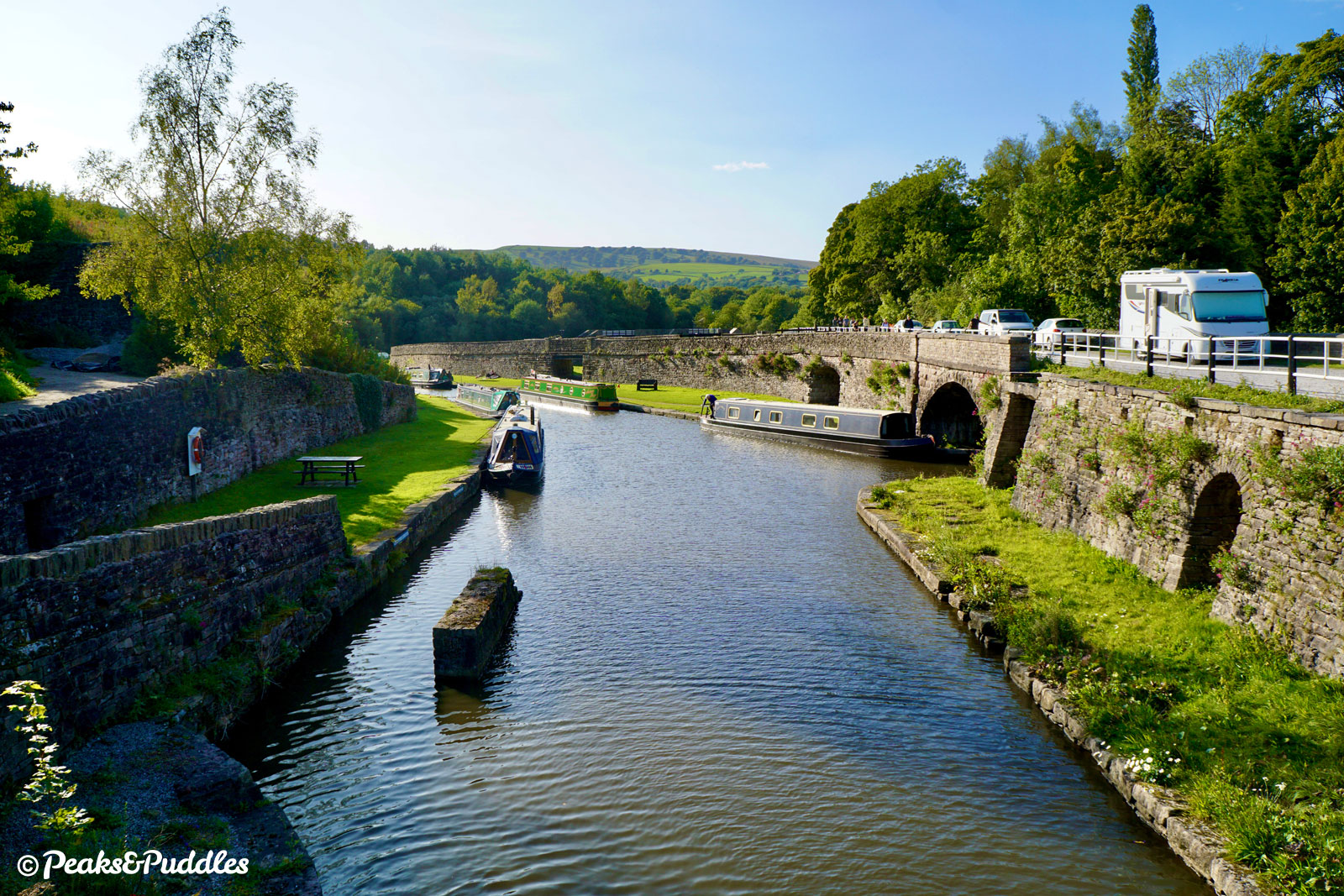
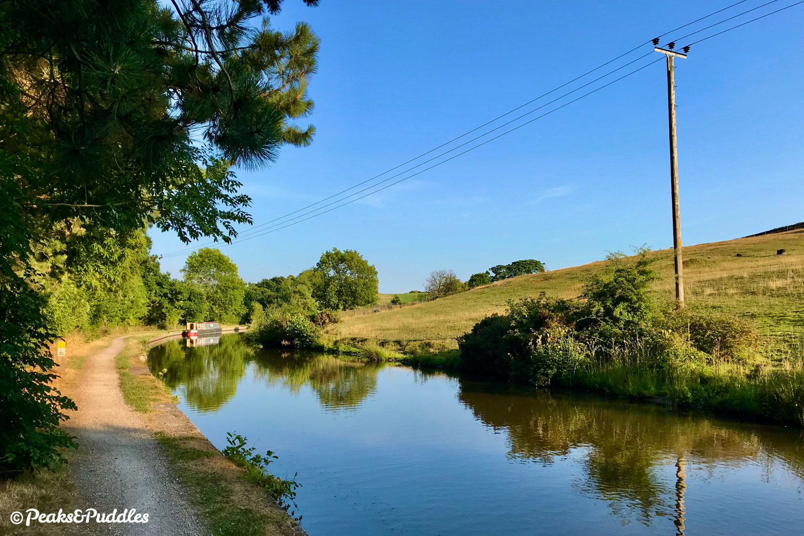
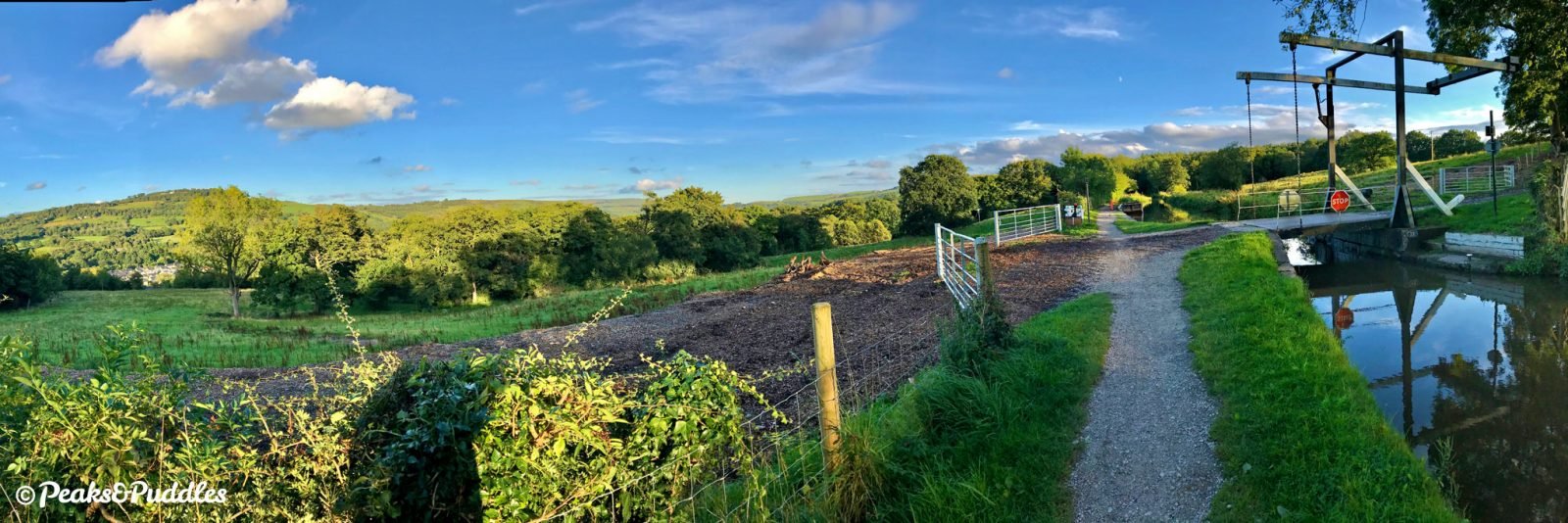
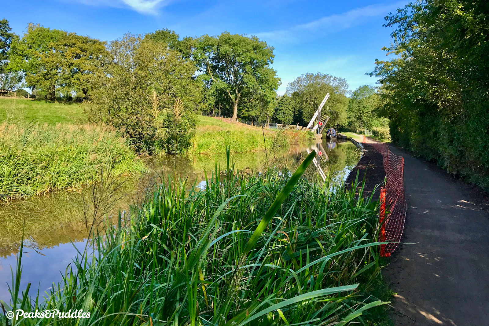
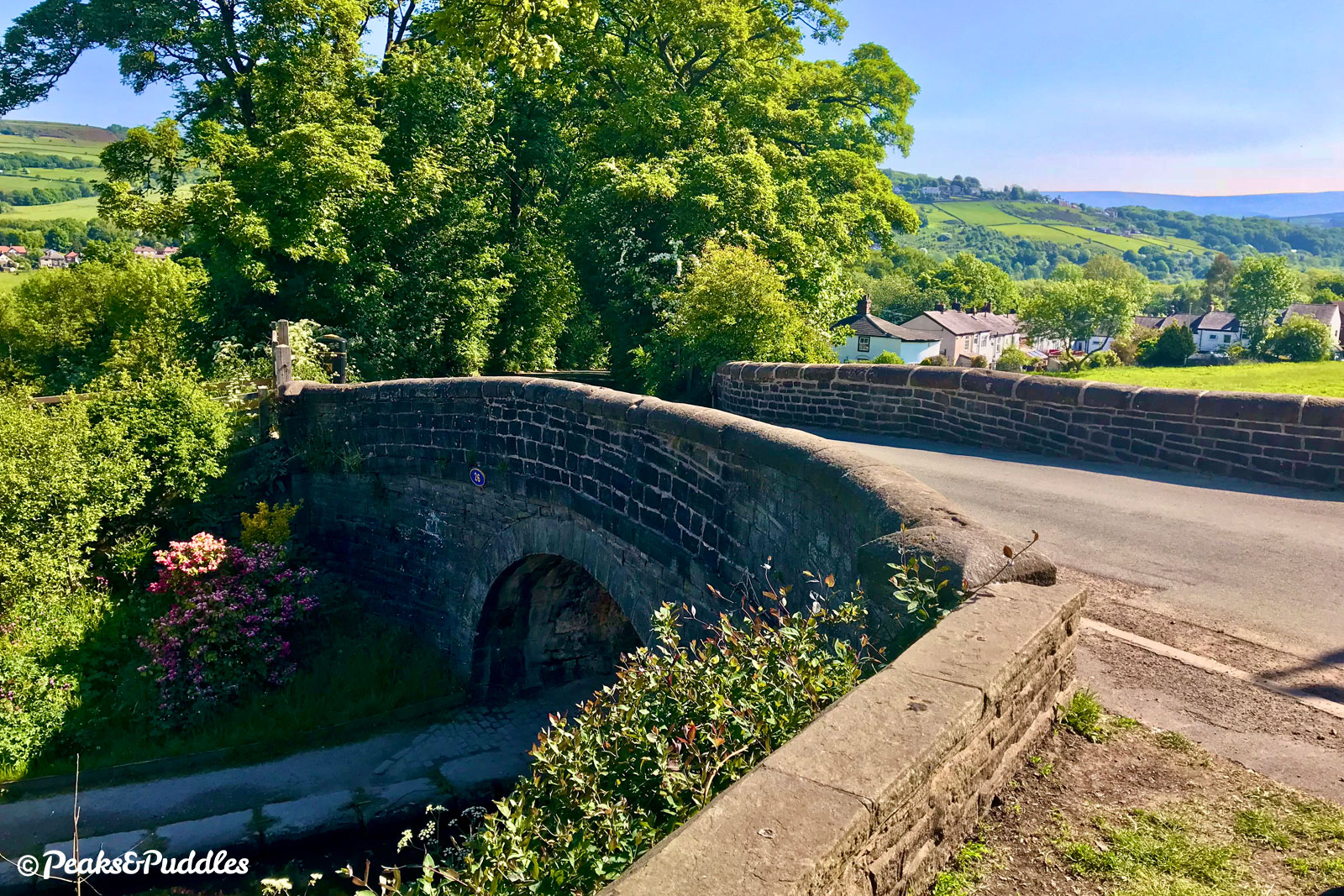
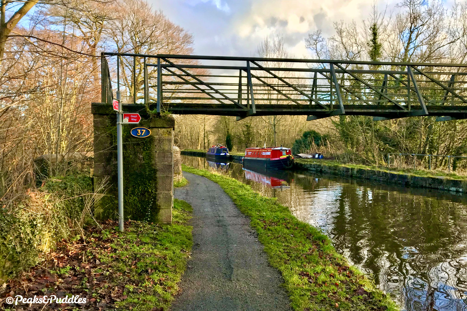
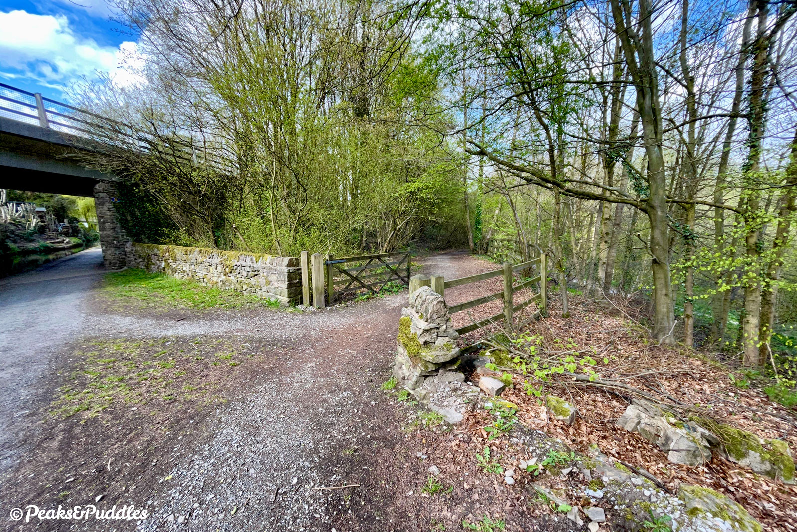
- Only tightening stone walls signify the canal crossing Furness Brook Aqueduct, before the unusual Bridge 31, rebuilt in 1924 with concrete and painted white, carries Station Road down from the A6 at Furness Vale. The building beside it was once the Travellers Call Inn. The Buxton railway line and the noisy A6 are now packed tightly alongside the canal as the valley begins to shrink into its upper reaches, with sometimes a rather stagnant smell from the water treatment works below. Bridge 33, Greensdeep Bridge, is the canal’s final stone arch (ignoring a couple without towpaths at Buxworth), straddled by two footbridges almost an equal distance either side. The first once had a lift bridge alongside while the second, Bridge 34, was until very recently (well, perhaps the 1980s) also the site of Botholmes Hall Swing Bridge — those earlier Peak Forest boaters really had to work this route for all the moving bridges! Its replacement was effectively the concrete Bridge 35 which, along with Bridge 36, were built to bypass part of Bridgemont. These link the A6 and Whaley Bridge onto the Chapel Bypass at a deafening roundabout which also serves Bothomes (previously ‘Bottoms’) Hall.
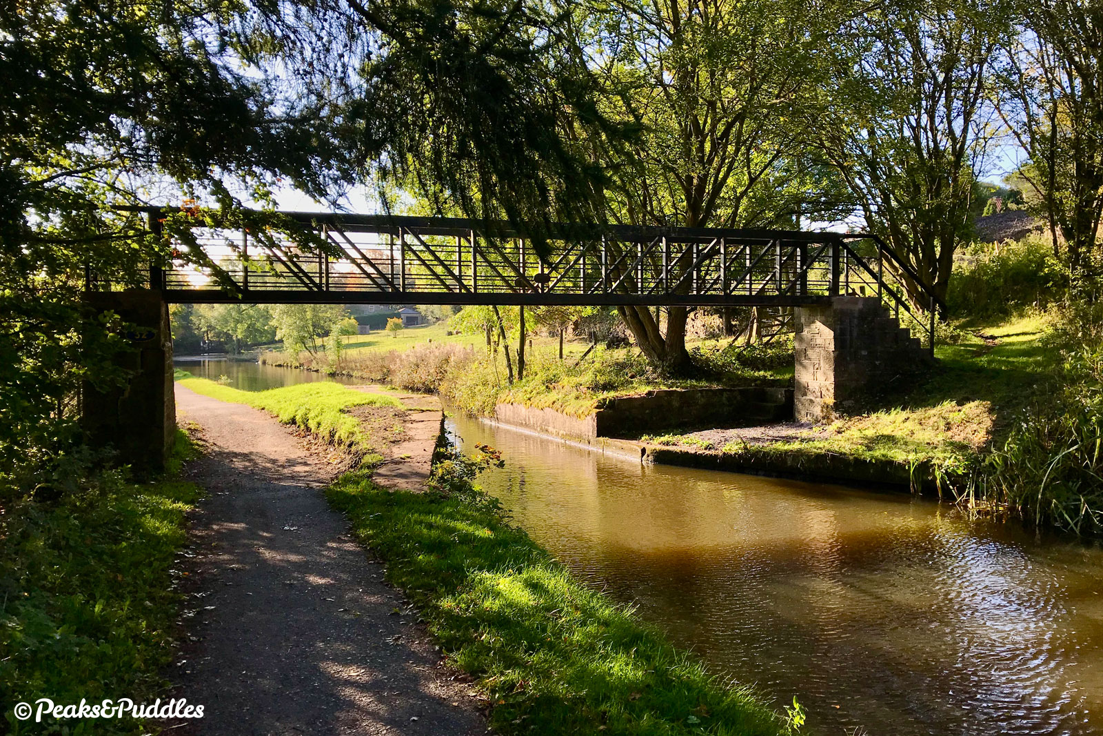

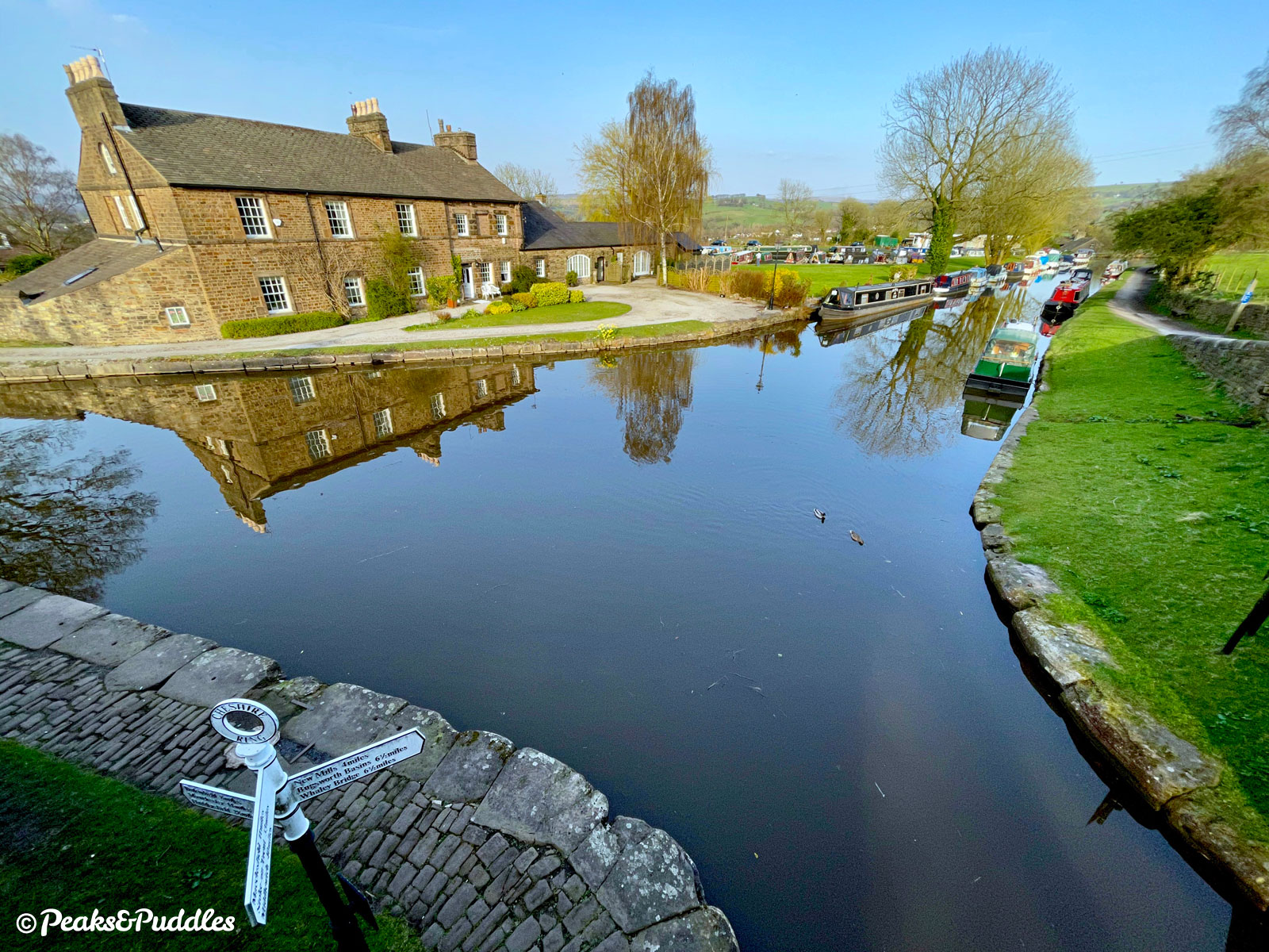
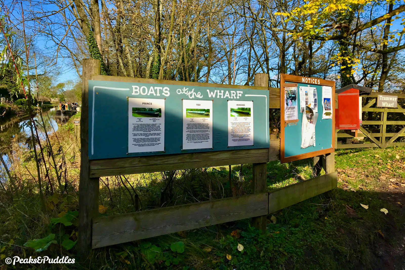
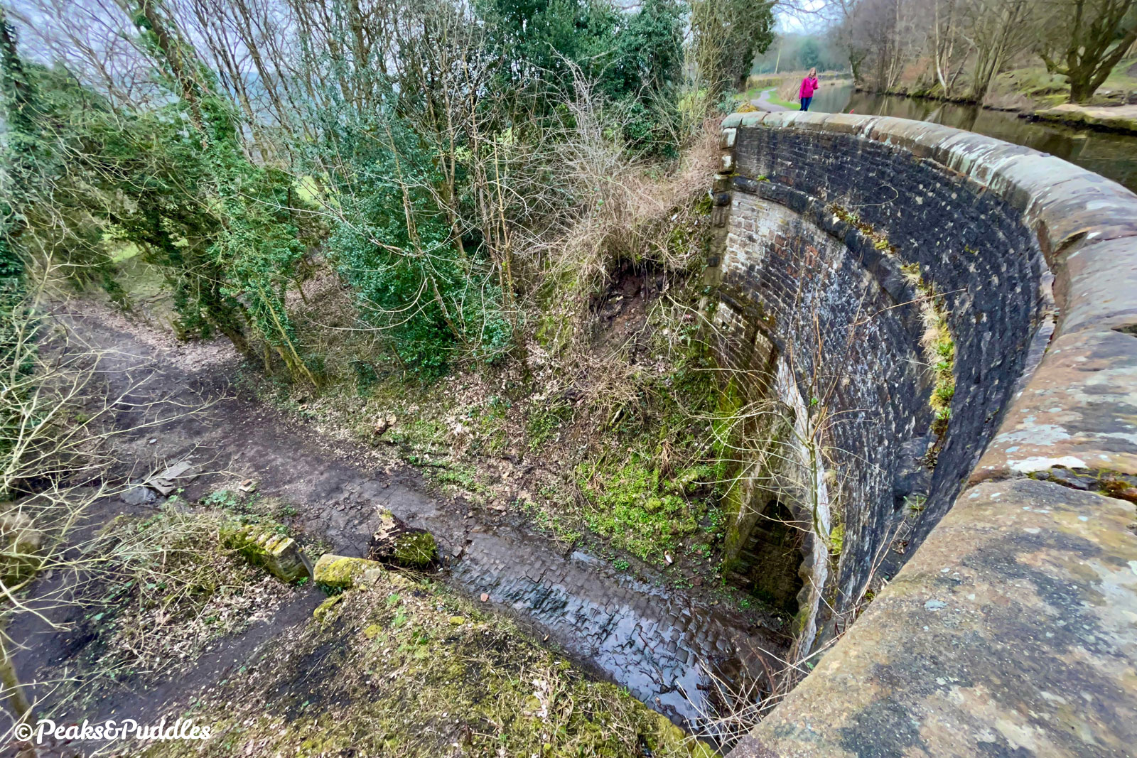
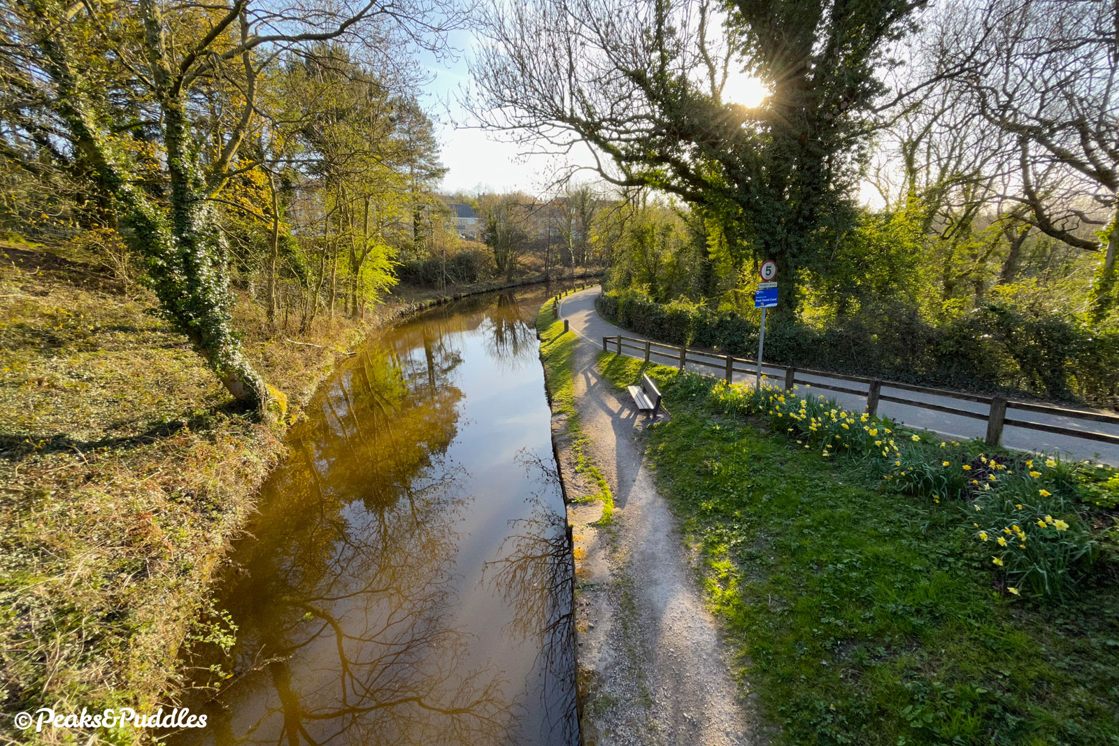
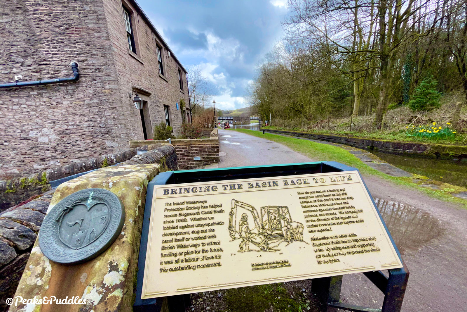
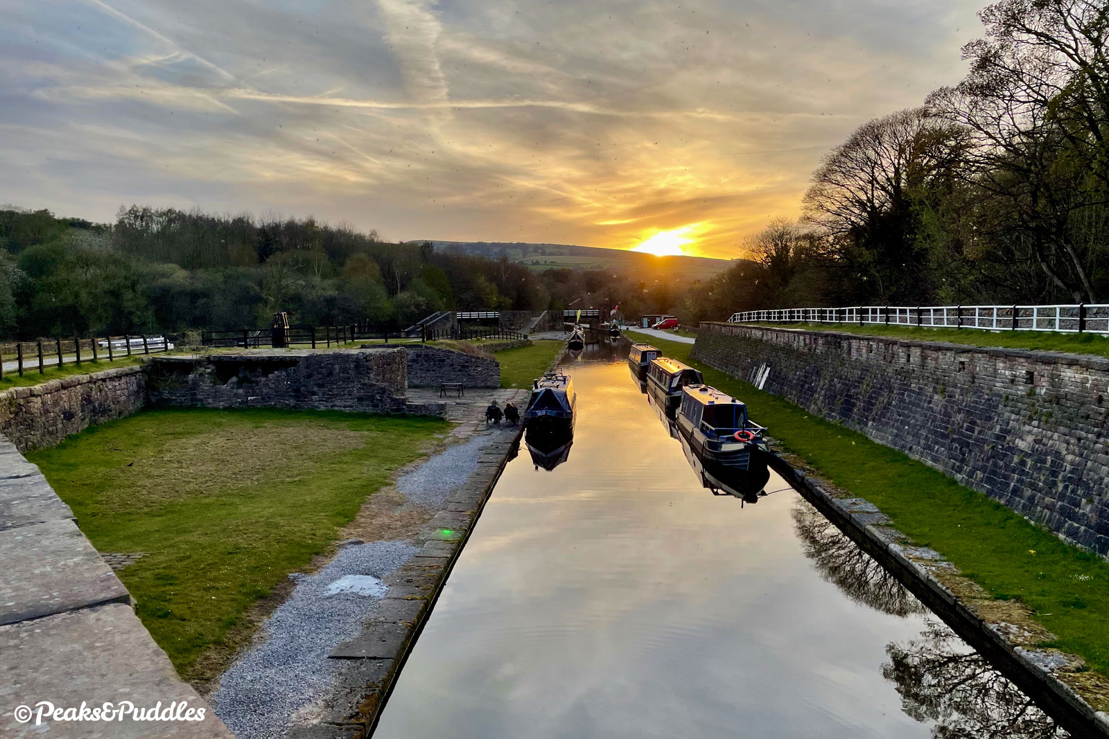
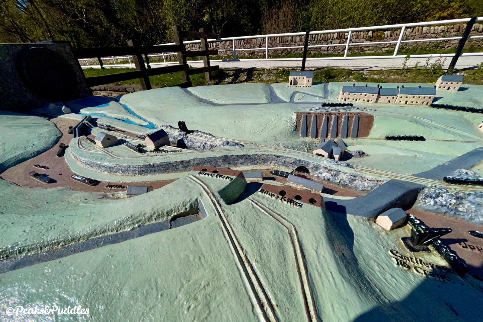
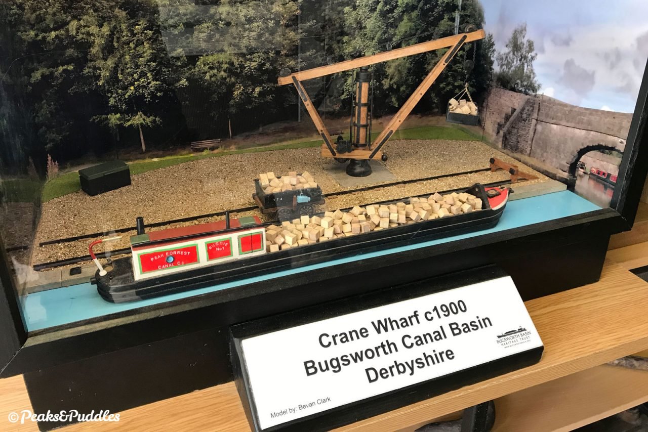
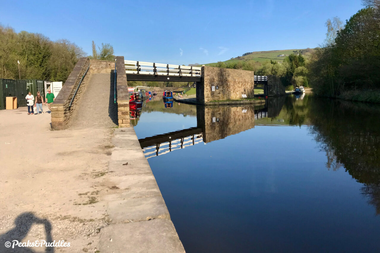
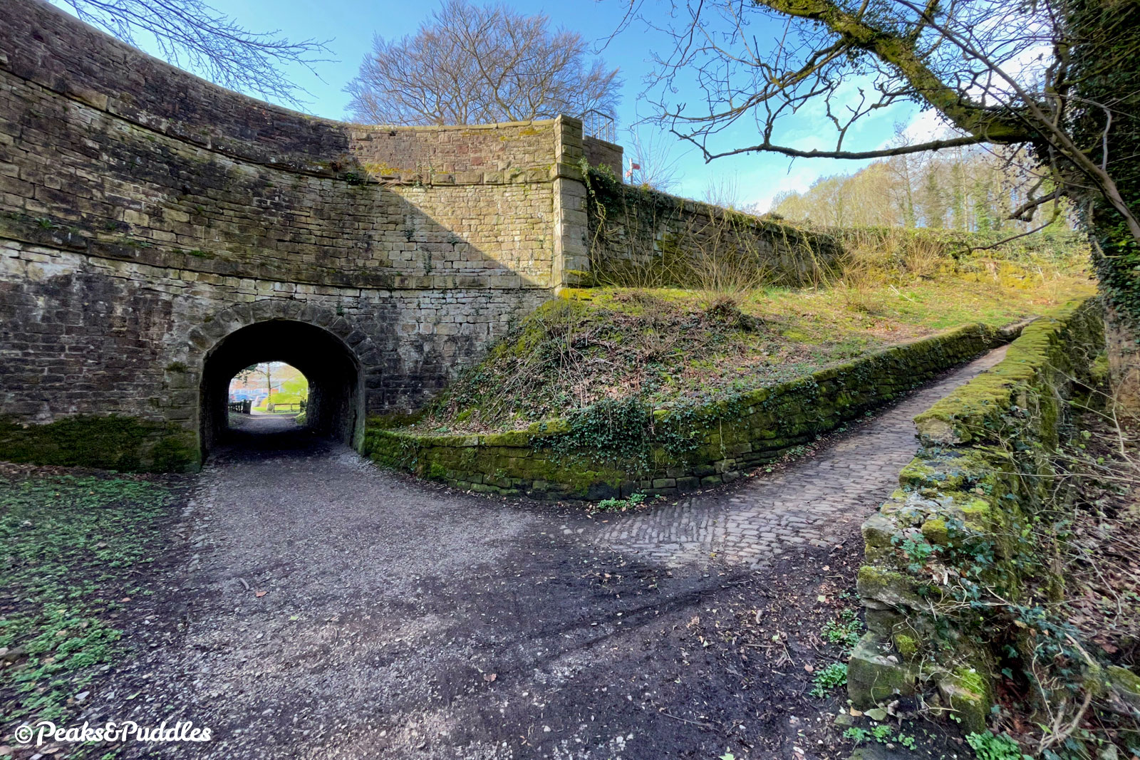
- At Whaley Bridge Junction, the canal splits in two with differing opinions as to which is the “main line”. But as the key source of its limestone traffic, it makes sense to at first explore the Bugsworth arm, following the towpath left, under a footbridge. Bridgemont Aqueduct is in fact one long structure incorporating both a horse tunnel and the River Goyt Aqueduct, though even then barely noticeable from above through the trees. After passing under the Chapel Bypass itself on a third new structure, Bridge 57, the path then rounds a bend to present a terrace of cottages ahead, nicknamed Teapot Row — as it’s said the occupants used to empty their teapots into the canal. Entering Bugsworth Basin, one final stone building was the Wharfingers house and office, now with a blue plaque to commemorate German Wheatcroft, the first wharfinger of this busy little inland port. Miraculously, its lower, middle and upper basins (all in fact on the same level) survived the building of the bypass in the 1980s and were restored thanks to the Inland Waterways Protection Society and determined volunteers. Though it briefly re-opened 1999, it was determined drastically more work was required to ensure the basins were watertight and so only as recently as 2005 has this again been the Peak Forest Canal’s ultimate terminus. The basin had tramway lines down to each wharfside (try to find the replica wagon), lime kilns on the banking either side and several covered stone warehouses, now lost. A small arm on the northern side next to the Black Brook river is a particularly quirky mooring, having been built with a stone structure on top to load lime fresh from the kilns. The track beside the basin is surfaced in quite coarse, bumpy stone, especially on the small hill. Continuing onwards across the road leads straight into the Peak Forest Tramway Trail.
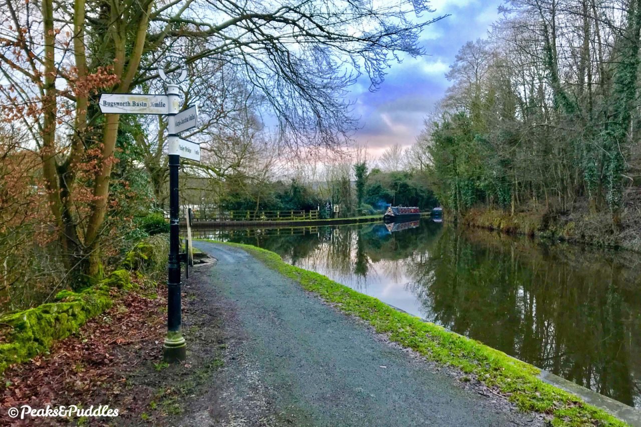

- Once you’ve explored Bugsworth, turn around and follow the towpath back down to Marple — or perhaps make a diversion onto the Whaley Bridge arm?
Whaley Bridge arm
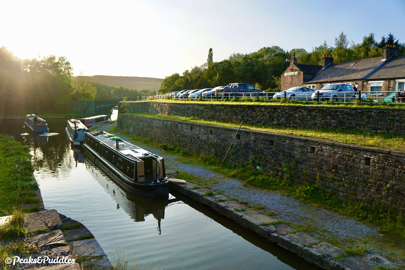
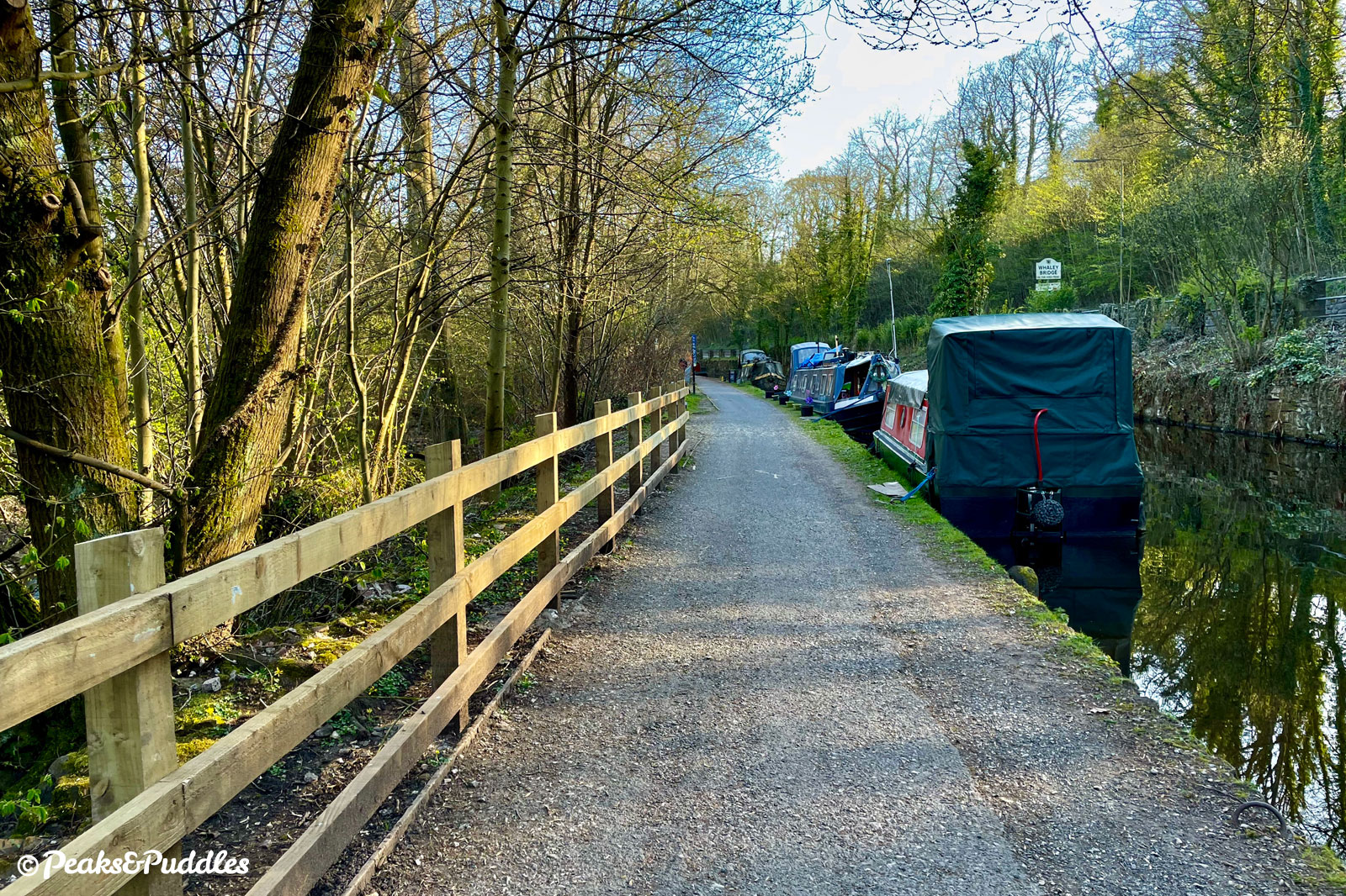
From Whaley Bridge Junction, the canal also continues half a kilometre (0.3 miles) south into the centre of Whaley Bridge, though this requires either carrying your bike over the very narrow footbridge or using steep cobbled ramps down under the Bridgemont Aqueduct (a potential alternative via the supermarket car park is described in ‘Things to note’).
This arm of the canal is completely lined with moored boats and often busy with people, so take it steady and watch out for mooring rings in the path as you pass the Tesco superstore below and follow the now far smaller and closer River Goyt below the towpath, bringing you swiftly into the town.
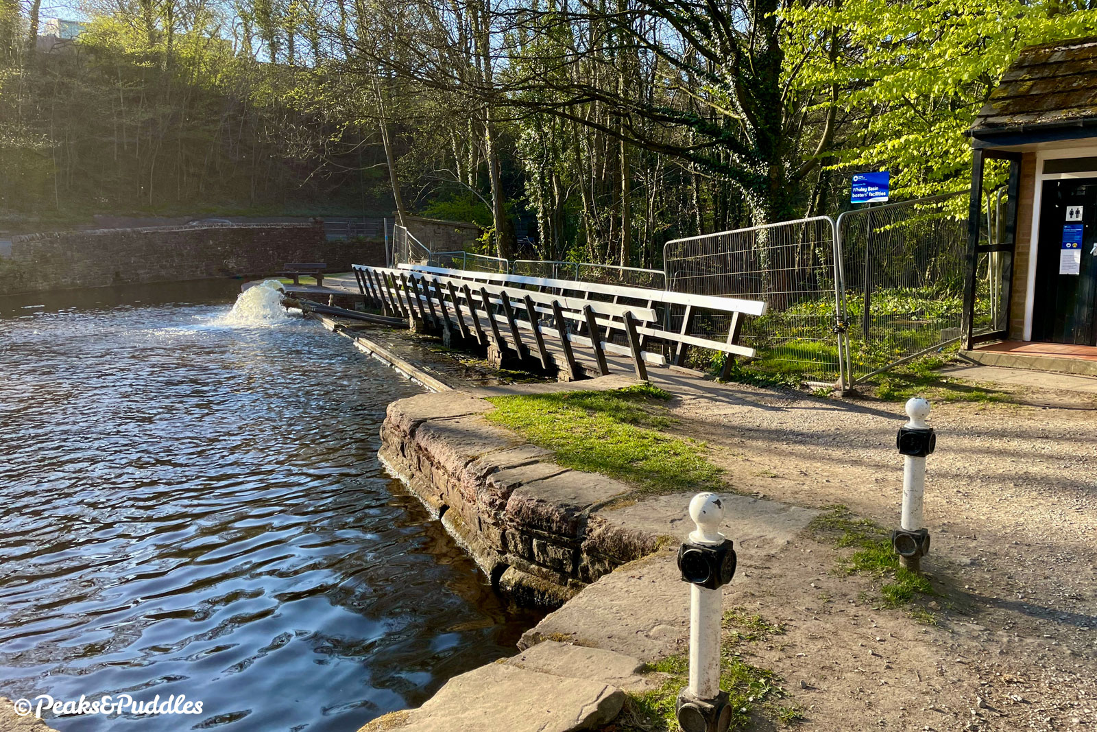
The 1801 Transhipment Warehouse is a wonderful preserved landmark of the basin at the end, where a level footbridge takes you over an overflow channel to complete your journey. From 1832, goods were transferred undercover here between the canal and the Cromford and High Peak Railway, taking them via a series of spectacular inclines over the High Peak itself, forming an unlikely and fascinating link between the Peak Forest and Cromford Canals. South from Hurdlow this is accessible for cycling as the High Peak Trail. The town itself is behind the warehouse to the right, up Canal Street.

Found this guide helpful?
Please consider chipping in the price of a coffee to help pay the bills and support my work. Or become a Peaks & Puddles Plus supporter to get access to exclusive routes and pages in return.
More to explore
- Peak Forest Tramway Trail
Two miles of the horse and gravity-powered plate railway which supplied the waterway with its traffic of Derbyshire limestone is now a multi-user cycle route, linking Buxworth to Chinley. - Oldknow’s Lime Kilns
Between locks 15 and 16 at Marple, follow Lime Kiln Lane to see the remains of these stone kilns, now unearthed with new interpretation boards as part of a trail leading to the Mellor Mill archaeological dig site. - Bugsworth Basin
It’s already hard to imagine that this major canal wharf was, for much of the second half of the 20th Century, devoid of water. It now provides boaters with a water point and services as well as a canal shop for visitors and, on certain days, a temporary shipping container which opens to reveal a wonderful exhibit by the Bugsworth Basin Heritage Trust on the history of the basin and the tramway. They’re one day aiming for a permanent visitor centre. - Marple
Once dominated by mills, now a leafy suburb of Manchester with canal locks, shops and refreshment stops.
From Marple Junction, head through the gate beside the Toll House opposite lock 16 then turn right and follow the quiet Church Street downhill, bringing you right into the centre of town with plentiful cycle parking. - Whaley Bridge
Made famous in recent years for a certain iffy reservoir which feeds this very canal, the small High Peak town is a worthwhile end to the journey with several welcoming pubs and cafes. For further adventures, it’s also the gateway to the upper Goyt Valley reservoirs.
The Whaley Bridge arm deposits you right next to the Transhipment Warehouse, converted into an events venue. Follow Canal Street behind this into the town, where there’s cycle parking on either side of the main road. To see Toddbrook Reservoir, cross and turn right into Whaley Lane then left into Reservoir Road.
Further reading

From Bugsworth to Manchester: A History of the Limestone Trail by Ian Littlechilds and Phil Page
Charting the canal’s modern day path from country to city centre, across 96 pages of photographs, history and insights.

Pearson’s Canal Companion: Cheshire Ring & South Pennine Ring by Michael Pearson
Beloved by boaters, this edition of the Pearson’s series covers the entire Cheshire Ring, perfect if you’re likely to explore further. Just a few pages are devoted to the Peak Forest, but they’re packed with information.

Waterways Guide: North West & the Pennines by Collins Nicholson
Not just for boaters, these handy spiral-bound guidebooks cover vast areas, making them a great investment for canal explorers of all kinds. There are specific tips for cycling along with OS mapping, brief histories and local information.

The Peak Forest Canal and Railway: An Engineering and Business History by Graham Boyes and Brian Lamb
Covering not just the full length of the canal from Ashton-under-Lyne out to the High Peak but also its (two) tramways, this essential history of the route focuses quite heavily (and wordily) on the operational and business side of things, but is still well worth tracking down for anyone inspired by the endeavour and keen to delve deeper, with plenty of interesting photos and plans.
Original photography, words and design by Anthony Sheridan unless indicated otherwise. Found this guide helpful? Buy me a coffee to help keep the wheels turning!
The all-important disclaimer: While great care and attention has been put into gathering these routes, ensuring details are accurate and determining their suitability, all information should be used as a guide only and is not a replacement for using your own judgement or research when setting out on new adventures. Peaks & Puddles/the author cannot be held responsible for any issues that may arise from the riders own decision to ride a section of indicated route.
Always ensure your equipment is safe and legal for use and that you are well prepared, carrying everything necessary including access to a good map. Follow the Highway Code and the Countryside Code at all times. Respect the landscape, the wildlife and the people you encounter. And after all that, have fun!