Dropping some 200 feet down Marple’s sixteen locks to a stunning 200-year old aqueduct, the Peak Forest Canal’s leafy limestone waterway continues eight miles into the city, through Romiley, Woodley, Hyde and Dukinfield to Ashton-under-Lyne.
Route details
- Distance
 16.4 miles / 26.4 km
 - Elevation Gain
 115 m / 376 ft
 - Time allow 2 hours
- Difficulty
 Gentle
 - Suited to
 All Bikes
  Gravel Bikes
  Mountain Bikes
 - Notes Road Bikes: will also be able to cope with most parts of the route given wider tyres, especially Hyde to Ashton. Non-Standard Cycles: heritage steps, a tunnel, cobbles and narrow width very difficult, likely impossible.
- Suggested Start SK6 6BN SJ 9614 8840
- Places Ashton-Under-Lyne, Dukinfield, Greater Manchester, Hyde, Marple, Marple Locks, Romiley, Tameside, Woodley
- Attributes Accessible by train, Bridges, Canals, Car parking, Family-friendly, Gentle climbs, Ideal for electric bikes, Industrial heritage, Museums and visitor centres, Out and back, Pubs and cafés, Reasonably flat, Suitable for older kids, Towns and villages, Tunnels, Urban, Views of hills and peaks, Views of open countryside, Woodlands and forests
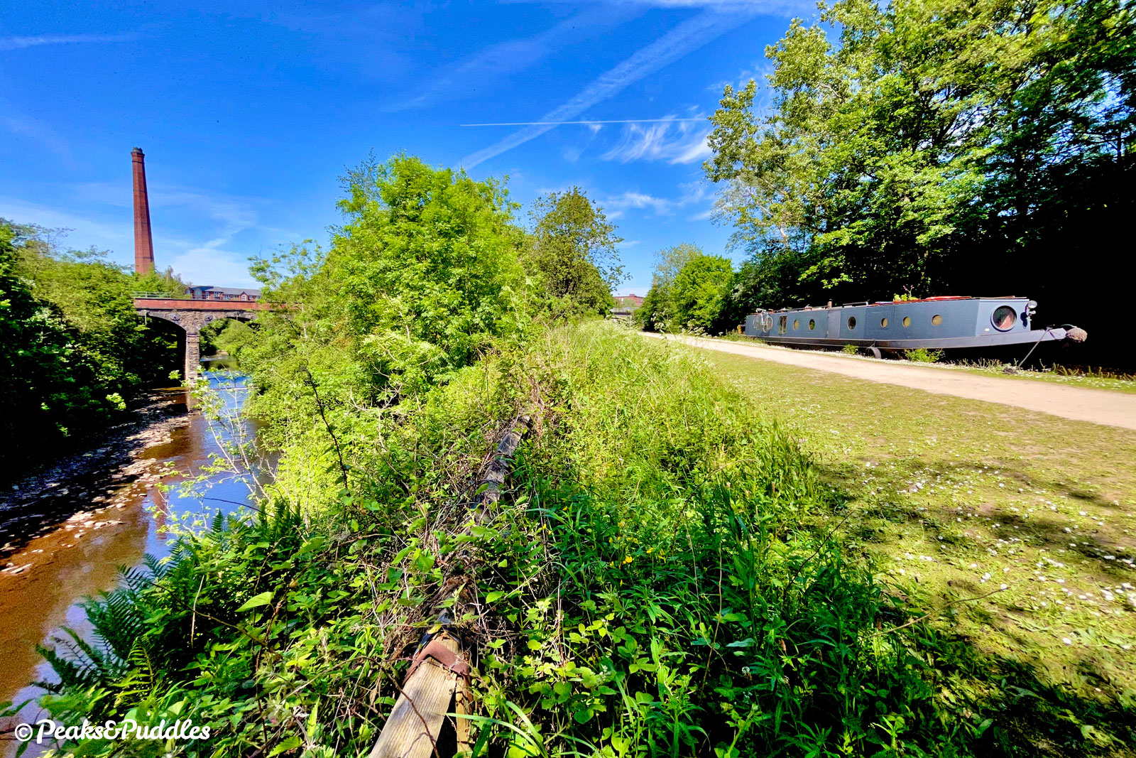
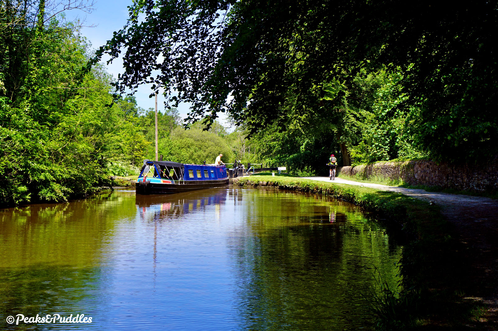
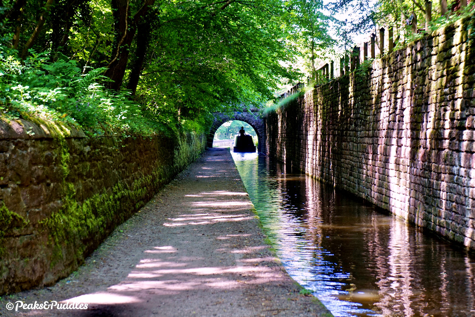
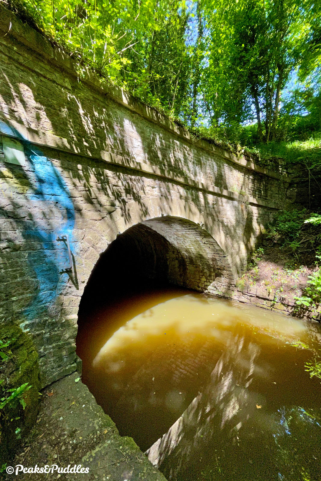
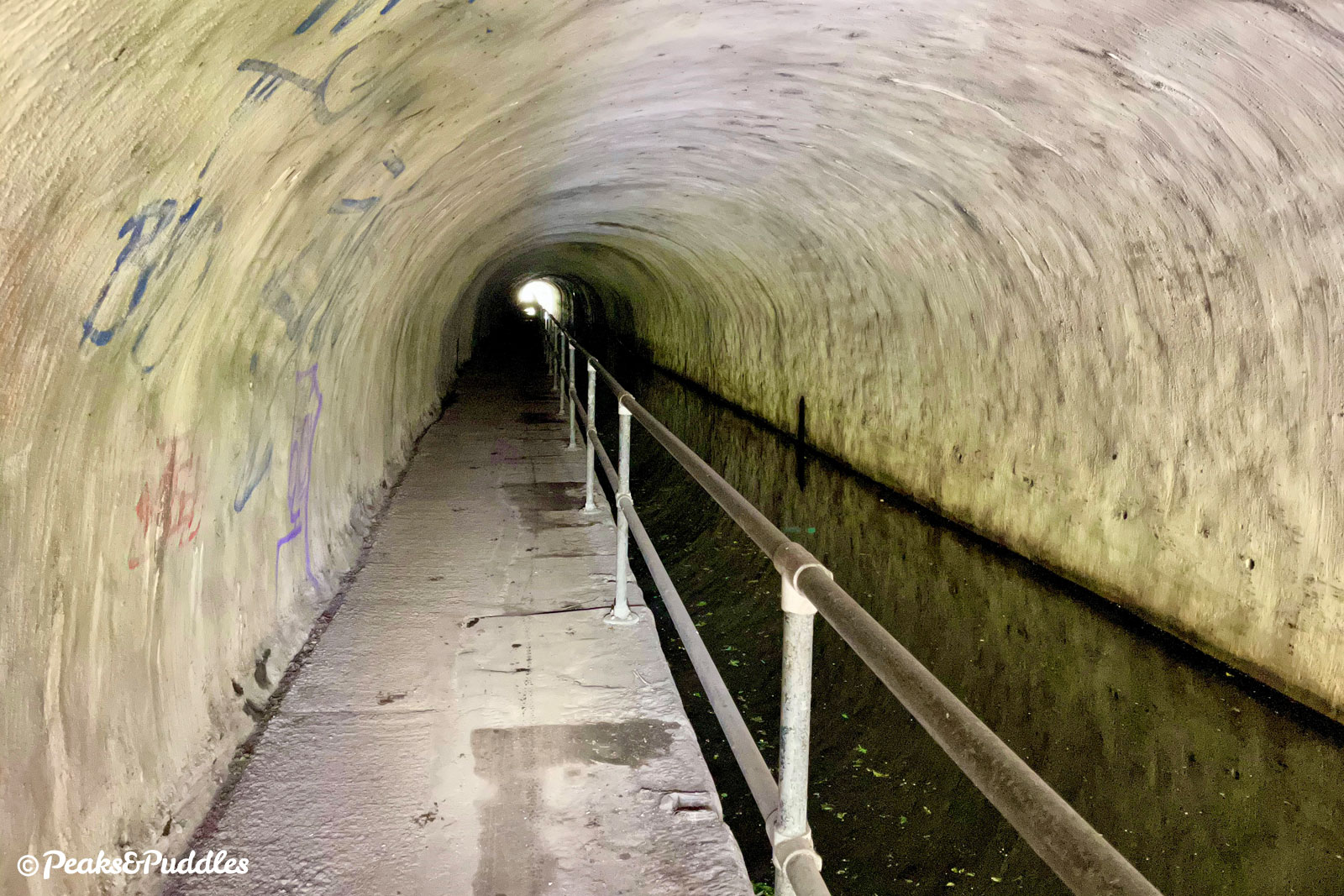
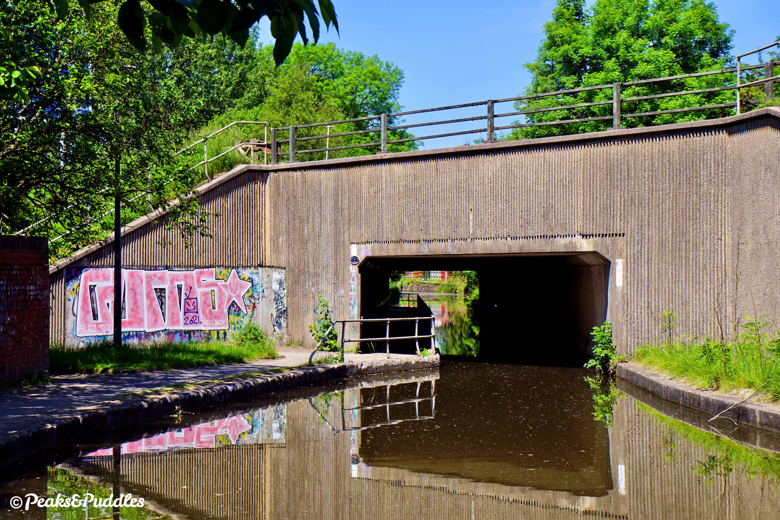
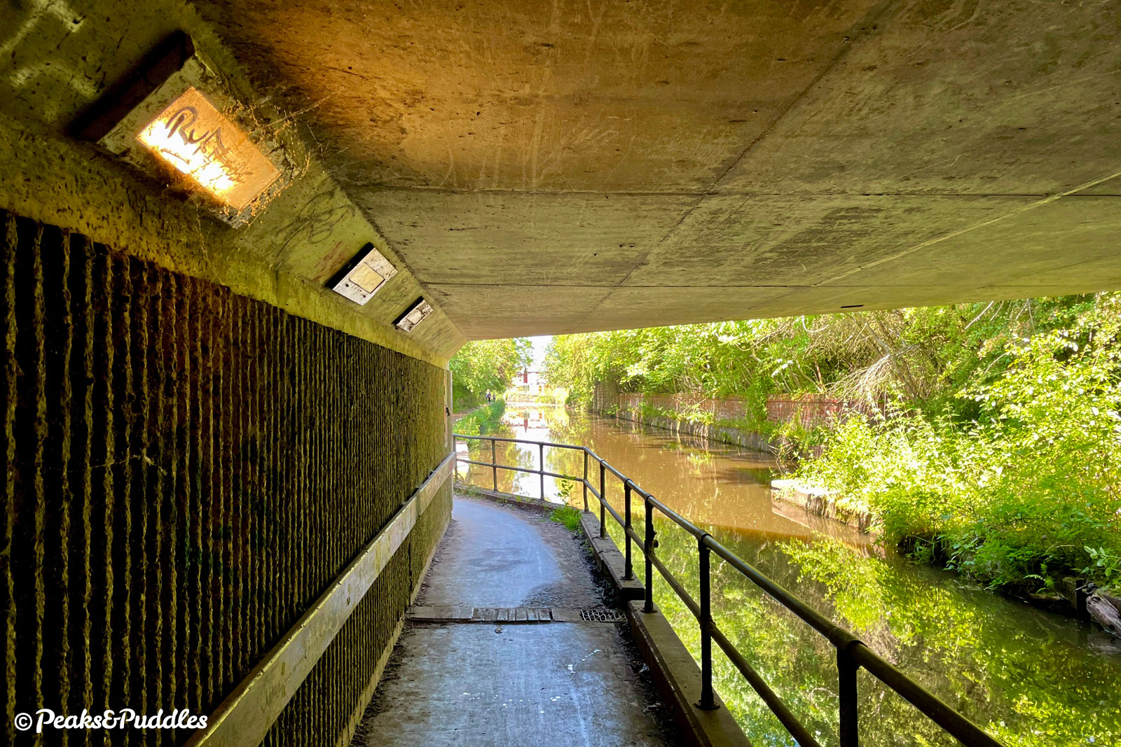
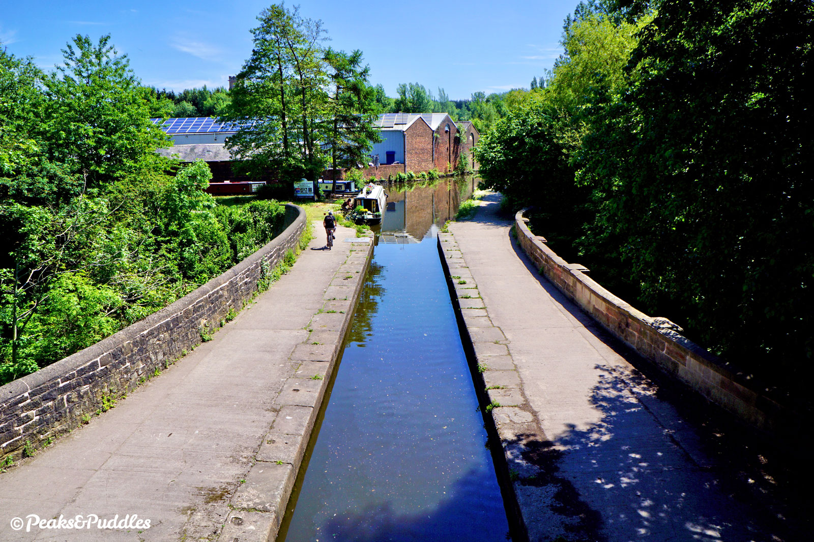
Entering the dark, damp 160 metre Woodley Tunnel, you now realise there are two sides to the Peak Forest Canal. Not just because it also later ducks under the deafening M67, or alongside grittier urban areas, the lower canal could be considered the “dark side.”
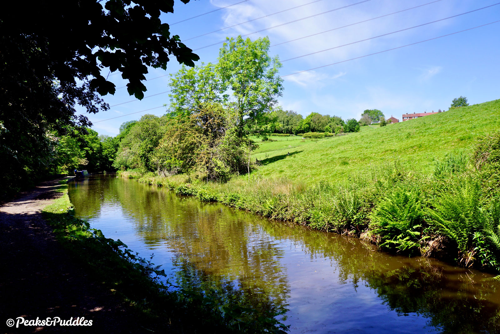
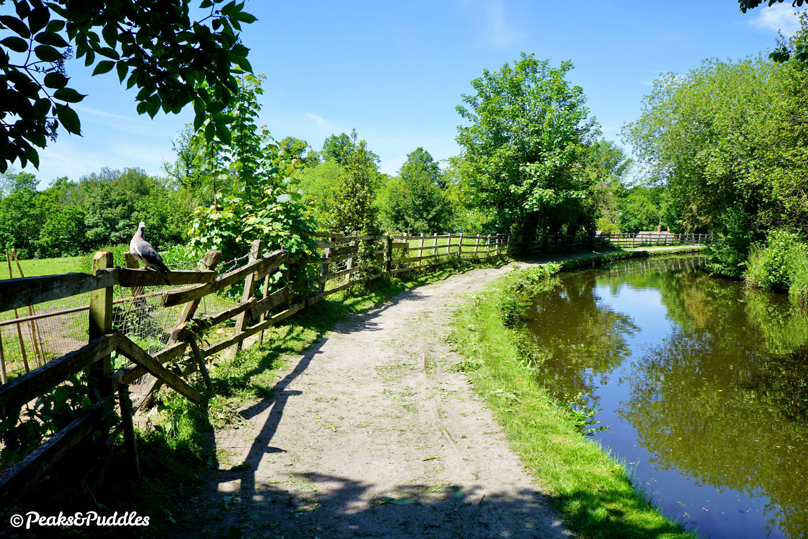
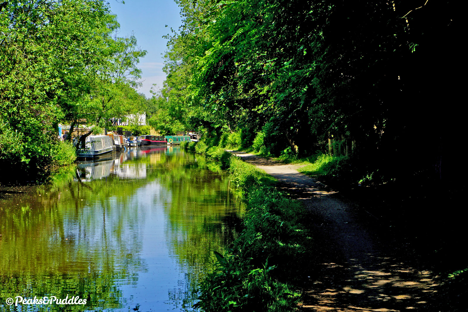
No, because this is a beautifully, densely wooded waterway too. Right from the mid-point of the magical Marple Lock Flight, centuries-old trees envelop the cut through an ever-changing landscape. Despite the intrusions of modern city life it miraculously retains a rural feel, in ebbs and flows, right the way to Dukinfield Junction in Tameside, its water held high above the River Tame.
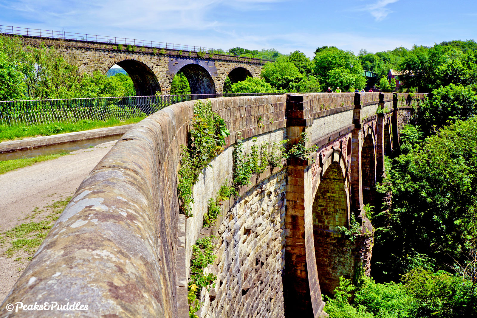
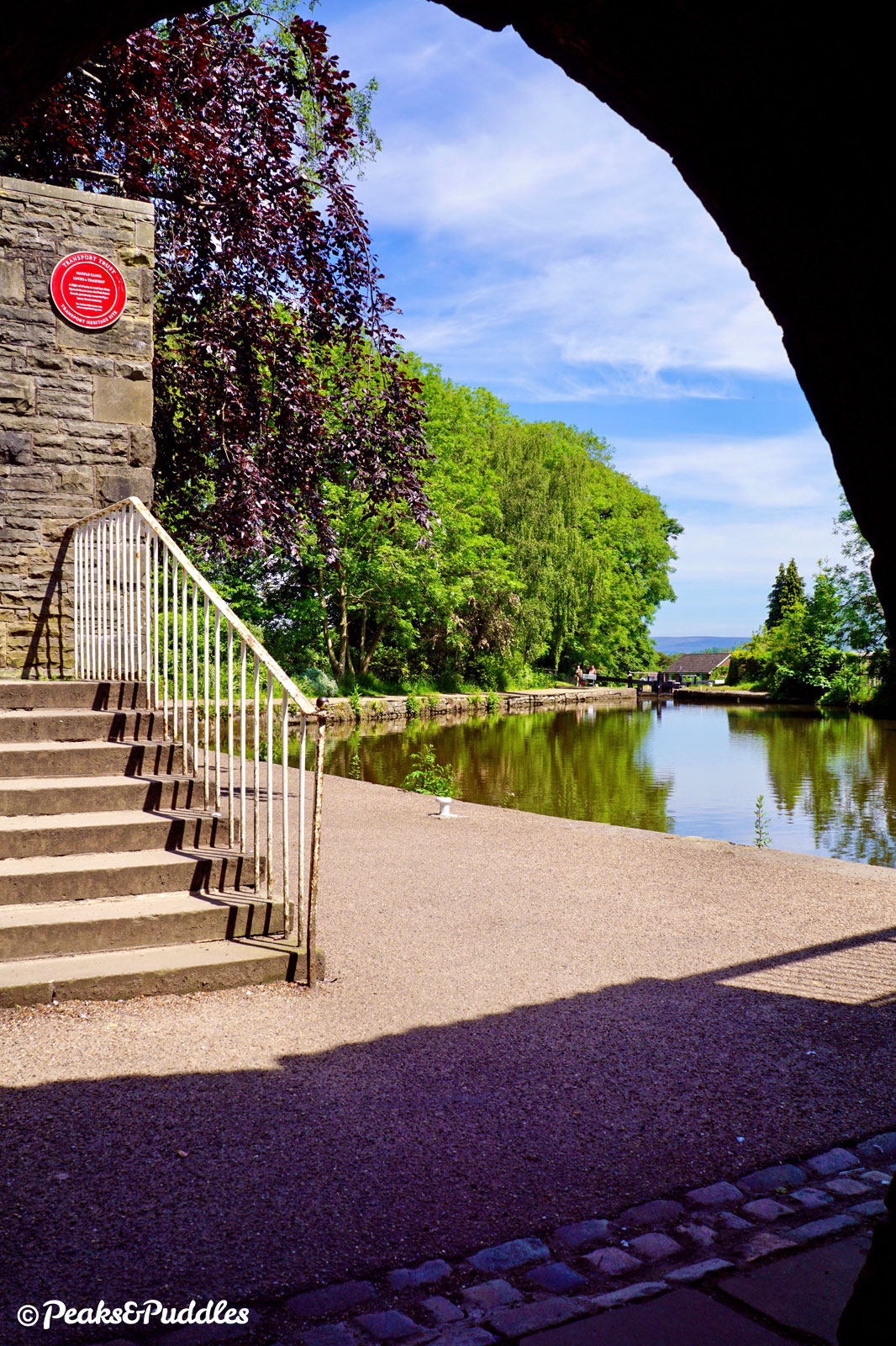
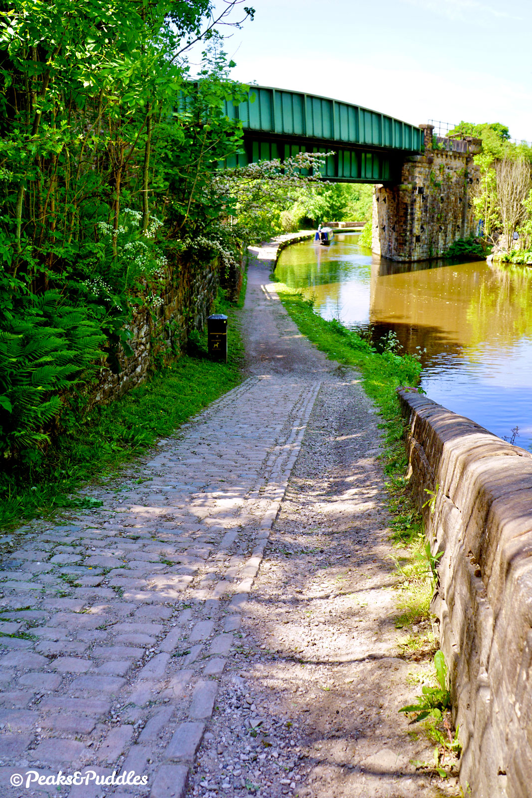
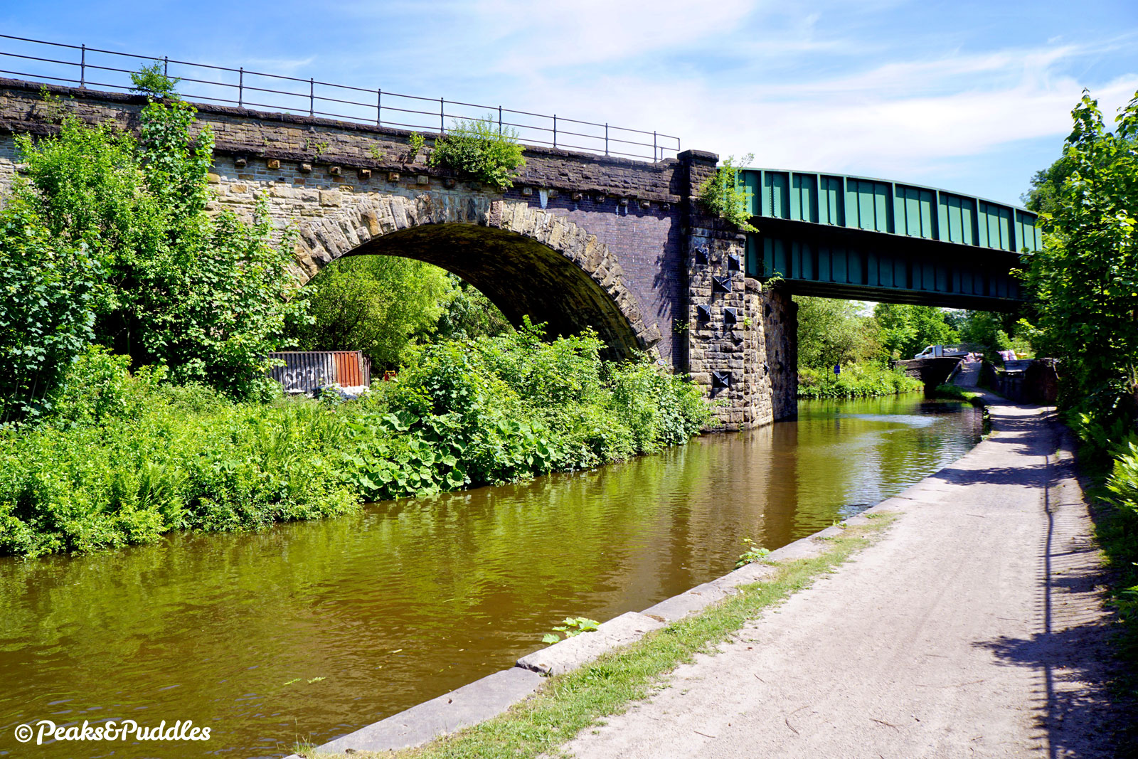
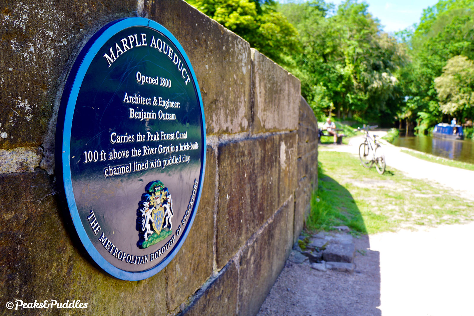
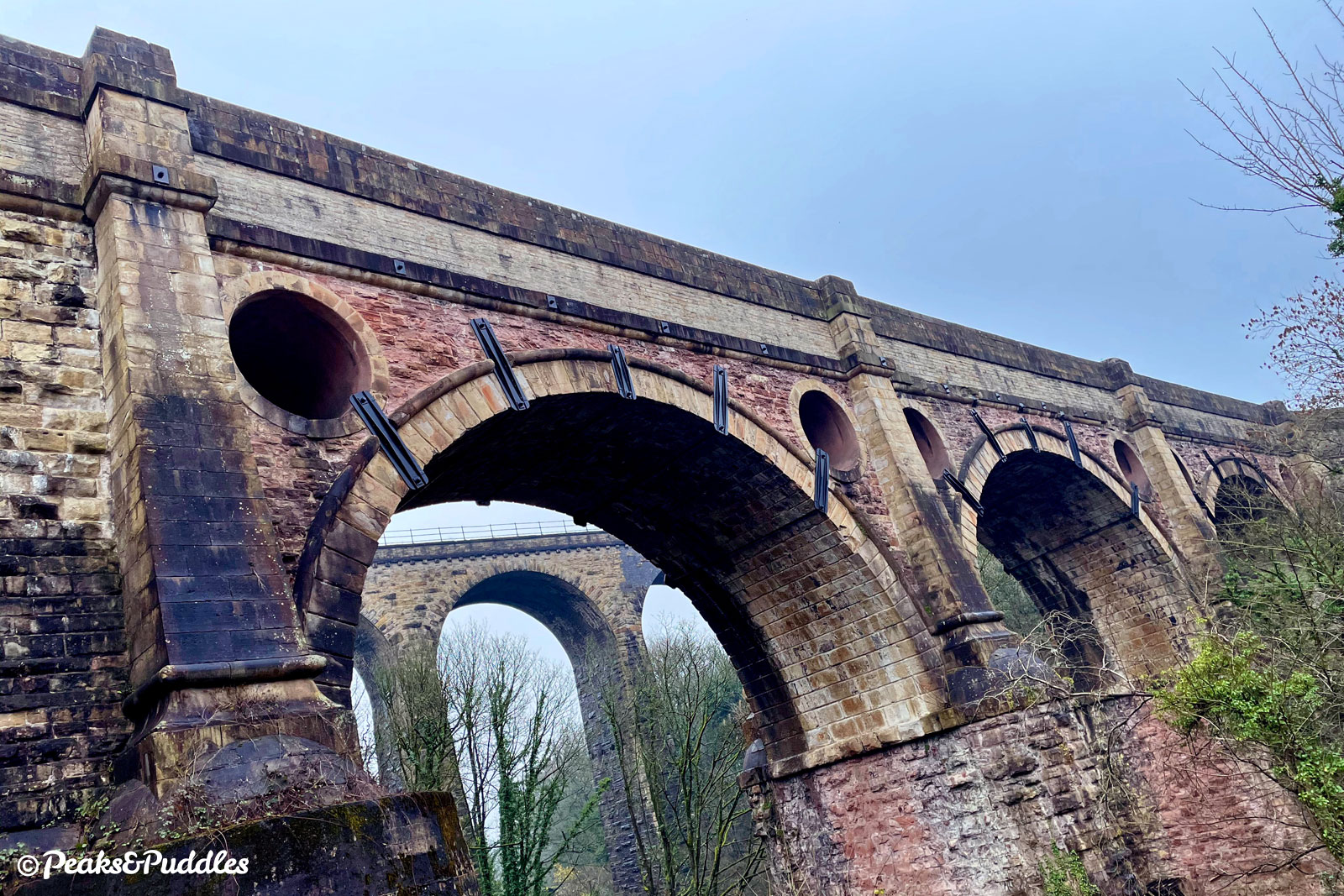
But what of the Goyt? The river that defined the Upper Peak Forest Canal takes one last, contented bow as it passes beneath the splendid Grade I-listed Marple Aqueduct. The highest canal aqueduct in England, it carries its waters some 27 metres (90 ft) above the river below, with a particularly unique design by Benjamin Outram including circular hollows to reduce its weight. A later railway viaduct passing right alongside only adds to the drama and delight of this wondrous spot.
A need to shift stone from the Derbyshire hills to the booming industrial workshop around Manchester saw plans for the Peak Forest Canal put forward in the late 18th Century by Samuel Oldknow, a cotton manufacturer who invested much of his wealth into industrialising the landscape around Marple.
Oldknow notably built the huge, lost Mellor Mill in the valley below the start of the upper canal and accompanied the waterway with numerous lime kilns to also turn the limestone into quicklime, used in construction and agriculture.
Authorised by an act of parliament in 1794, by 1796 both the upper and lower reaches were already largely finished, leaving just the minor problem of a flight of 16 locks, a 98 ft (30 metre) high aqueduct over the valley, a tunnel and a severe lack of money to connect them. Eventually the aqueduct was completed in 1799 and the canal fully operational by 1800. Yet still, a temporary horse and gravity powered “tramway” ran parallel to the promised locks until their completion in 1805.
Like many other canals, the Peak Forest fell victim to the competition of the railways from the late 19th Century. The impact of two world wars saw the lower canal and locks fall into disuse. It’s hard to believe now, but by the early 1960s these were silted up, overgrown, abandoned and completely impassable to boats; certain to be lost forever.
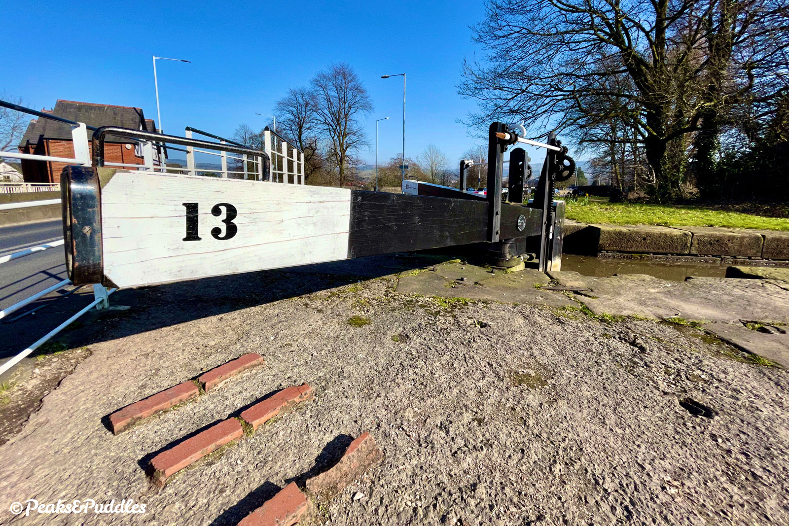
Instead, a national waterways revival and valiant campaign efforts saw the entire canal saved and restored by the 1970s. In 1968, Queen Elizabeth II notably visited the restoration effort at Marple’s Possett Bridge next to Lock 13. Today, this part of the canal forms part of the popular ‘Cheshire Ring’ canal circuit.
For cycling, the lower canal throws up surprisingly more challenges than the upper, with tunnels to pass both through and over. It’s nevertheless still a useful utility route in places and a fantastic, leisurely adventure. Even if you left your heart 200 ft above.
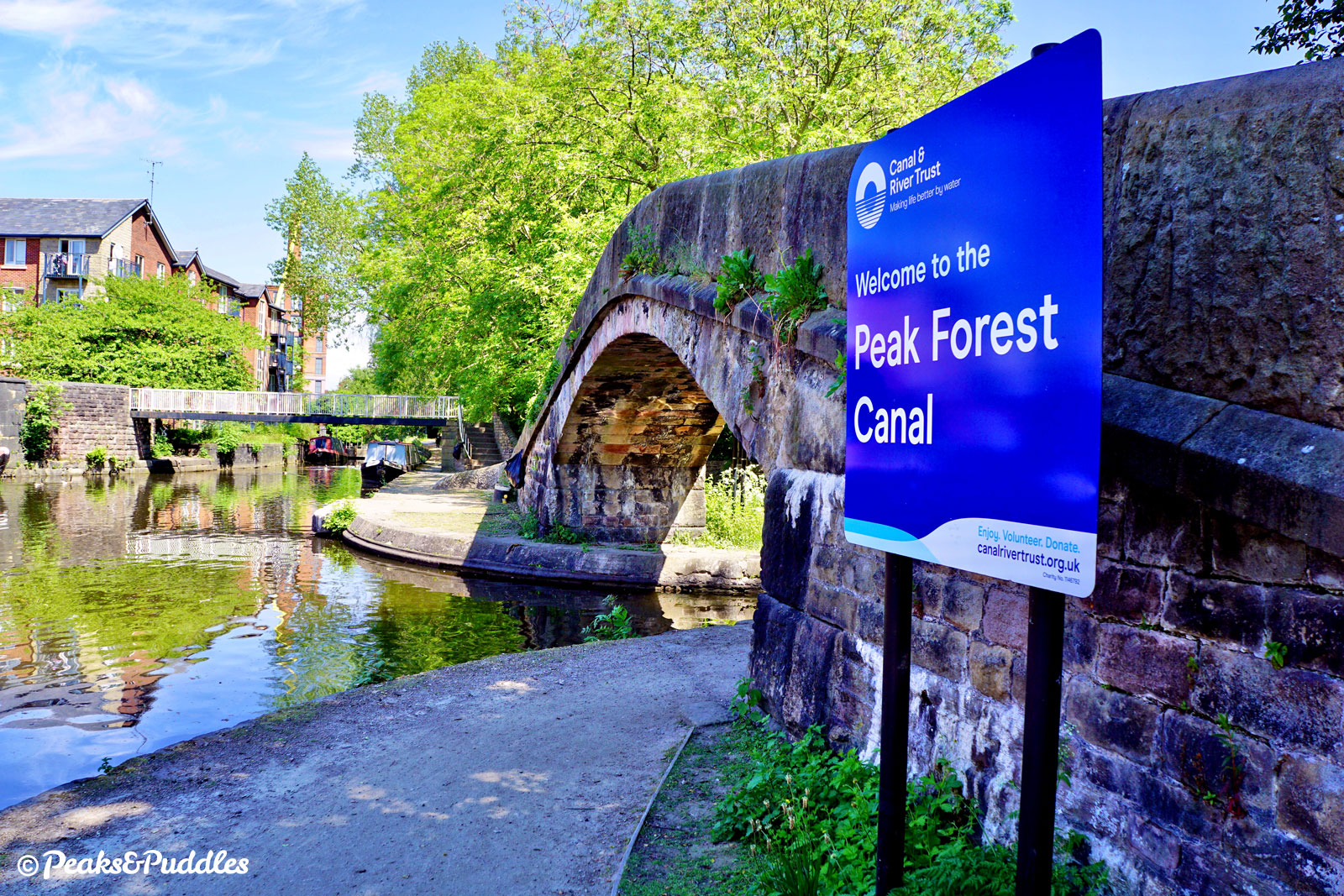
Combined as one route, the full Peak Forest Canal is a 24 km (14.9 mile) ride from Bugsworth Basin to Dukinfield Junction. See the separate Upper Peak Forest Canal cycle route guide to explore the rest of the route.
Route map
Where to begin
Close to the town centre, Marple Lock Flight provides a rewarding start and end to a ride, heading down from Marple Junction on Lockside. To get there, absolutely avoid the main Stockport Road through the town (unless you enjoy jostling with heavy traffic) and trace a route across the residential side roads to the north or south.
From the Middlewood Way, see the quiet road route using Mount Drive and Woodville Drive mapped in the Lyme Loop cycle route guide. From the Alan Newton Way and central Stockport, stick to the north side of Marple, using Bowden Lane and Norbury Drive to access the canal at Lock 7 off Grosvenor Road. From Brabyns Park and Marple Bridge, follow the wide track up through the park which leads to Lock 7.
The Upper Peak Forest Canal naturally links straight in from Strines, Disley, New Mills, Furness Vale and Whaley Bridge, while the bumpier Macclesfield Canal links from High Lane.
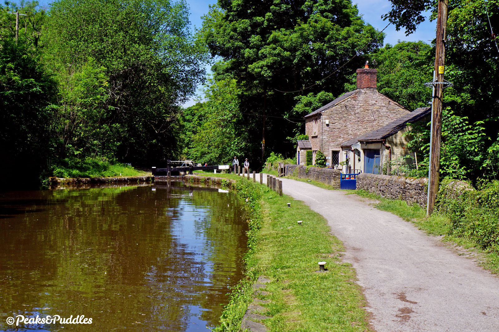
The lower Peak Forest Canal itself officially begins at the bottom of the locks, near the quite isolated Marple Aqueduct over the River Goyt. Romiley is the next starting point, with the best access being Oakwood Road through the board mill at Hyde Bank Tunnel. Onwards, there are links onto the towpath at almost every bridge through Woodley, Hyde and Dukinfield to Ashton-under-Lyne.
Other notable links onto the route are at Haughton Dale Nature Reserve from the Trans Pennine Trail, Apethorn Lane from the Godley Link Line (also part of the TPT) and of course Dukinfield Junction, at the end of the canal, from the Ashton Canal and central Manchester.
By train: Marple railway station is just 150 metres down Brabyns Brow below Lock 9, which you might prefer to push up rather than join the busy road. Romiley railway station is also convenient; cross the main road towards Oakwood Road and head through the board mill.
By car: Space is at a premium around the canal in Marple, so best to use the council car parks at Trinity Street, Townley Terrace or Memorial Park. At the Ashton end, Portland Basin Museum has a large car park, though access to the canal requires lifting bikes over two awkward bridges.
Things to note
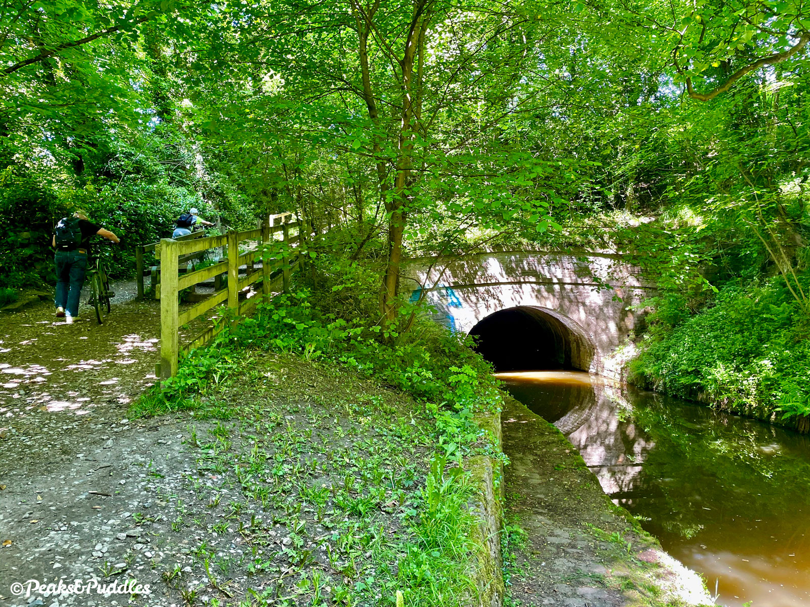
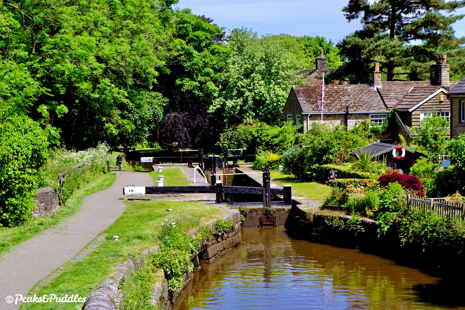
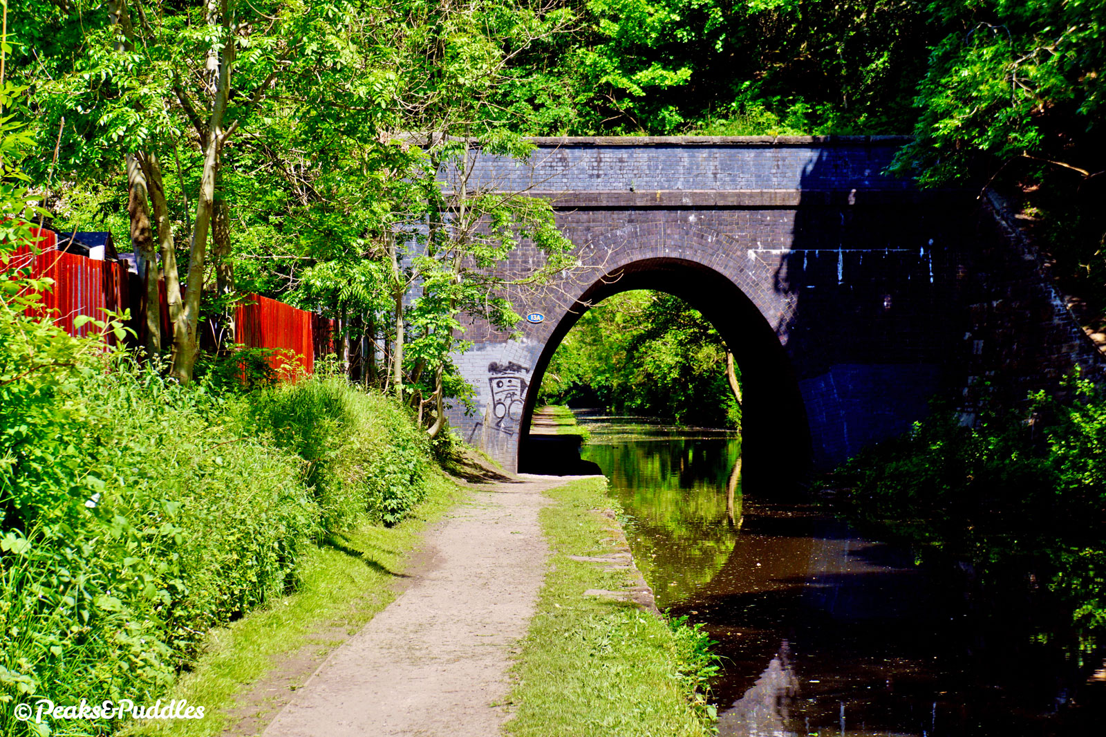
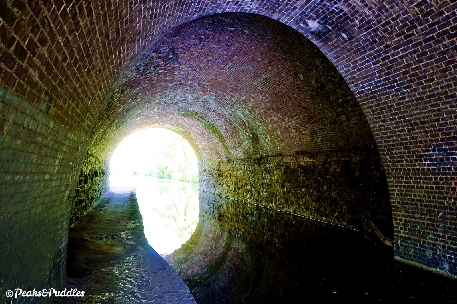
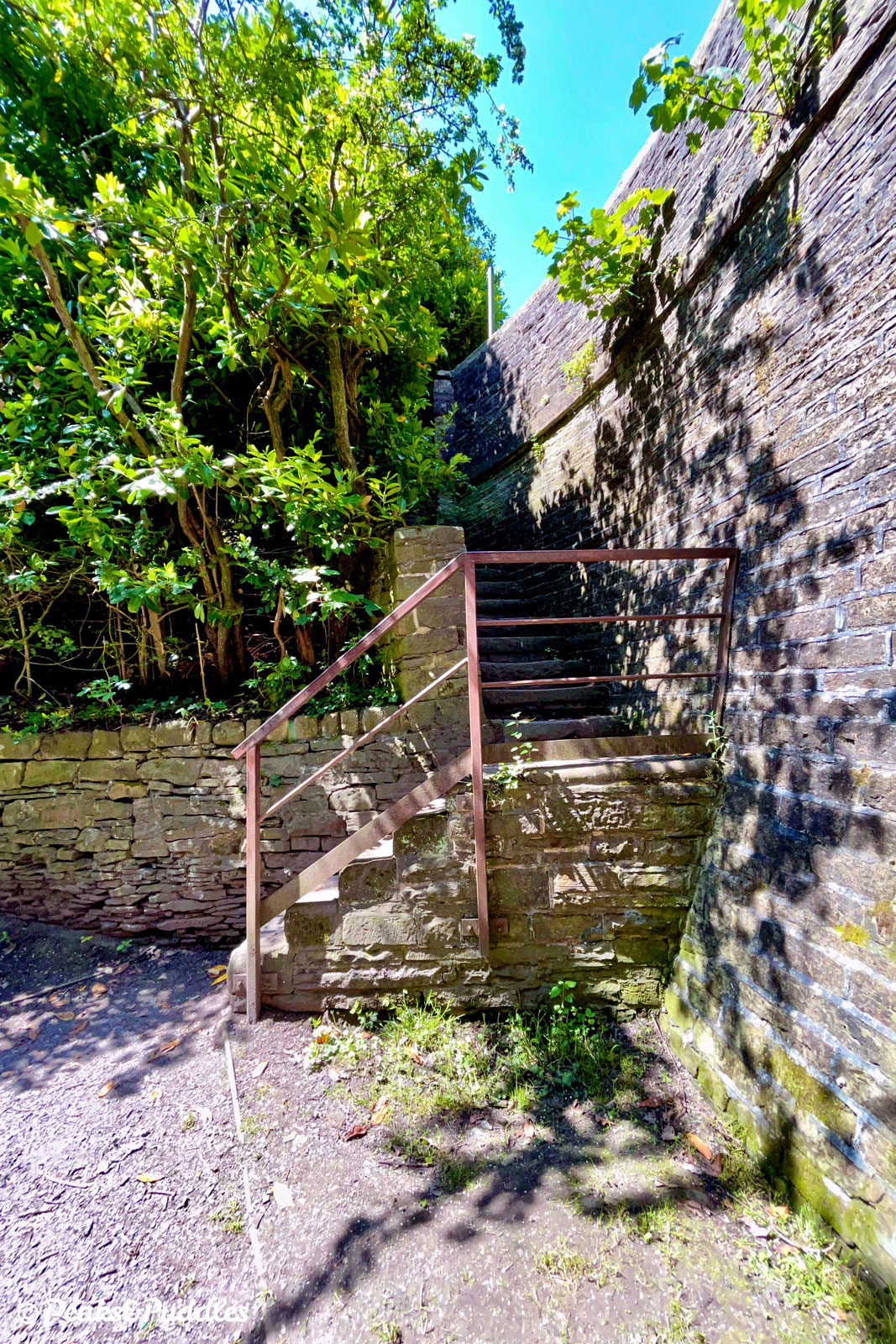
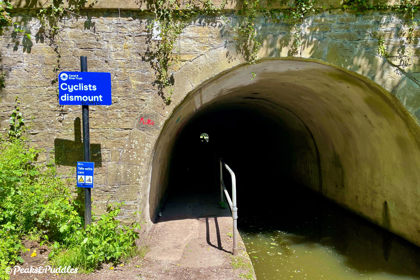
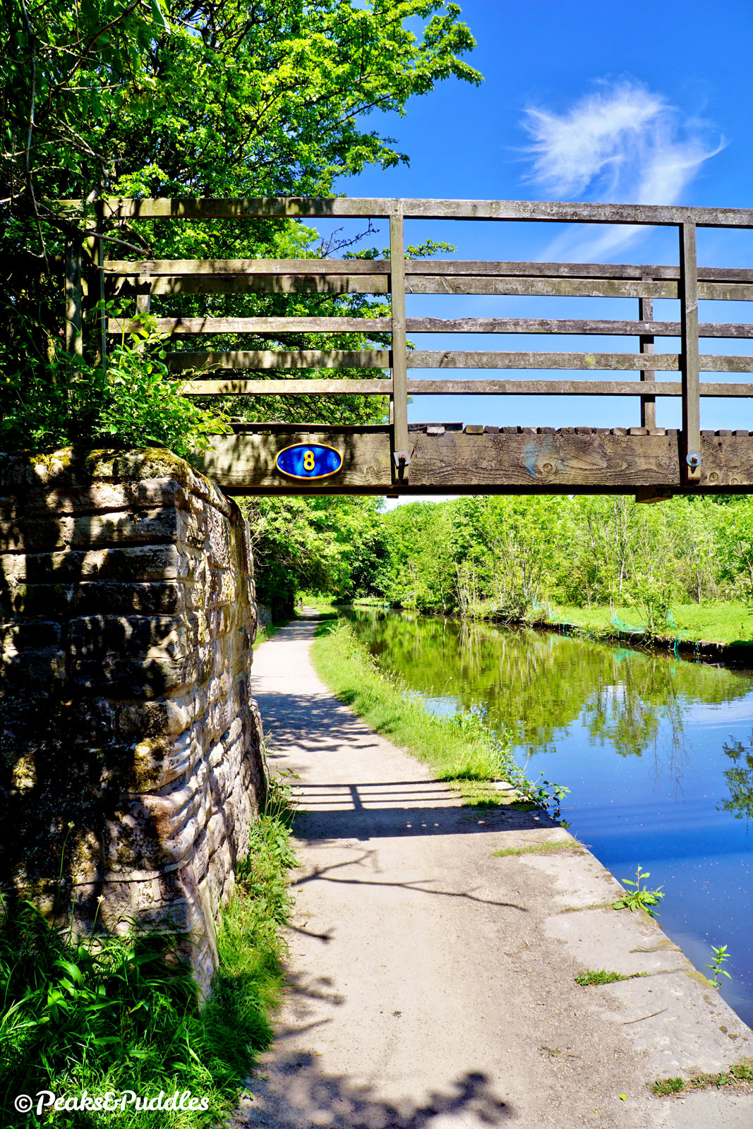
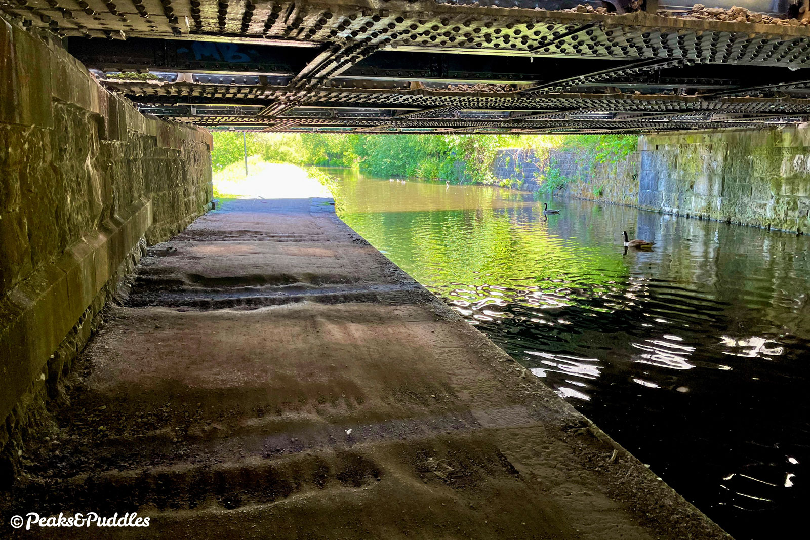
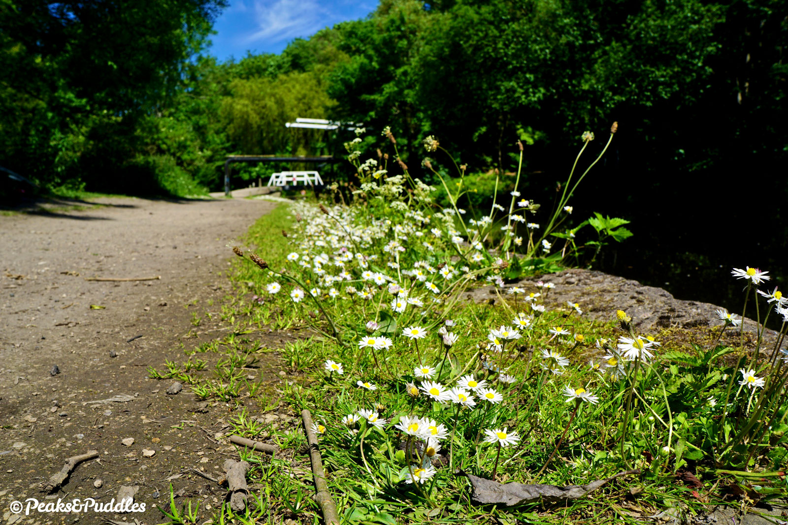
- Two major canal tunnels on the lower canal each present their own obstacle to continuous cycling. Hyde Bank Tunnel between Marple Aqueduct and Romiley has no towpath whatsoever: the only route around it is a large set of steps and a stoney track over the top. Woodley Tunnel on the other hand does have a narrow towpath, with a safety barrier, but it’s very difficult to cycle and official advice is to dismount and push the dark, damp 161 metres (176 yards). A front light or a torch is strongly recommended and wait for anyone approaching to clear the tunnel first.
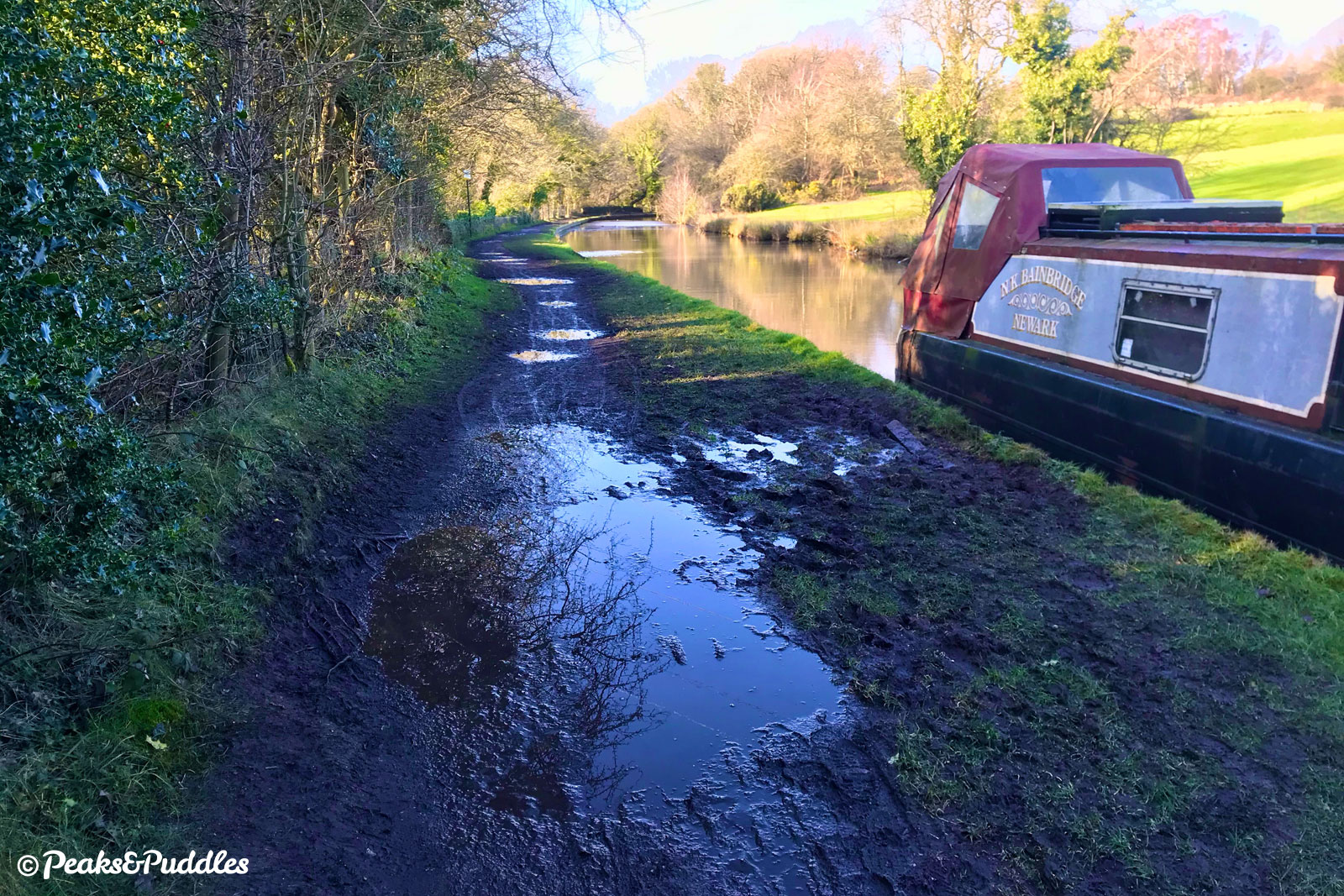
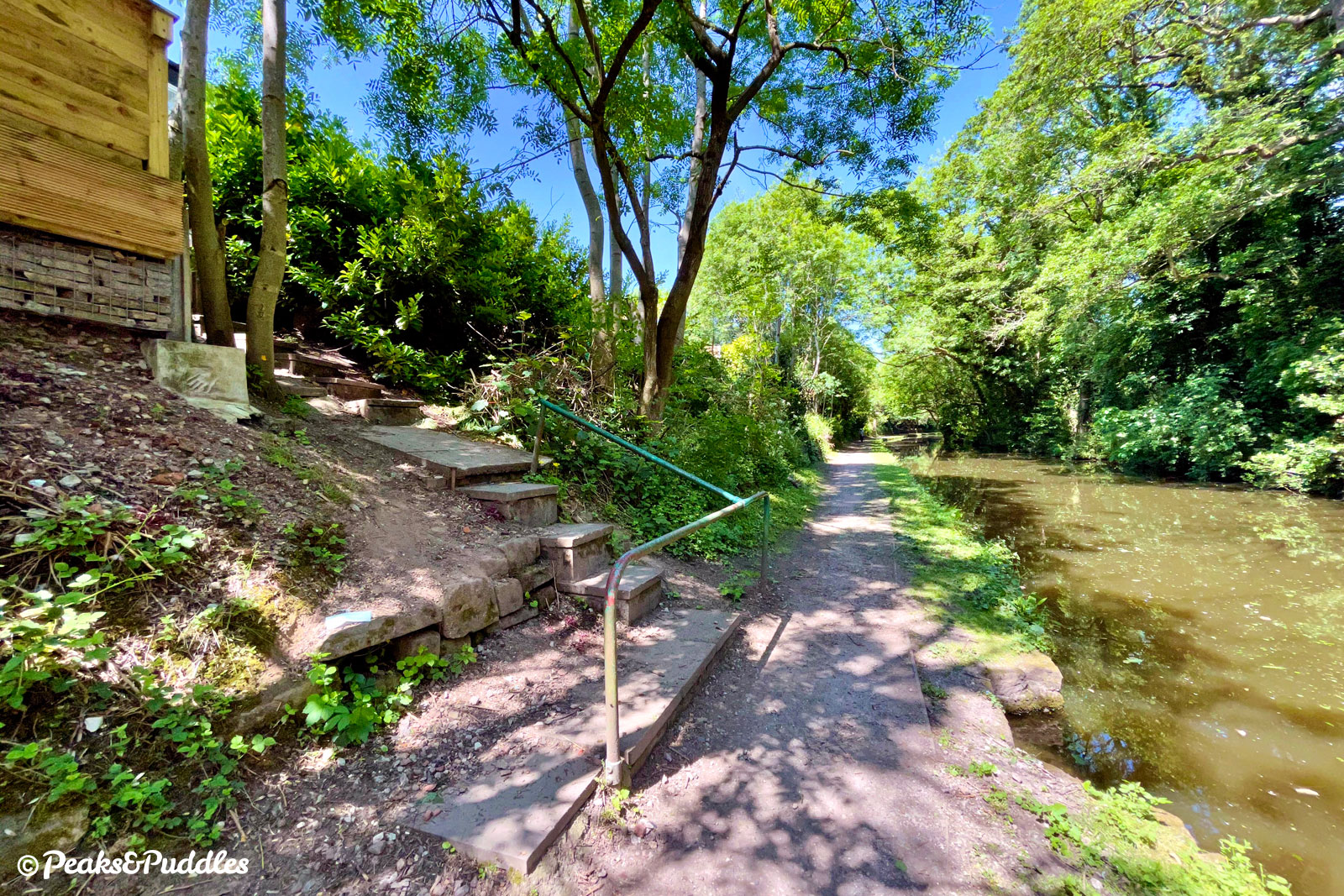
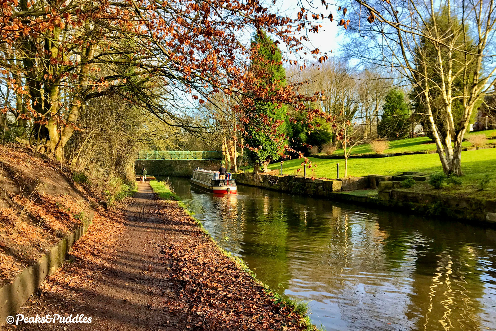
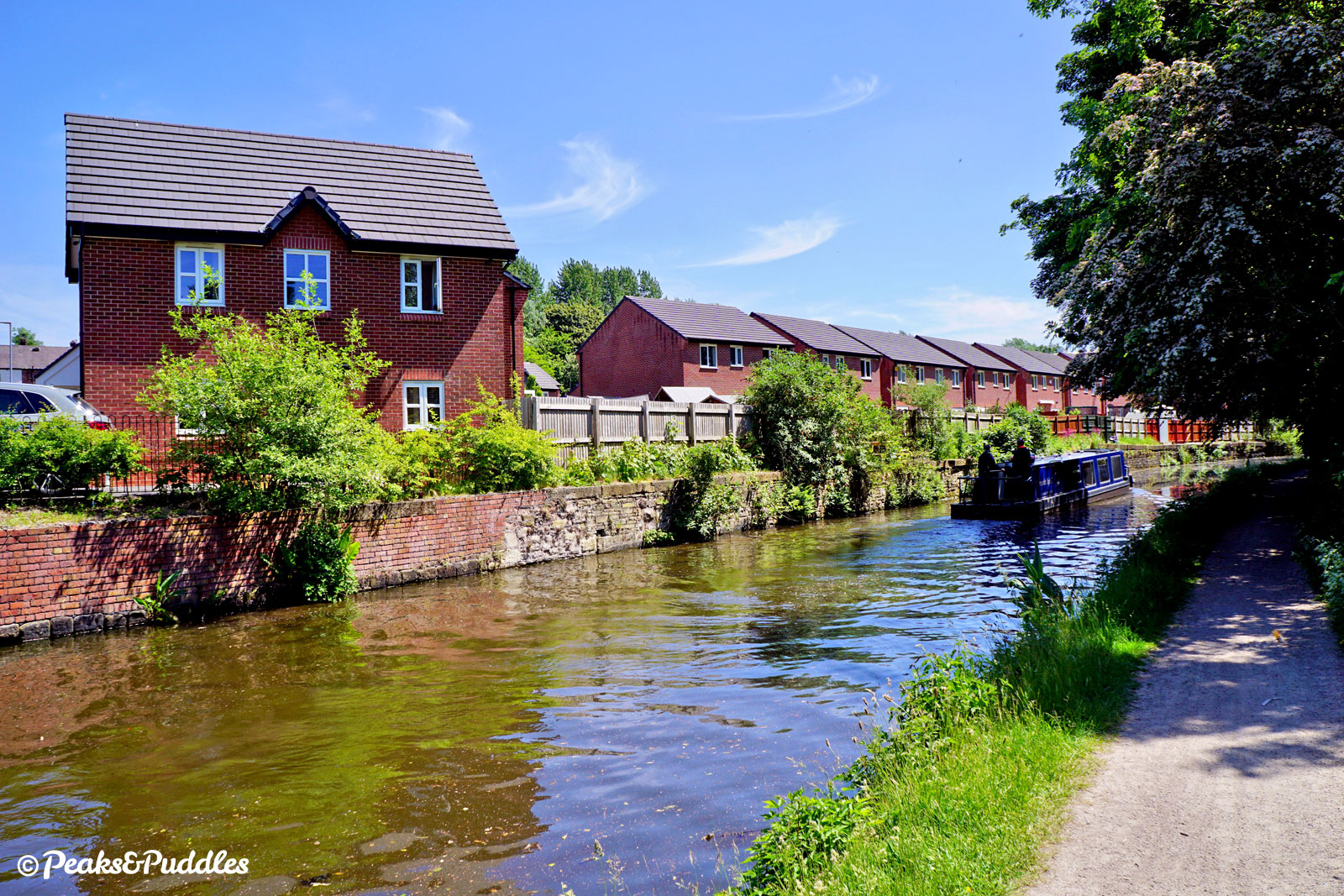
- Along Marple Locks the towpath surface is ideal, but it then has some really poor, puddly and sometimes muddy sections through Romiley. Volunteer work has improved things near Woodley, and from the outskirts of Hyde onwards it’s been improved to a very good standard (for a towpath) by Cycle City Ambition funding. Just watch for the bumps under the low railway bridge 1B in particular. Road bikes will do fine on this northerly section and along most of Marple Locks, but the areas around Romiley prevent it from being deemed suitable in its entirety.
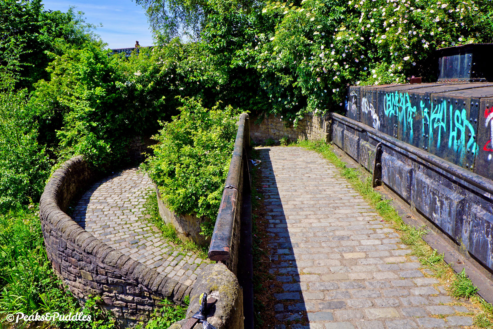
- There are approximately 15 low or tightly arched bridges over this canal of many varying designs, narrowing the towpath close to the water’s edge. The cobbled Possett Bridge tunnel at Marple is also tricky if you try to ride it (ensure it is completely clear first). It’s a good idea and good courtesy to slow right down and ring your bell on the approach to each, as the towpath is often hidden on the other side. Take care where there are uneven cobblestones underneath or if you’re unsure at first, dismount.
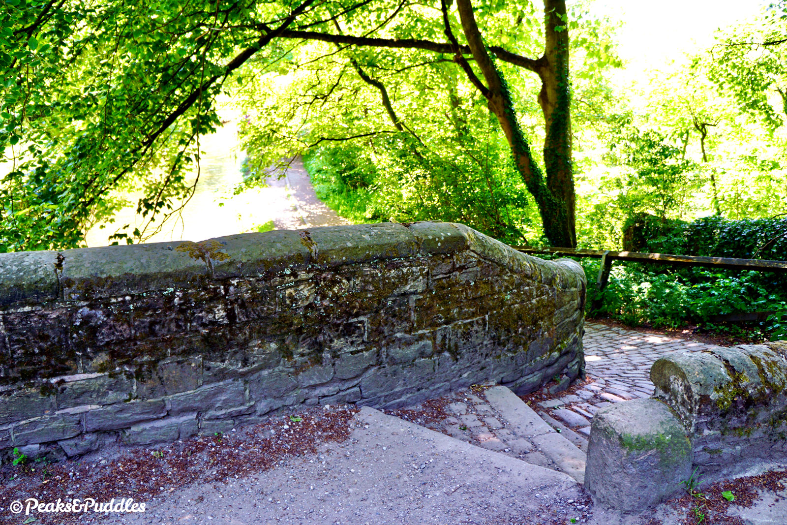
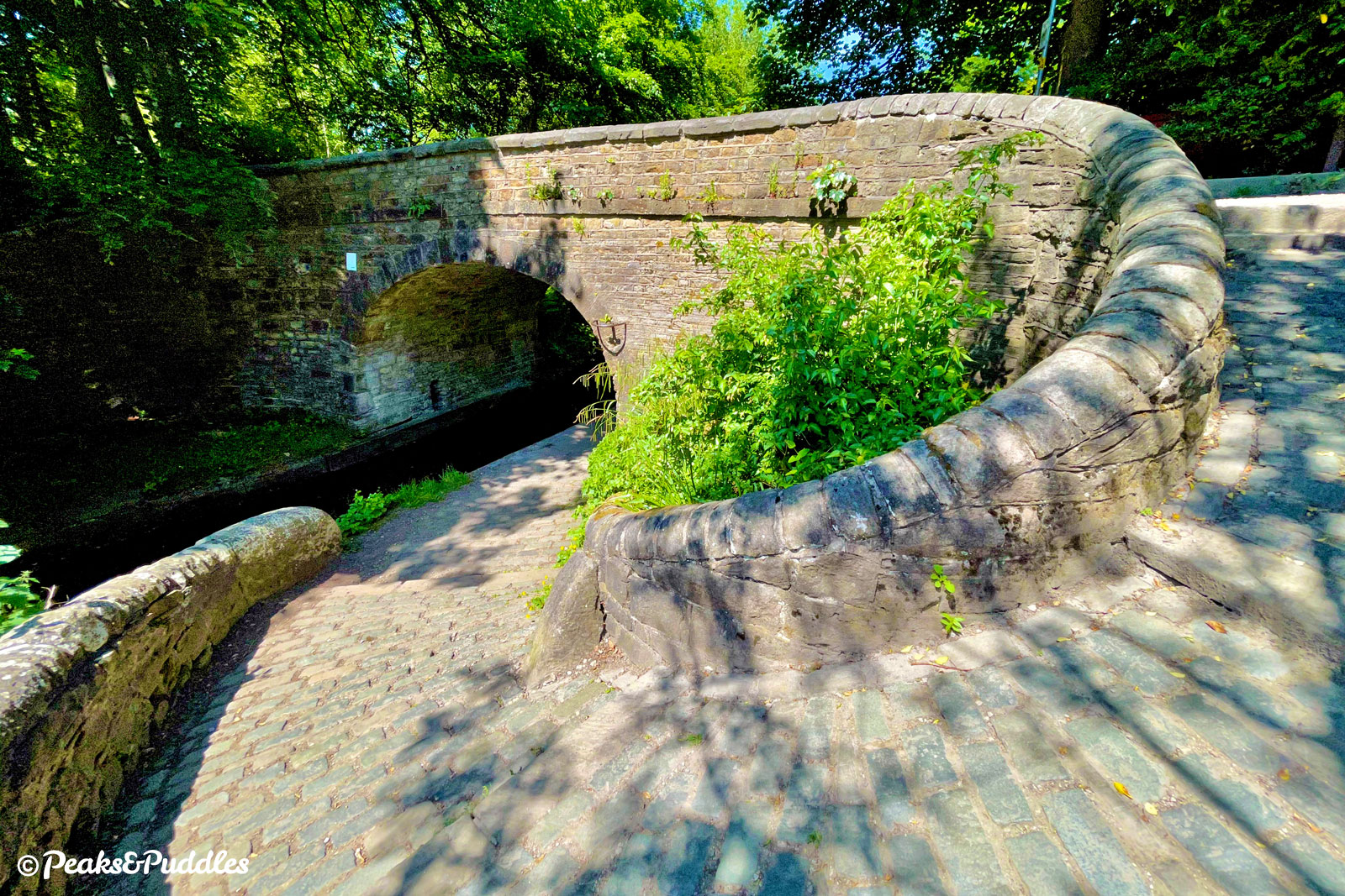
- Two more bridges offer a further challenge: Bridges 6 and 7 at Hyde see the towpath switch sides with “roving” curved cobbled ramps. Don’t even attempt to ride them — dismount and then watch your footing, they can be very slippery.
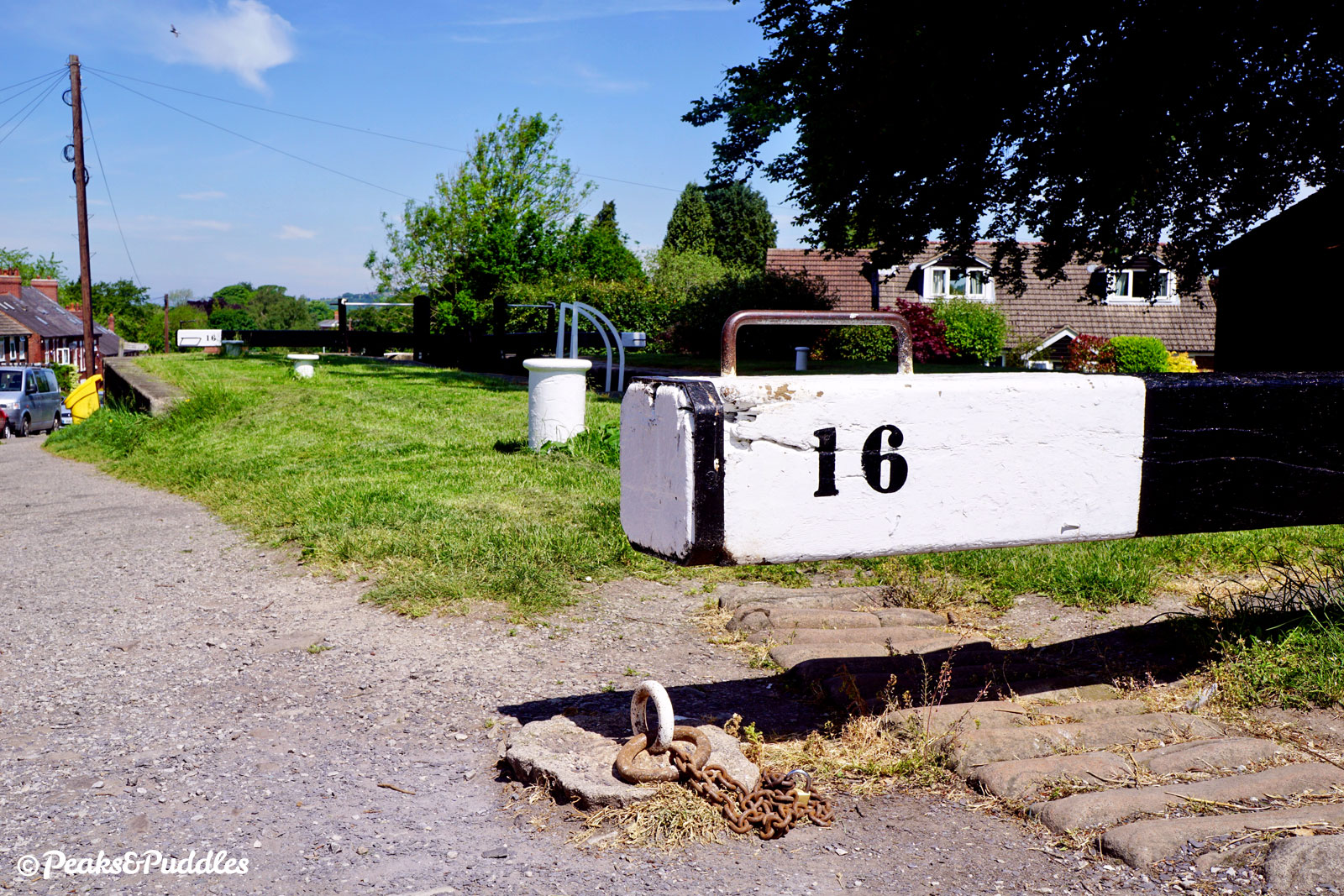
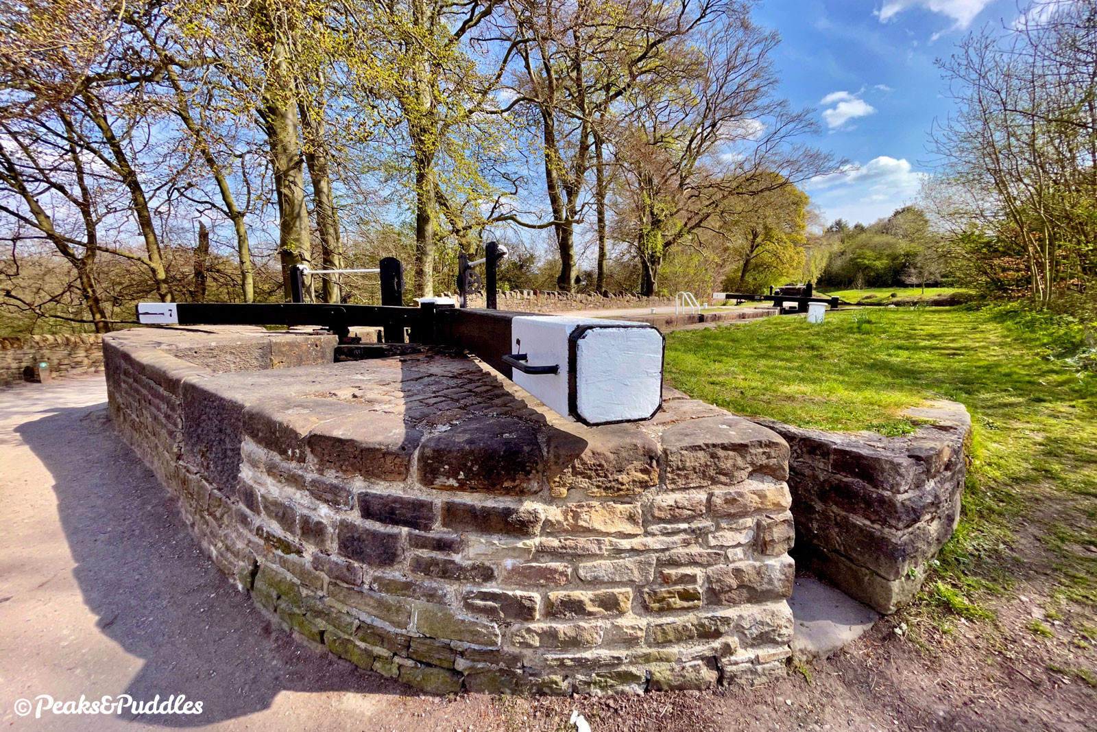
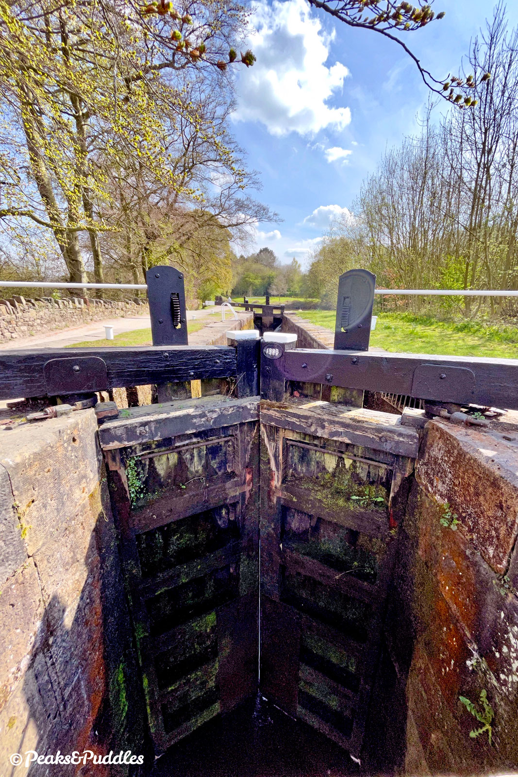
- Unlike most stretches of canal cycling, this one has a hill! However, the climb up Marple Locks is only roughly 64 metres (209 ft) by official canal estimates and drawn out over about 1.6 km (1 mile). Climbing the Locks 1-8, it can be easier to use the adjacent lane, which has a consistent gradient, though watch for vehicles. Likewise along Locks 13-16, it can easier to use the road alongside rather than the very narrow path.
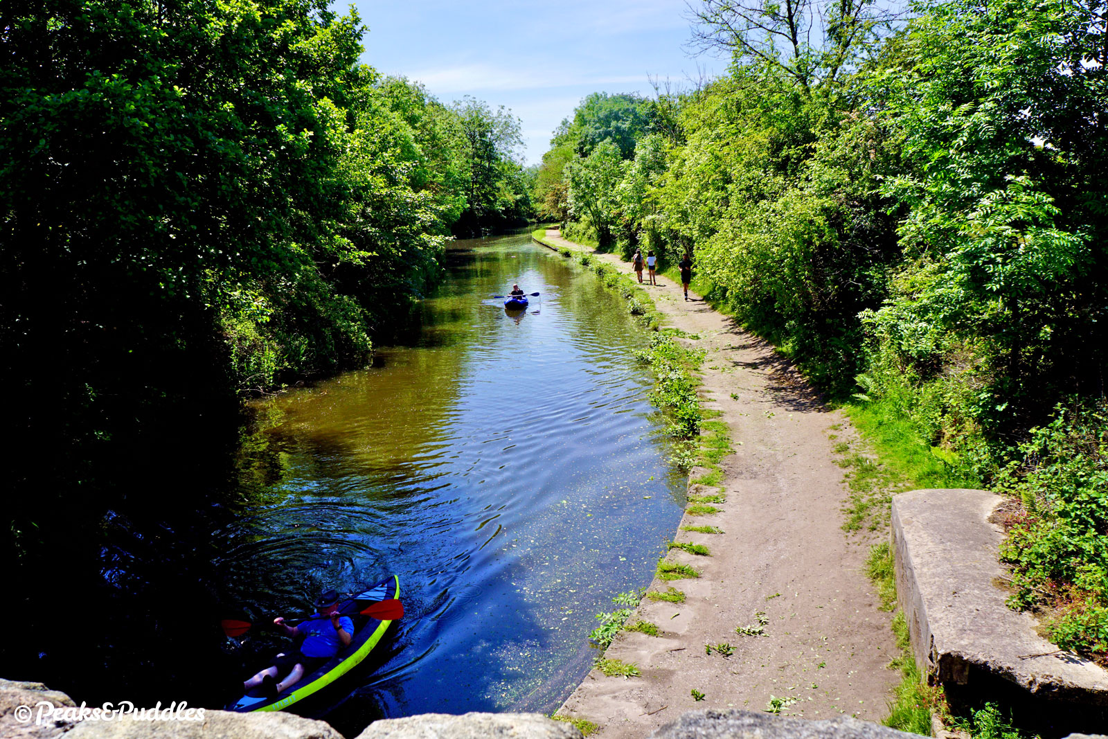
- See Tips for Cycling on Shared Paths for general advice about cycling on towpaths. When passing others: slow right down, ask to pass well in advance by bell or a friendly voice, wait until a signal that you’re welcome to pass. Pedestrians ultimately have priority. If it feels too narrow to pass, stop and/or wait. Canal towpaths often aren’t designated rights of way for cycling (or even walking) but the Canal & River Trust thankfully allow access with little restriction, so always be a gracious and courteous guest.
Found this guide helpful?
Please consider chipping in the price of a coffee to help pay the bills and support my work. Or become a Peaks & Puddles Plus supporter to get access to exclusive routes and pages in return.
Route description
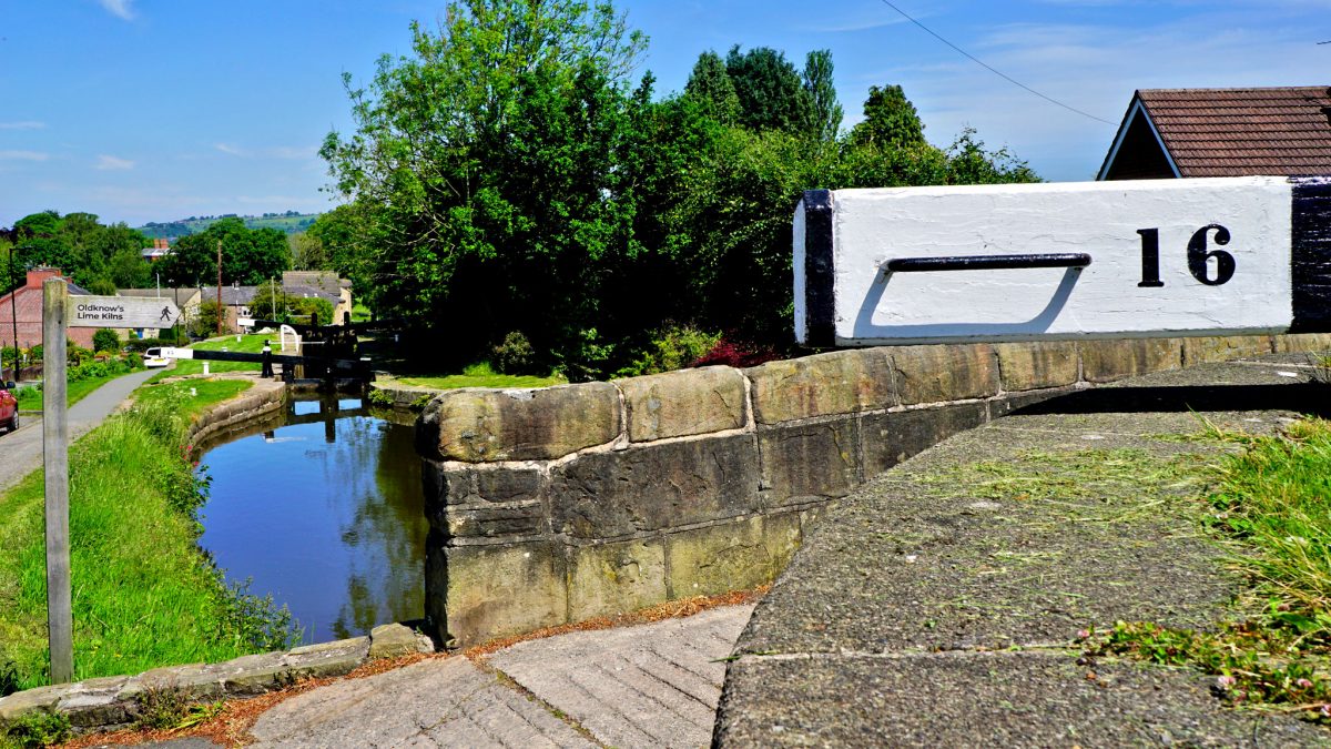
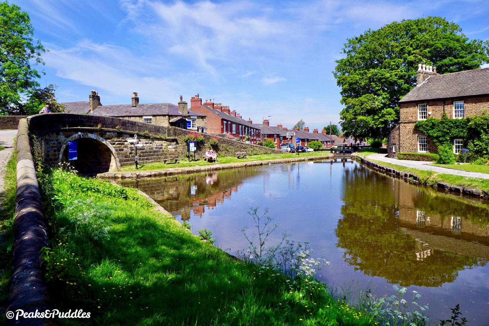
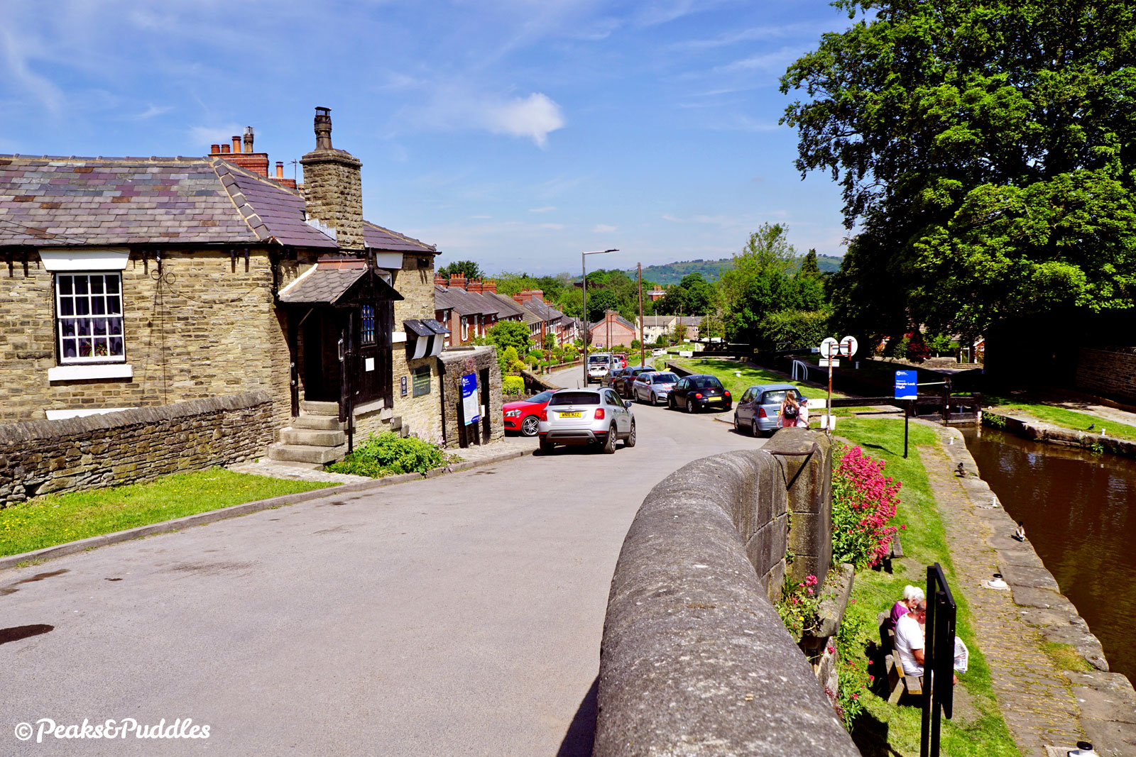
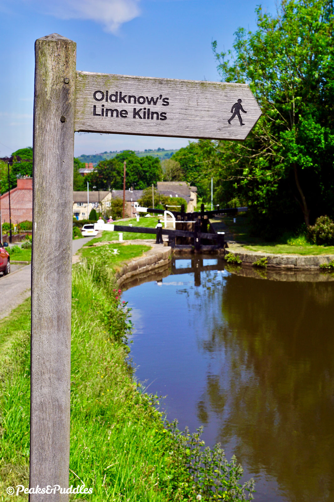
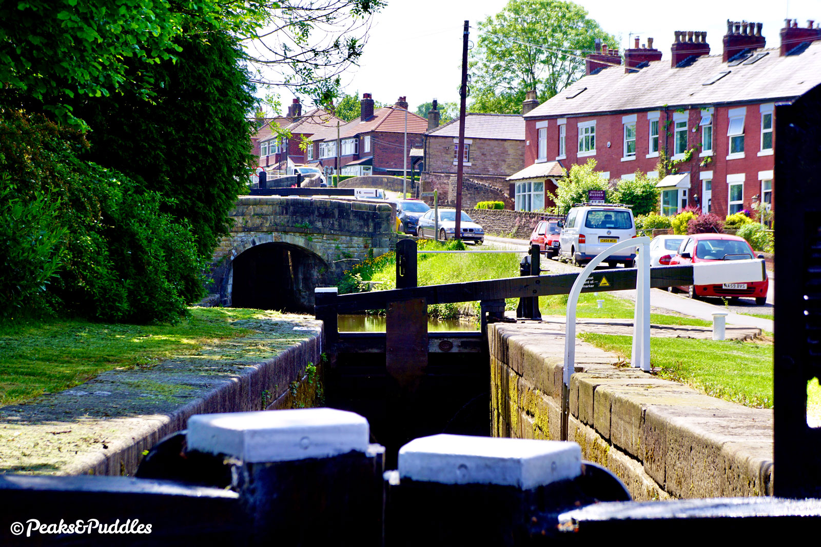
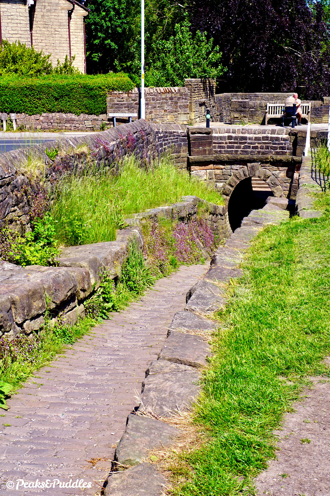
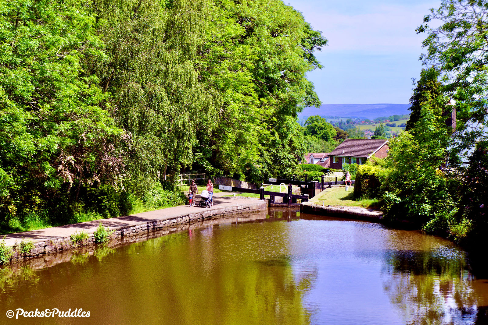
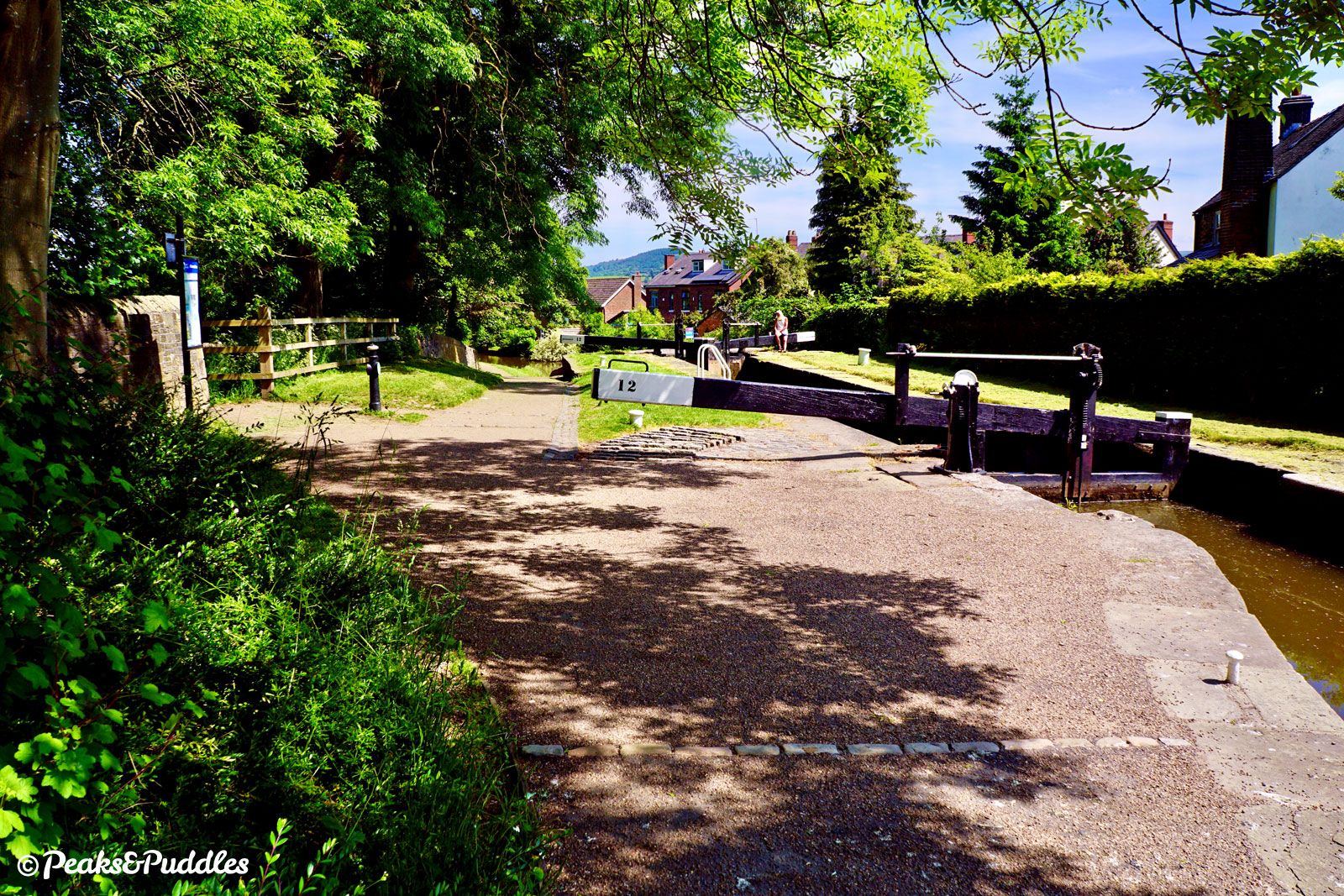
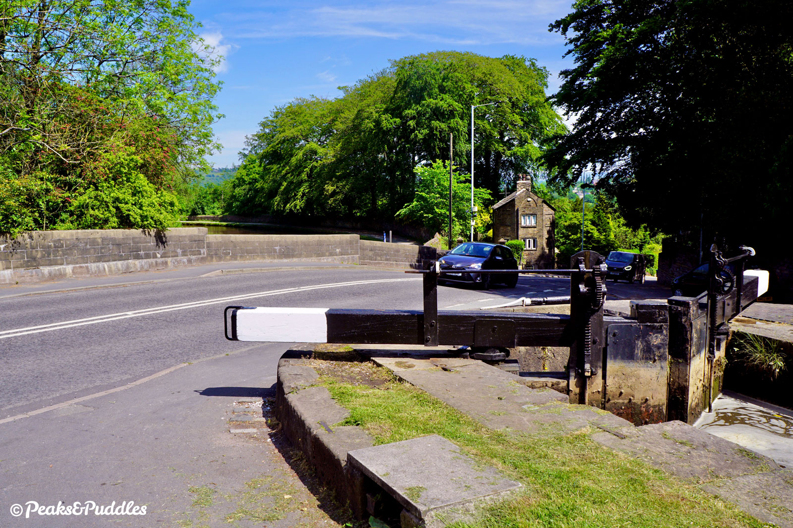
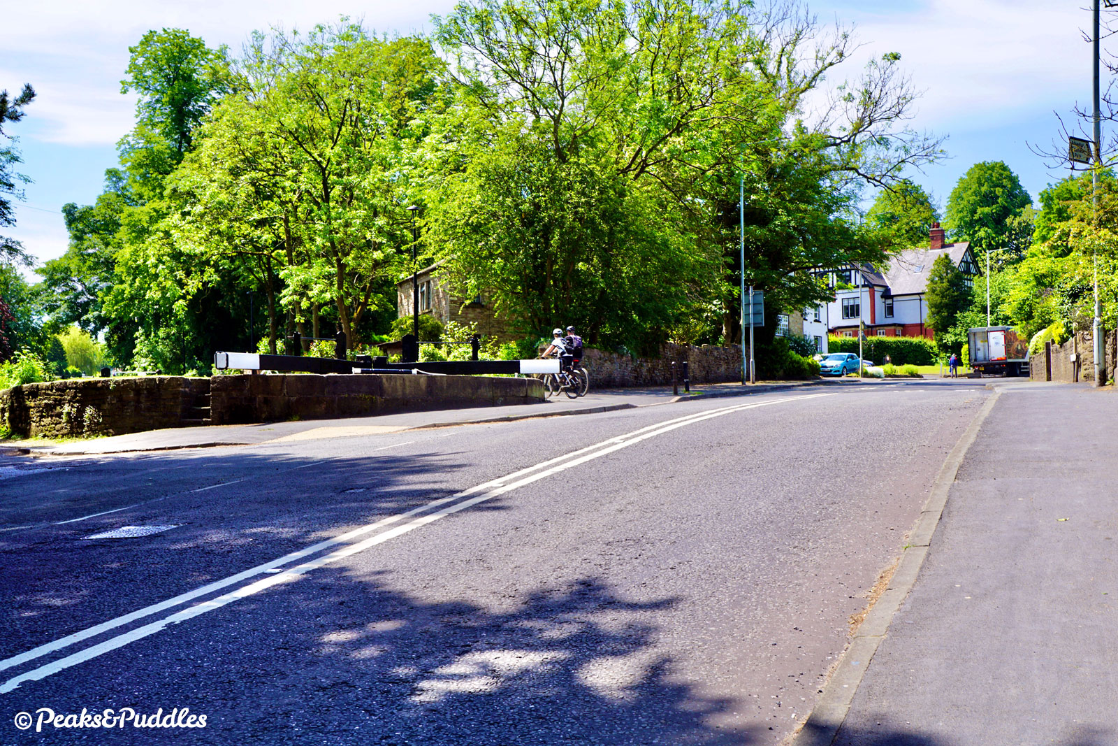
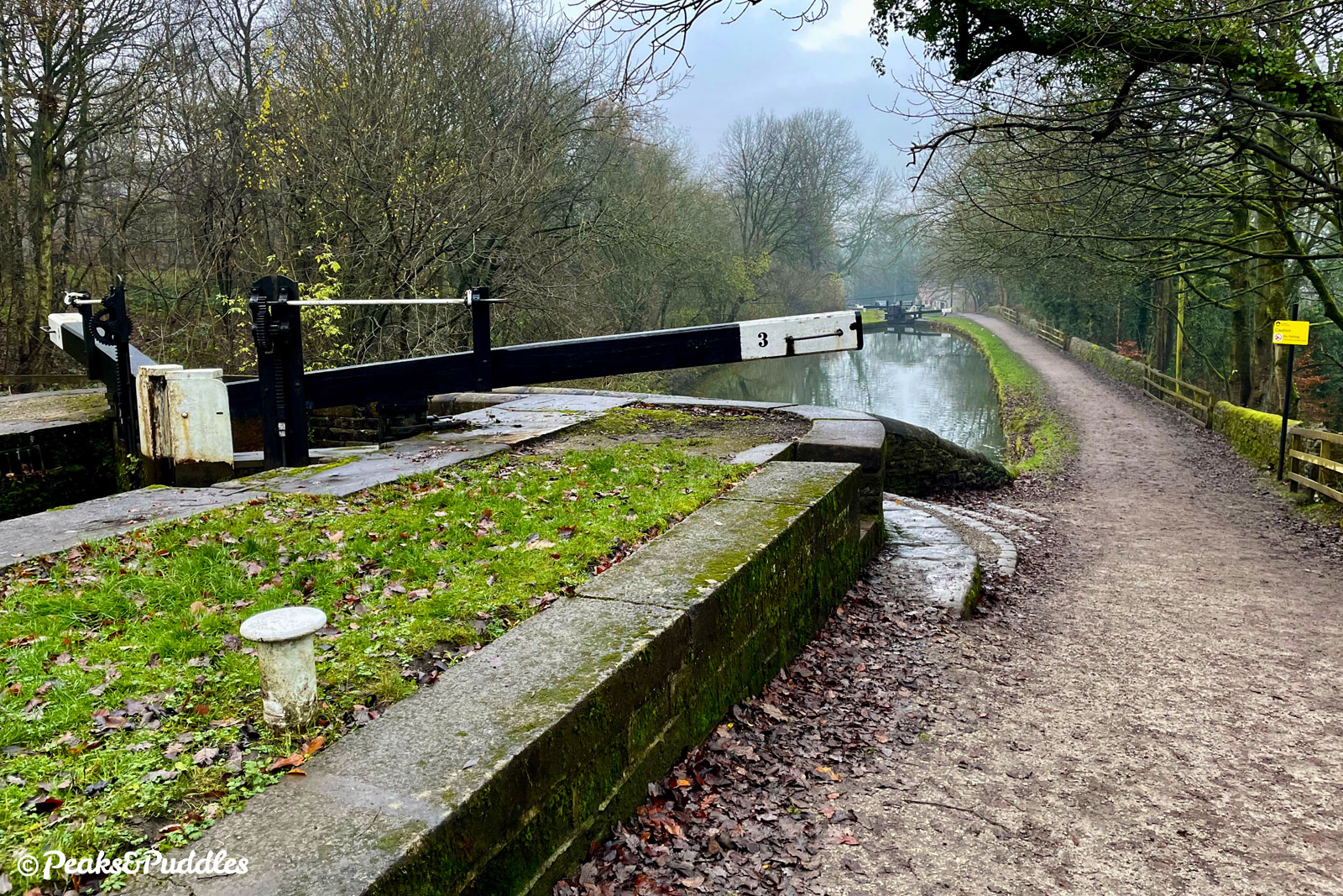
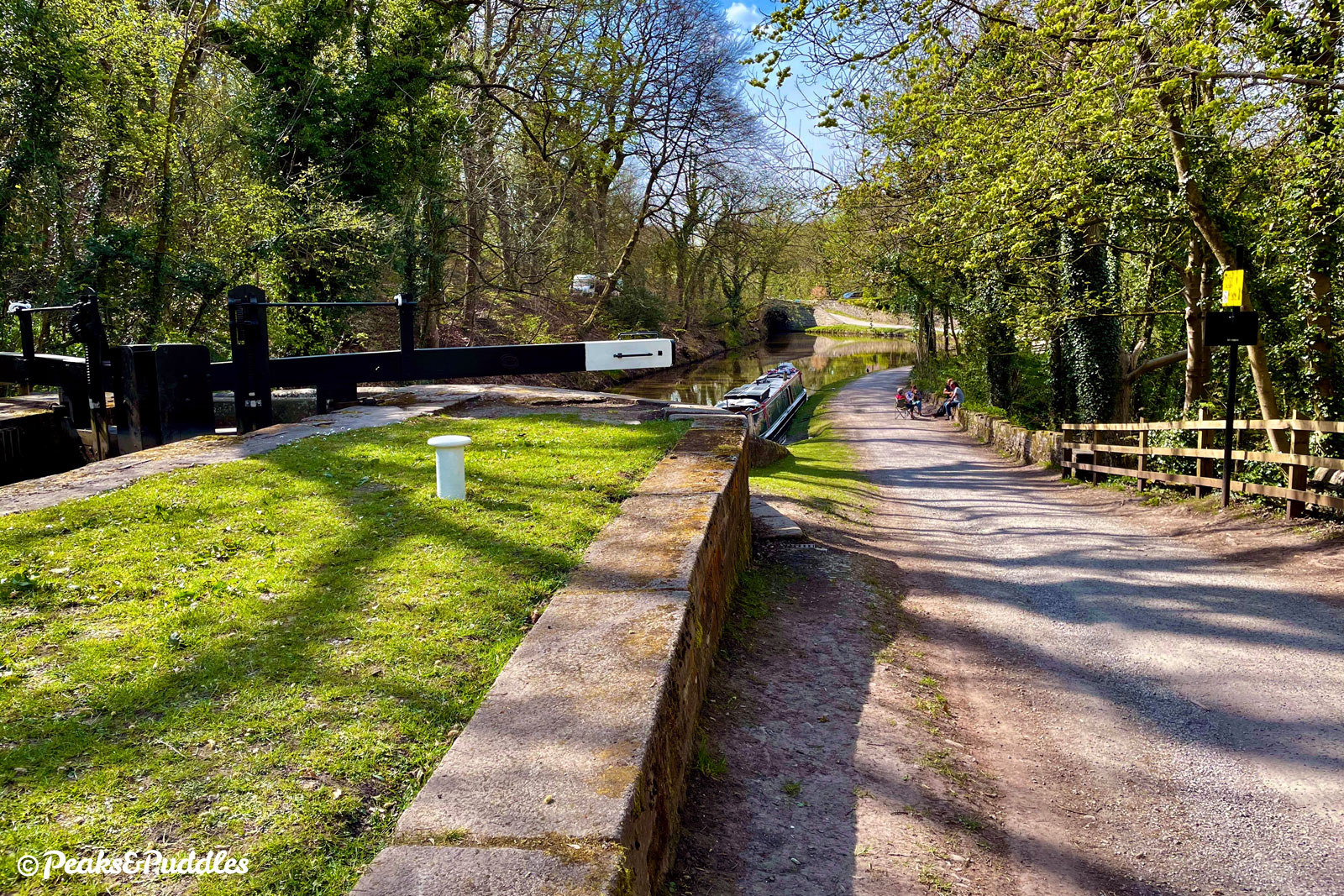
- From atop the bridge at Marple Junction, the sixteen locks of the Marple Lock Flight drop away downhill. Since the path which runs alongside is narrow and busy, it’s often easier to start out on the quiet Lockside road itself, following it down between redbrick terraces and the first four locks. Immediately between Locks 16 and 15, Lime Kiln Lane leads over the canal to Oldknow’s Lime Kilns, where limestone from the quarries of the High Peak was burnt into quicklime for local use.
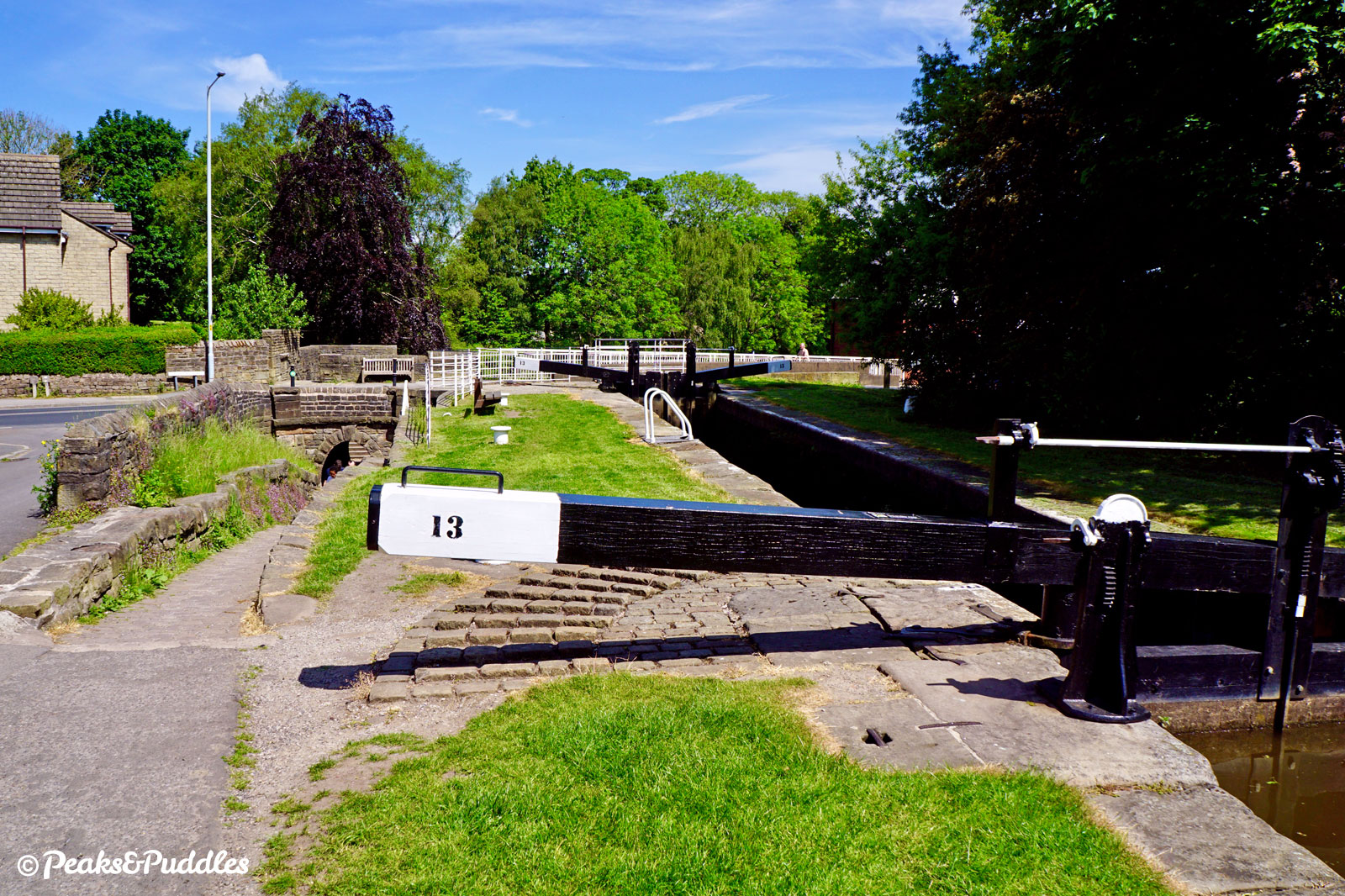
- Just before the busy Stockport Road ahead, rejoin the canal path and prepare for a bumpy drop through the unique horse tunnel at Posset Bridge beside Lock 13. This reputedly gained its name from the milky ale posset drink supplied to exhausted workers. The next three locks pass alongside Marple Memorial Park, gifted by two local families to commemorate the lives lost to the First World War, and are often busy with “gongoozlers” watching boats pass through. Above Lock 9 is Oldknow’s Warehouse, built in 1801 to tranship goods from boats undercover and now converted into offices. As the canal now drops underneath Brabyns Brow, those on the towpath must wait (often for quite a while) to cross this busy road. On the other side, veer right and rejoin the towpath.
- Leaving the bustling town behind, the second half of the locks are an entirely different experience. Surrounded by huge mature trees and now visibly cut into the hillside above Brabyns Park and the River Goyt’s valley again, they lower the canal through what almost begins to seem like a never-ending descent. Just below Lock 5, look to the right for a glimpse of the railway line entering Marple North Tunnel right below the canal — miraculously built by the Marple, New Mills and Hayfield Junction Railway after the canal.
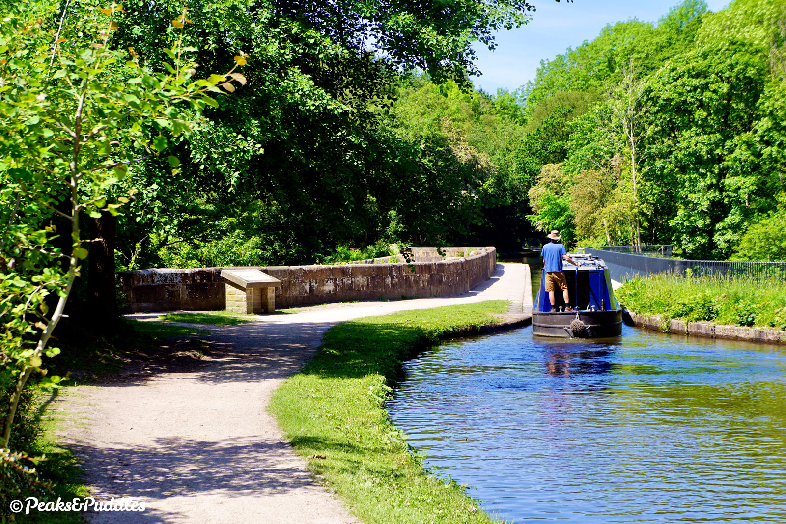
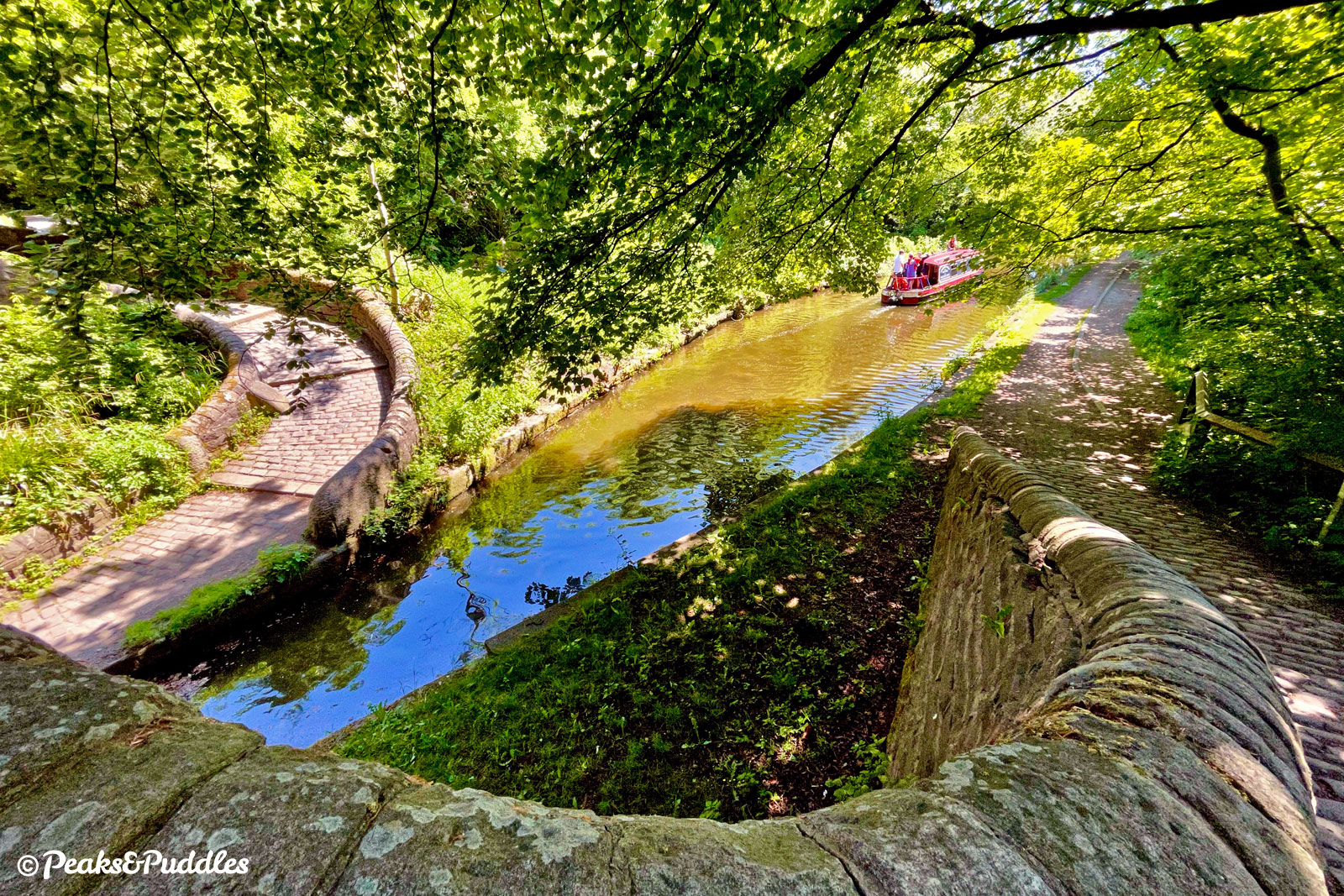
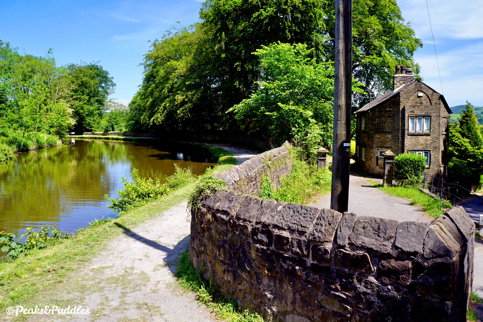
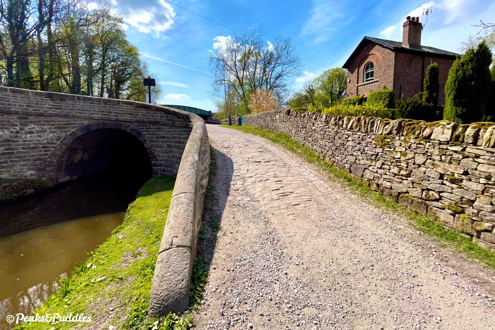
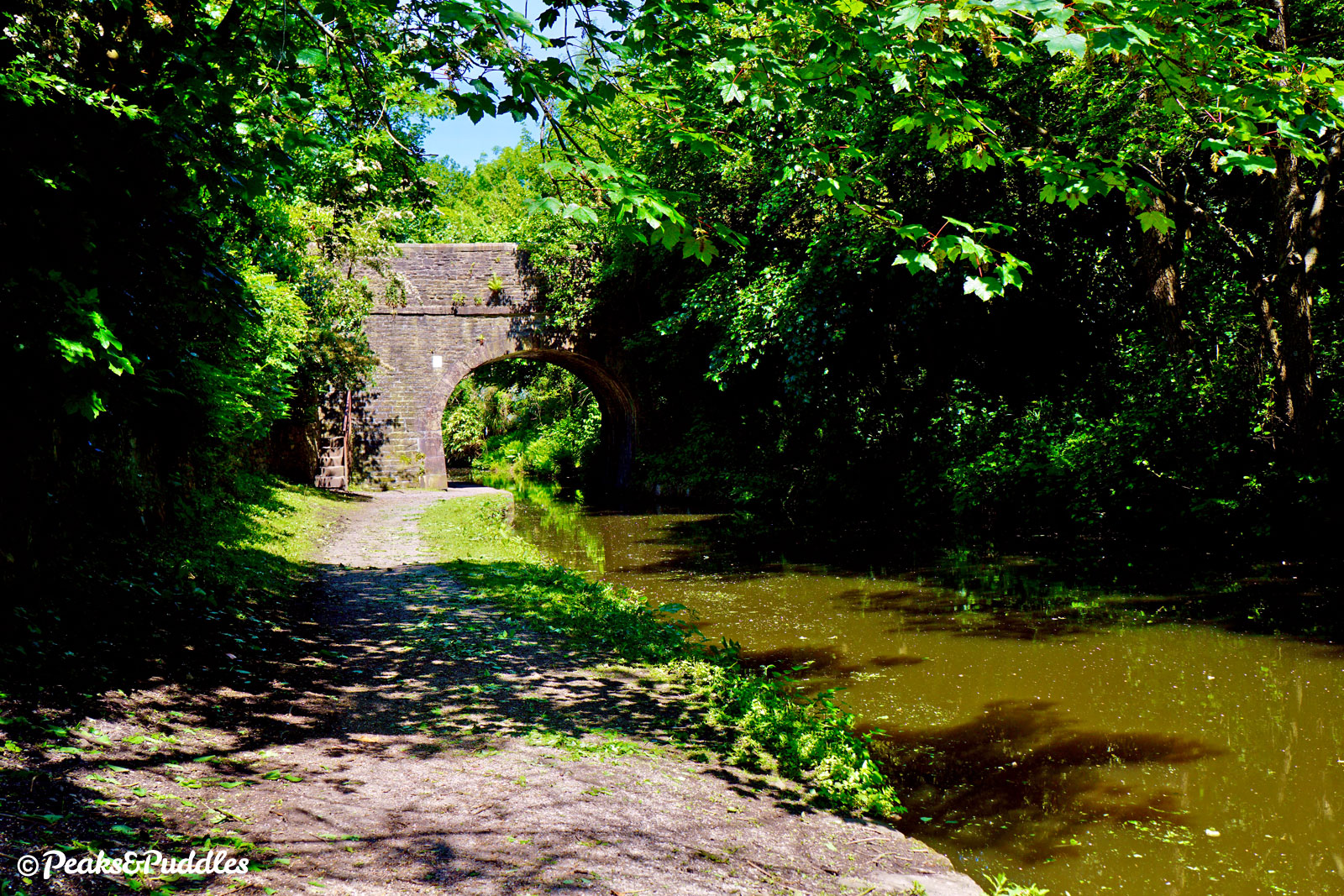
- After passing Lock 1, the towpath switches sides at Bridge 16 with cobbled ramps either side. Ahead, a great magic trick of the waterways is revealed: the railway is now far above the canal as it dashes out across the valley on a wrought iron bridge adjoining the main 12 stone arches of Marple Viaduct completed in 1863. If this seems a remarkable feat, the real wonder is ahead: a whole six decades earlier in 1800, Marple Aqueduct spanned the same valley with a watertight bridge that still stands over 200 years later. Built with sandstone at its lower level, the main bulk of the structure is limestone from quarries near Chapel Milton, at the upper end of the canal. Original plans had looked at using a lighter weight iron trough similar to Thomas Telford’s Pontcysyllte Aqueduct on the Llangollen Canal. Instead, Benjamin Outram bought weight savings and additional strength through the circular hollows above each of the three arches, giving the structure a wonderfully ornate look. While Wales’ Pontcycsyllte is three times longer and the tallest canal aqueduct in the world, Marple’s at just 8 metres lower still retains the title for England.
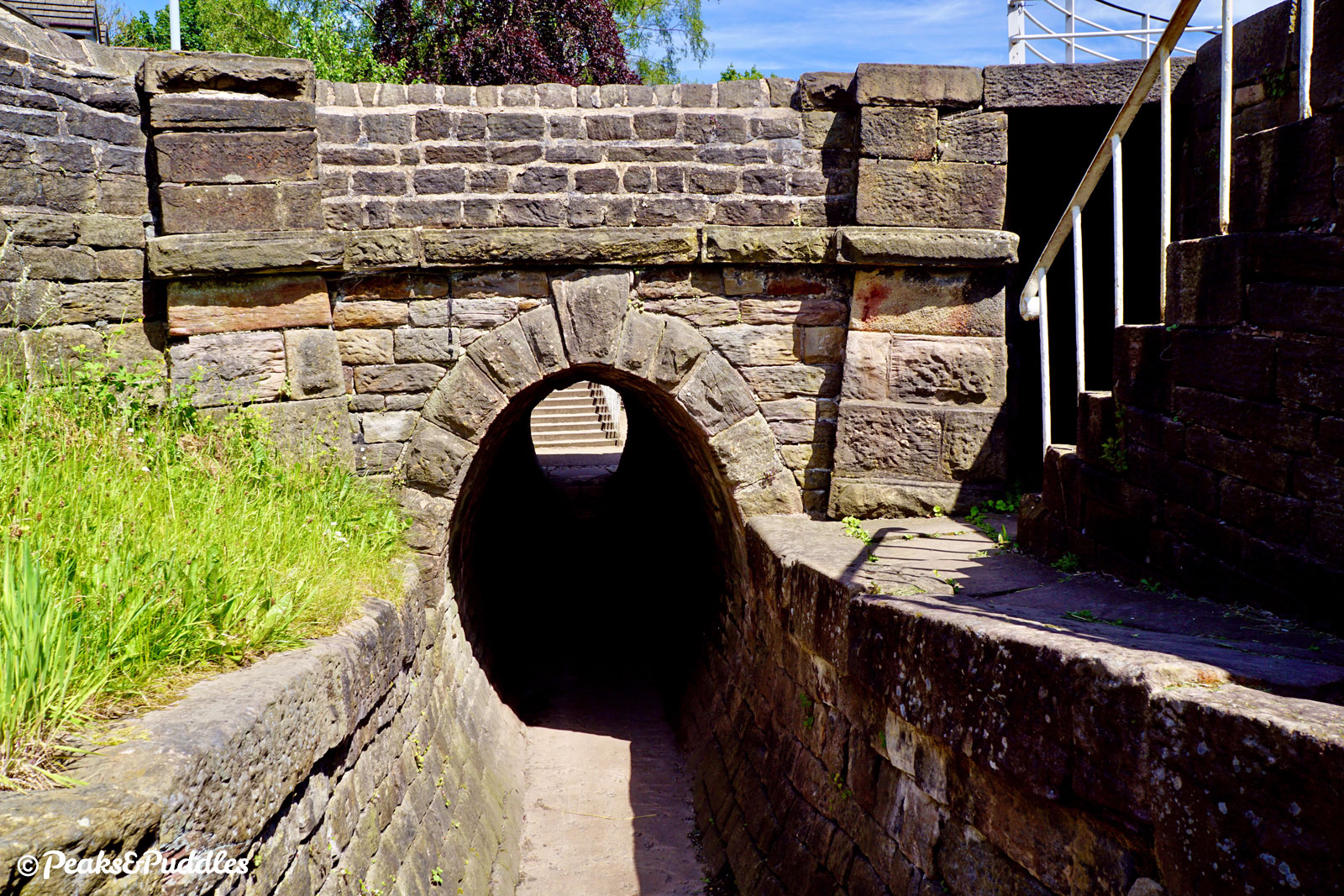
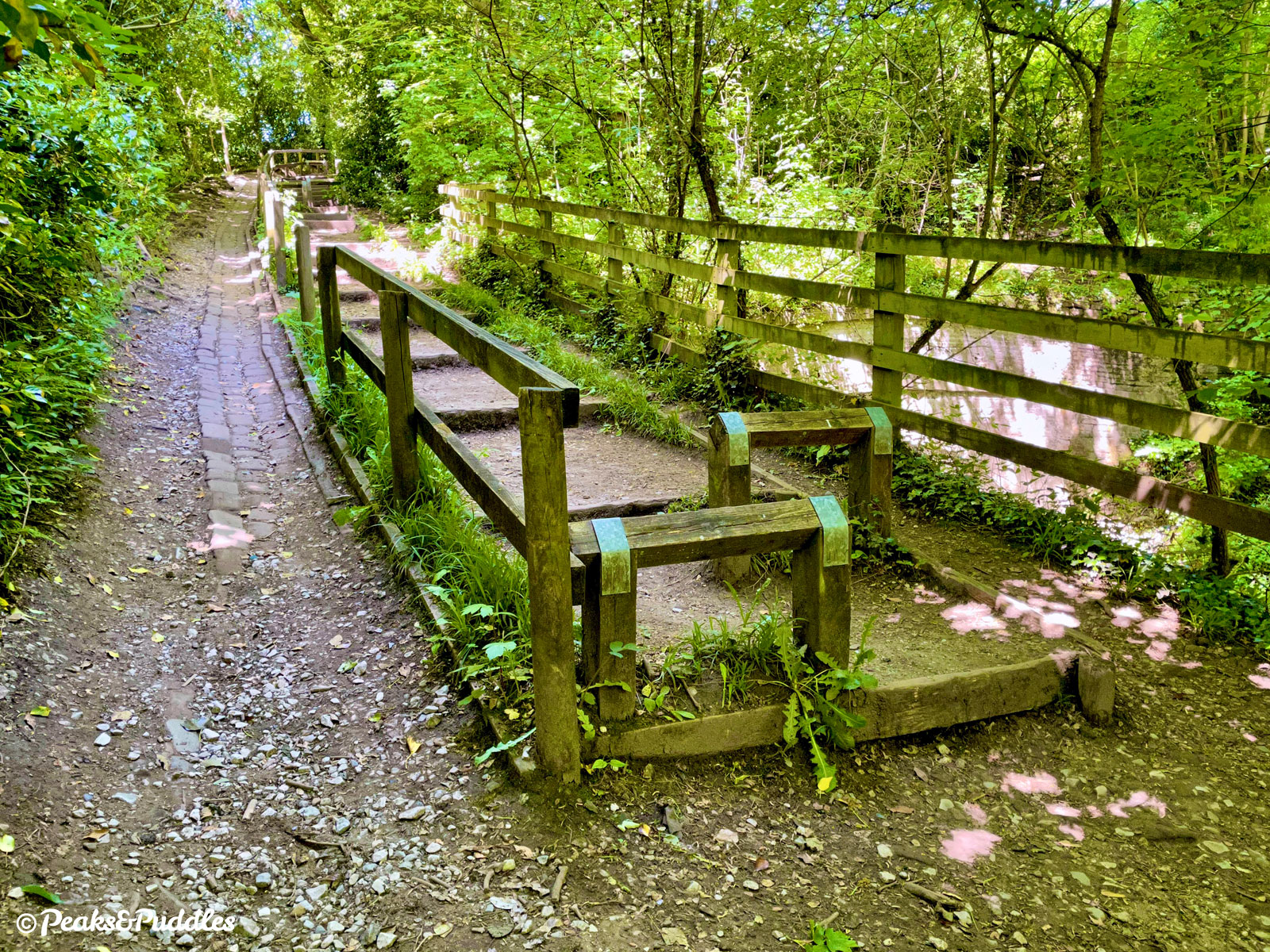
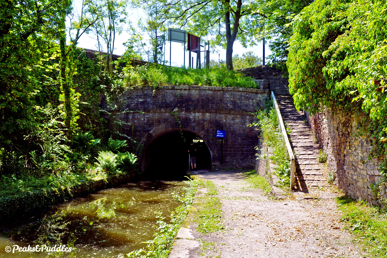
- Leaving the Goyt behind, the canal cuts immediately into Rose Hill Tunnel — or what’s left of it. Now just a cutting, a roof collapse early in its life saw it opened up as a narrow one-way passage for boats, with a towpath that’s often damp and puddly, bookended by Bridge 15. After a brief open view across grassy banks to the railway line again, the canal enters a beautiful, deeply wooded section. While the Goyt has snuck back close again, deep below, as the path approaches Hyde Bank Tunnel the only way to go is over: the choice being a long set of wooden steps with doubly awkward wooden barriers, or a steep cobbled channel to one side that’s tricky underfoot. Boats would’ve been “legged” through this tunnel by men lying on their backs on the roof, with horses led over the top. While the access for today’s walkers and cyclists isn’t quite so painstaking, it really could do with a major rethink.
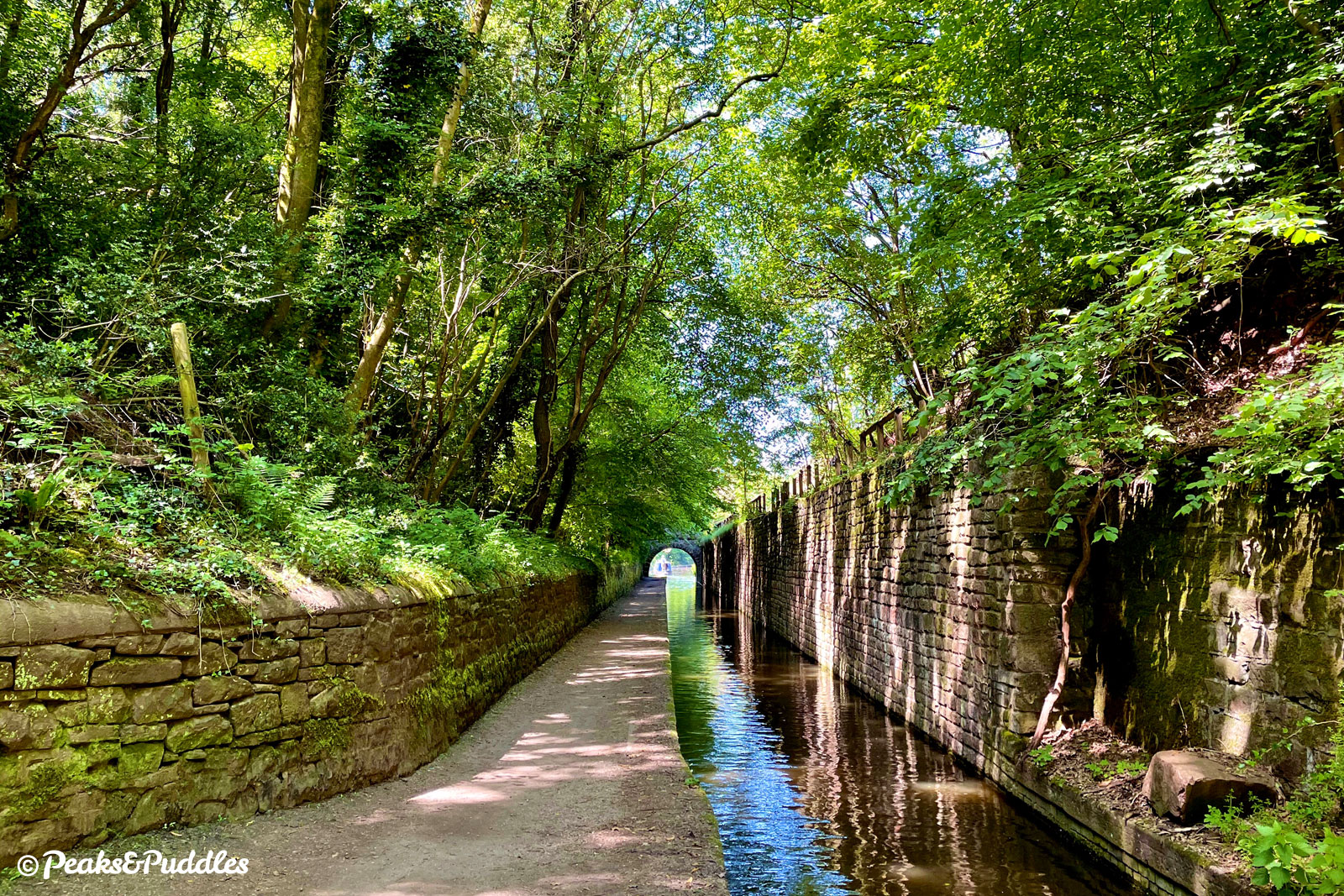
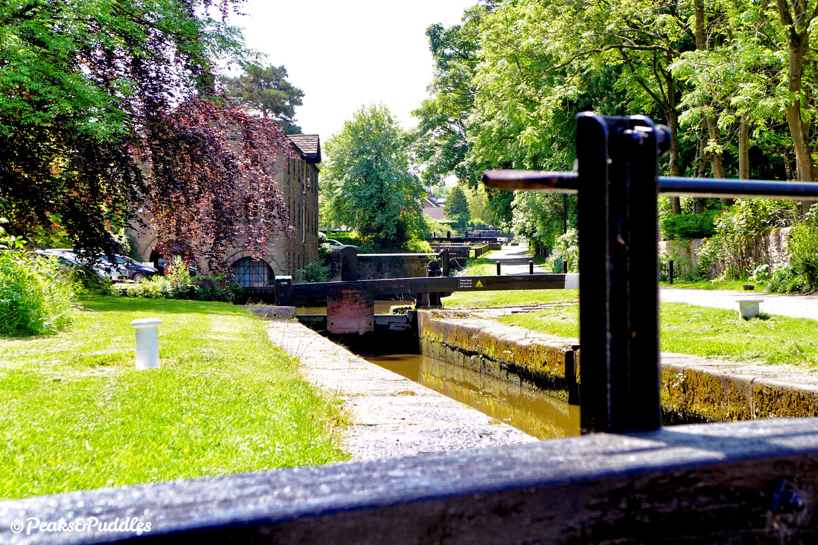
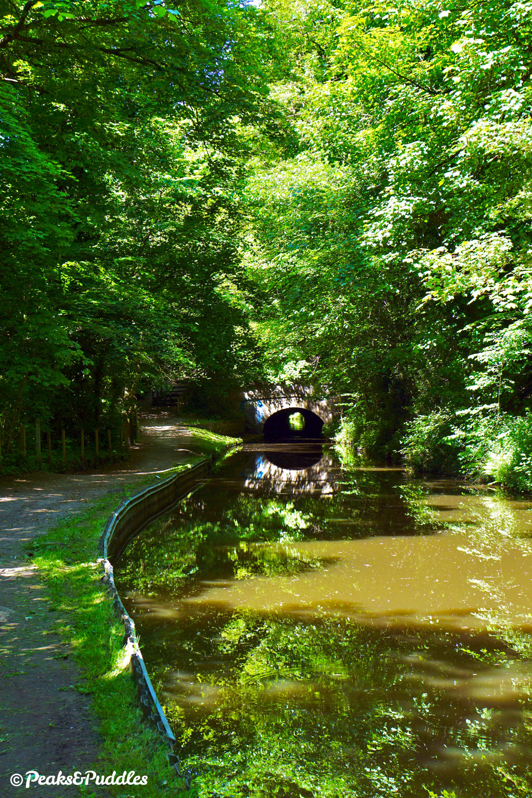
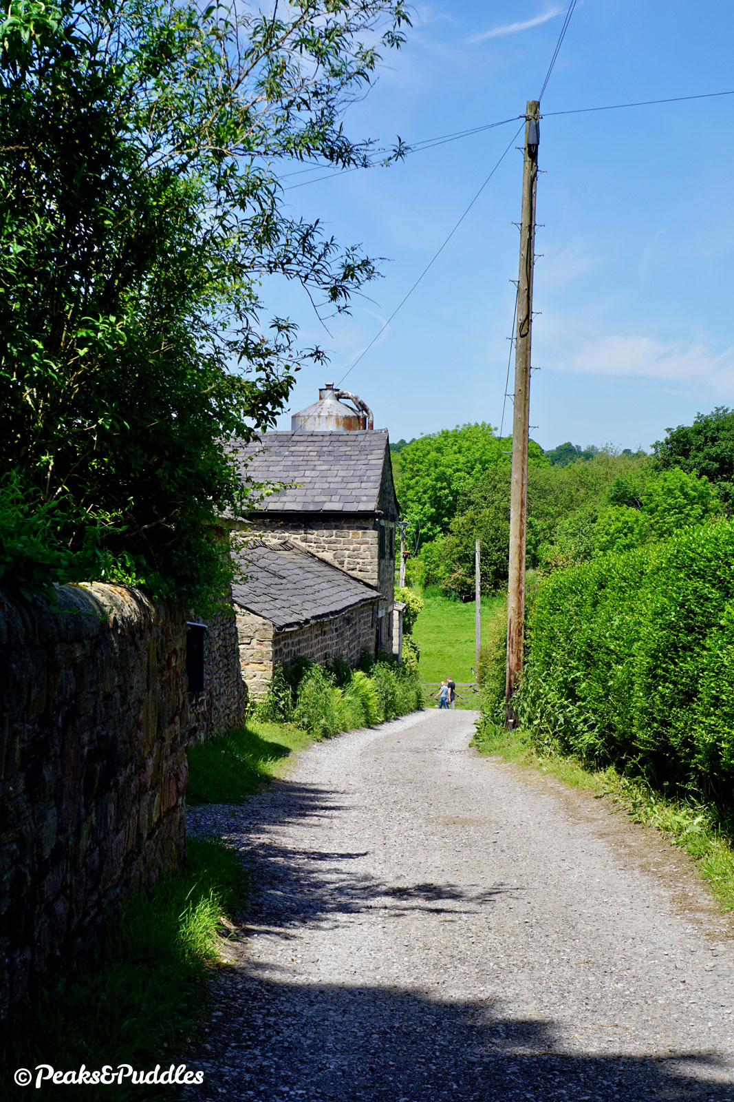
- At the top of the steps, the route now joins a narrow stone track between houses on the edge of Romiley. Take care as it drops down over coarse gravel and turn left at the bottom. Soon ahead, veer left again down a wide (but not very well-signposted) pathway beneath an ornate bridge, watching for the harsh drainage channels. The bridge led to the opulent Oakwood Hall, built around 1844 by Ormerod Heyworth, who also owned Oakwood Mill which sits ahead beside the northern portal of the tunnel (now a board mill with a thoroughly unpleasant “wet cardboard” smell). The towpath here amongst the thick tree cover of Kirk Wood is consistently poor. Even emerging onto the edge of the bank below Burymewick, it is narrow with undulating bumps. Chadkirk Aqueduct carries it over a lane which leads down to the ancient chapel (there are only narrow, steep steps off the towpath here). In a sudden sharp turn, the canal veers to the north over the tiny Hatherlow Aqueduct. With the centre of Romiley passed by at some distance, a supermarket and busy road bridge are all that marks the town on the waterway today.
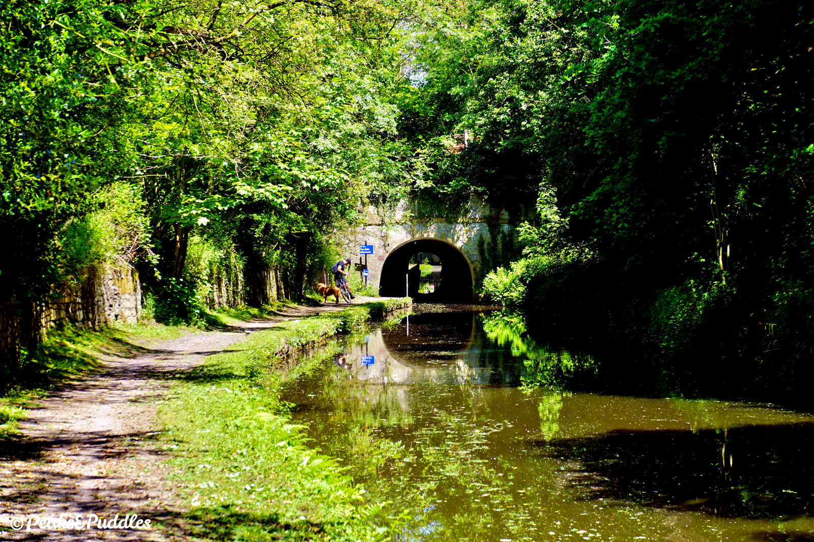
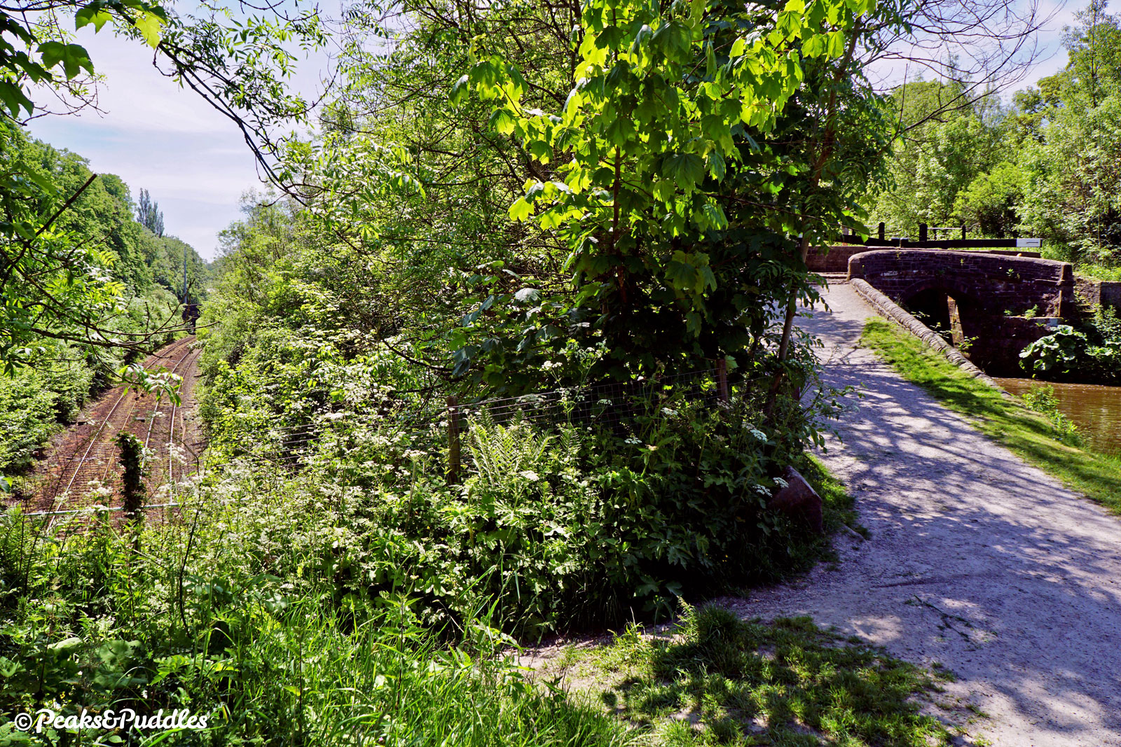
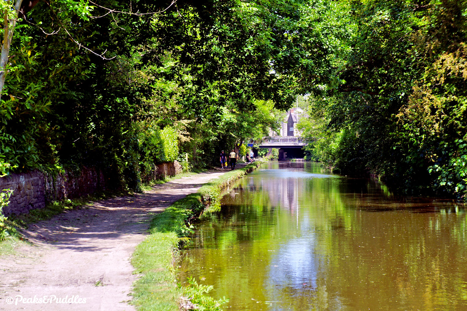
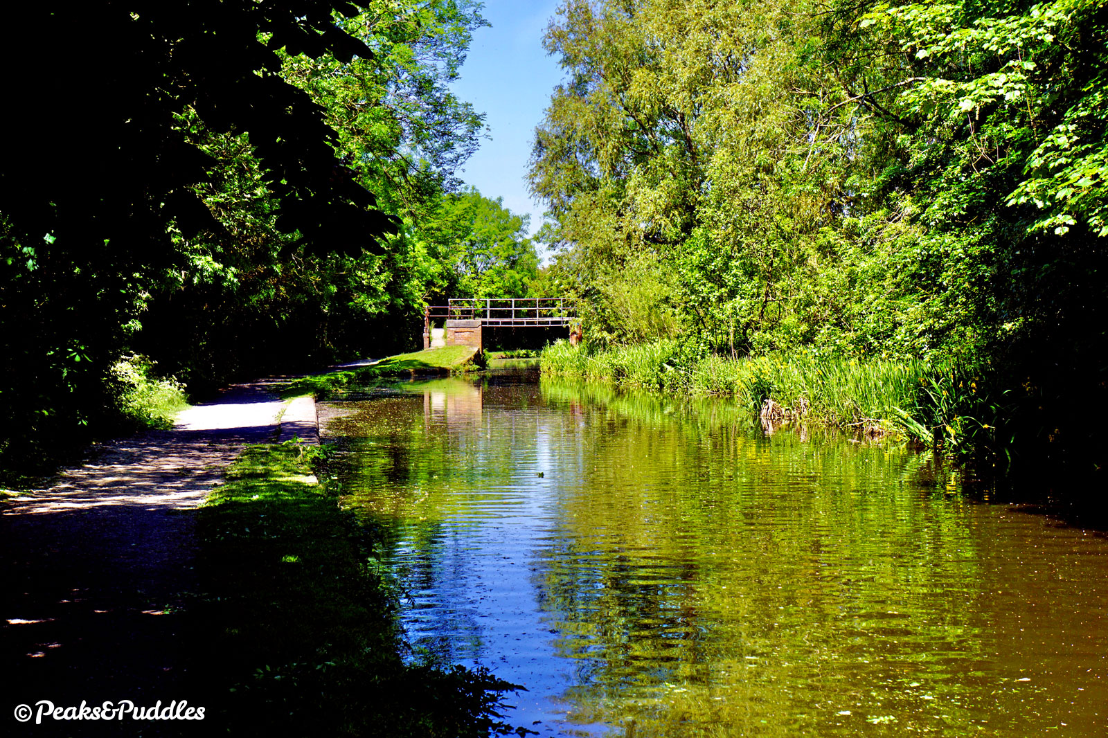
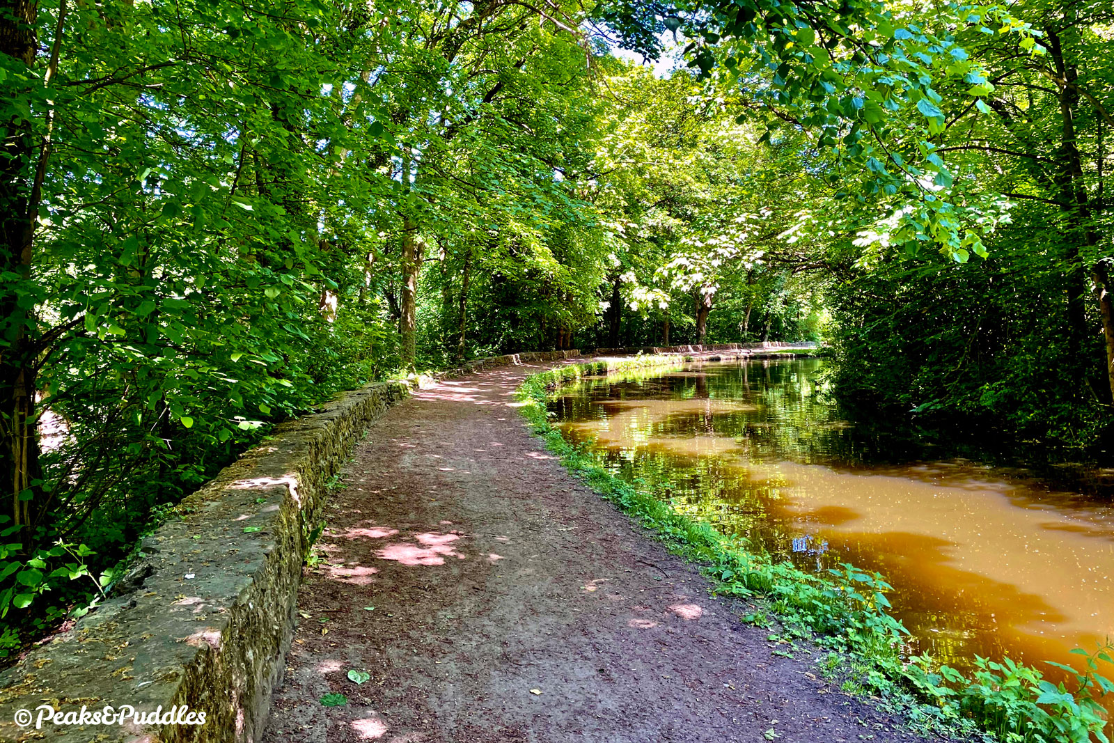
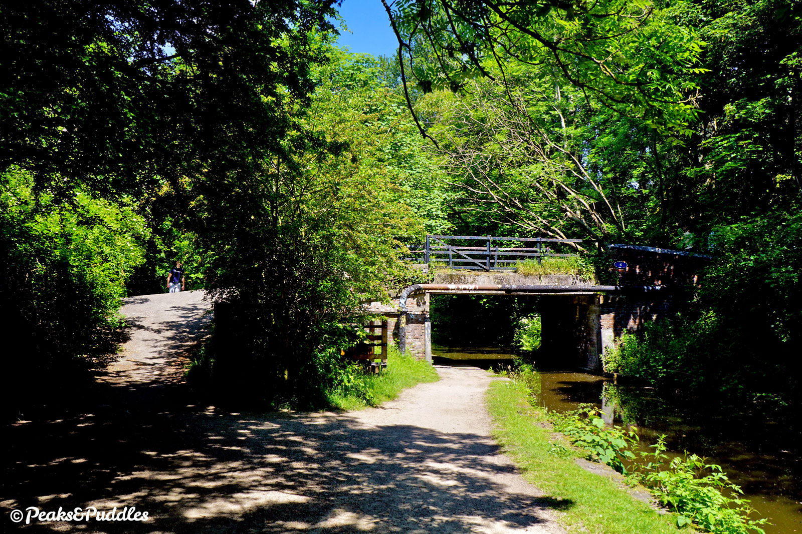
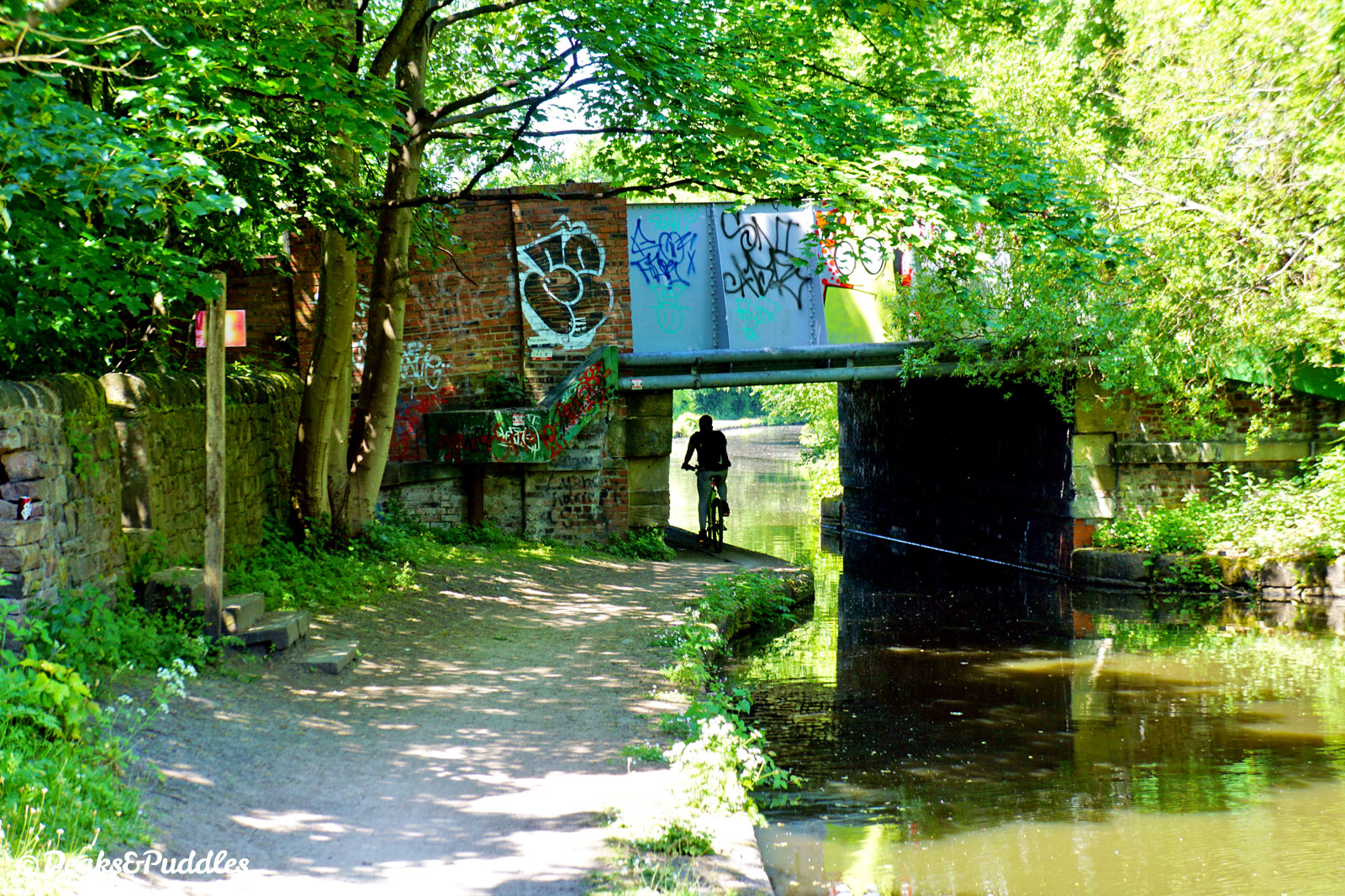
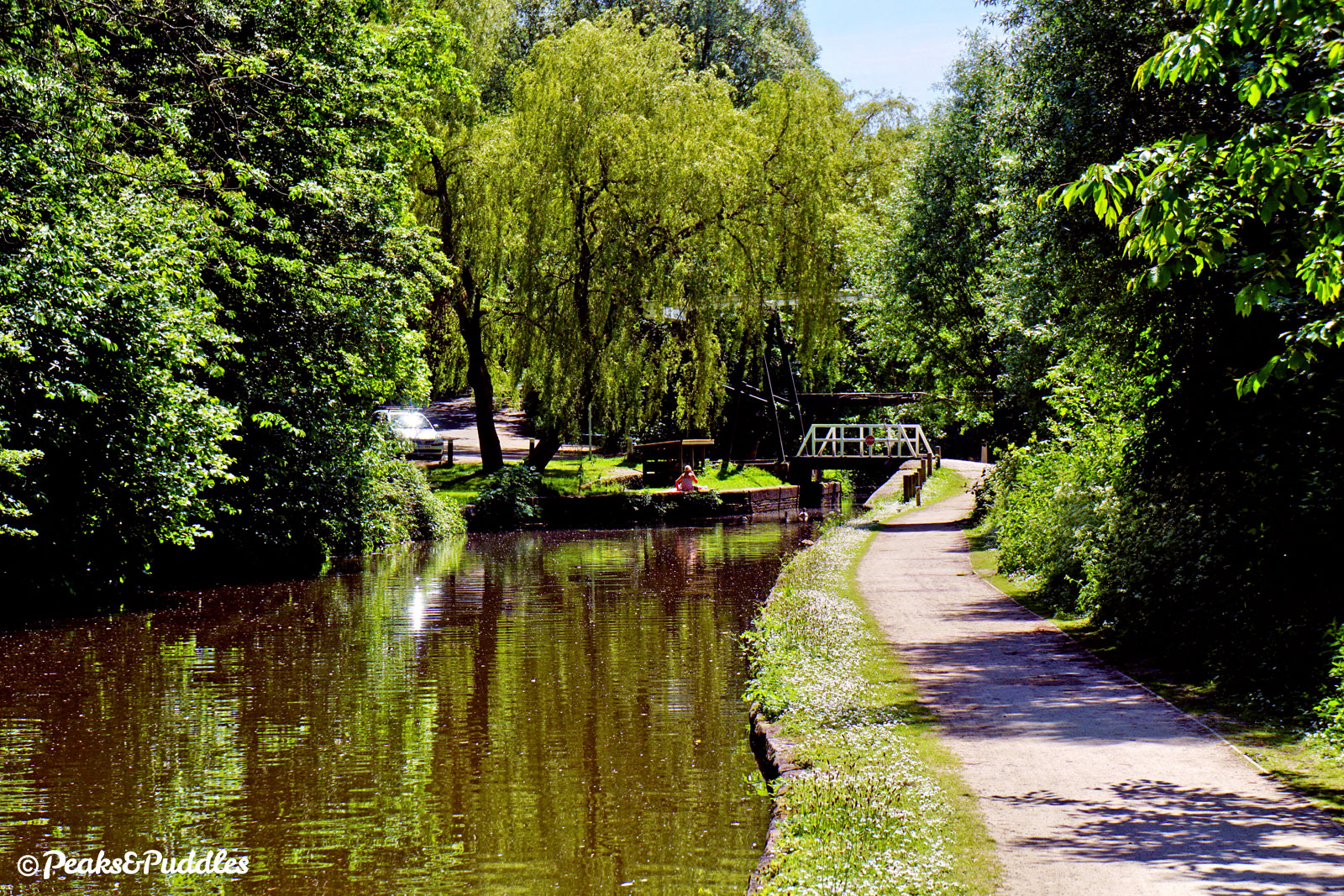
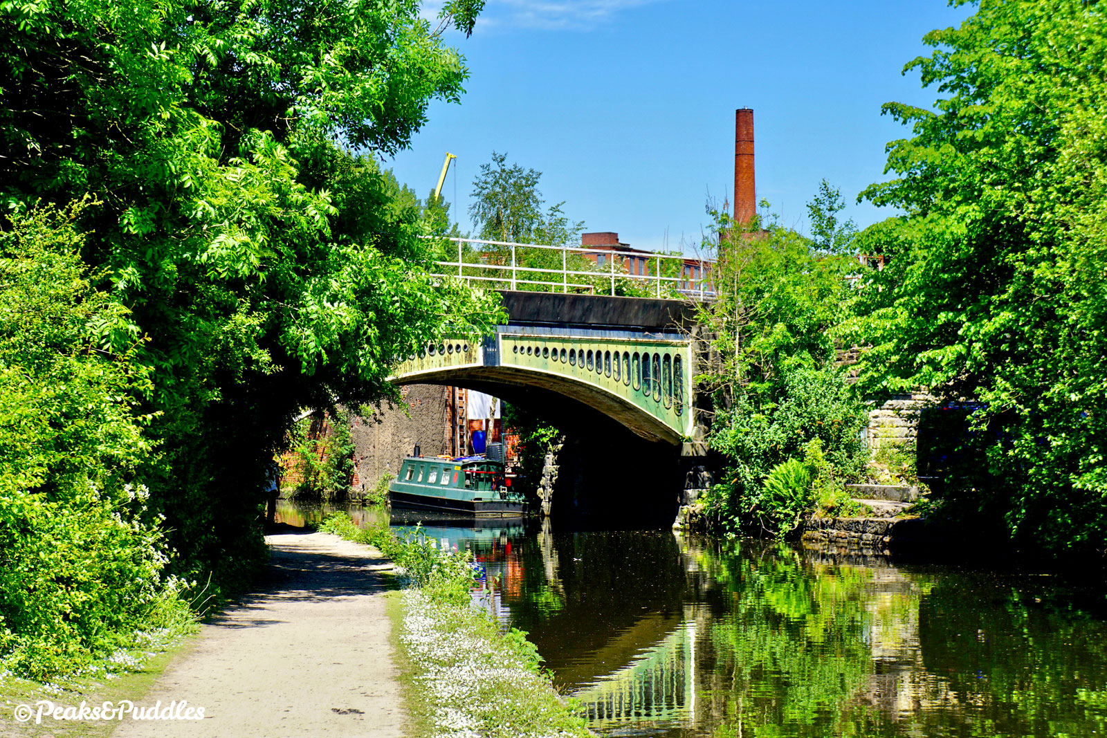
- Between wooded banks hiding dense suburban housing above, the canal continues in an unusually arrow-straight course northwards. Bridge 13A is notable not just for being a later addition but a two-in-one bridge: first built for the railway line from Romiley into Manchester, then later widened for the now abandoned line into Stockport Tiviot Dale. One half is narrower than the other, but the concrete surface inside is consistently bumpy. With the noise of urban life above, the canal feels like a lost world here as it approaches Woodley. While Bridge 13, Gilbert Bank Bridge might look on a map like a good escape route to avoid the Woodley Tunnel ahead, with its incredibly tight steps it almost makes sticking to the towpath seem the better option. The tunnel is then approached as a solid face with nowhere to go but through. The dark and tricky towpath has an inconsistent width, always with a very wet patch somewhere in the middle. Even if only a modest 161 metres (176 yards) by canal standards, it’s still a relief to be back in daylight on the other side.
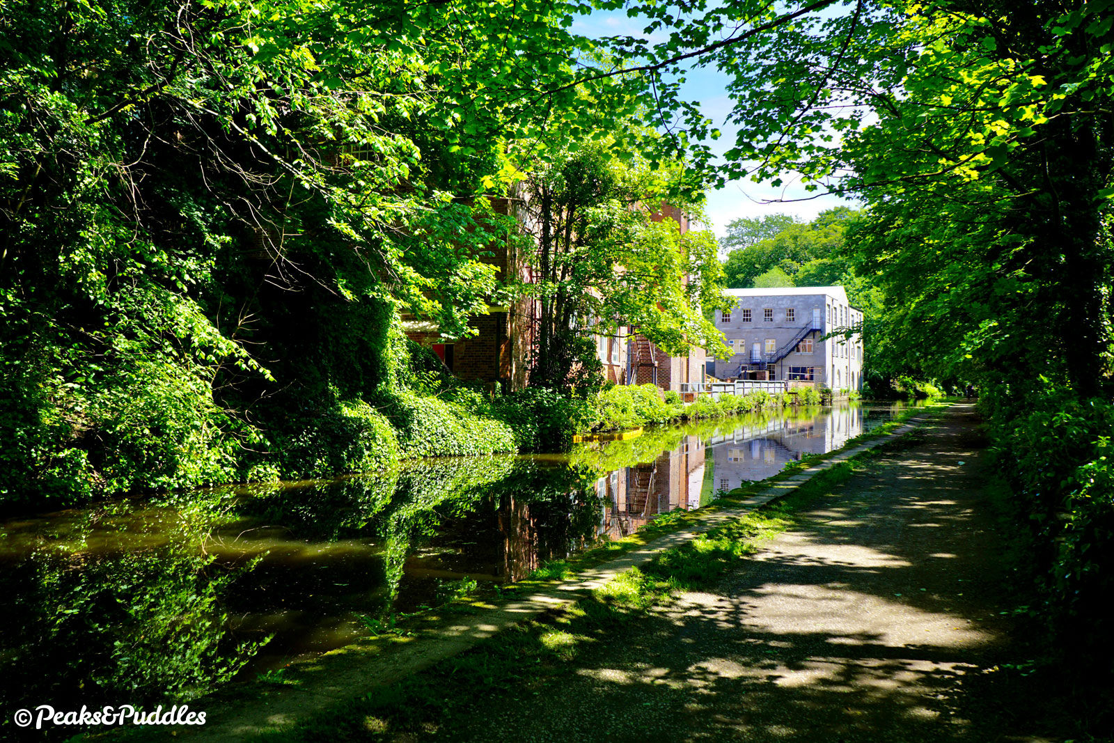
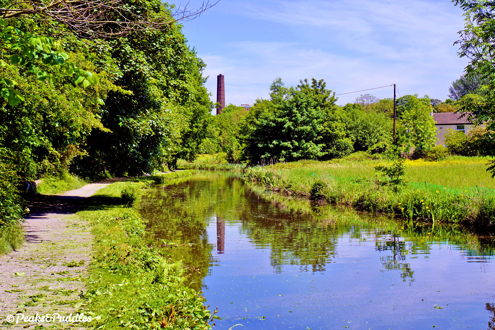
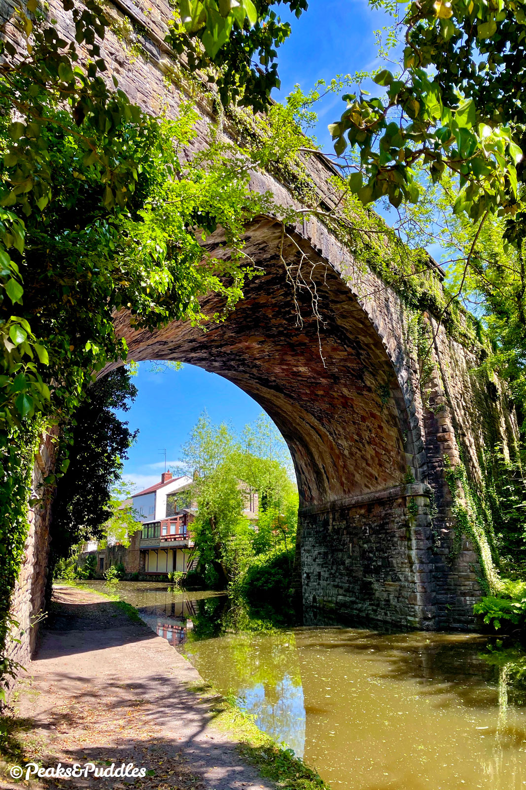
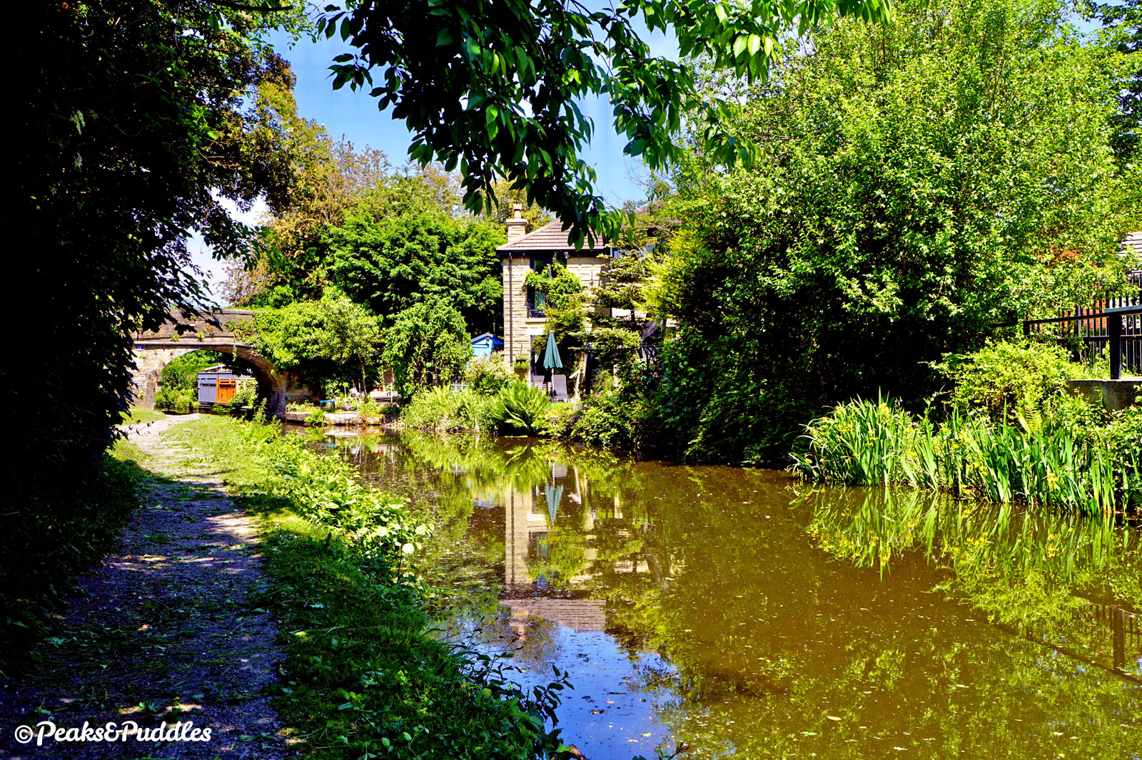
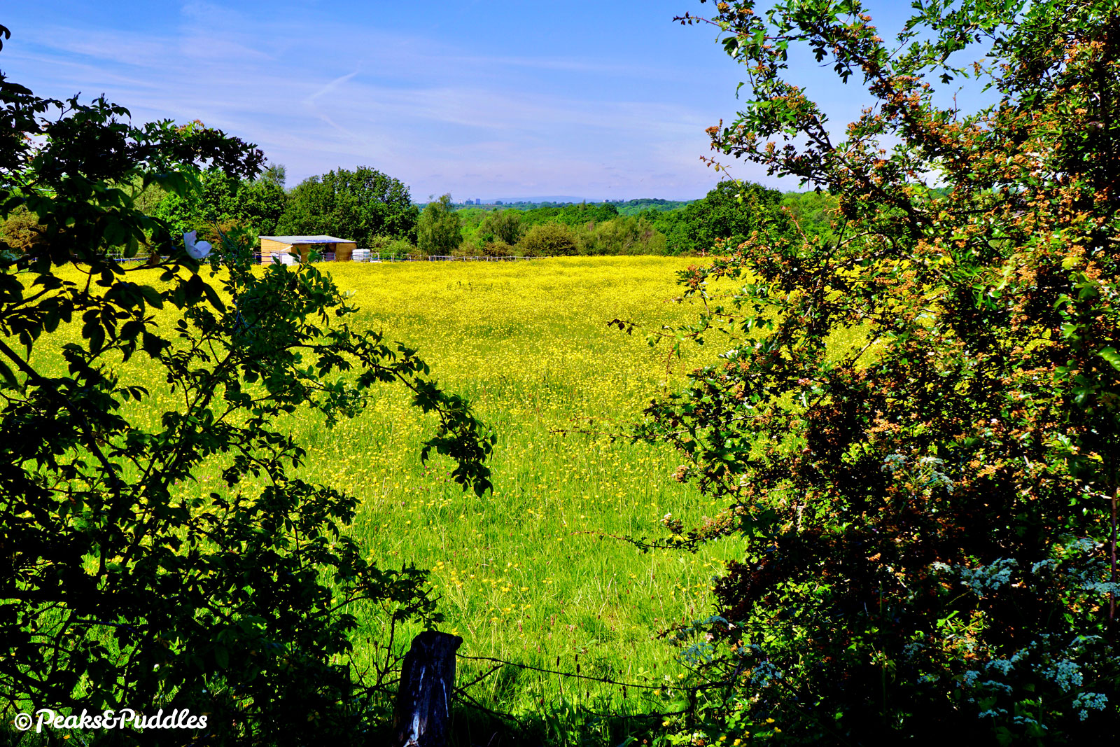
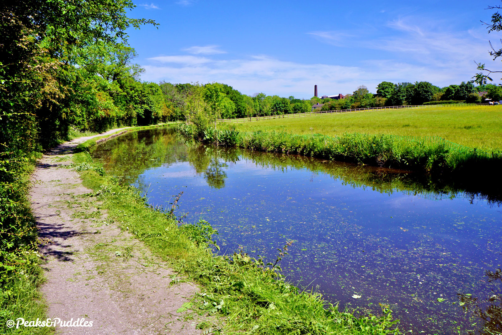
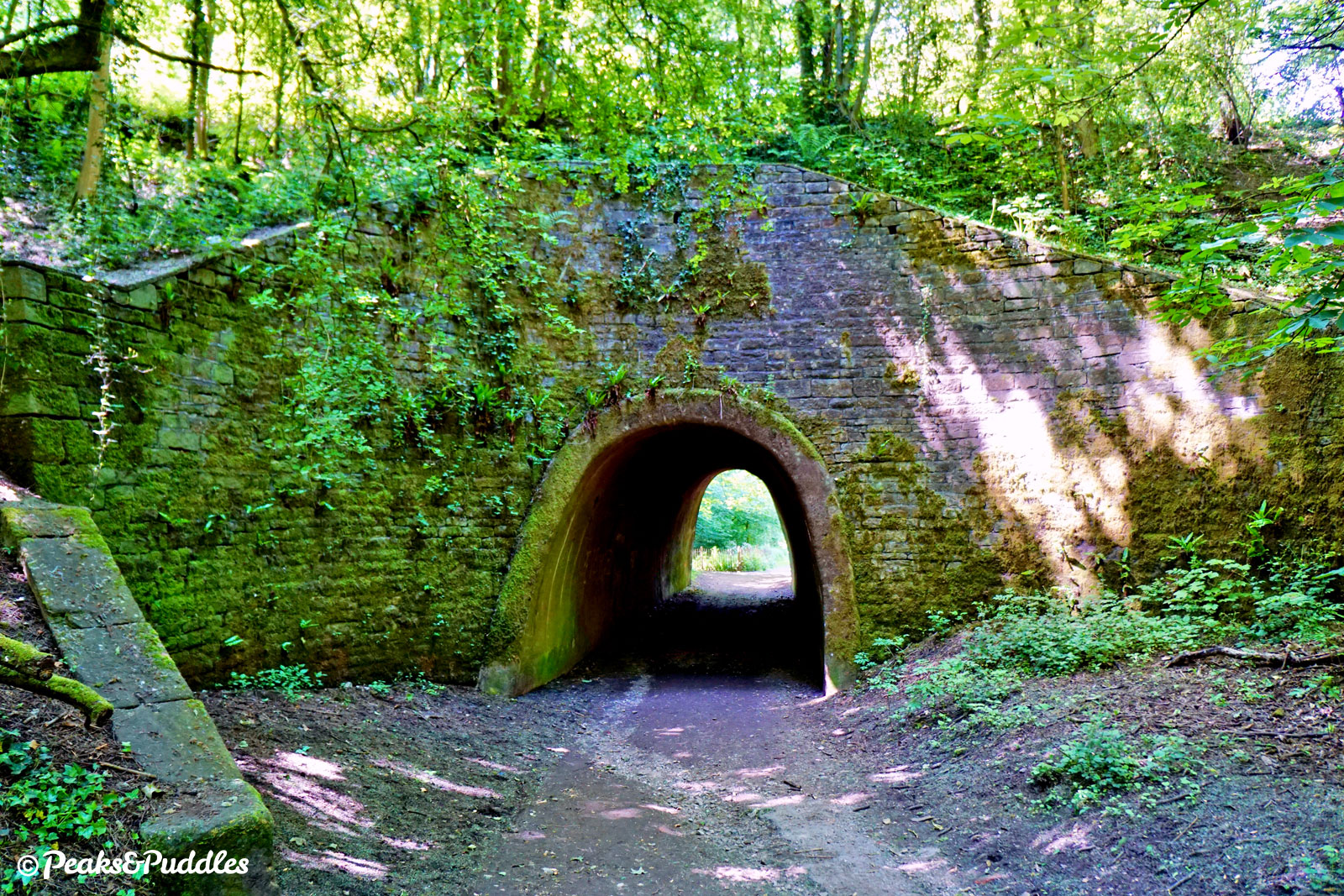
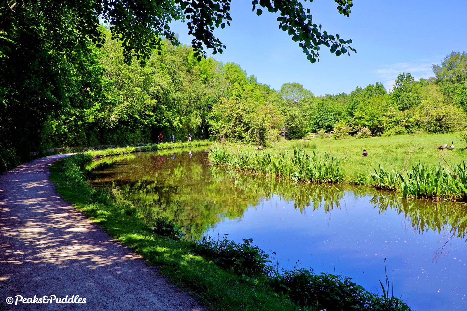
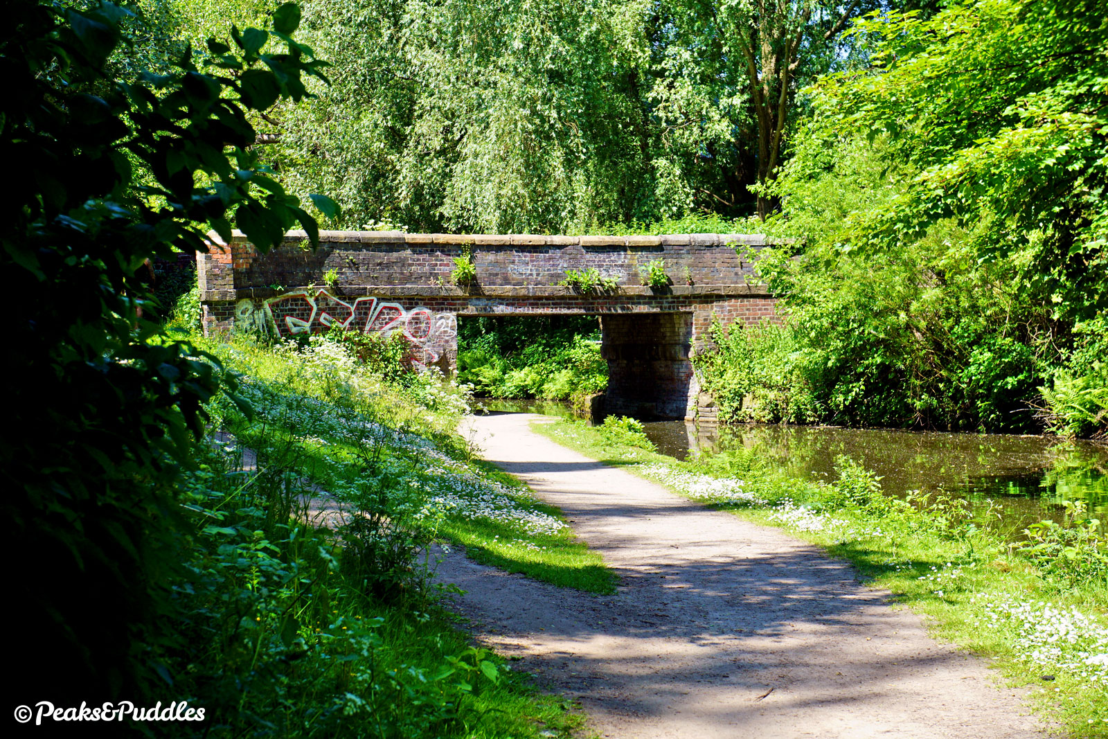
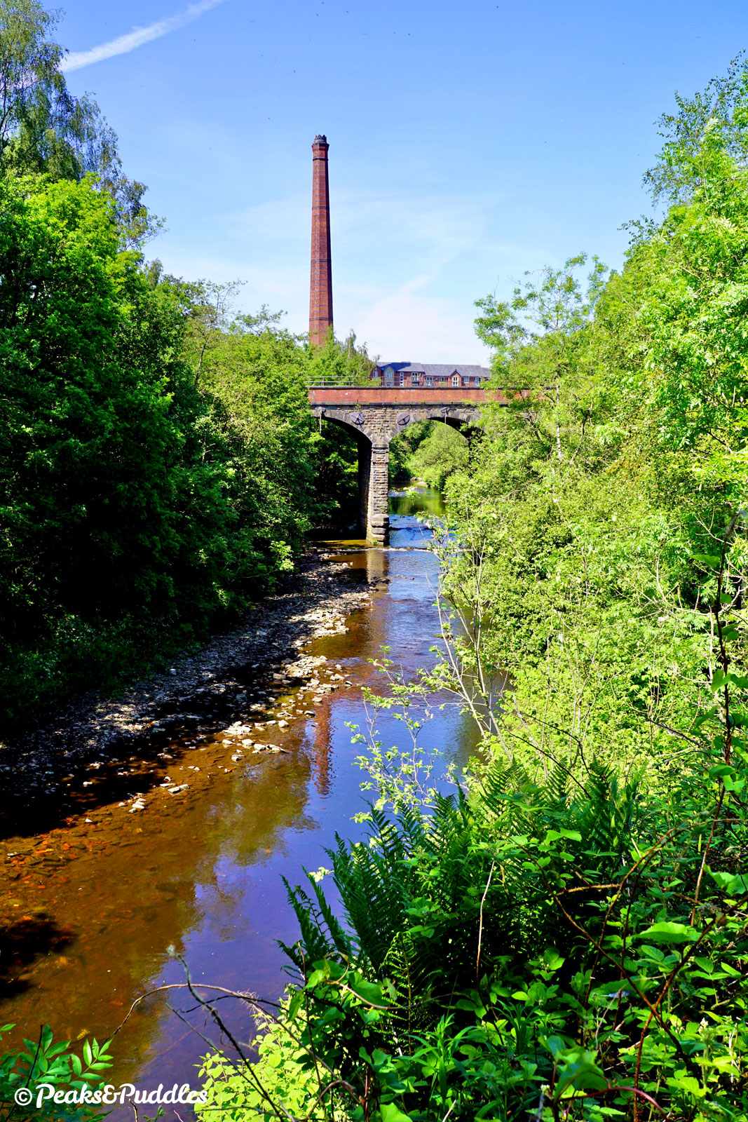
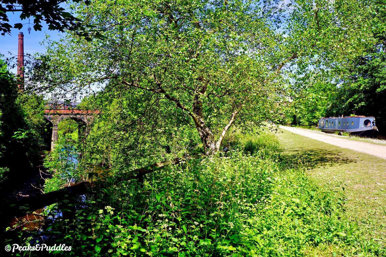
- Rewarding the struggle of the tunnel, the impressive, skewed stone arch of Bridge 12A crosses high above the canal, built by the Cheshire Lines Committee as link into Stockport but now stopping short at a recycling depot. Under the much quainter Bridge 12, a surprisingly rural feel takes hold of the canal once again for the whole of the next 2.3 km (1.4 miles). Though there are distant city sounds and glimpses of tower blocks, the immediate surroundings are buttercup meadows and wooded banks. The chimney ahead belongs to the derelict Unity Mills, built for cotton spinning in the 1860s. Though it won’t be seen until the very end of the canal, the River Tame is now firmly below its cut as it passes under the stone-built Bridges 10 and 9, Murrys and Windlehurst Bridges, reminiscent of its upper reaches. Approaching Haughton Dale, a large local nature reserve straddling the river with stunning ancient trees and green meadows, a first steep path to the left offers a step-free route down. This is followed, around a wide bend, by Bridge 8A, Gee Cross Footbridge, offering a link into the Trans Pennine Trail which passes deep below the canal under Apethorn Aqueduct — hard to spot from the towpath but unusual and rather eerie from below.
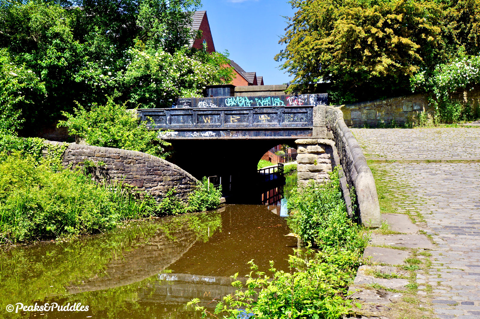
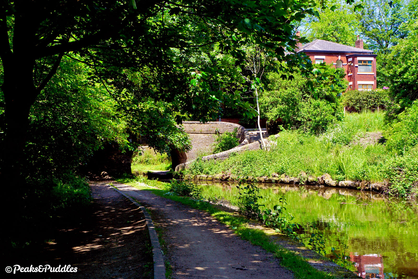
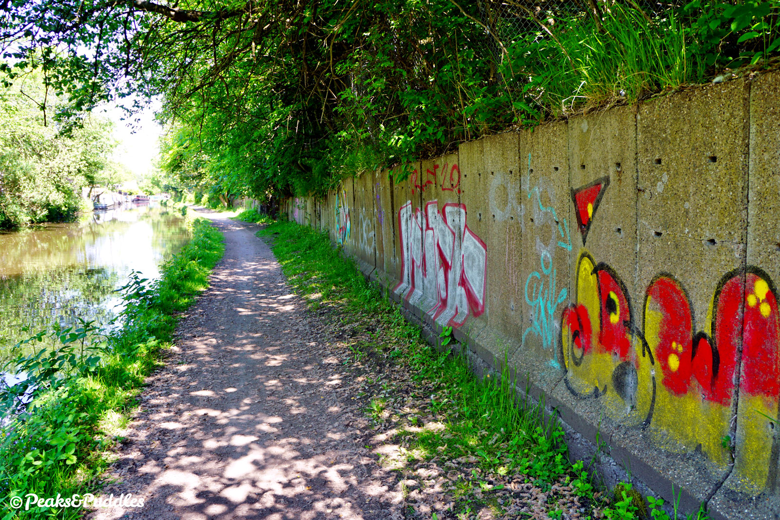
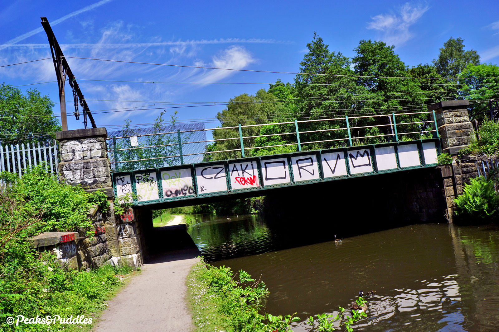
- The full length of Tameside’s once persistently muddy Peak Forest Canal towpath was improved substantially in 2015 thanks to a cycling grant, but that hasn’t changed one tricky historical feature ahead. Bridge 7, Captain Clarke’s Bridge is a roving bridge, allowing the towpath to change sides without boaters untying their horses. For cycling, it requires a definite dismount (there are a couple of steps too) and a careful shuffle down the cobbled roving ramp. There was no structural need for the towpath to change sides for the next 800 metres (half a mile), only the insistence from one of the canal’s backers, George Hyde Clarke, that it not pass through the land belonging to his Hyde Hall estate. History has not been kind, and instead the land on the offside is today littered with industrial yards and merchants. The canal itself becomes industrial in feel, with graffitied brick walls making the towpath space rather narrow. Nearing the main road through Hyde beside a supermarket, a length of bumpy cobbles lead into the second roving bridge, returning the towpath back across. Though on first glance potentially rideable, it’s a foolhardy and usually foolish decision. Dismount and weave around, below the A57 Manchester Road.
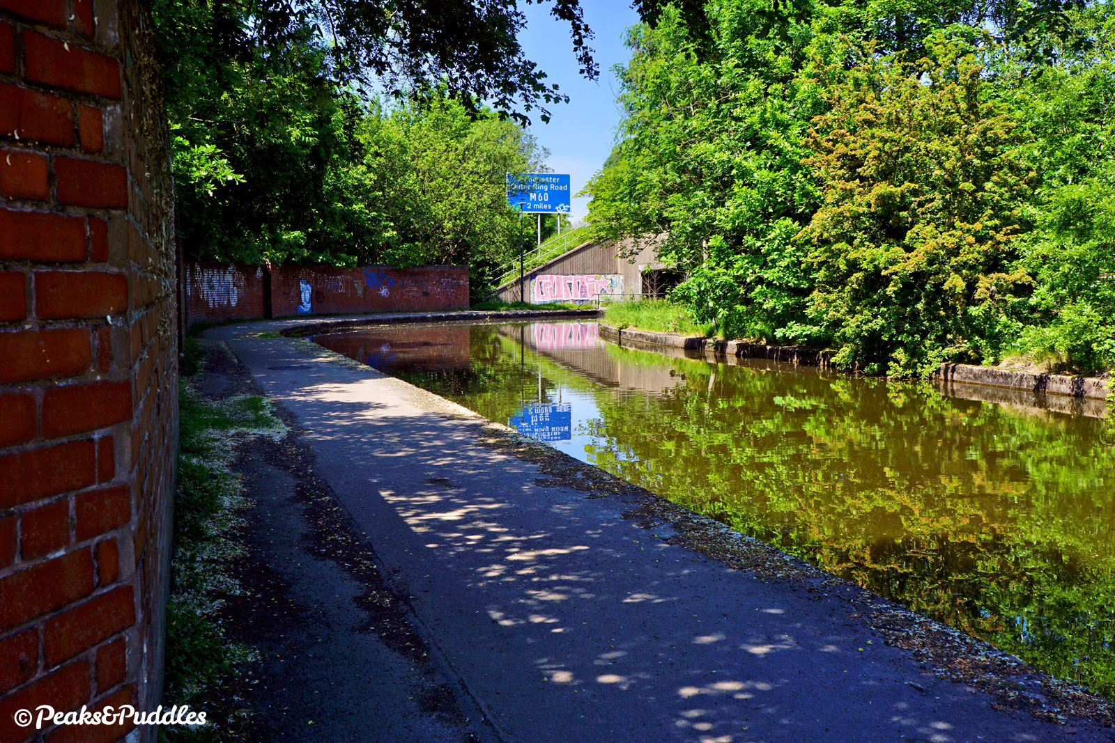
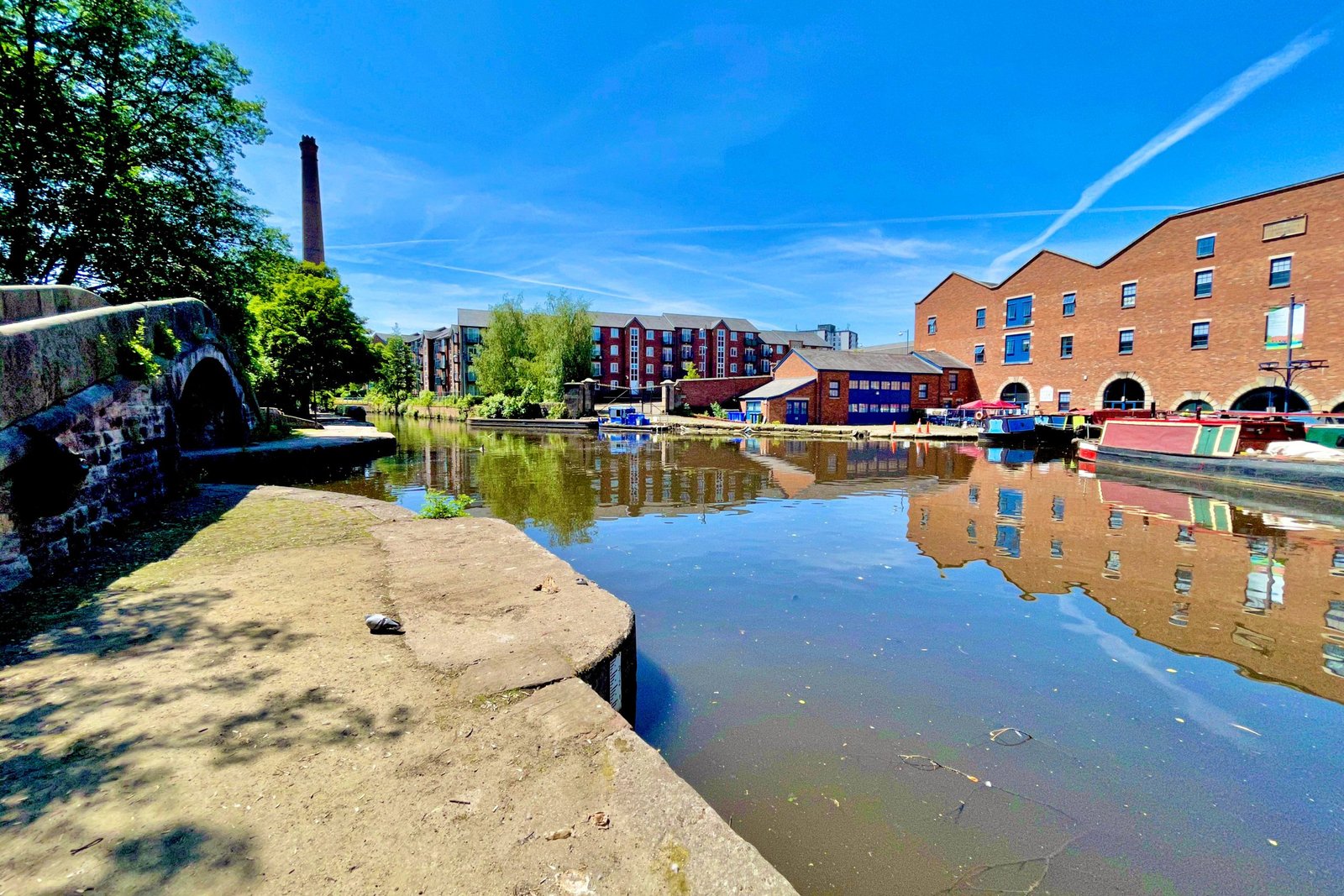
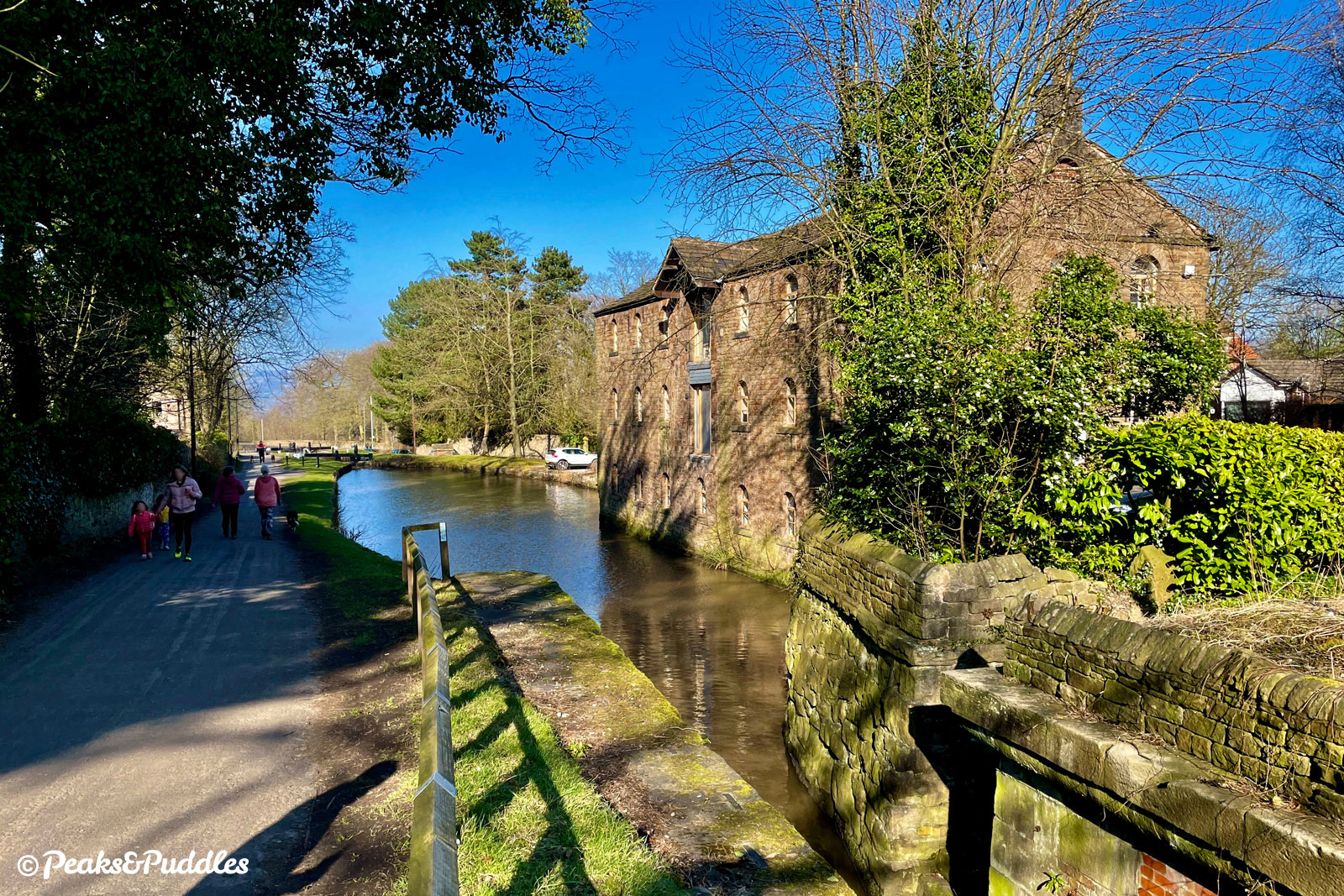
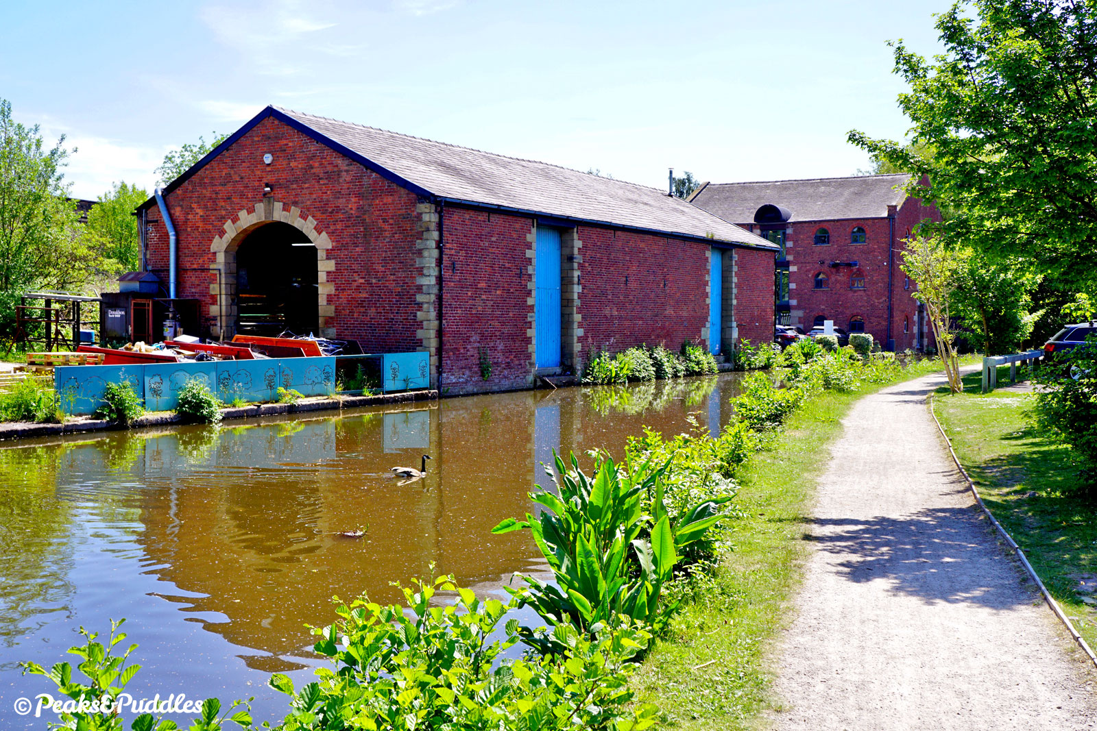
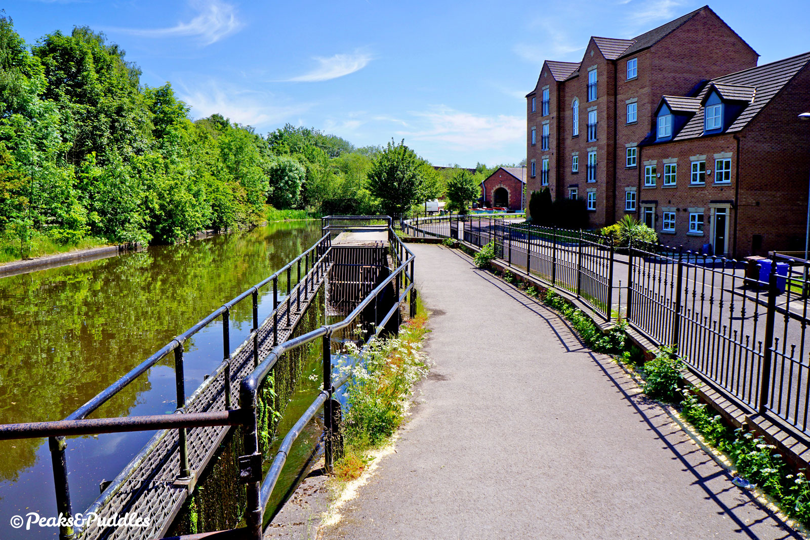
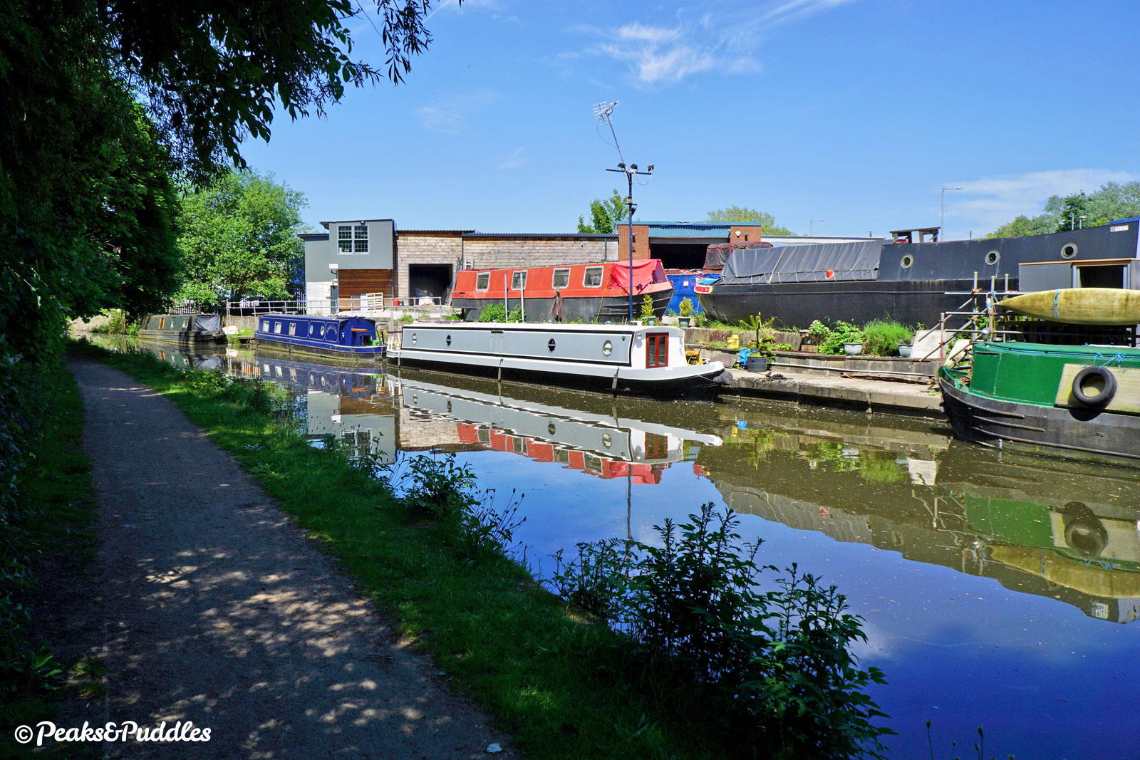
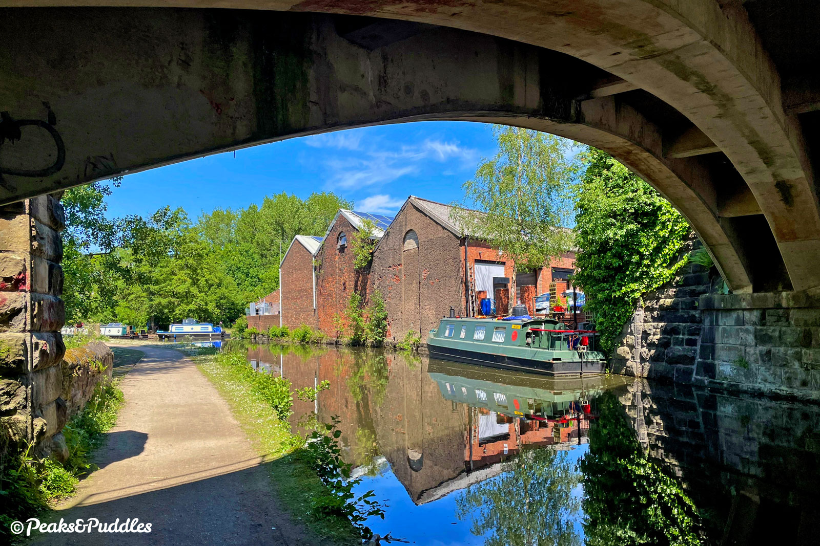
- Modern housing now occupies part of the former Hyde Wharf basin, but two historic buildings have been saved. The first, taller Wharfinger’s Warehouse across the canal built in 1828 and the squatter, but more cavernous 1859 warehouse built by the neighbouring railway which has followed the canal from Marple. Salvaging these two industrial relics is all the more impressive as the canal turns to face the monstrous M67. Constructed in the late 1970s, this saw the canal re-routed through a fairly dingy, squat concrete tunnel. Luckily the atrocious noise is soon a memory and the canal’s final length between the Tame Valley and the Flowery Field, Dewsnap and Dukinfield areas can feel rather pleasant. Picturesque, not entirely, but certainly green and free from the urban rush. Modern housing has replaced some of the industrial units, making the waterfront feel more alive, though sewage works down below pervade the air a little. The area around Bridges 2 and 3 has a surprising amount of history, if hard to see today, including Dukinfield Hall, now reduced to a ruined chapel in an industrial unit’s car park! Huge coal pits at Astley and Dewsnap to the north east were connected to the canal and its Dewsnap Basin (now a winding hole for boats) via primitive tramways. The next, very low, Bridge 1B carries the railway lines from Marple and Glossop into Guide Bridge — watch for the terrible surface underneath where water has dripped through its girders.
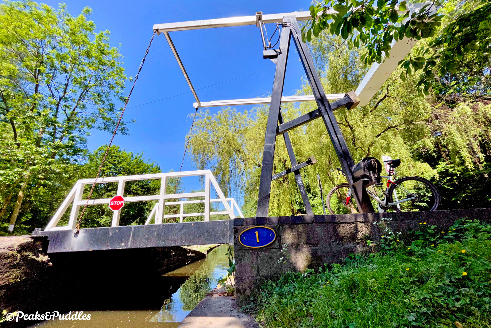
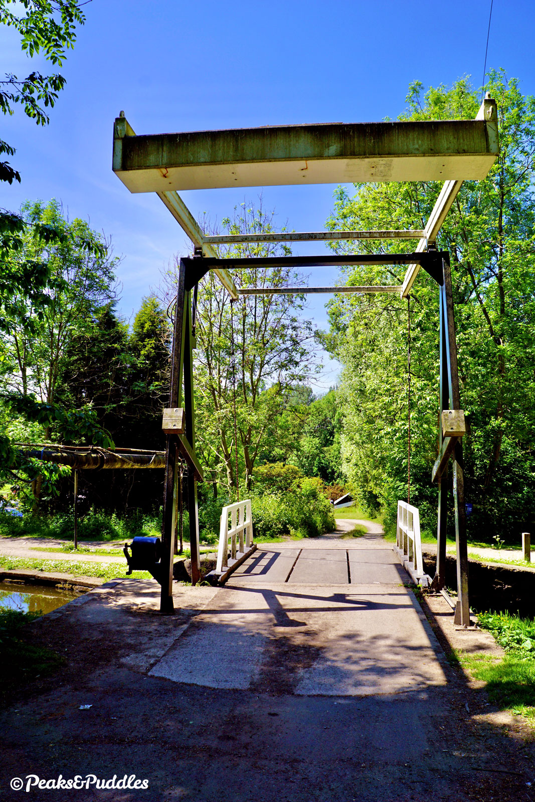
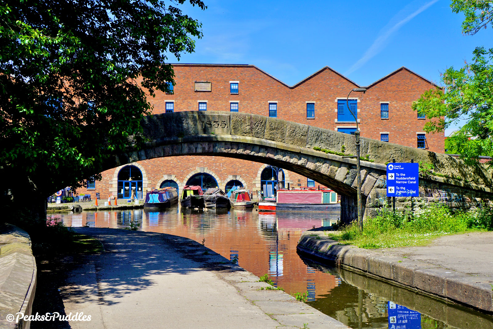
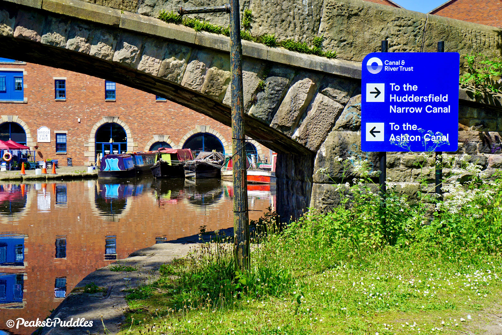
- Still green and buried by trees, the canal approaches Bridge 1, Stanley Lift Bridge, a throwback to Strines and Disley, yet still has two more bridges to go. Around the next gentle bend, a brilliant view epitomising the industrial north finally opens up over the River Tame, with a railway viaduct and the preserved Junction Mill Chimney perfectly framed. Without a name or even a number, Bridge A is nevertheless a very attractive railway bridge carrying a branch to Stalybridge (now mostly Trans-Pennine services) over six cast iron ribs. It had at one time been wider, with the platforms of Dukinfield Central station carried over the canal. On the other side, the very end of the Peak Forest Canal is now in sight, past Dukinfield Wharf and Garforth’s Private Branch on the offside. With a final flourish, it crosses Dukinfield Aqueduct and flows under the beautifully graceful 1835 Portland Basin Stone Bridge to join the Ashton Canal. Sitting opposite Dukinfield Junction is the 1834 Ashton Canal Warehouse, now Portland Basin Museum.
- To complete the out-and-back ride, turn around and head back to Marple, only 13 km (8 miles) but somehow a distant memory, such has been this canal’s adventurous course.
Shop and support
Bikes, accessories and gear to start your next adventure. Simply buying through these links is a totally free way to support the cost of keeping Peaks & Puddles online. See more here.
Gallery


More to explore
- Marple
Once dominated by mills, now a leafy suburb of Manchester with canal locks, shops and refreshment stops.
From Marple Junction, head through the gate beside the Toll House opposite lock 16 then turn right and follow the quiet Church Street downhill, bringing you right into the centre of town with plentiful cycle parking. - Oldknow’s Lime Kilns
Between locks 15 and 16 at Marple, follow Lime Kiln Lane to see the remains of these stone kilns, now unearthed with new interpretation boards as part of a trail leading to the Mellor Mill archaeological dig site. - Portland Basin Museum
Housed in the 19th Century Ashton Canal Warehouse opposite the end of the canal, this family friendly museum explores the local history of Tameside and its canals.
Access is not great from the canal: go over the cobbled final bridge of the Peak Forest, then use the next bridge straight ahead to cross the Ashton Canal, with steps. - Ashton Canal
From Dukinfield Junction at the end of the Peak Forest Canal, the Ashton Canal can take you a further 9.8 km (6.1 miles) right into the heart of Manchester. Well surfaced, it does however have some tricky moments around its numerous locks and passes some less appetising spots. A good round-trip adventure is to follow the entire Peak Forest Canal and Ashton Canal from Whaley Bridge all the way into Manchester Piccadilly, using the train to complete the loop.
Further reading

From Bugsworth to Manchester: A History of the Limestone Trail by Ian Littlechilds and Phil Page
Charting the canal’s modern day path from country to city centre, across 96 pages of photographs, history and insights.

Pearson’s Canal Companion: Cheshire Ring & South Pennine Ring by Michael Pearson
Beloved by boaters, this edition of the Pearson’s series covers the entire Cheshire Ring, perfect if you’re likely to explore further. Just a few pages are devoted to the Peak Forest, but they’re packed with information.

Waterways Guide: North West & the Pennines by Collins Nicholson
Not just for boaters, these handy spiral-bound guidebooks cover vast areas, making them a great investment for canal explorers of all kinds. There are specific tips for cycling along with OS mapping, brief histories and local information.

The Peak Forest Canal and Railway: An Engineering and Business History by Graham Boyes and Brian Lamb
Covering not just the full length of the canal from Ashton-under-Lyne out to the High Peak but also its (two) tramways, this essential history of the route focuses quite heavily (and wordily) on the operational and business side of things, but is still well worth tracking down for anyone inspired by the endeavour and keen to delve deeper, with plenty of interesting photos and plans.
Original photography, words and design by Anthony Sheridan unless indicated otherwise. Found this guide helpful? Buy me a coffee to help keep the wheels turning!
The all-important disclaimer: While great care and attention has been put into gathering these routes, ensuring details are accurate and determining their suitability, all information should be used as a guide only and is not a replacement for using your own judgement or research when setting out on new adventures. Peaks & Puddles/the author cannot be held responsible for any issues that may arise from the riders own decision to ride a section of indicated route.
Always ensure your equipment is safe and legal for use and that you are well prepared, carrying everything necessary including access to a good map. Follow the Highway Code and the Countryside Code at all times. Respect the landscape, the wildlife and the people you encounter. And after all that, have fun!