An all-too-brief but useful and interesting jaunt from the end of the Peak Forest Canal links Buxworth and Chinley, along two miles of the horse and gravity-powered plate railway which supplied the waterway with its traffic of Derbyshire limestone.
Route details
- Distance
 3.8 miles / 6.1 km
 - Elevation Gain
 34 m / 112 ft
 - Time allow ½ hour
- Difficulty
 Gentle
 - Terrain 35% Off-Road Path Traffic-free trails, towpaths & cycleways 30% Road Quieter lanes, sometimes brief busier roads 35% Unpaved Bumpier tracks & bridleways
- Suited to
 All Bikes
  Gravel Bikes
  Mountain Bikes
 - Notes All except mountain bikes will struggle beyond stage 4 in route description, east of Whitehough Head Lane, where the trail is unsurfaced and has large stone sleeper blocks. Some of the route is shared with very low vehicle traffic to houses and a factory.
- Suggested Start Bugsworth Basin SK23 7NE SK 0222 8204
- Places Bugsworth Basin, Buxworth, Chapel Milton, Chinley, Derbyshire, High Peak, Whitehough
- Attributes Accessible by train, Canals, Car parking, Family-friendly, Gentle climbs, Industrial heritage, Out and back, Pubs and cafés, Railways, Reasonably flat, Rivers, Suitable for older kids, Suitable for young kids, Towns and villages, Views of hills and peaks
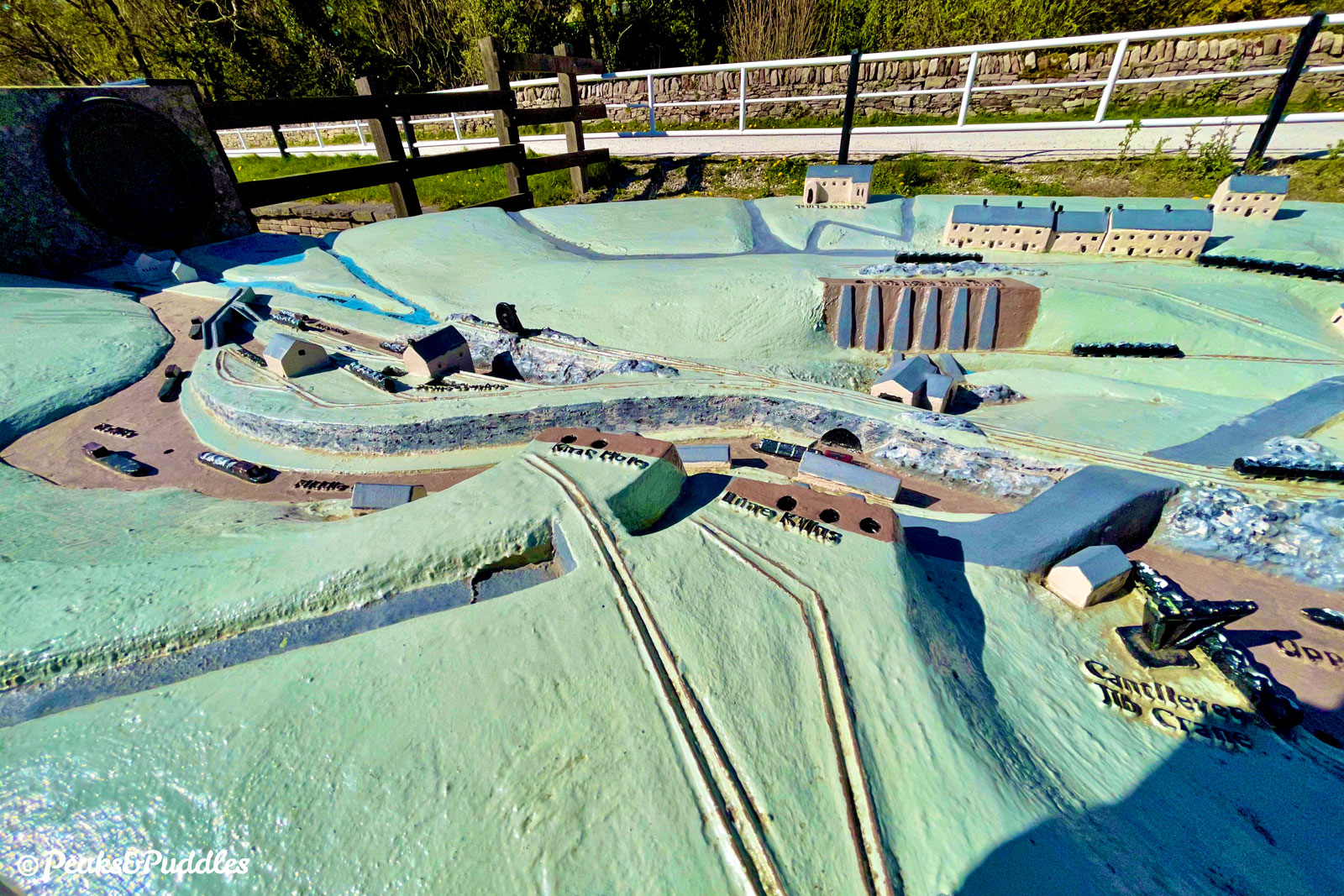
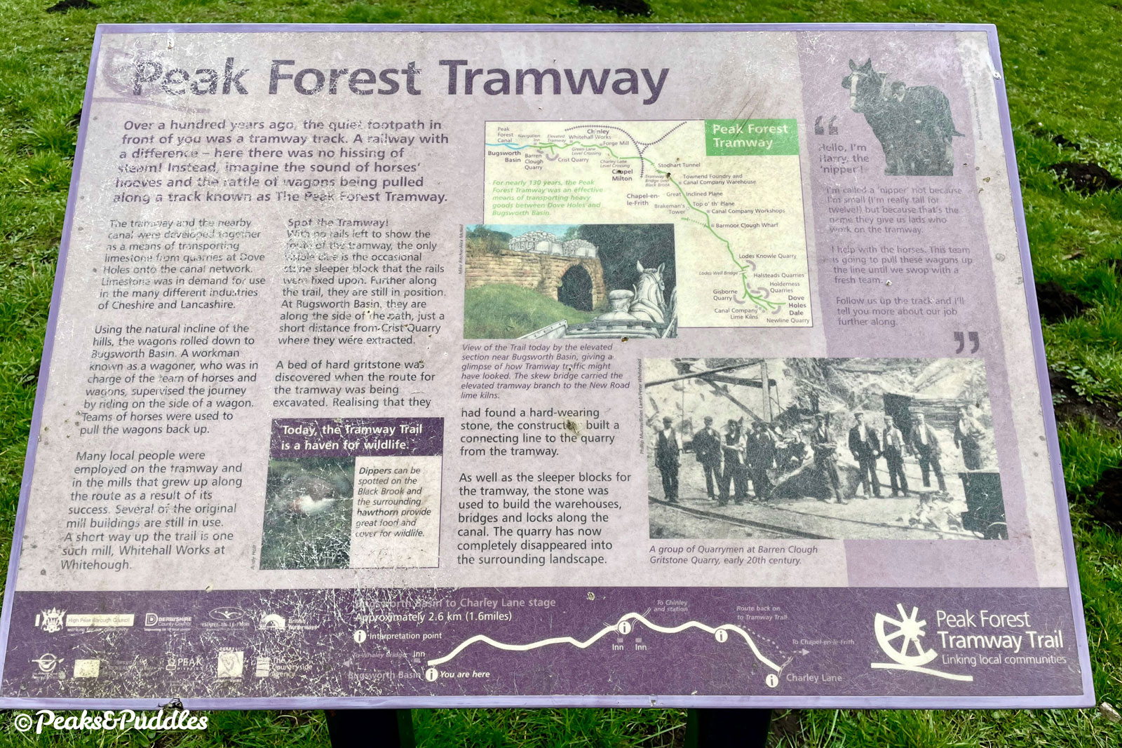
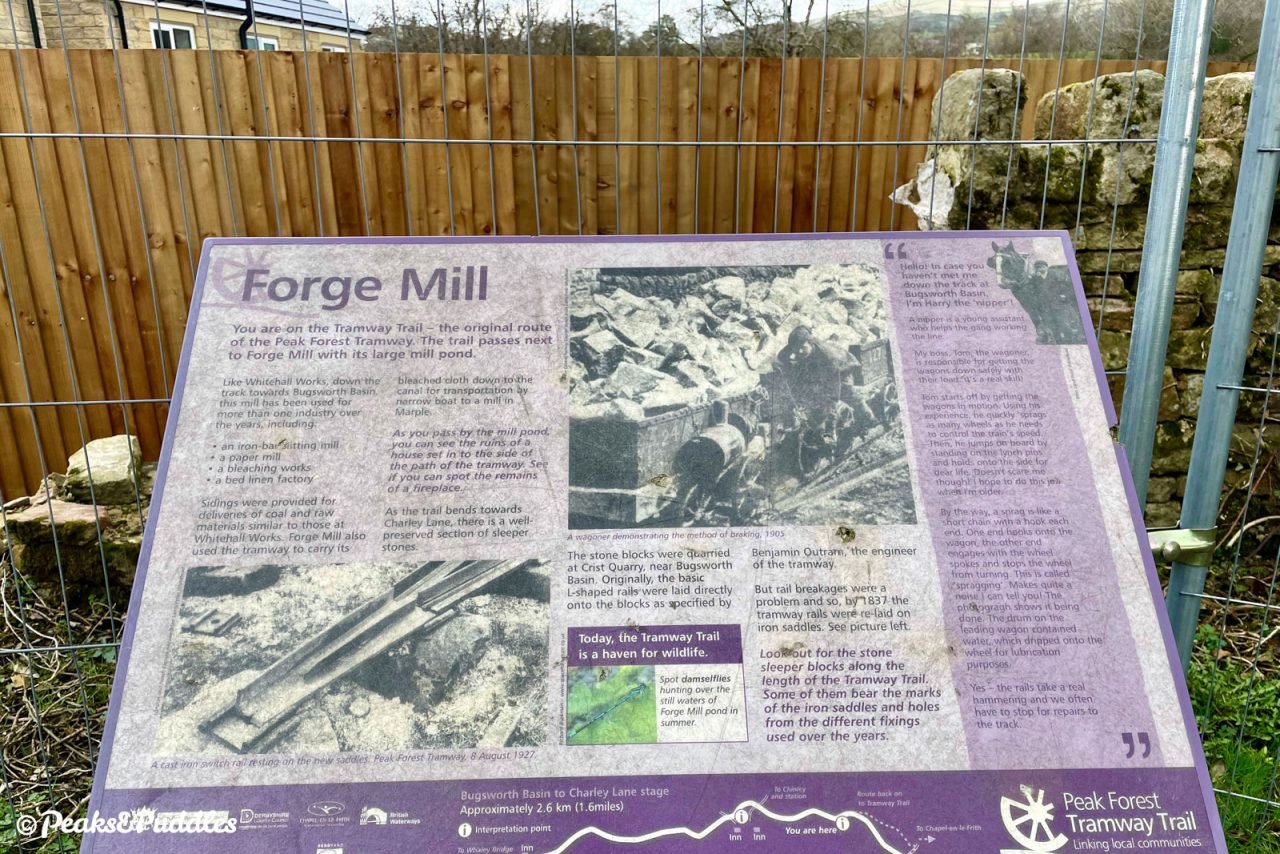
This was very nearly a canal too. In the late 18th Century, seeking a way to link the rich limestone quarries of Peak Forest, east of Dove Holes, with the Ashton Canal into Manchester, Samuel Oldknow began promoting a Peak Forest Canal — with an adjoining tramway. Original plans saw the waterway extending much further up the Black Brook valley here to Chapel Milton, where a wharf complex would’ve seen goods transferred from wagon to boat.
Oldknow made his wealth in cotton before playing a key part in the industrialisation of the green valleys around Marple and Mellor in particular. But, as the financial challenge of building this route became clear, it was soon decided to end the canal two miles short at Bugsworth (now Buxworth), forgoing the need for another set of locks, and instead extending the planned tramway to be engineered by Benjamin Outram. It opened for trade in 1796.
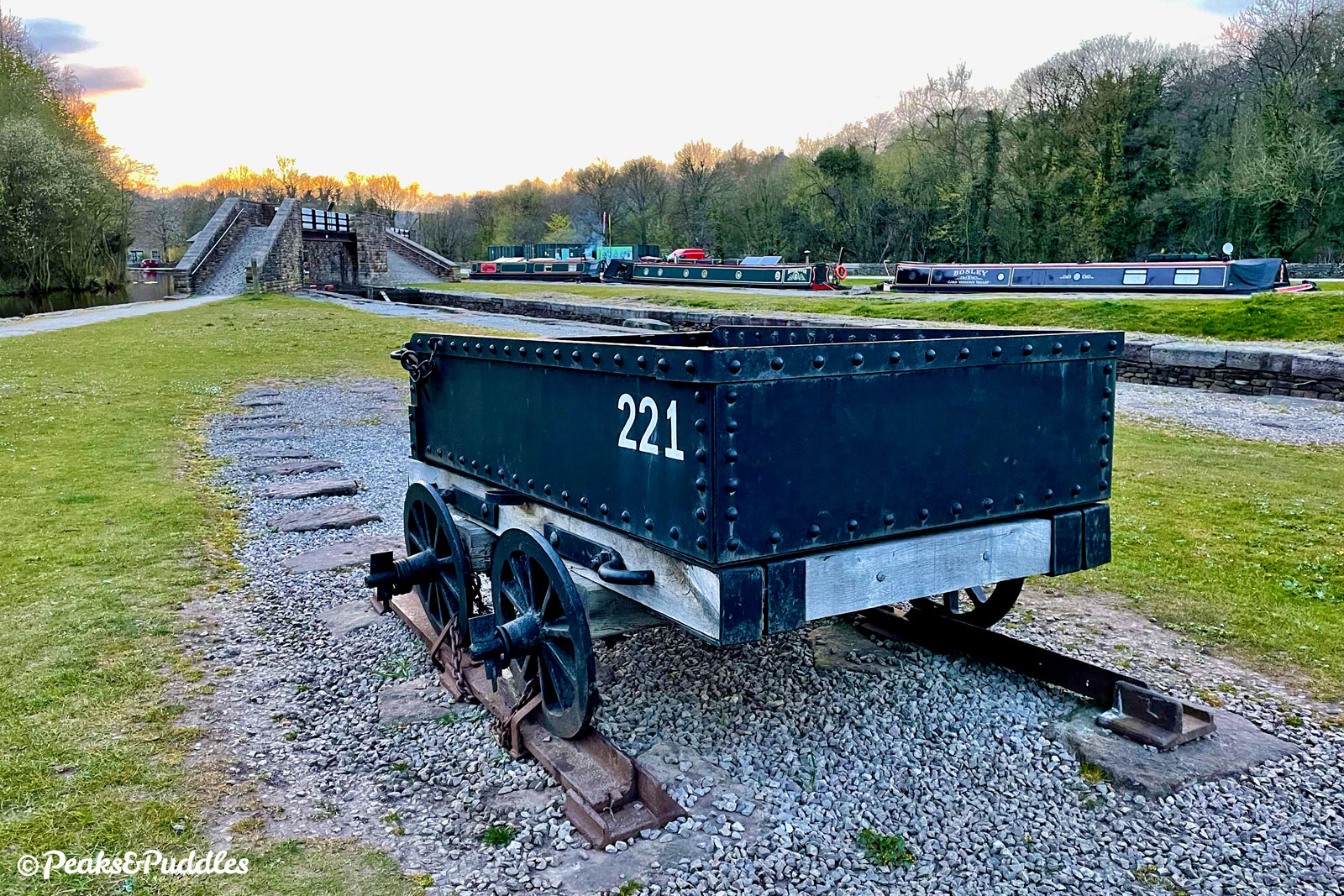
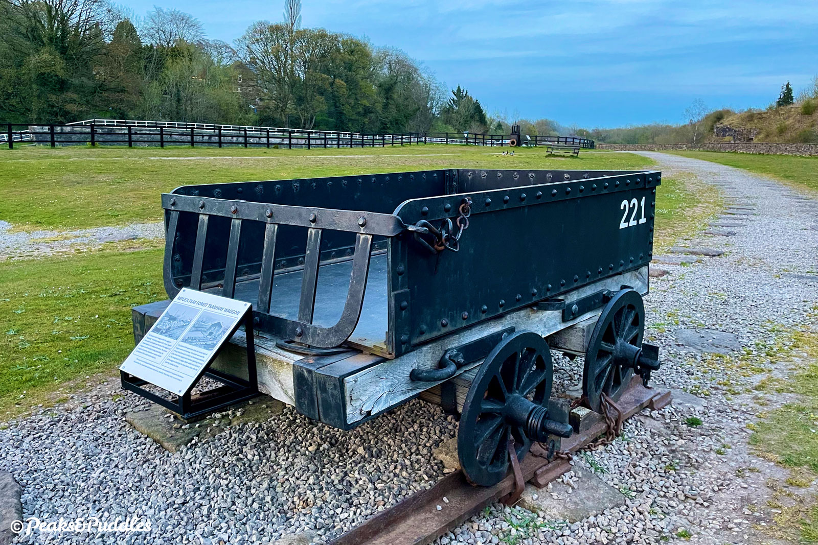
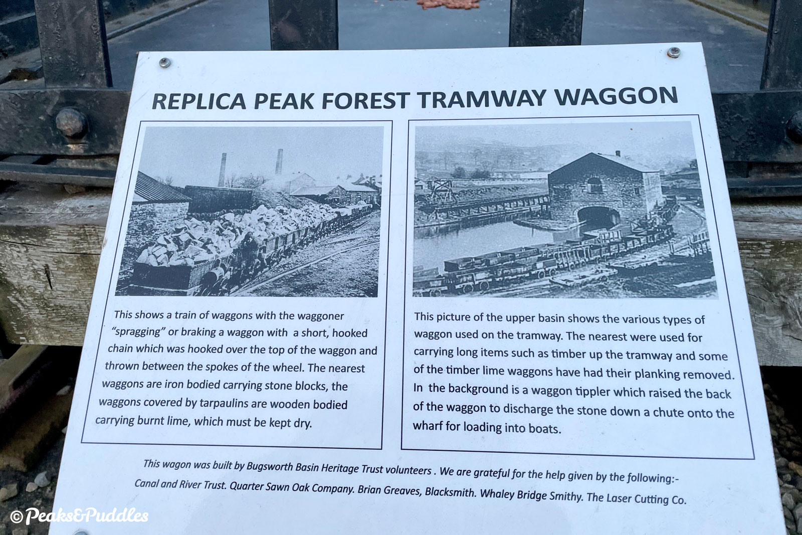
This was not a “tramway” in the sense of Blackpool, nor a railway with steam-powered locomotives, but a comparatively primitive “plate-way” line built of L-shaped cast iron tracks. Made up of 3 ft pieces weighing 56 lbs (25 kilograms) each, these were mounted on stone blocks to be traversed by basic wagons pulled by horses or worked downhill by gravity alone — braking provided only by whipping a chain around the wheels to lock them.
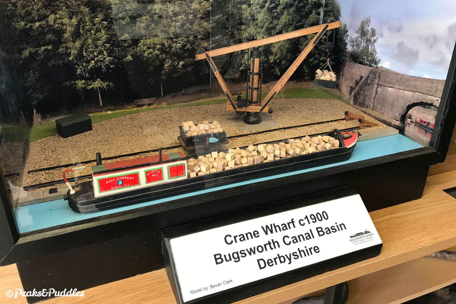
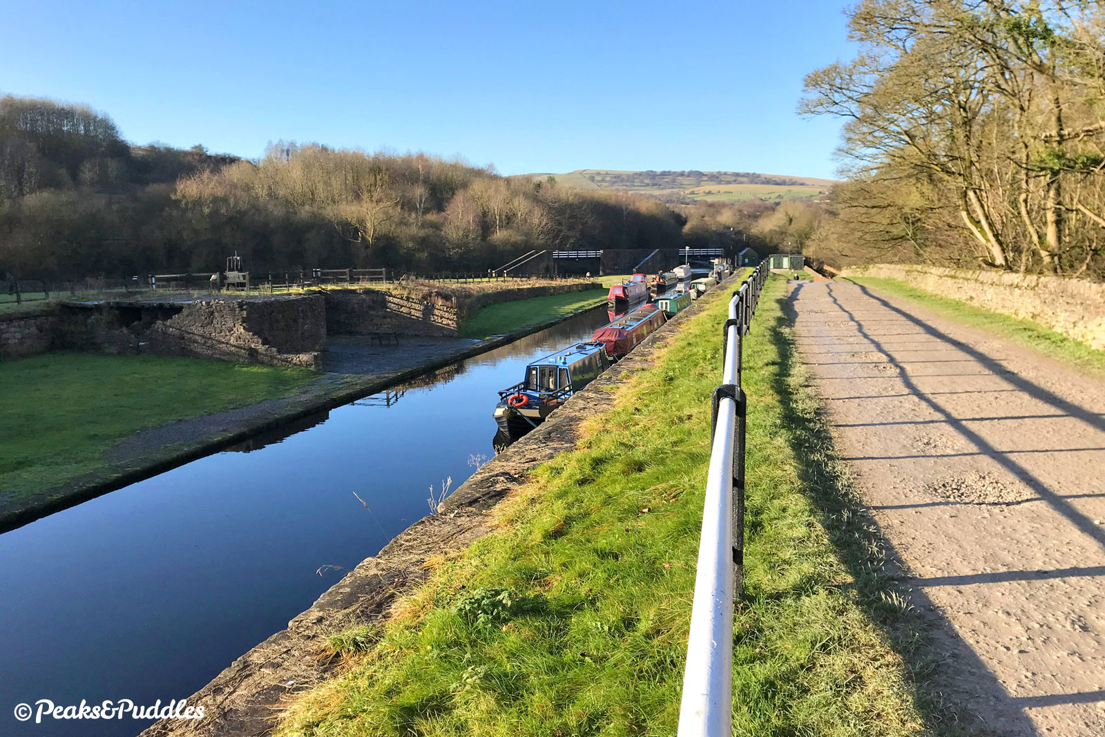
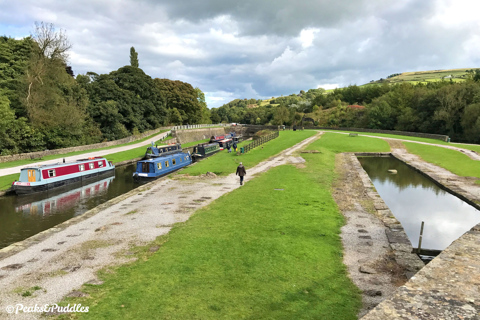
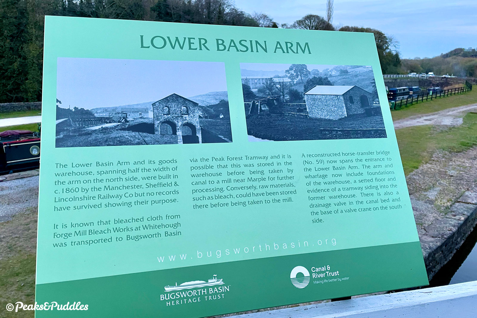
Bugsworth Basin became a hive of industry, with space for 20 boats and stables for 40 horses, surrounded by lime kilns. Here the limestone was either shipped out as stone or turned to “quicklime”, used both as building material and for “improving” acidic farmland. This was achieved by heating it to staggering temperatures in the kilns, fired by coal brought in largely by boat from nearby coalfields such as Poynton.
The tramway didn’t exclusively carry limestone and much coal made its way up the line to the various other lime kilns and works along the route, along with local crops and goods. The line completely escaped the steam revolution of the 19th Century, only in the 1860s seeing its rails replaced by steel, staggeringly surviving over a century with horse and gravity power alone. However, by the 1920s the shift in trade and the dominance of the new, high capacity steam railways eventually saw it fall into disuse.
While the curtailed route which forms today’s very short trail below Chinley is fairly easy-going, the tramway would then clatter through the Stodhart Tunnel on the edge of Chapel-en-le-Frith and pass through the edge of the town before climbing a huge inclined plane up towards Barmour Clough and the quarries around Dove Holes.
The tunnel partially remains today, sadly inaccessible and at risk, as one of the oldest remaining rail-related tunnels. The rest of the route, including “the plane” where loaded wagons going down pulled empties up, is vaguely visible on aerial photos but mostly unwalkable, especially without trespassing.
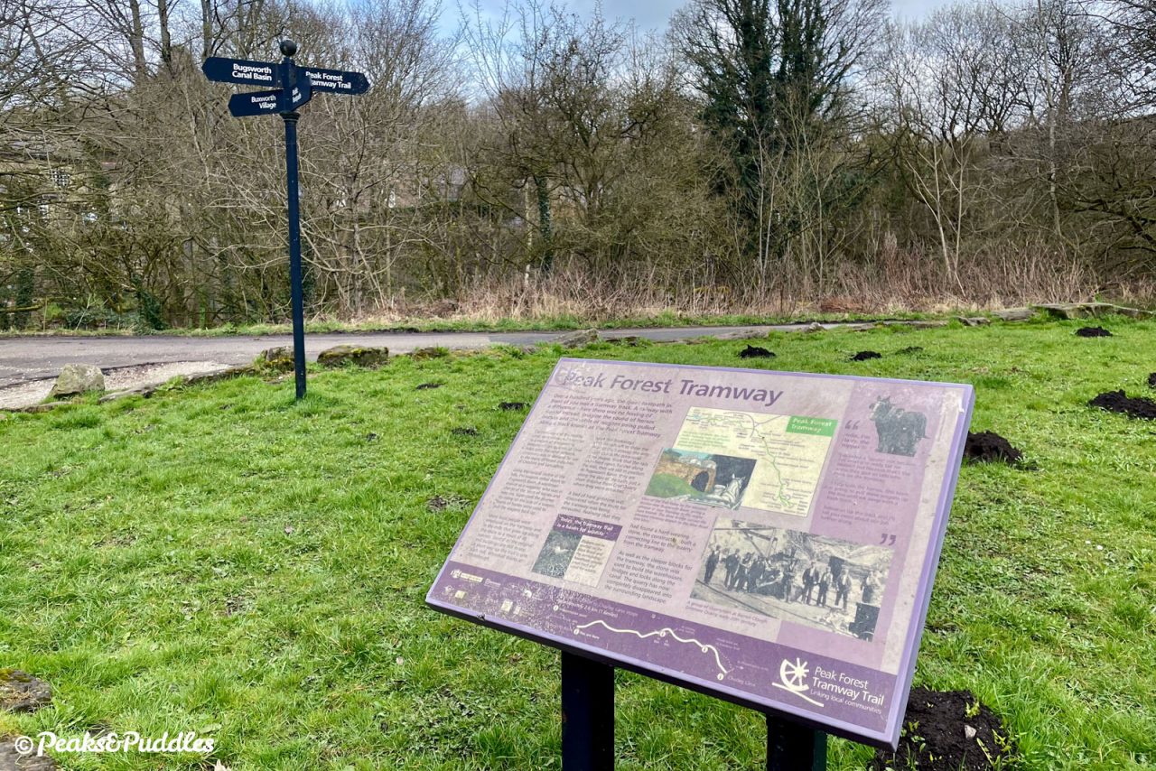
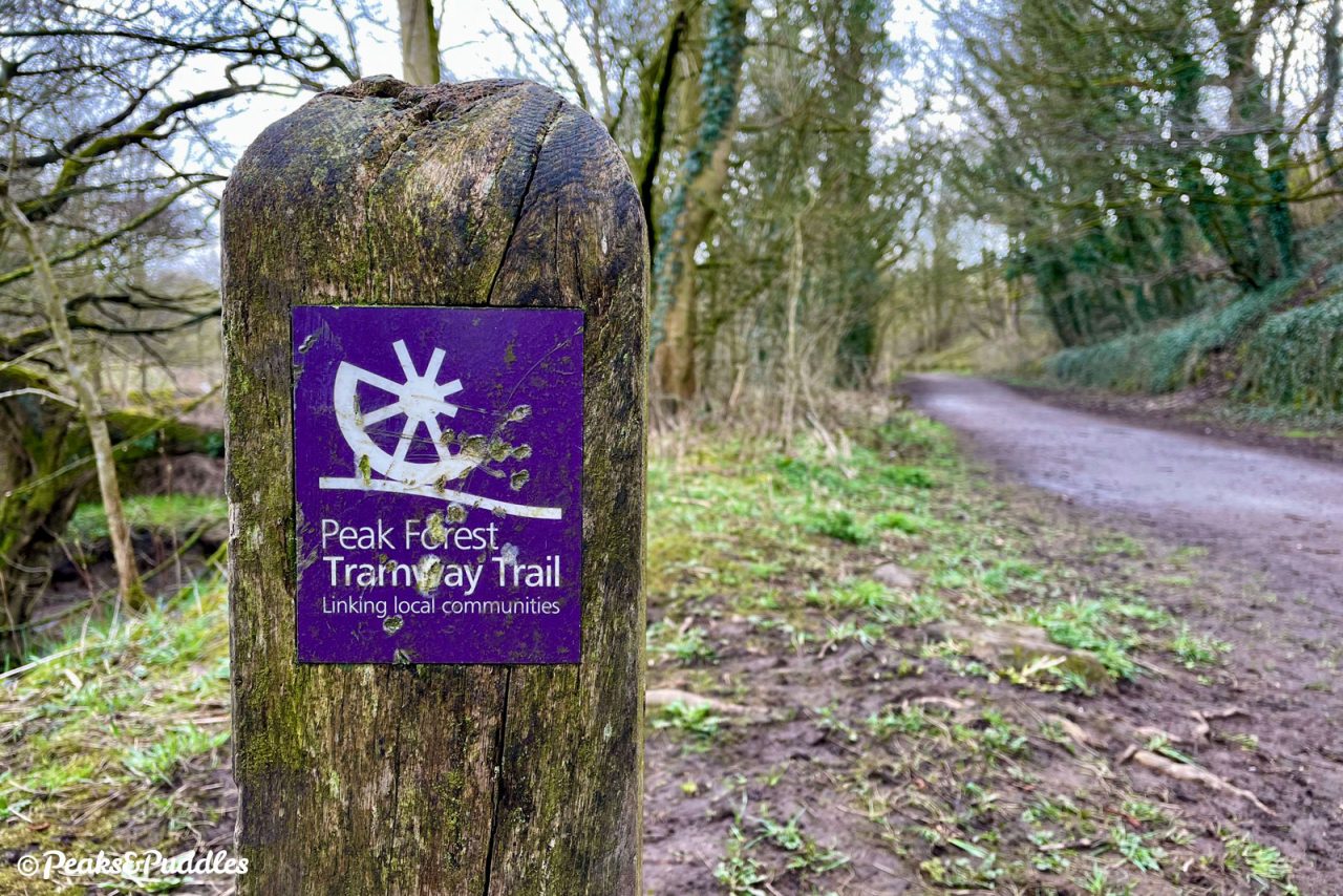
Though the trail remains registered as a footpath only, in the mid-2000s High Peak Borough Council and Derbyshire County Council secured funding and agreement to improve much of the surface, provide interpretation boards, install branded signposts and open it up permissively to cycling and horse-riding. It’s a great way to avoid the terrifying A6 Chapel Bypass which roars alongside but, though useful and intriguing in its own right, it still stops well short of its full potential.
Completing the trail along the full length of the original tramway would turn it into a crucial off-road link between the central High Peak, Buxton and the Peak District itself, avoiding the busiest roads (if not entirely the hills — the old Chapel incline would be quite a pull!). Even a modest extension to the edge of Chapel-en-le-Frith would plug that disconnected town into the network of cycling around the Upper Peak Forest Canal.
Both of these ideas are listed in Derbyshire’s future cycle network plans but so far down their list of priorities they’d take decades at the current rate of investment to achieve. When you consider the entire original tramway was built in the space of a few years, it’s not such a wild dream — it just needs a little Outram and Oldknow determination from us to keep pushing the council for it.
Route map
Where to begin
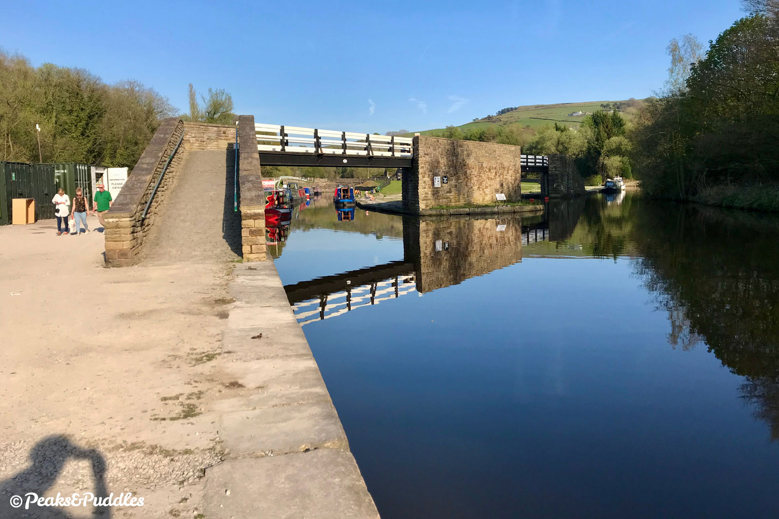
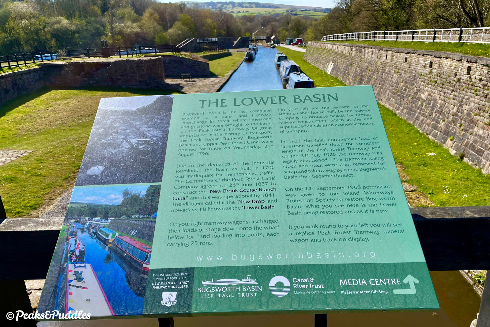
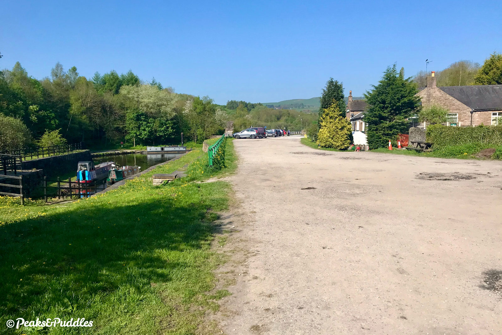
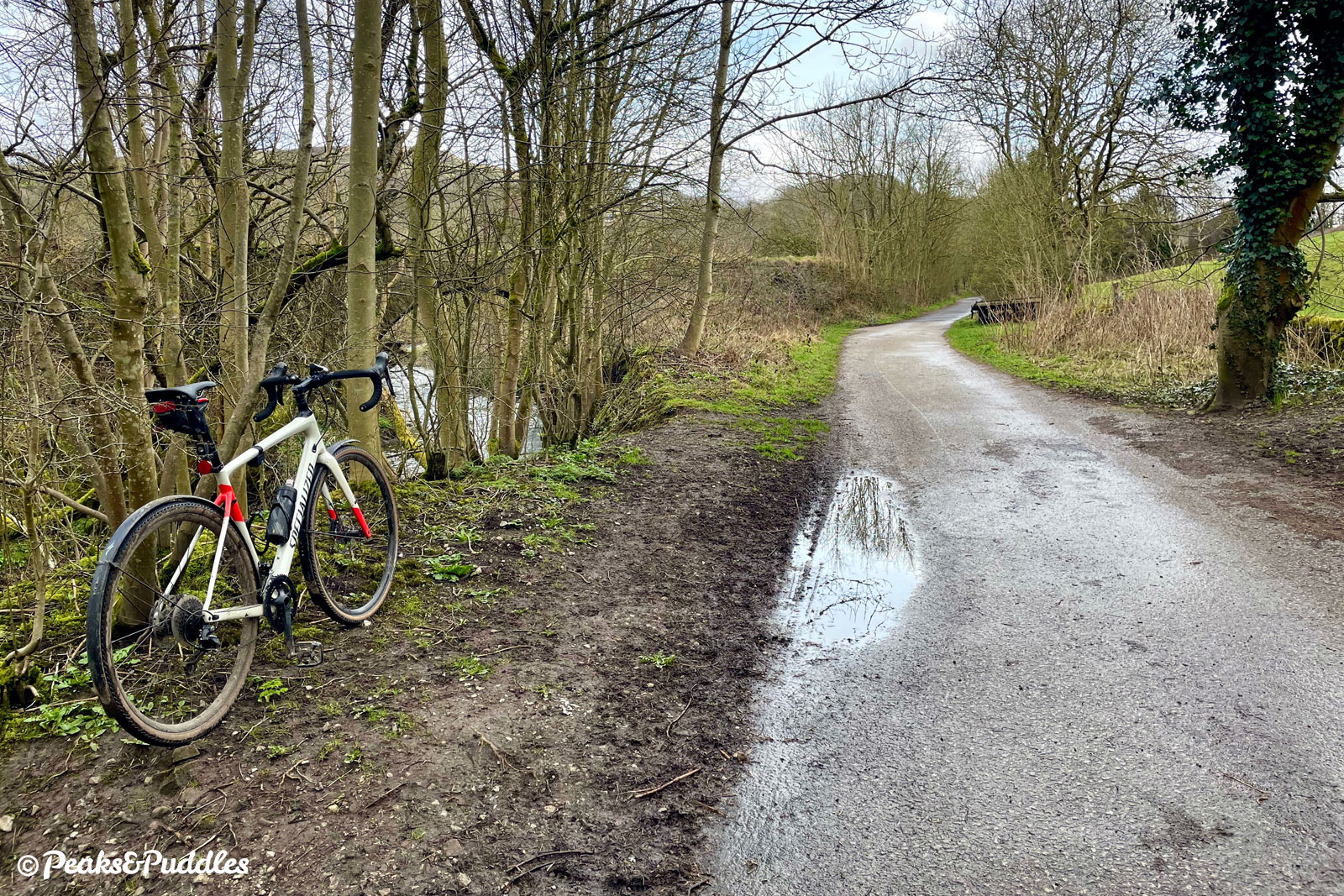
Bugsworth Basin at the end of the Upper Peak Forest Canal is the natural place to join this short trail, as you’ll enjoy the gentle climb up to Chinley before turning and coasting back to the start.
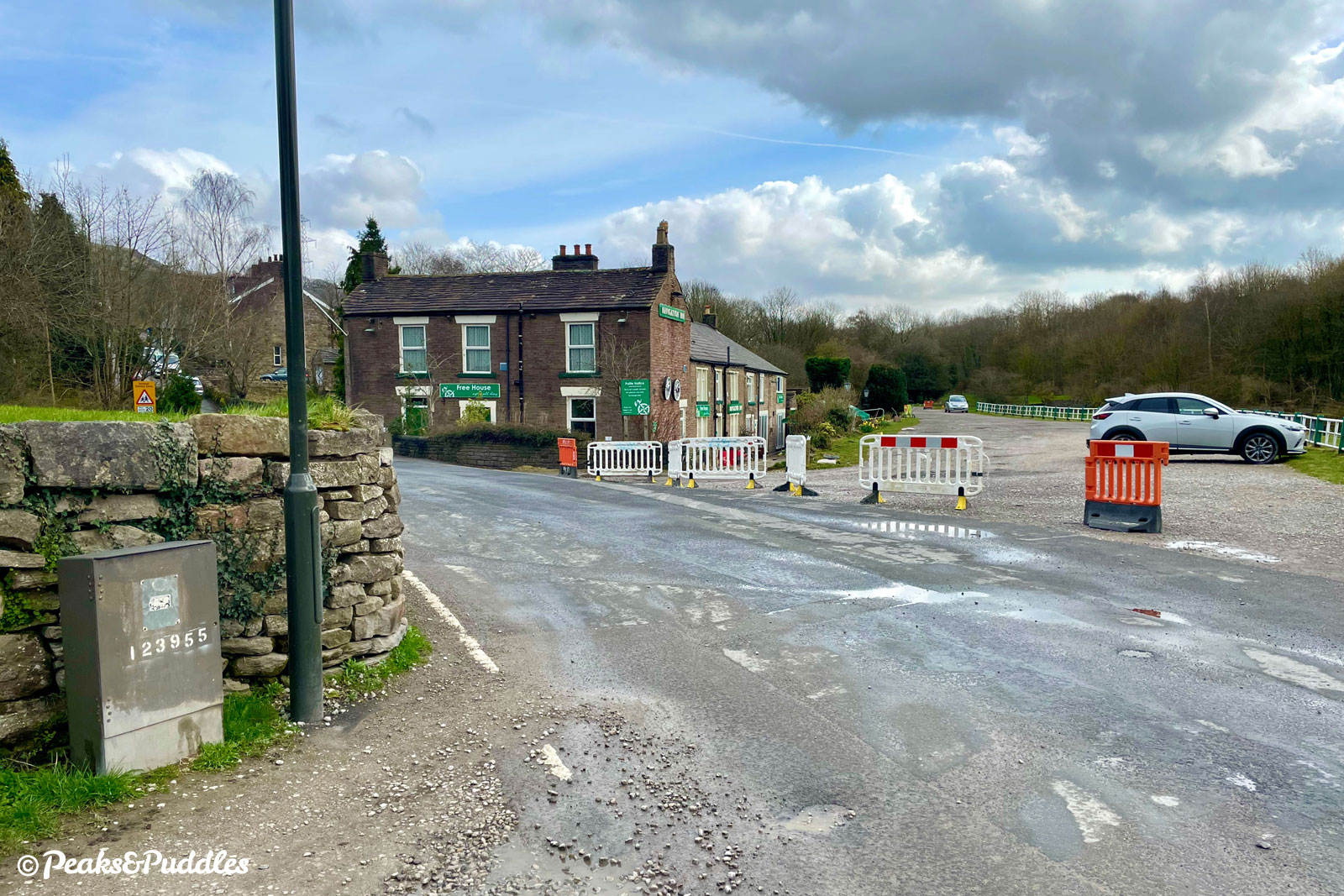
Rather than being transhipped from a narrowboat onto a rattling wagon, you can cycle on straight through from the end of the canal, past the Navigation Inn pub to join the trail, which is tarmac at first.
Note that if you’re coming from the Whaley Bridge branch of the canal, you’ll need to lift and carry your bike over a narrow bridge at the junction for Bugsworth Basin, or use steep cobbled ramps and a tunnel underneath, to access the towpath to the basin. Bings Road offers an alternative step-free, but very steep, route over Silk Hill to Buxworth.
By train: Chinley railway station on the Hope Valley line is near the top of the trail, although it has steep steps from its island platform and a fair hill between the station and this trail. Another option could be to simply cycle down the towpath from Furness Vale railway station on the Buxton line, which is practically next to and level with the canal (though there are steps to access to the towpath).
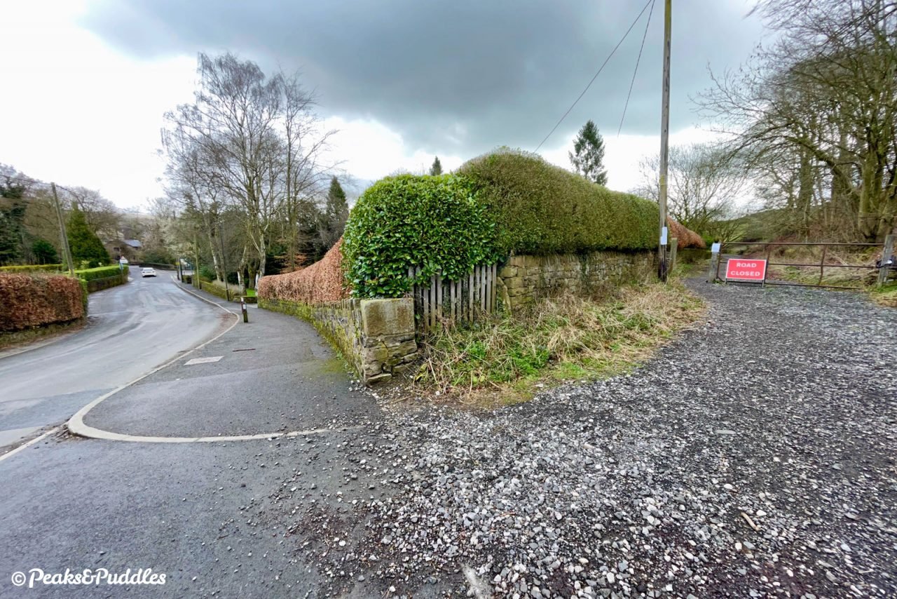
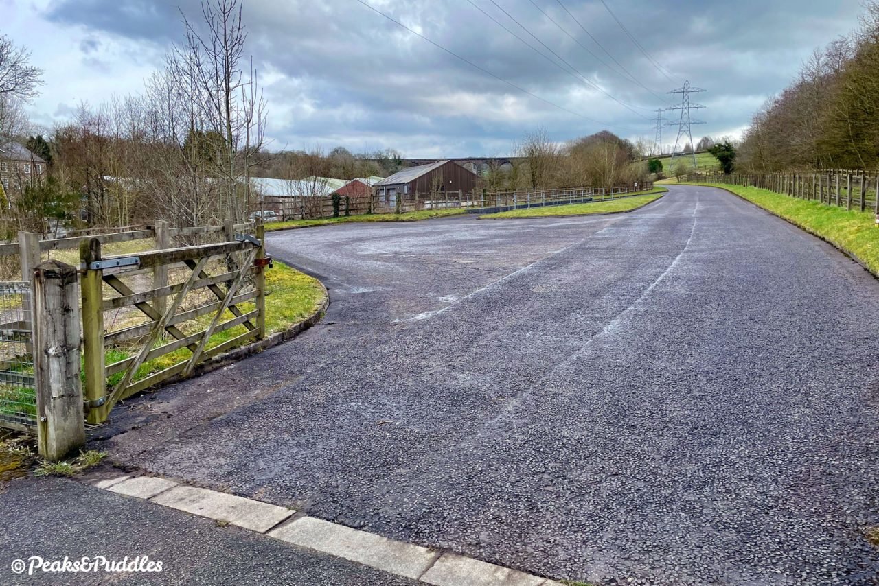
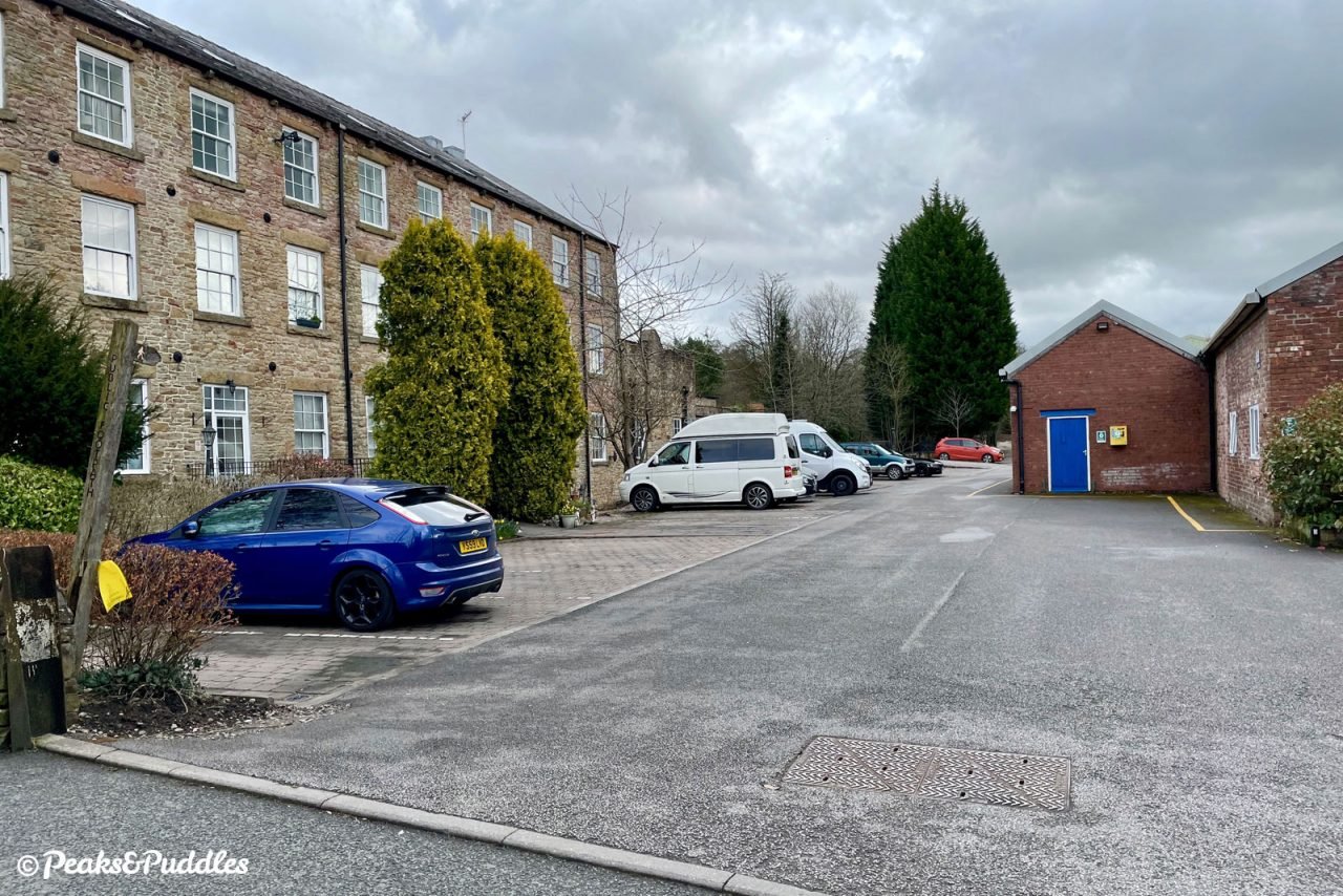
By car: Bugsworth Basin doesn’t have official car parking spaces, but there’s enough space to park along the stone access road above the canal basin, or along the side of Brookside, the road which runs through up and over the A6 Chapel bypass. Note that the parking in front of the Navigation Inn is for patrons only.
Things to note
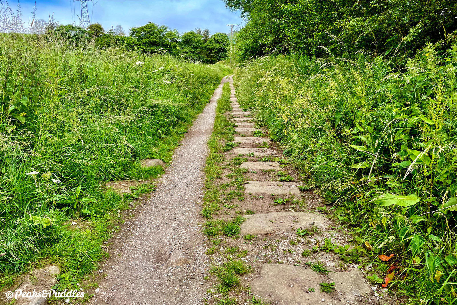
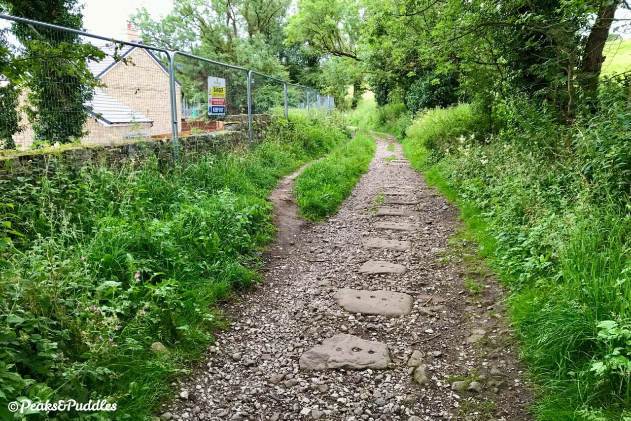
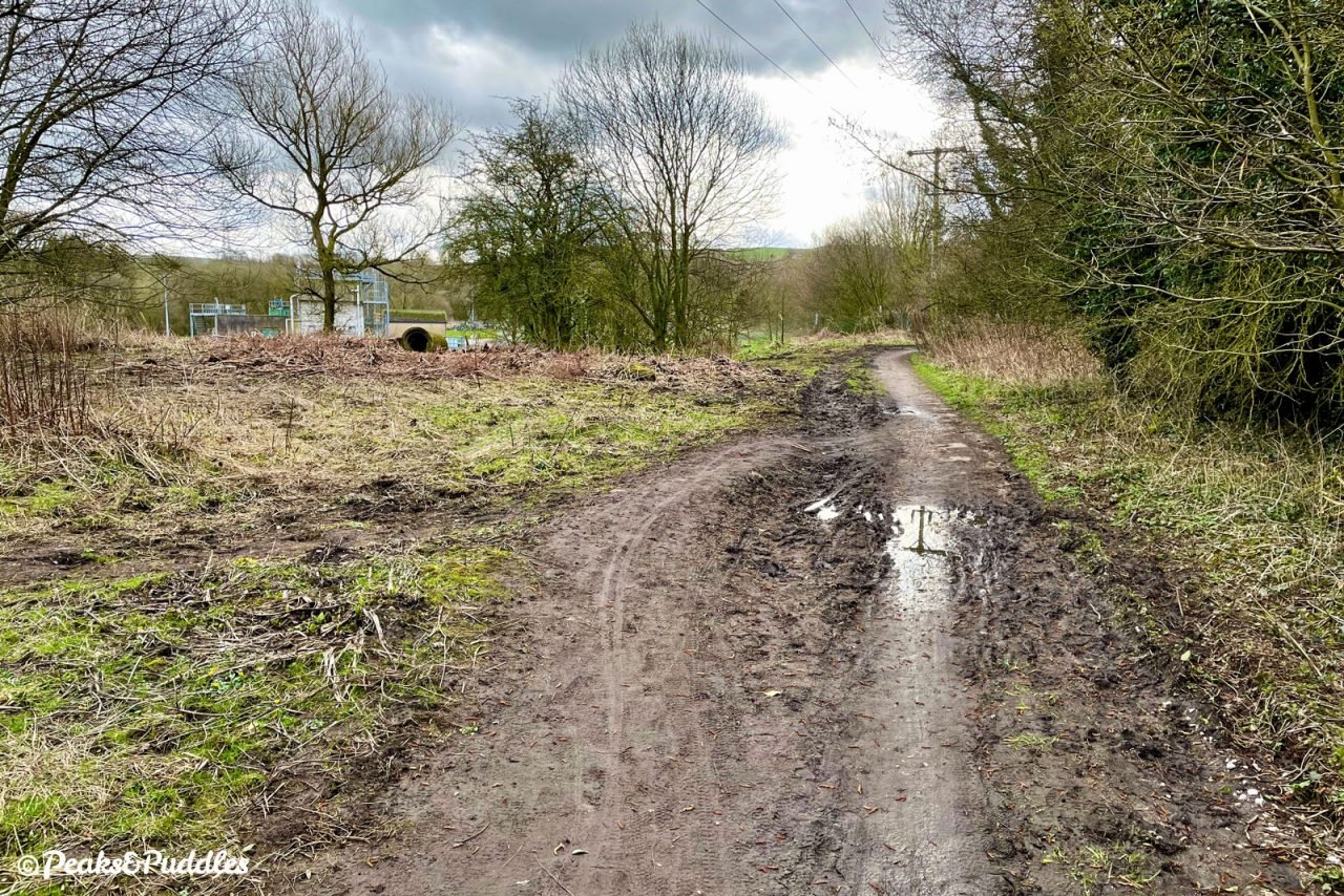
- The trail east of Whitehough Head Lane (just over a mile from Bugsworth) is basically unsurfaced, with loose and sometimes coarse stone, a few muddy puddles and most inconveniently of all, lots of giant stone sleeper blocks from the former tramway. Unless you’re on a mountain bike with suspension, it certainly gets very bumpy going and you’d probably want to turn back before here, making this a very short out-and-back.
- For its first few hundred metres, the trail is tarmac and shared as an access lane to properties meaning cars may occasionally be encountered.
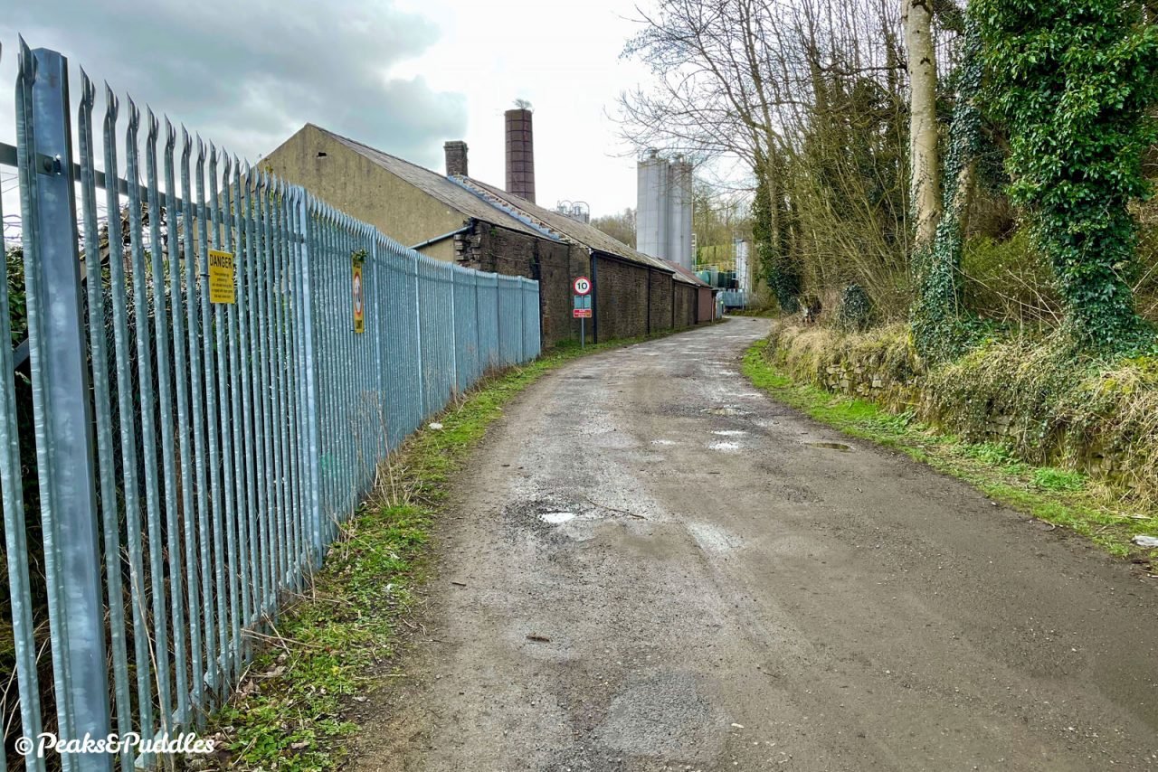
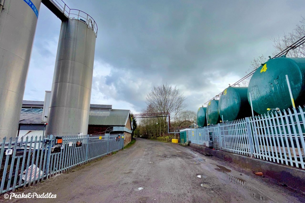
- Further along near Stephanie Works, the trail passes through an access and loading space for a large industrial works, with forklifts and wagons. Luckily the space is more than wide enough that these aren’t really a problem — watch instead for the very harsh speed bumps.
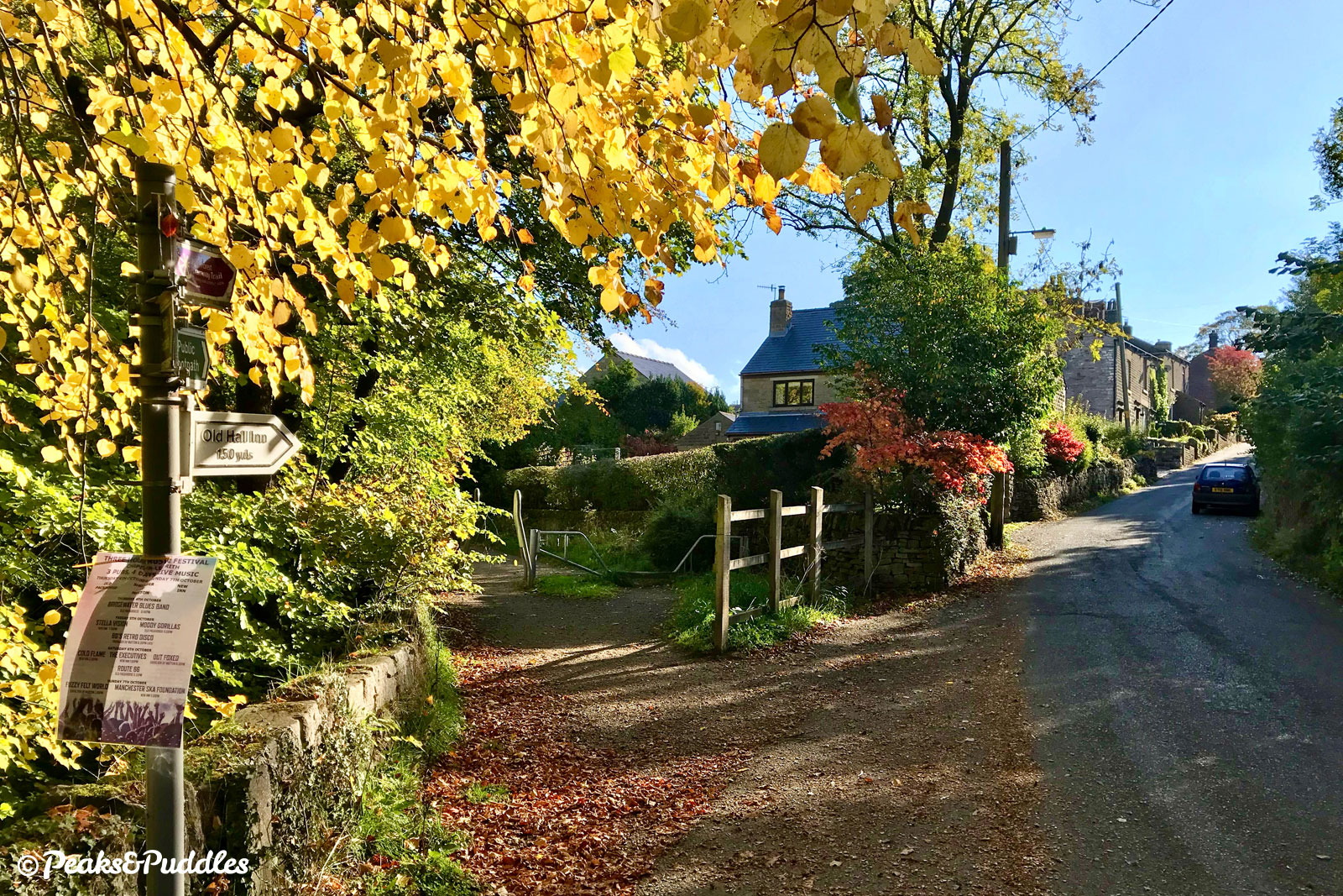
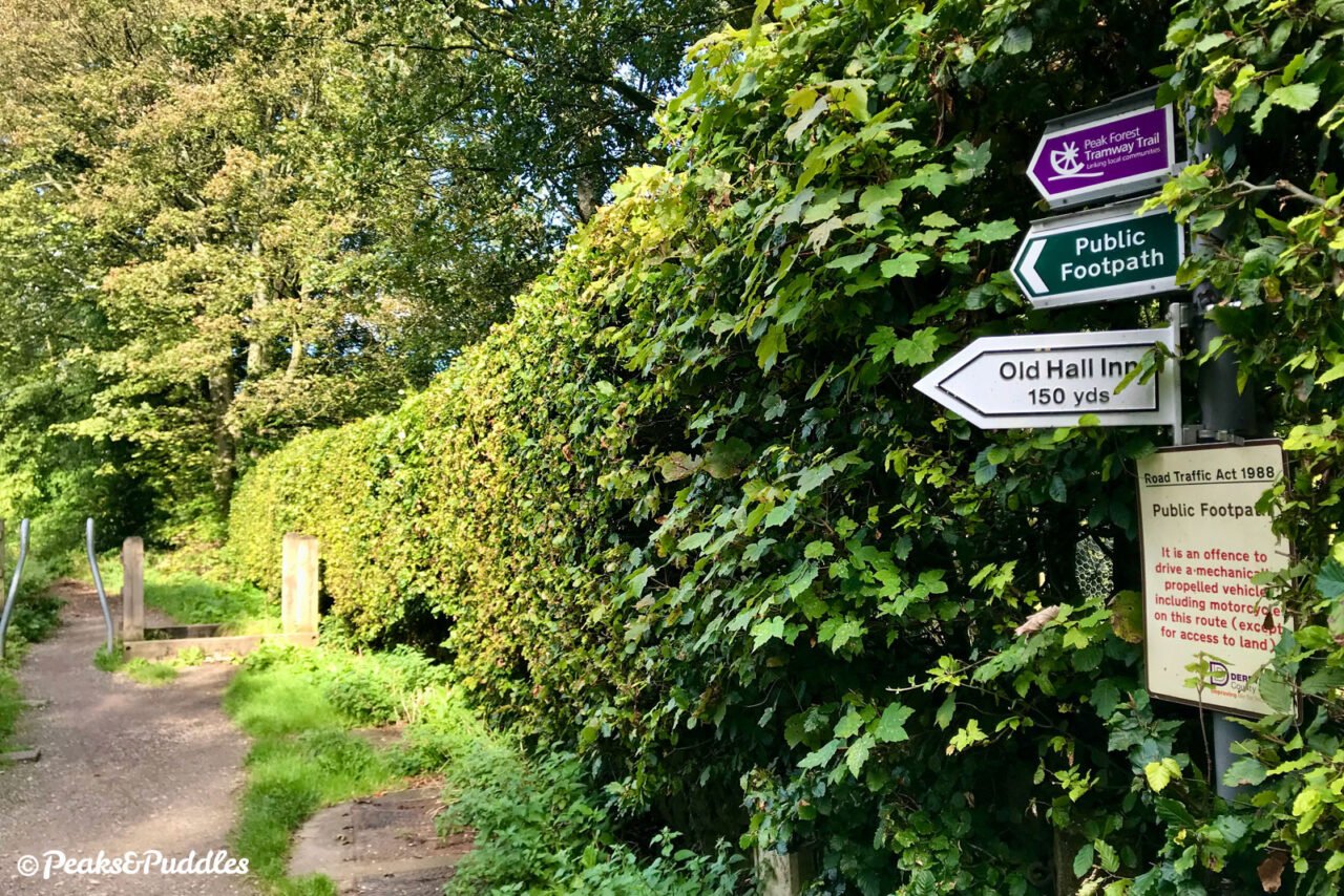
- At Whitehough, the trail crosses two roads which are very quiet but can still be tricky to cross, with poor visibility and some drivers choosing to speed downhill. At the first, turn right uphill for the beautiful, historic Old Hall Inn pub with a large garden seating area. At the second, turn left to climb sharply uphill into Chinley, for a couple of cafés, shops and the railway station.
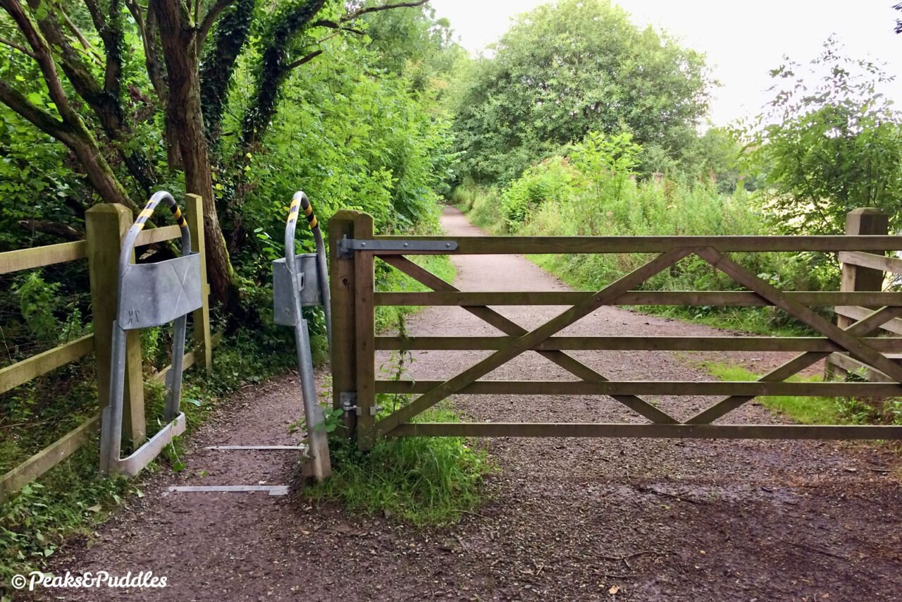
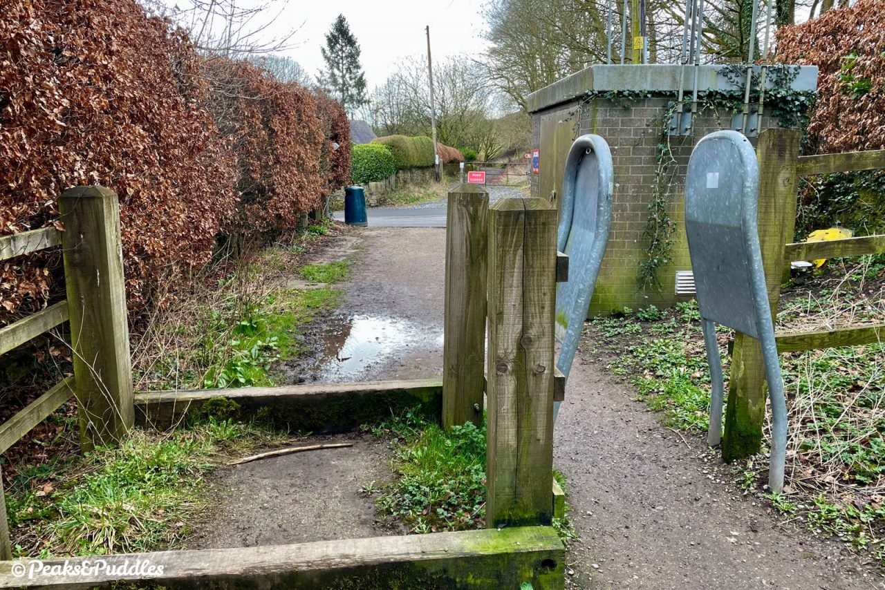
- Either side of these road crossings, and at one point entering Stephanie Works, there are narrow metal A-frame style access barriers — three in total on the trail. In early 2023, Derbyshire County Council promised to look at removing these, in line with Equality Act 2010 legislation.
Route stage-by-stage
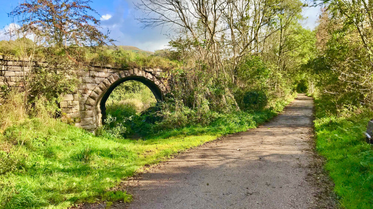
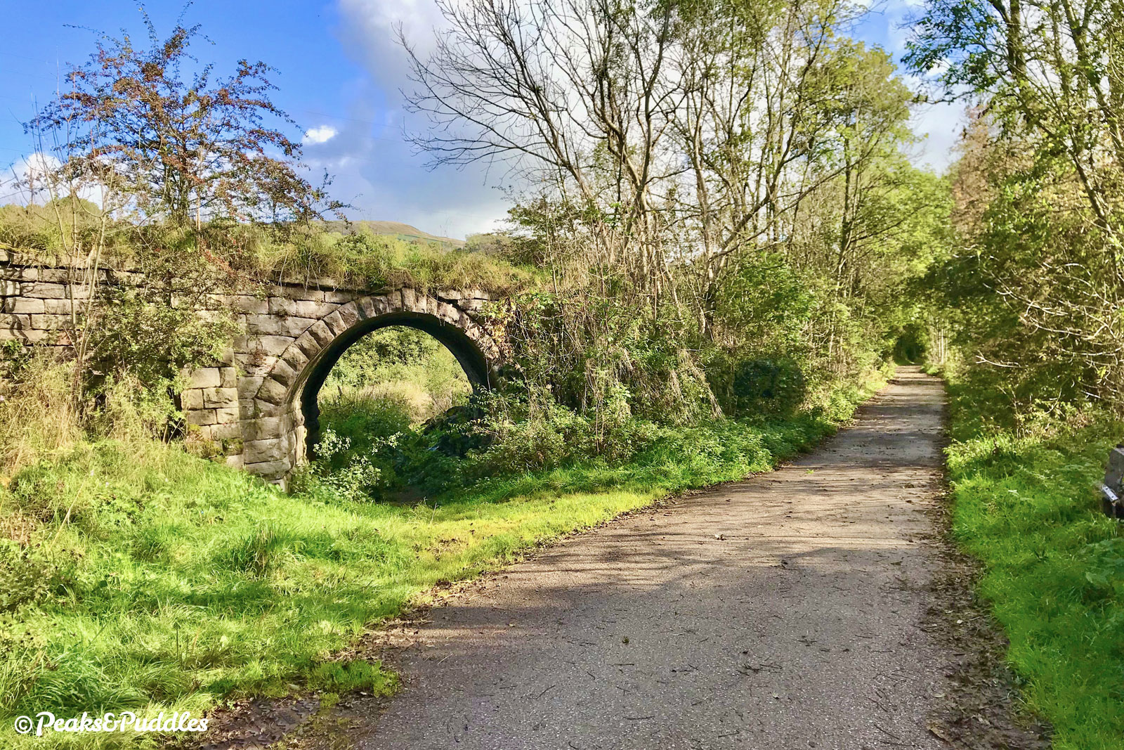
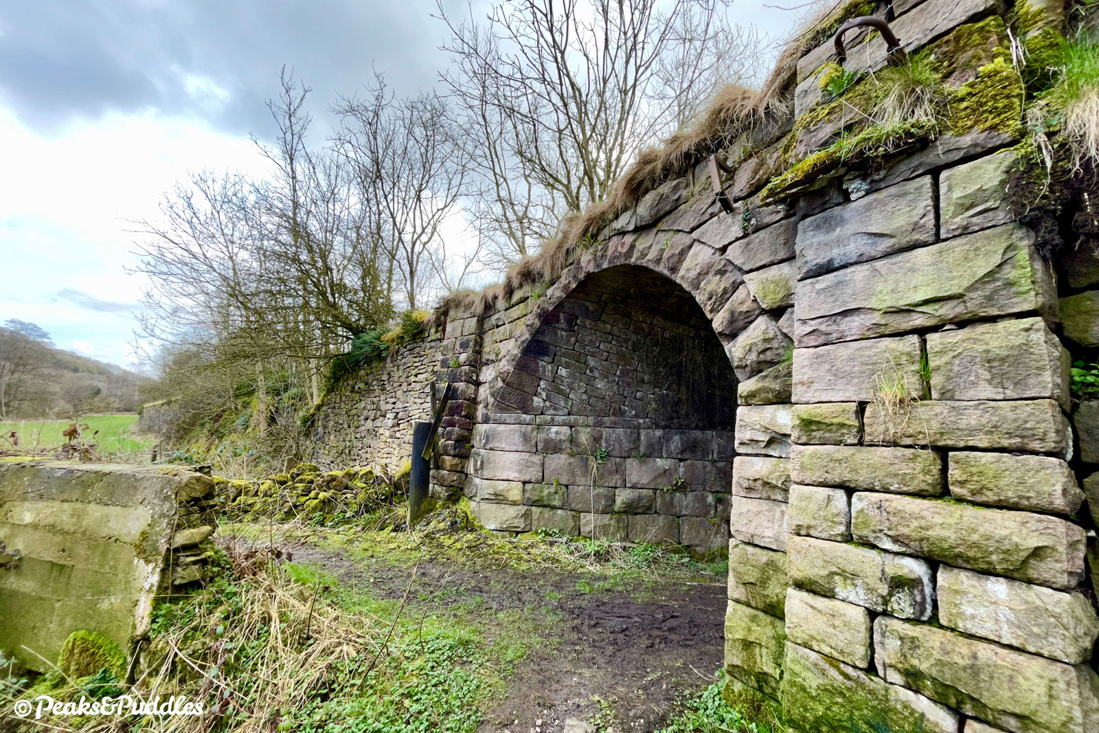
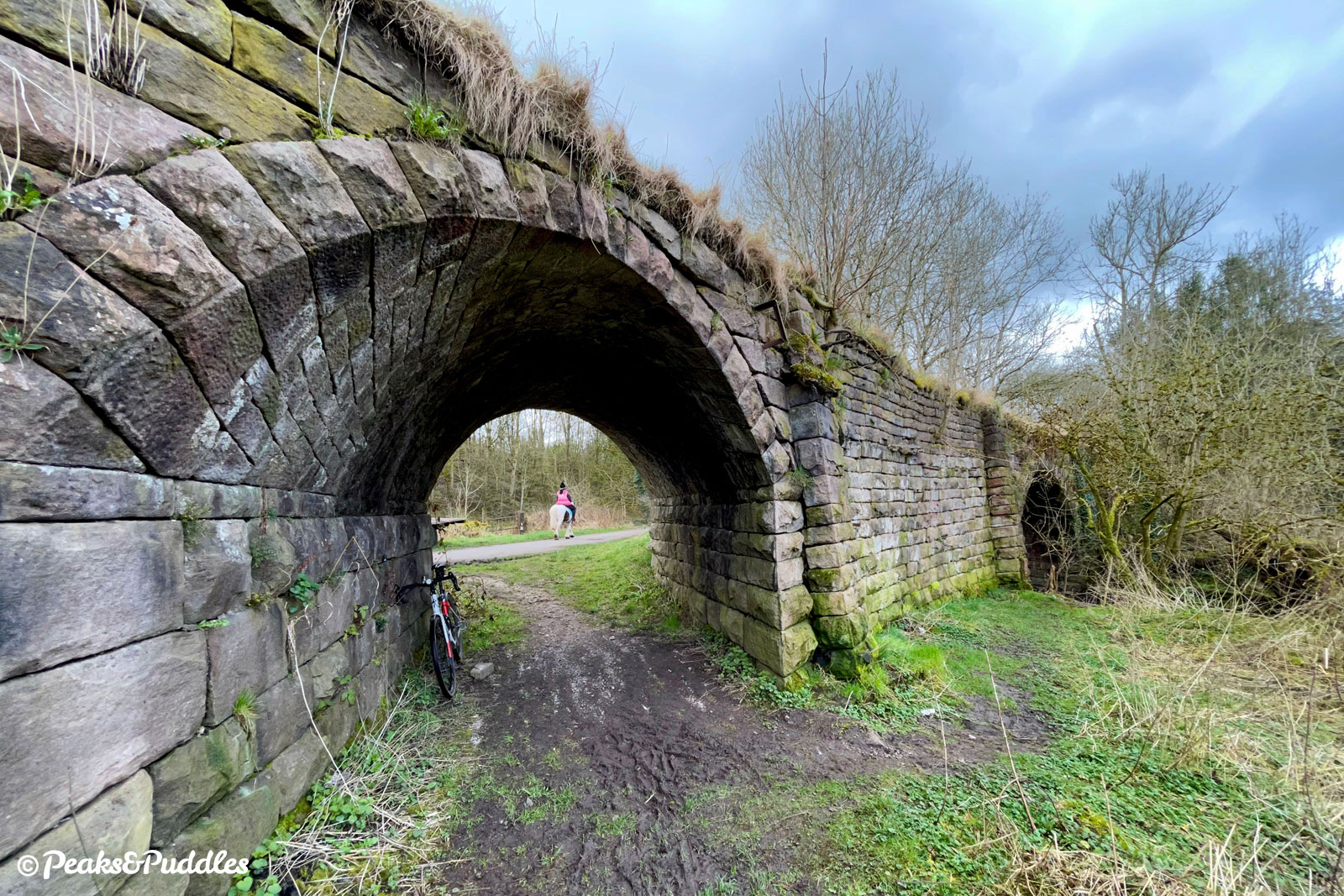
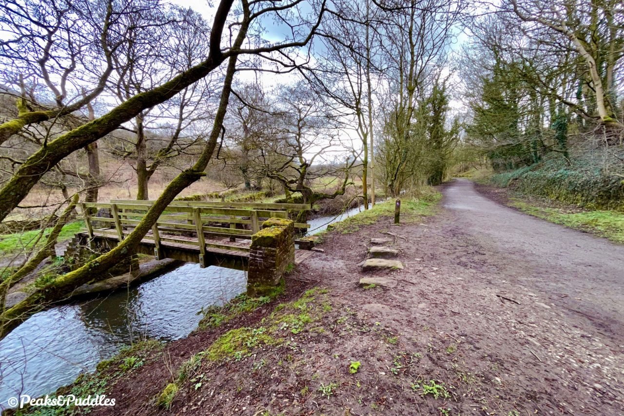
- From the Navigation Inn at Bugsworth Basin, where a labyrinth of stone tramway sleepers still surrounds each wharf, cross the stone parking area in front of the pub with the end of the canal basin on your right. The path narrows and veers left to join a tarmac lane. Turn right onto this and you’re now on the main route of the old Peak Forest Tramway, with its gentle but steady gradient immediately noticeable. Almost straightaway, one of its key structures appears on the left. This perilously intact stone over-bridge carried a branch of the tramway over to lime kilns back near the basin itself, but on the other side of the brook below St James’ Church.
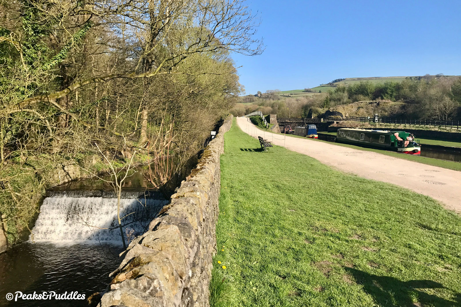
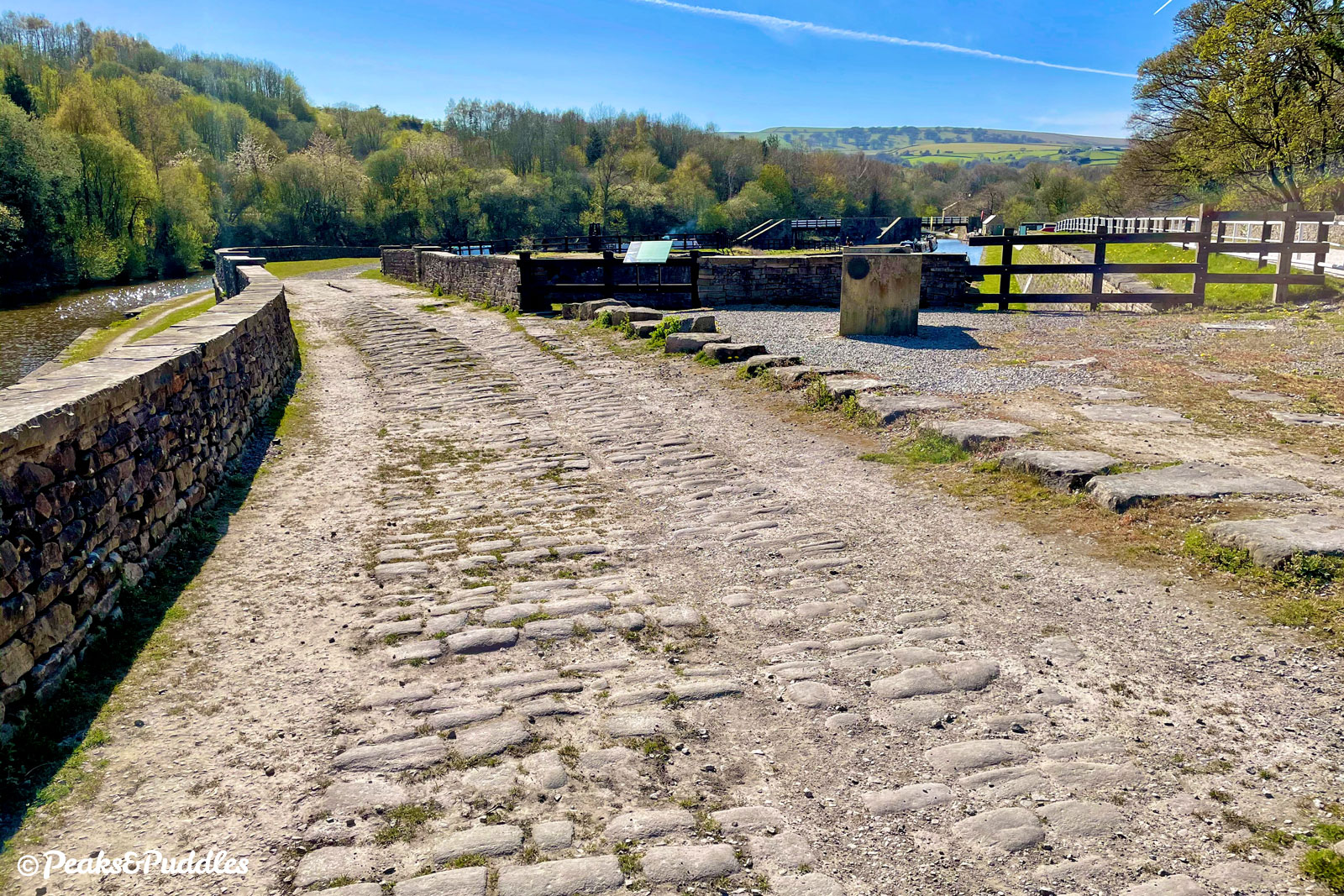
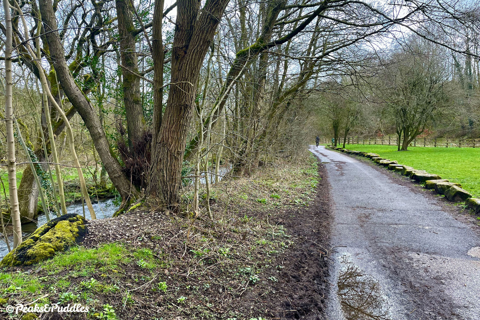

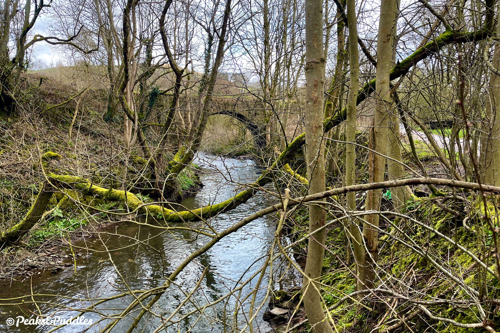
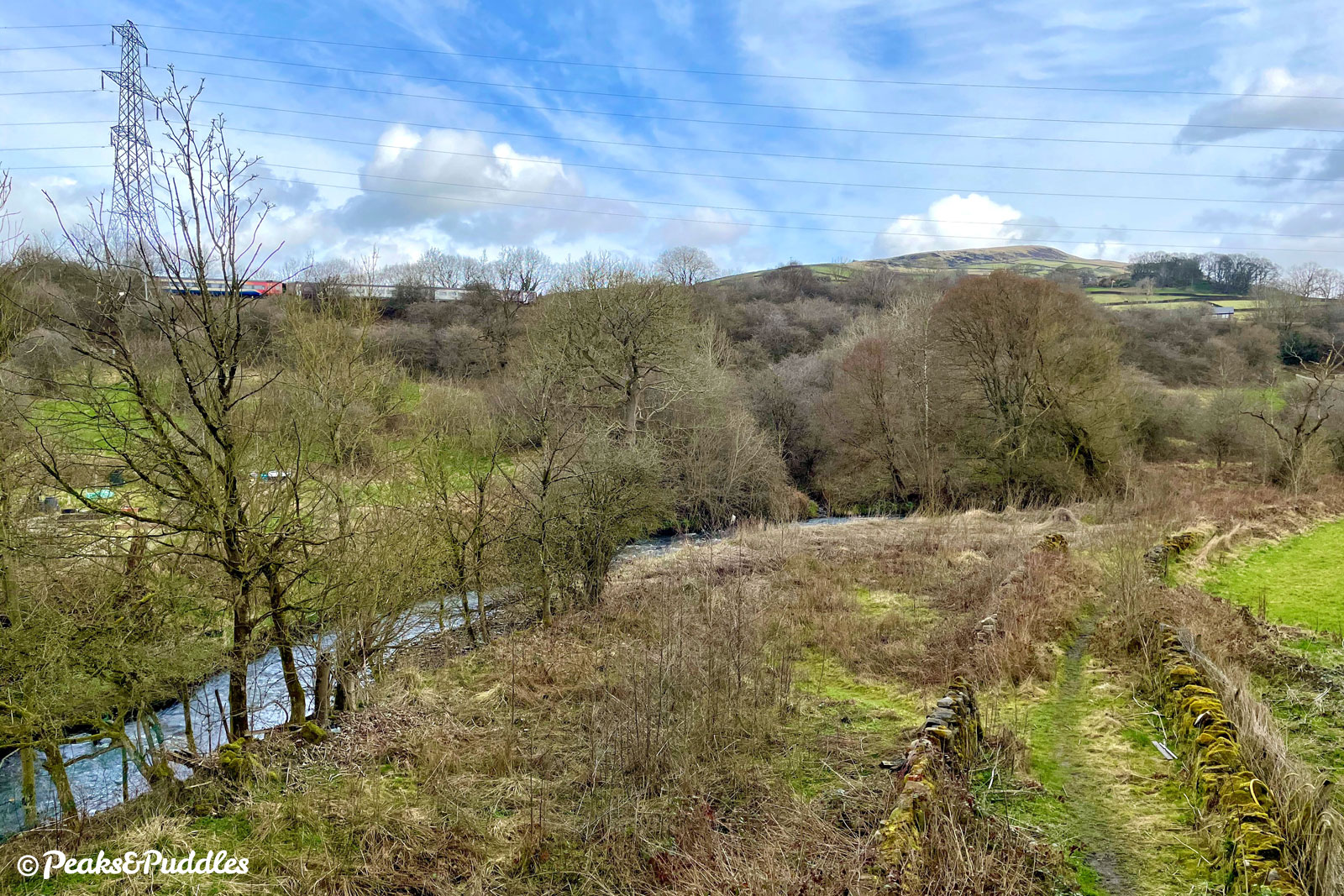

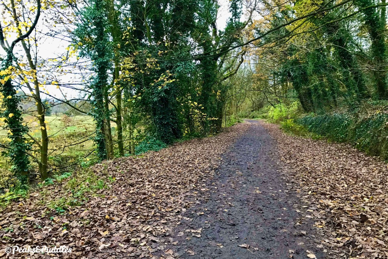
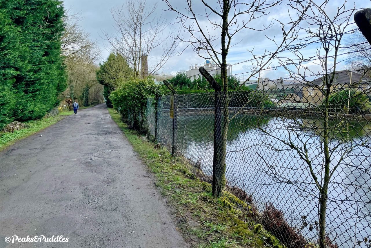
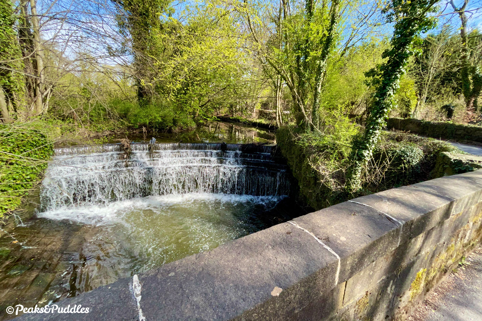
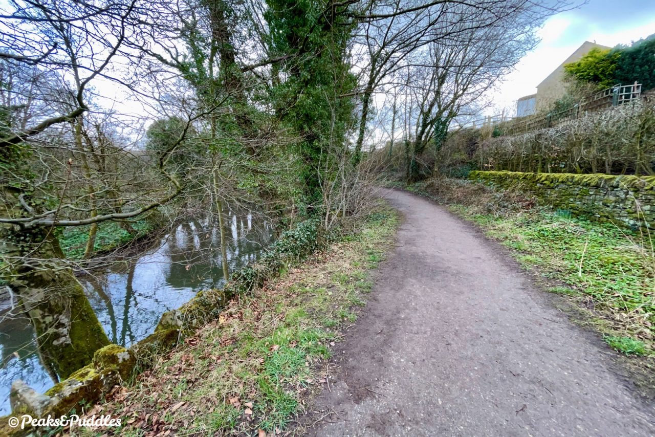
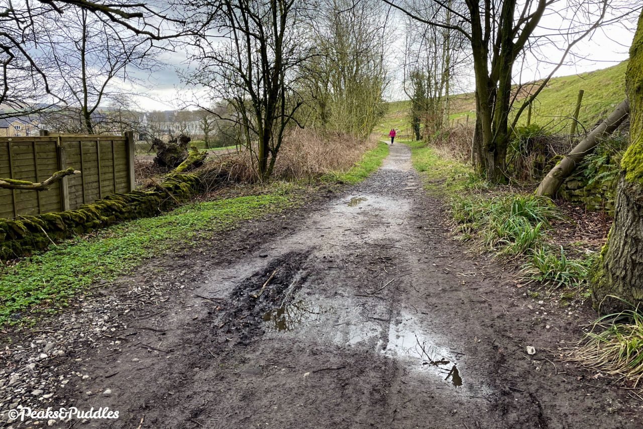
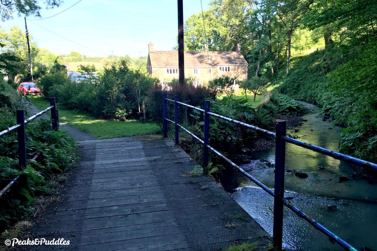
- After passing a few houses on the right, the trail turns to compacted stone but fairly wide and usually dry. Yet another line branched to the right here, bringing stone from the small Crist Quarries which were also served by two further lines (one involving a long tunnel) from the top of the basin. A footbridge over Black Brook and fields to the left make for a picturesque spot as the craggy mass of Chinley Churn looms dramatically into view. Continuing along the heavily wooded path, the sound of water is met by the roar of traffic on the A6 Chapel bypass, now coming close in to the right.
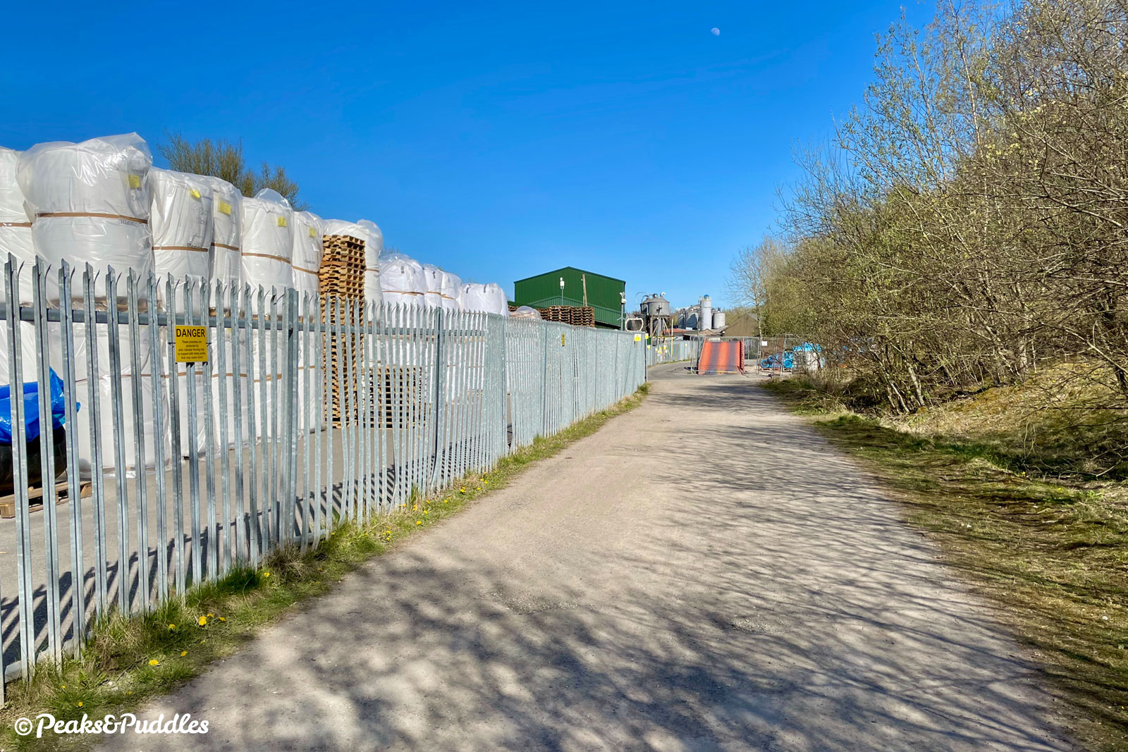
- A metal a-frame style barrier marks the entry into Whitehall or Stephanie Works, a faintly dystopian landscape of industrial works where the rural trail suddenly becomes bizarrely surrounded by plastic barrels, forklift trucks and hissing machinery. The heavily potholed track here has now been resurfaced, but with five uncomfortable bumps to slow the occasional HGV traffic accessing the works. Around a bend, it emerges at the millpond of the former paper mill and one of two roads leading up to Whitehough.
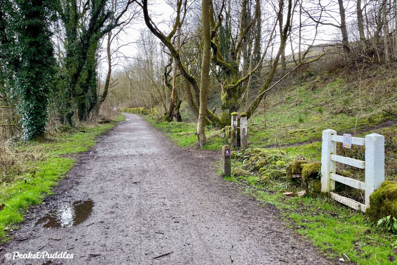
- Cross this fairly quiet unnamed road — being careful not to be distracted by the old stone tramway sleepers embedded in the tarmac — and all too soon you’re already in what may as well be the final gallop of the trail. After it curves gently around beside the brook, you’re again shunted through a metal barrier onto Whitehough Head Lane. Turning left here takes you up steeply but briefly to the village of Chinley. While there is more trail to explore, the surface beyond here sadly hasn’t yet been given the same treatment and unless you’re riding a mountain or gravel bike with an appetite for bumps, you might want to just turn back.
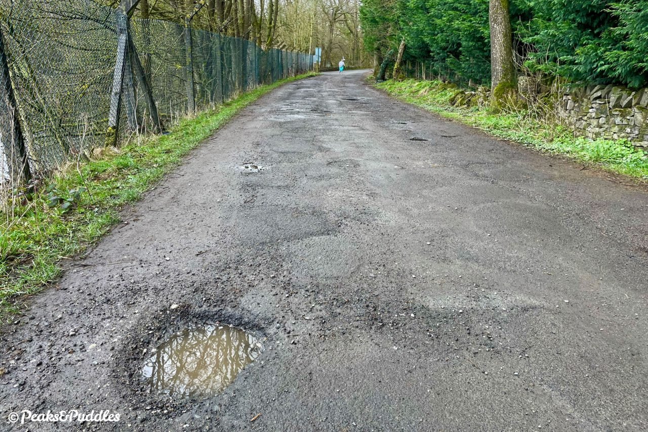
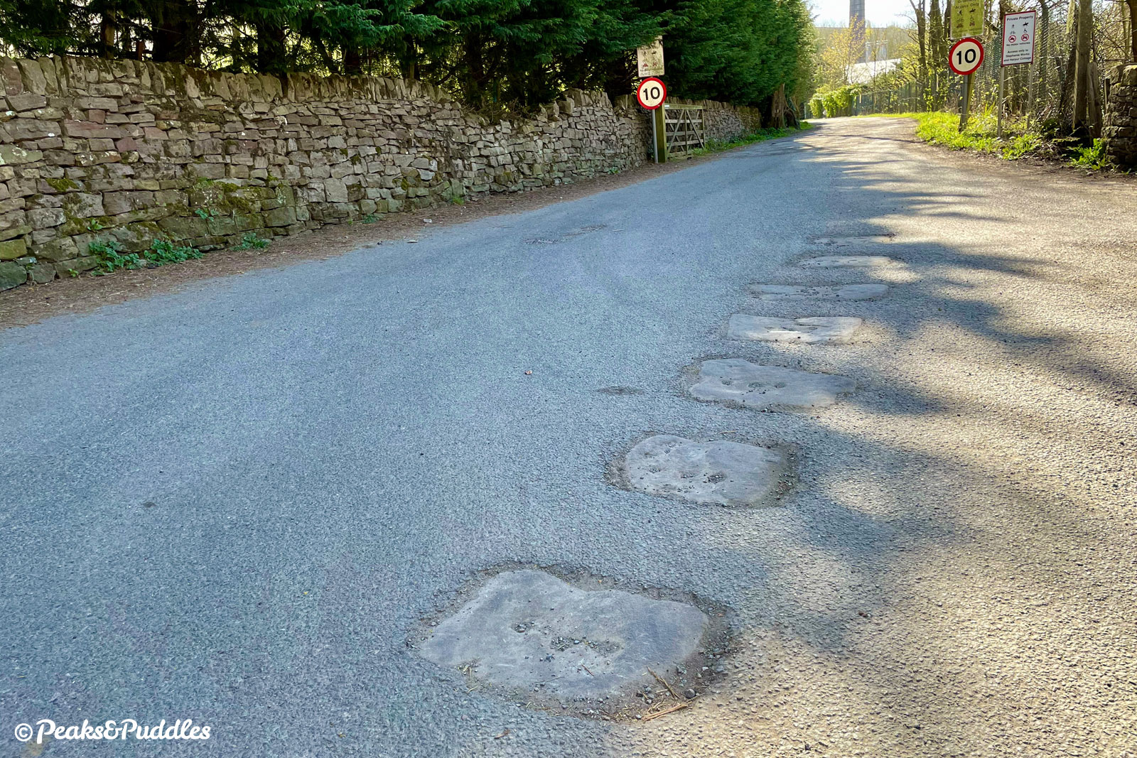
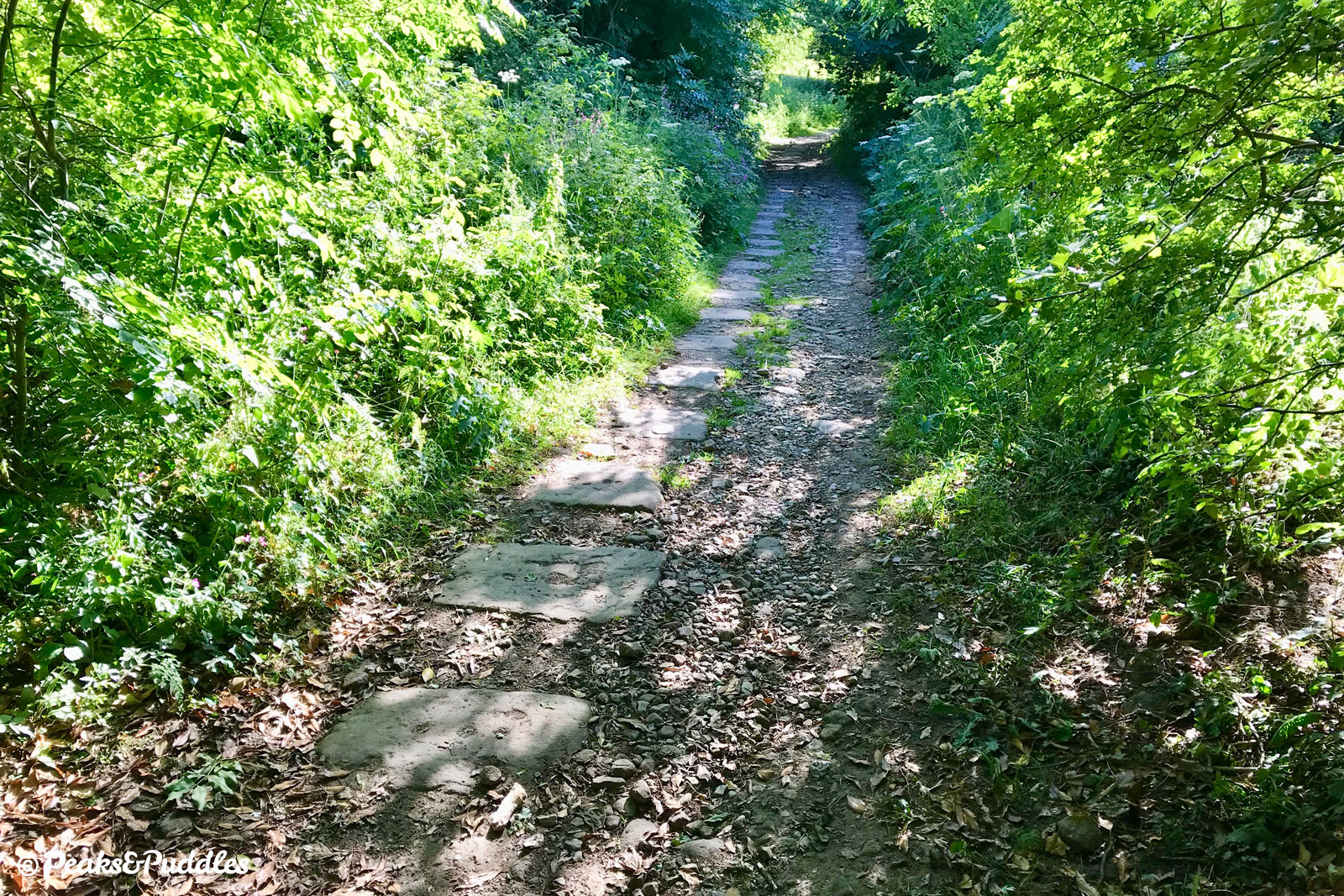
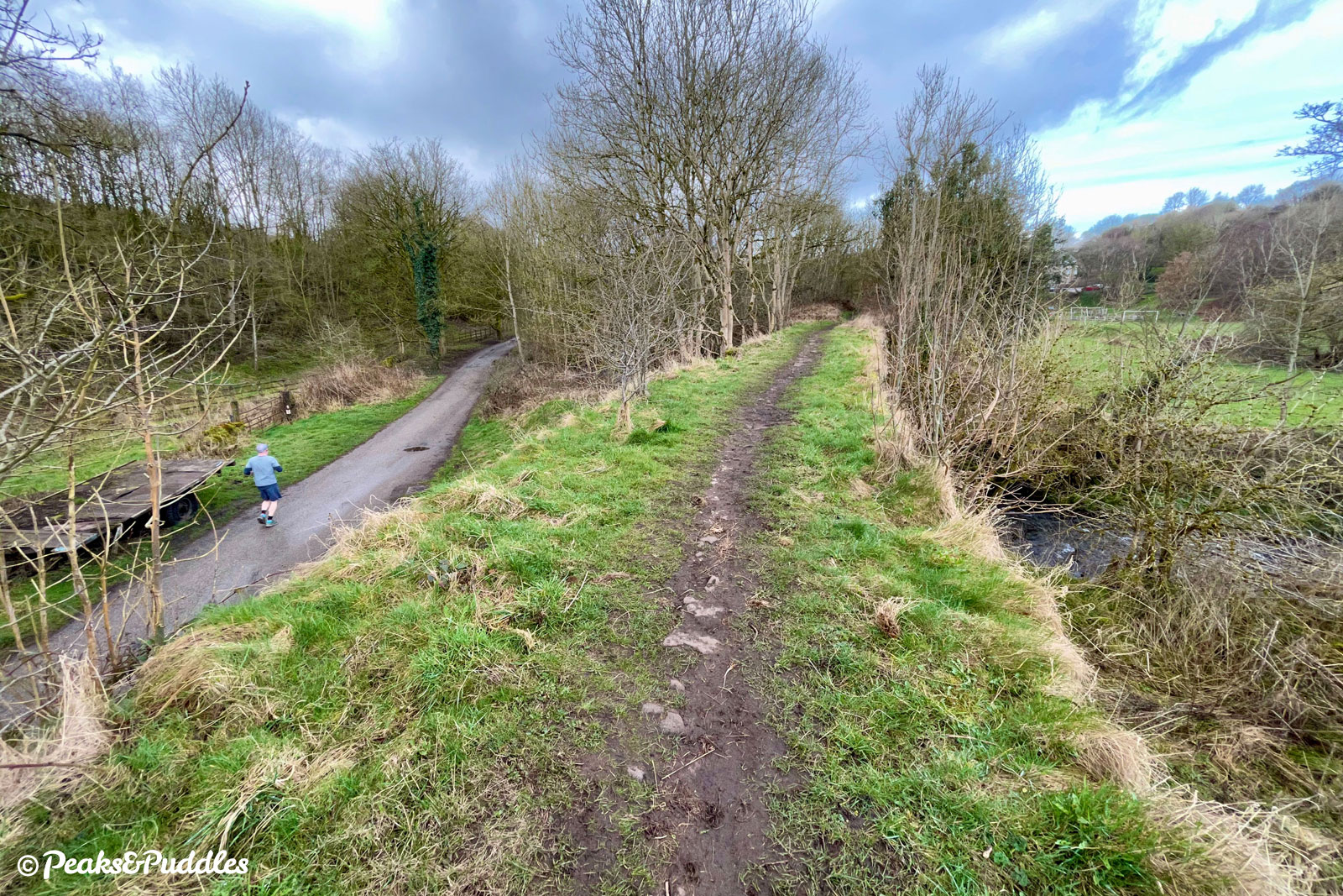
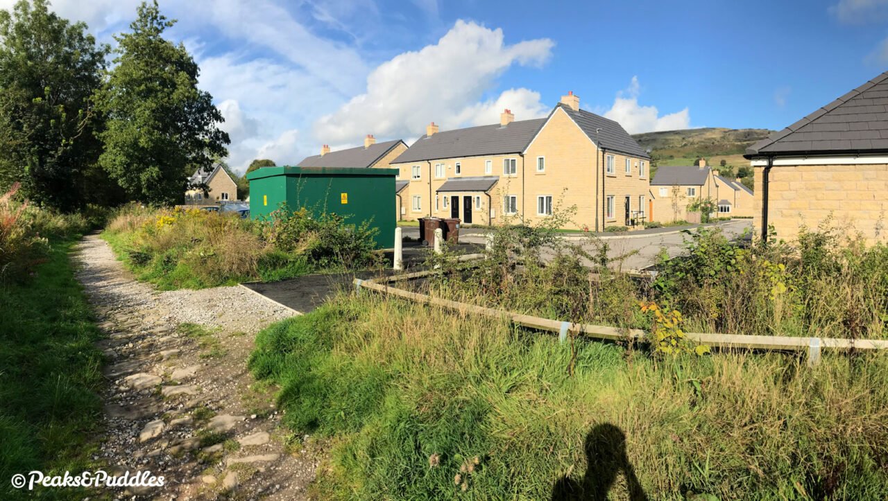
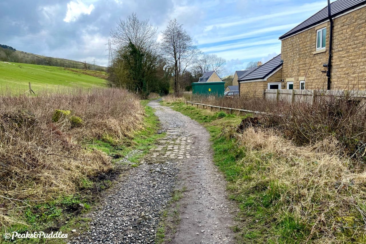
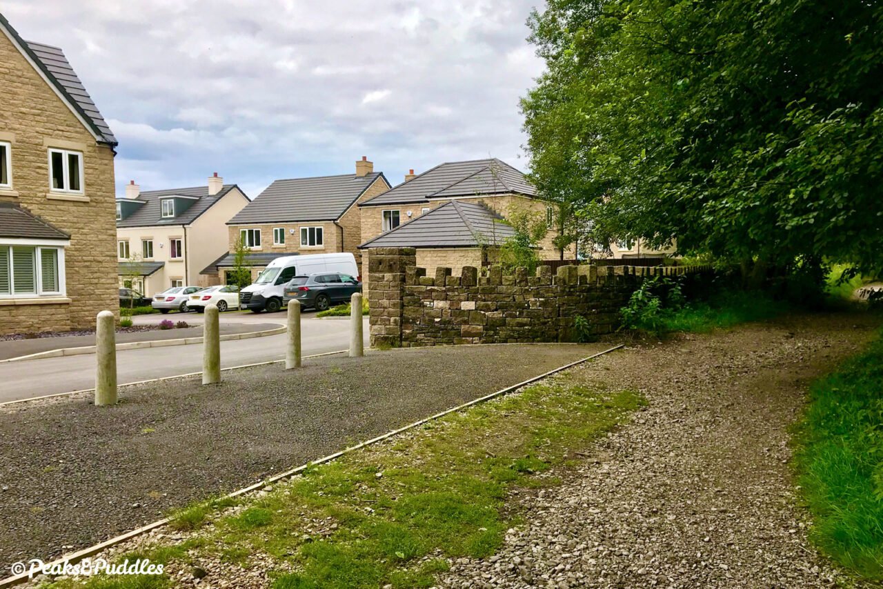
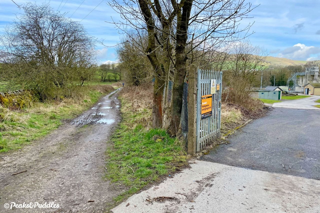
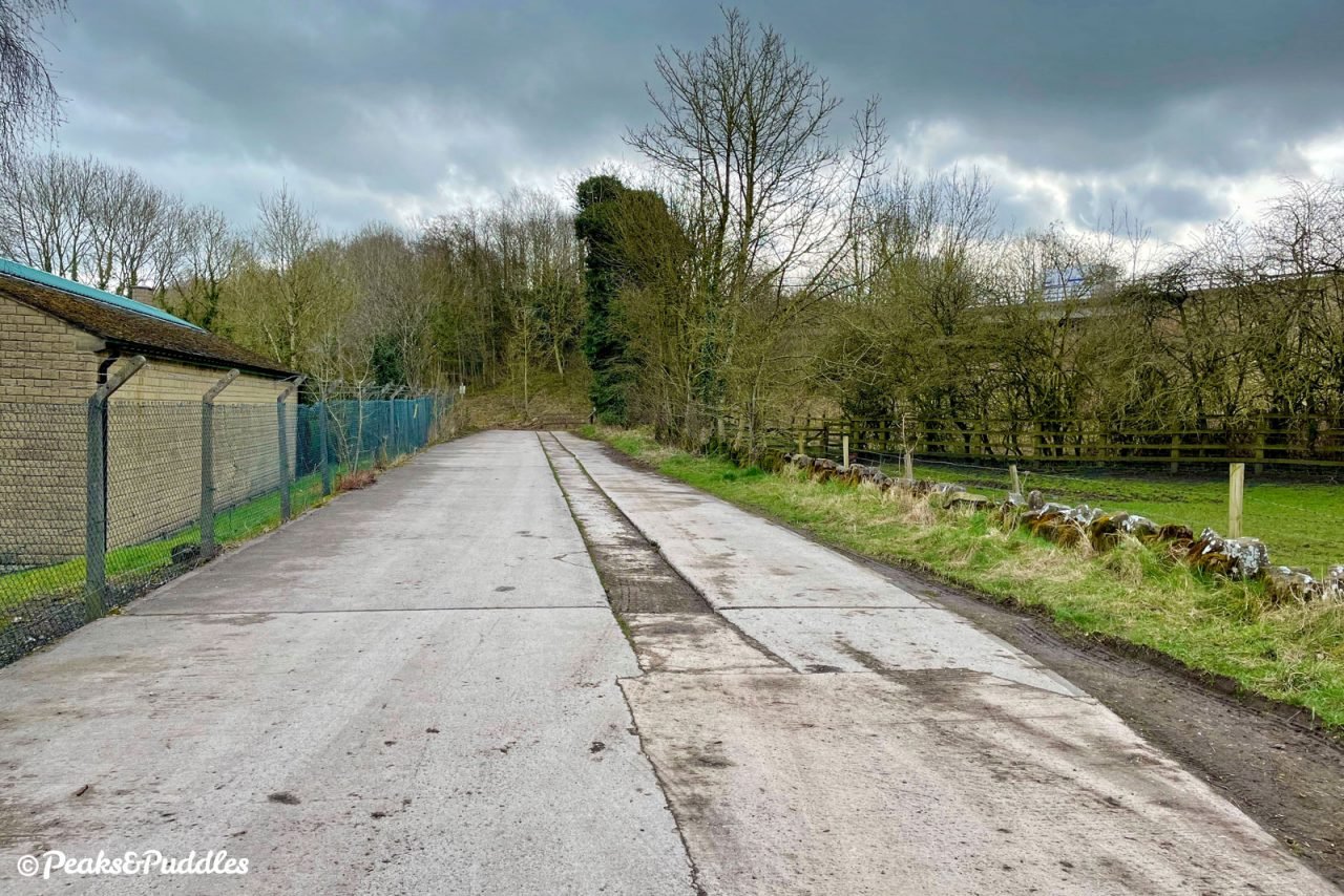
- Immediately on coarser, looser stone, with more chance of puddles, you pass alongside a couple of houses before emerging alongside a huge development of well over a hundred new properties, occupying the site of the former Forge Mill. This new Forge Manor estate has good access onto the trail, but as you continue the surface deteriorates again and the old stone sleeper blocks of the rail plates are poking well above the surface. The joy of seeing such industrial history still intact may not last long, as vegetation then narrows the route, forcing you to bump and bounce painfully over the endless slabs or attempt to find routes around them. After passing a less-than-pretty water treatment works to the left, the trail breaths a sigh of relief onto smooth tarmac as it ends, for cyclists at least, at Charley Lane.
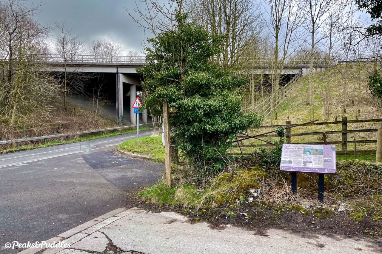
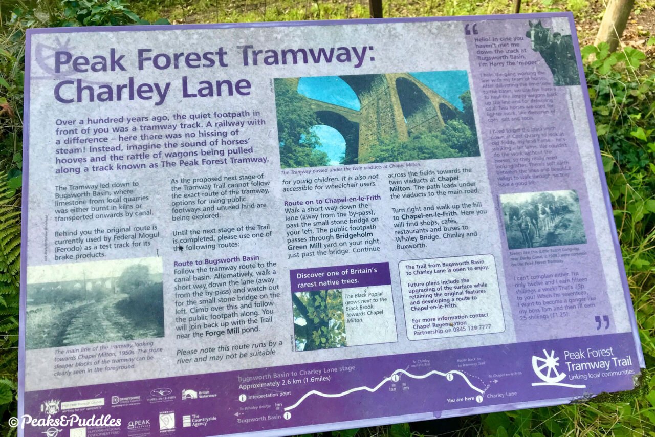
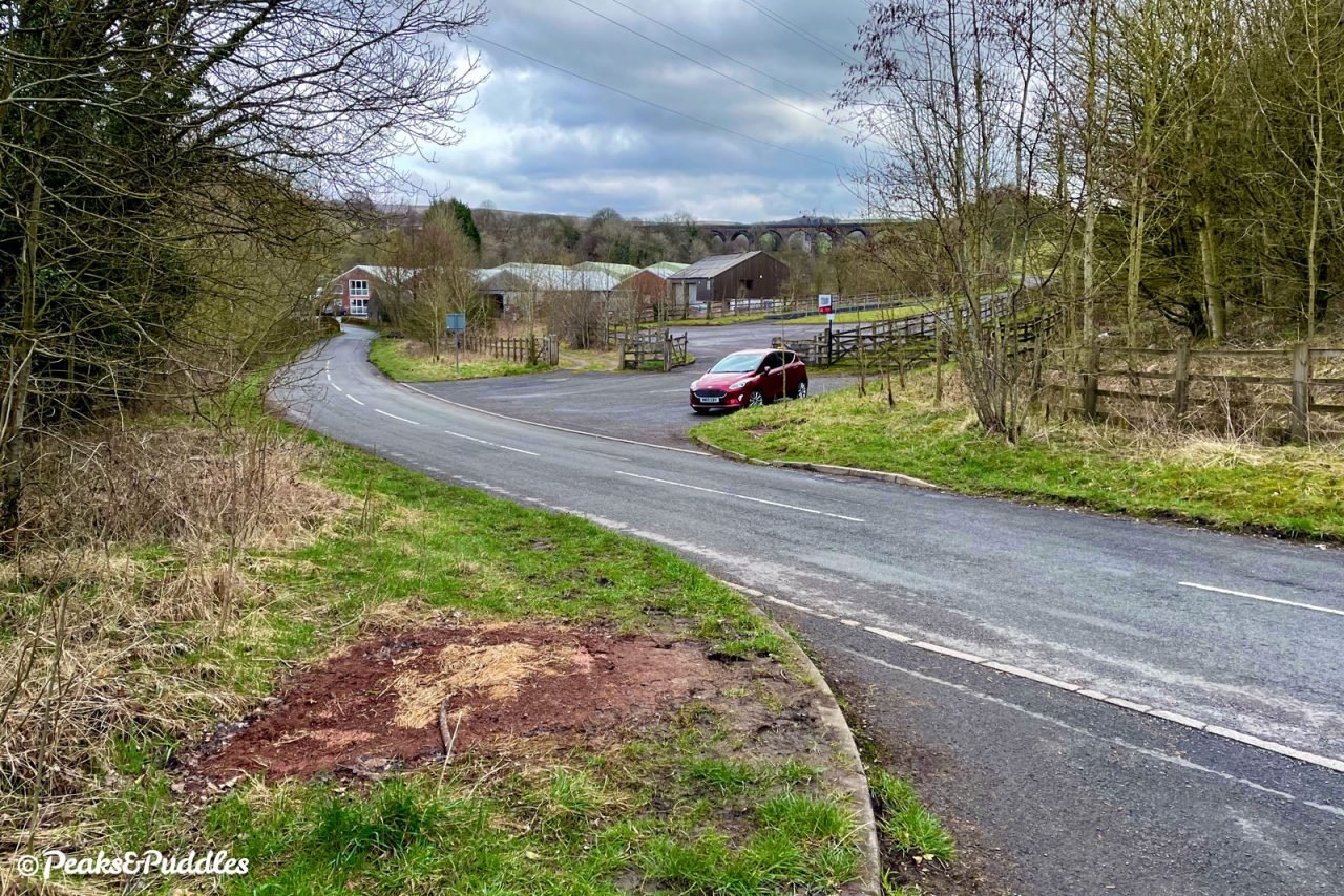
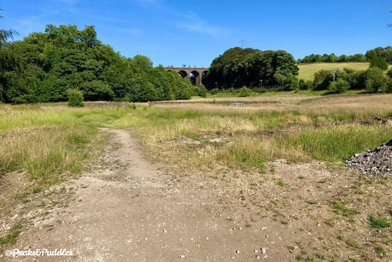
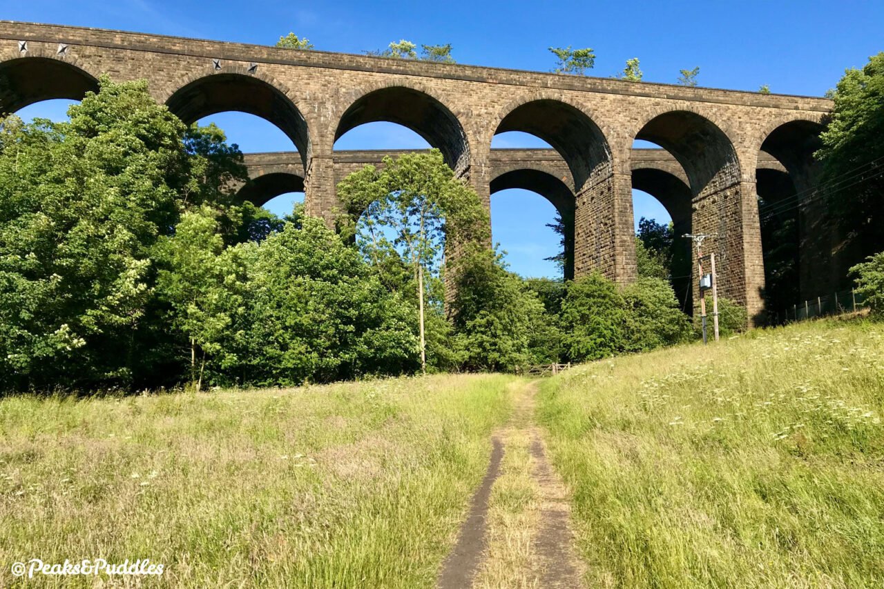
- While the signposted trail takes you further to Chapel Milton, under its unique, curved, double railway viaduct already visible ahead, the route is a footpath only and goes across a grassy field. Frustratingly, the actual line of the tramway ahead was repurposed by Ferodo, a major local employer, as a test track for their vehicle brake pads. Perhaps one day the trail will provide a cycle-able route into Chapel-en-le-Frith or even right out to Dove Holes? For now, turn back and tackle those bumps again before coasting down to Bugsworth like a fully-laden limestone wagon.
More to explore
- Bugsworth Basin
It’s already hard to imagine that this major canal wharf was, for much of the second half of the 20th Century, devoid of water. It miraculously survived the A6 Chapel bypass being ploughed through the landscape and was finally brought back into reliable use for narrowboaters in 2005. It now provides them with a water point and services as well as a canal shop for visitors and, on certain days, a temporary shipping container which opens to reveal a wonderful exhibit by the Bugsworth Basin Heritage Trust on the history of the basin and the tramway. They’re one day aiming for a permanent visitor centre. - Upper Peak Forest Canal
The most obvious onward route from the tramway is the one the limestone took all those years ago. From Bugsworth Basin you can cycle on towpaths all the way into Ashton-under-Lyne and Manchester city centre, but for a scenic start with history and wondrous views around every corner, the upper canal at least is absolutely not to be missed. - Chinley
Though burgeoning in size thanks to new developments on its former mill footprints, Chinley retains a small village feel with a good assortment of local services including, at last count: a café, convenience store, fish and chip shop, takeaway, pharmacy and of course the Chinley Cheese Post Office-turned-deli. There’s a cycle parking stand beside the red phone box on Green Lane, which is the best route to climb into the village from where the trail crosses Whitehough Head Lane. - Whitehough
Turn right (or south) off the trail at either of the roads after Stephanie Works and climb the short hill to be treated to two popular pubs under the same ownership: The Old Hall and The Paper Mill Inn. As you sip a drink in the sun, the view back down Whitehough Head Lane with Chinley Churn peeping above the quaint stone cottages is pure Peak District magic (and yet you’re not even in the National Park!)
Recommended rides
Find all routes featuring the Peak Forest Tramway Trail.
- Peaks and Perry Dale
The trail forms the start of a challenging ride out into the white limestone Peak, passing both the quarries which brought about the tramway and where it once crossed over a road in Dove Holes.
Further reading

The Peak Forest Tramway by D. Ripley
Almost a brief as the current trail itself, this 27-page booklet is nevertheless crammed full of detail on the route right out to Dove Holes and how it was worked with a handful of rare photographs, diagrams and route plans to bring the line to life. (A newer edition is also available.)

The Peak Forest Canal and Railway: An Engineering and Business History by Graham Boyes and Brian Lamb
Covering not just the full length of the canal from Ashton-under-Lyne out to the High Peak but also its (two) tramways, this essential history of the route focuses quite heavily (and wordily) on the operational and business side of things, but is still well worth tracking down for anyone inspired by the endeavour and keen to delve deeper, with plenty of interesting photos and plans.
Original photography, words and design by Anthony Sheridan unless indicated otherwise. Found this guide helpful? Buy me a coffee to help keep the wheels turning!
The all-important disclaimer: While great care and attention has been put into gathering these routes, ensuring details are accurate and determining their suitability, all information should be used as a guide only and is not a replacement for using your own judgement or research when setting out on new adventures. Peaks & Puddles/the author cannot be held responsible for any issues that may arise from the riders own decision to ride a section of indicated route.
Always ensure your equipment is safe and legal for use and that you are well prepared, carrying everything necessary including access to a good map. Follow the Highway Code and the Countryside Code at all times. Respect the landscape, the wildlife and the people you encounter. And after all that, have fun!