Update: We’re now in September 2021 and the road is… still open. Which has obviously been a relief for many people who walk and cycle up there, but it’s not clear why Derbyshire County Council’s closure notices were so confused on this and why they couldn’t pin down a more certain, shorter set of dates from the start.
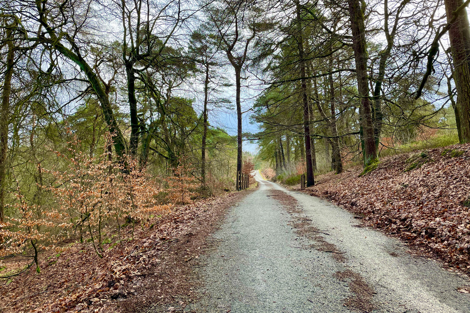
Derbyshire County Council has authorised a five month closure of the unnamed one-way road from Errwood Hall to Derbyshire Bridge for forestry works. A beloved route for cycling out of the Goyt Valley into the wider Peak District, its closure will potentially leave few alternative routes for an entire summer of cycling.
The closure order, posted online and in small print at the road itself, spans from 24th May to 31st October 2021, with the specific bold notice at the top: “no access for cyclists.”
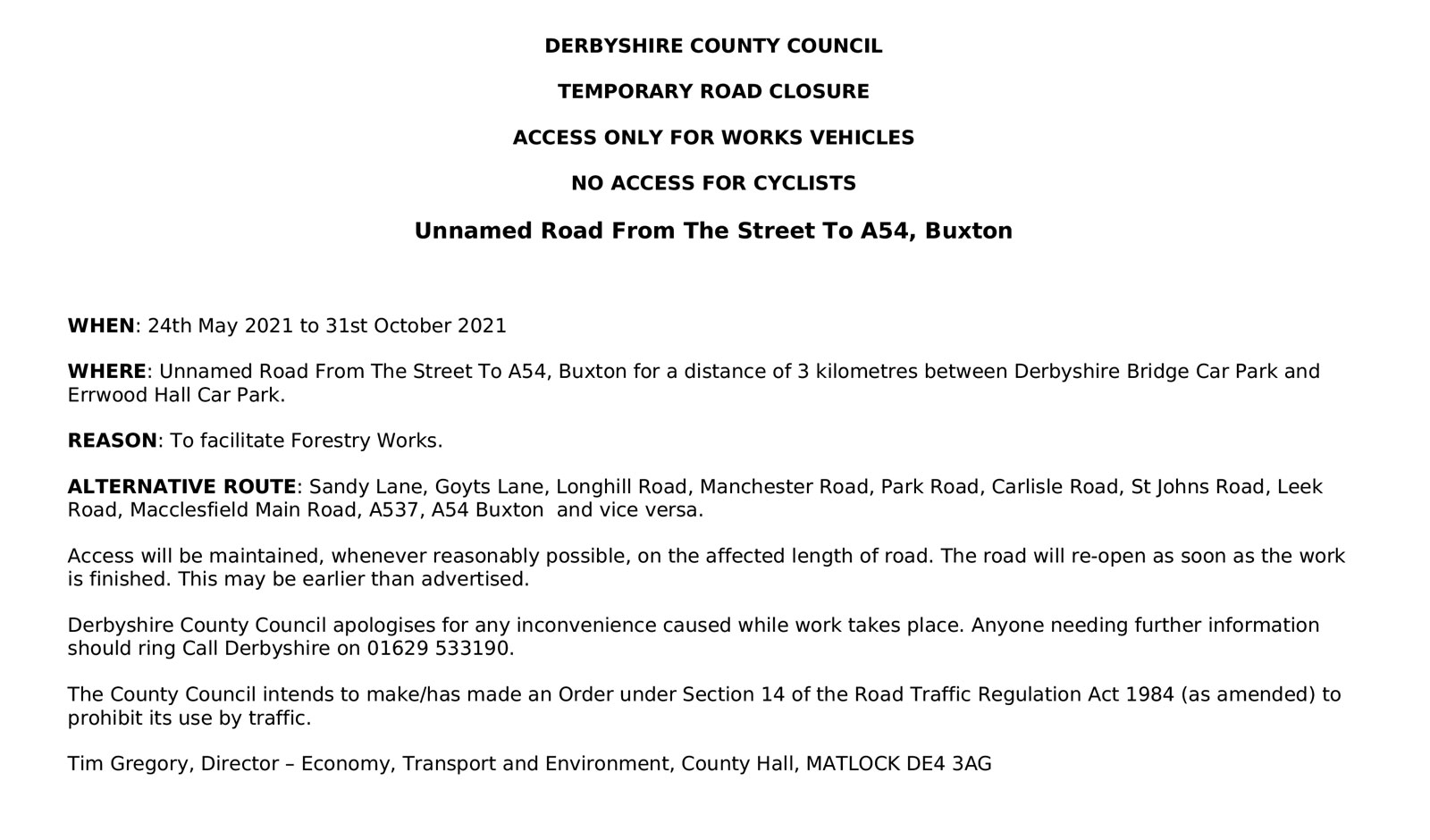
This is notably at odds with the forestry works which took place either side of the unclassified road running across Hoo Moor to the north last year, when access for pedestrians, cyclists and equestrians was maintained throughout (and, in fact, this formed part of the diversion route despite being used by heavy wagons).
The new closure order makes no mention even of pedestrian access, so it’s unclear whether it will even be possible to push a bike through the closure or use this popular walking route, one of very few to access the upper valley.
While it remains to be seen just how stringently access will be blocked to cyclists, or if the five months allotted is a generous estimate, the potential disruption to local leisure cycling and cycling tourism in the area over an entire summer could be terrible.
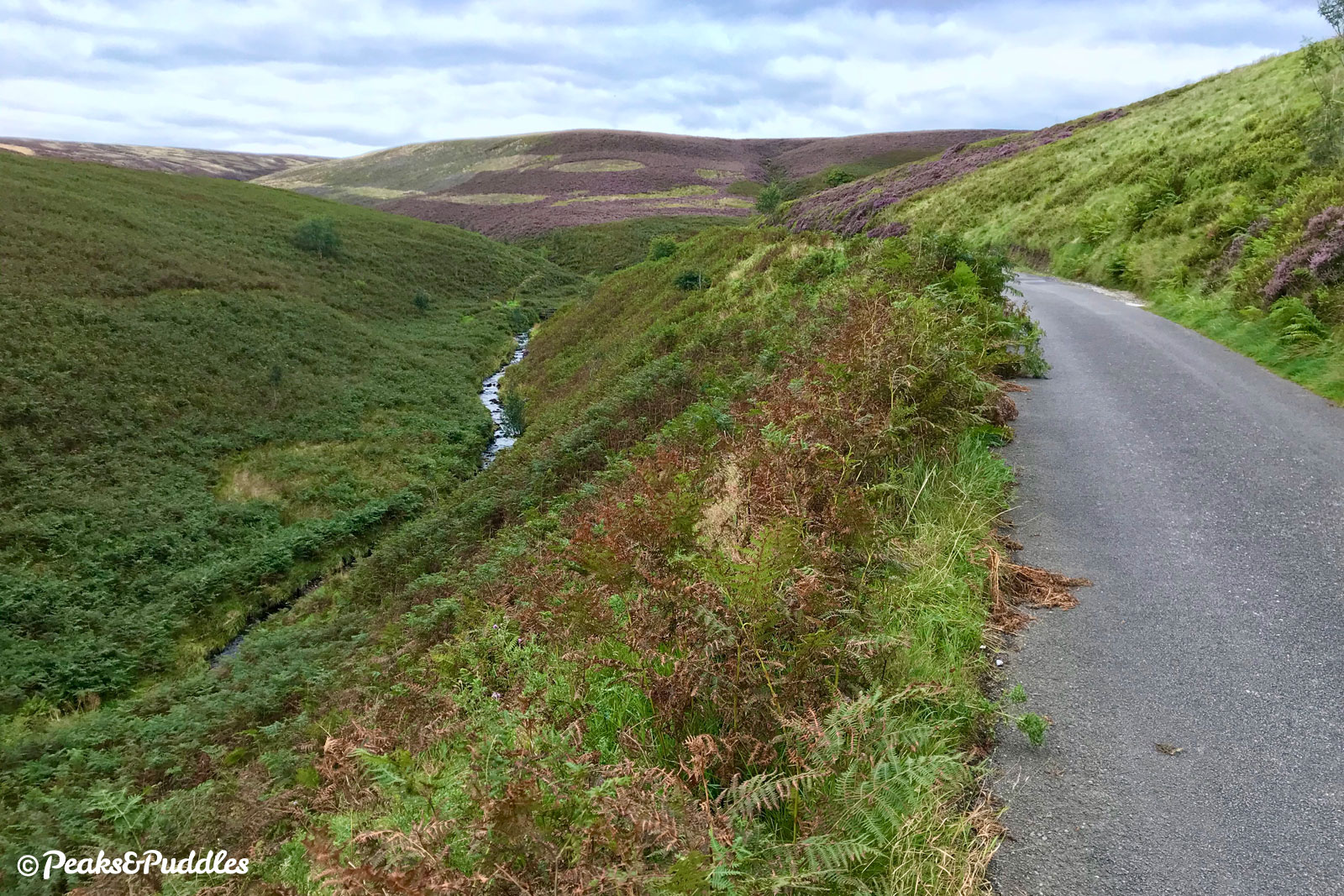
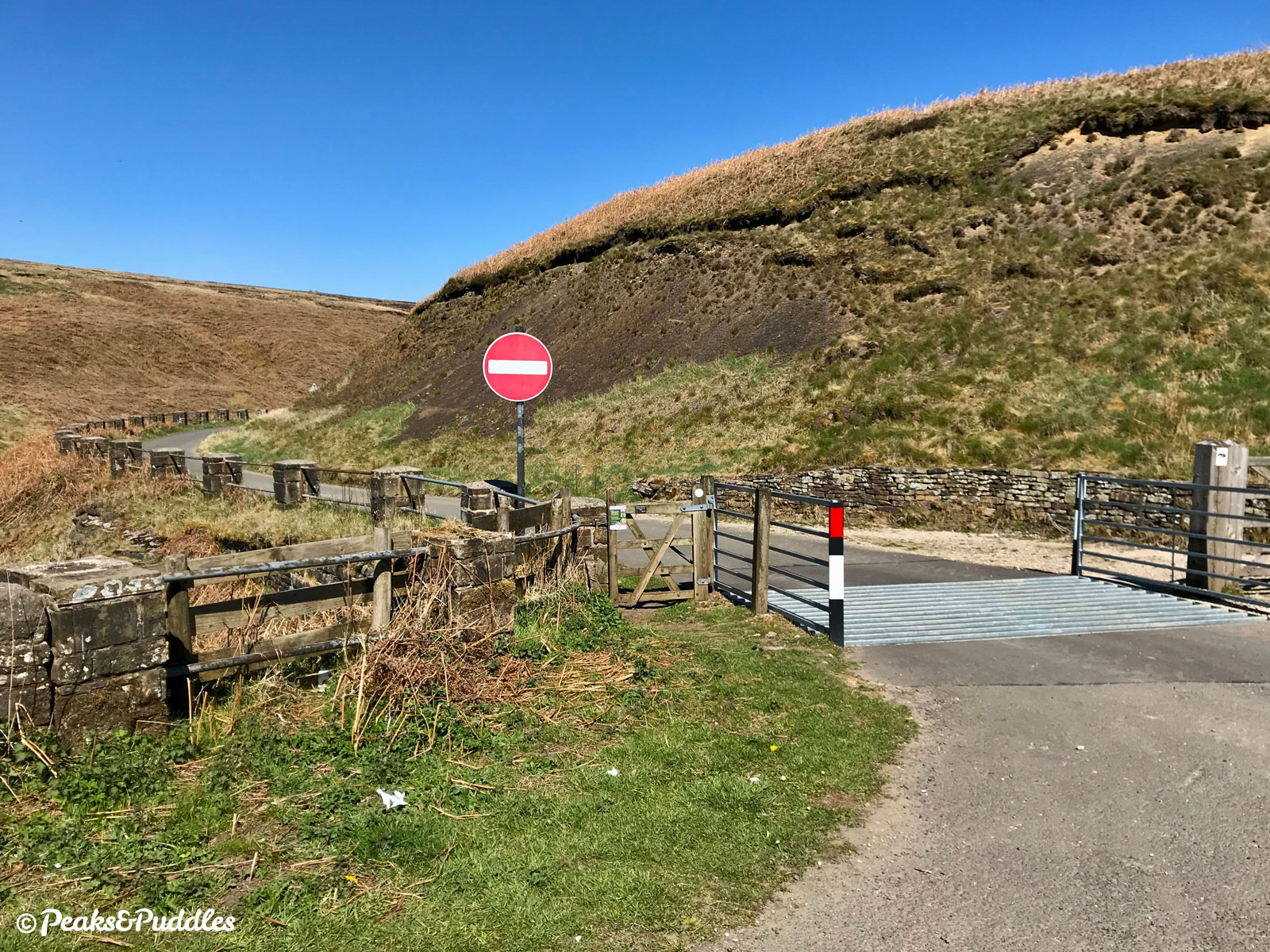
The road already suffers from being made one-way in 1980 (including for cycles, who are not legally exempt) making it a block in the landscape for two-way leisure cycling. The only alternative routes involve sections on the intimidating A5004 Long Hill (and a drop into and out of the “Buxton bowl”) or the notoriously dangerous A537 Cat and Fiddle. In authorising this very unclear — and potentially very long — closure, Derbyshire County Council appear not to have considered cyclists’ needs whatsoever.
Similar closures have taken place on the roads and tracks around the Upper Derwent Valley in recent years, with strict blockage of access to all users, but these seemed to have much shorter durations and even had allowances like making sure the route was re-opened for certain weekends.
I’m going to attempt to ask Derbyshire County Council for more clarification about the scale of the works, whether foot traffic will also be blocked and how much it may be possible to “reasonably maintain” access during the closure for cyclists, making clear how vital the route is to so many in accessing the wider Peak District by bike. If I get anywhere, I’ll report back. (And if you want to do the same, go for it!)
Unnamed and unnecessary for cars?
One thing this potential summer-long closure does prove is that the unnamed, mountainous pass of a road clearly serves no purpose as a through-route for motor traffic, if they can close it for such a lengthy period again.
From September 2019 to the end of May 2020, it was closed while the council waited to complete subsidence works. During that closure, it became a beautifully peaceful, two-way traffic-free paradise for cycling, walking and wheeling.
If you follow Peaks & Puddles on Twitter, you might remember the petition this triggered: Keep the Upper Goyt Valley road to Derbyshire Bridge traffic-free.
Admittedly derailed slightly by the pandemic, personal life, trying to make headway with everything else (including starting this website) and a desire to want to do it right, it does now seem a good time to finally submit this, especially as the upheaval of county council elections is out of the way.
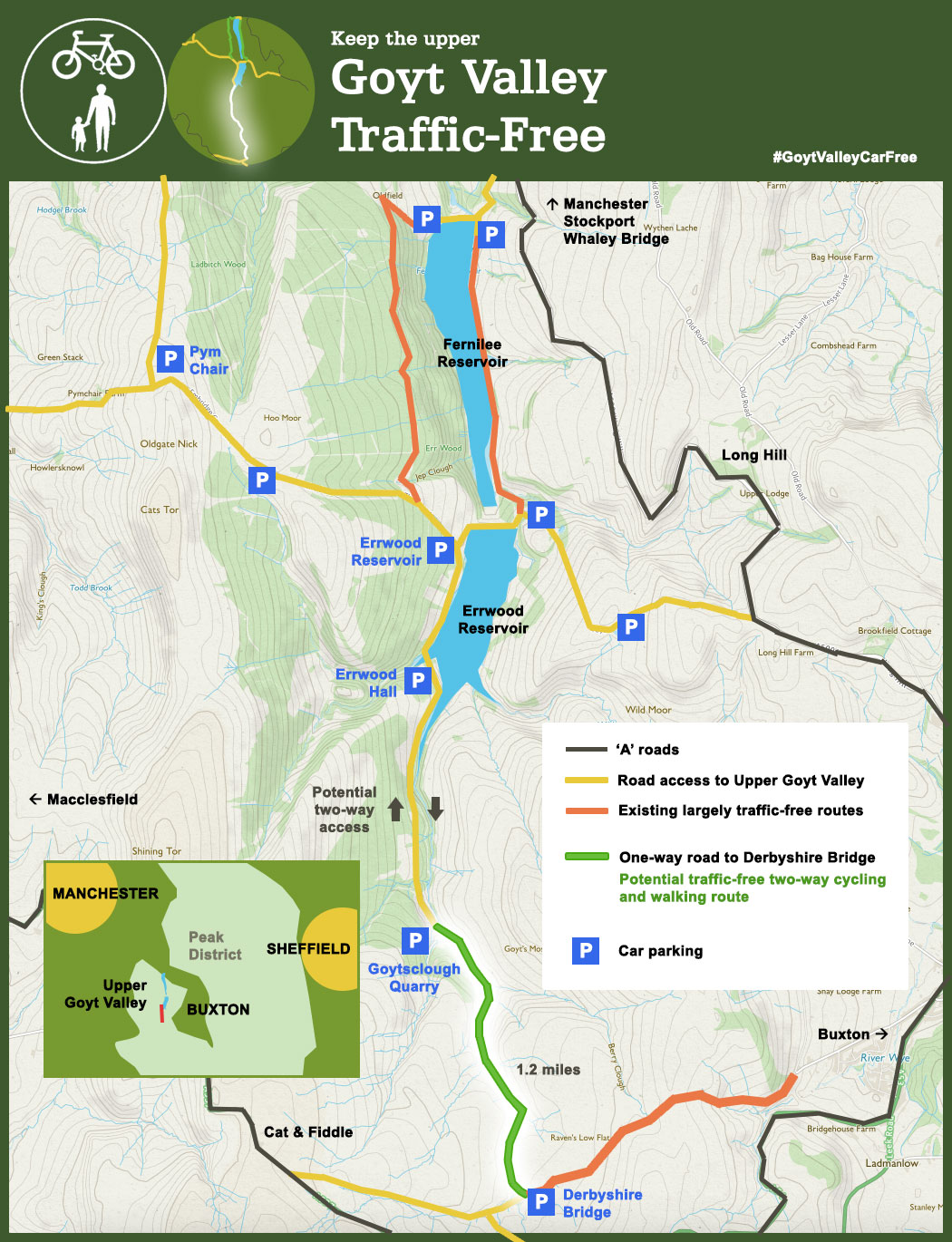
One change I plan to make to the proposal, following various feedback received, is to just focus on removing cars from the section between Goytsclough Quarry and Derbyshire Bridge. Despite the overwhelmingly positive response of 1,695 signatures in support (far more than I ever imagined), a very small number felt closing the entire road up from Errwood would “remove access” and make it difficult for some people to access the popular area around the packhorse bridge. I can understand that.
So as a compromise, allowing people to drive up as far as Goytsclough Quarry, where there’s space for parking and turning, seems reasonable. This part of the road is slightly wider and has some passing places already, so making it two-way wouldn’t cause problems on weekdays (the National Park Authority might still want to close it entirely on weekends, as they already do on summer Sundays).
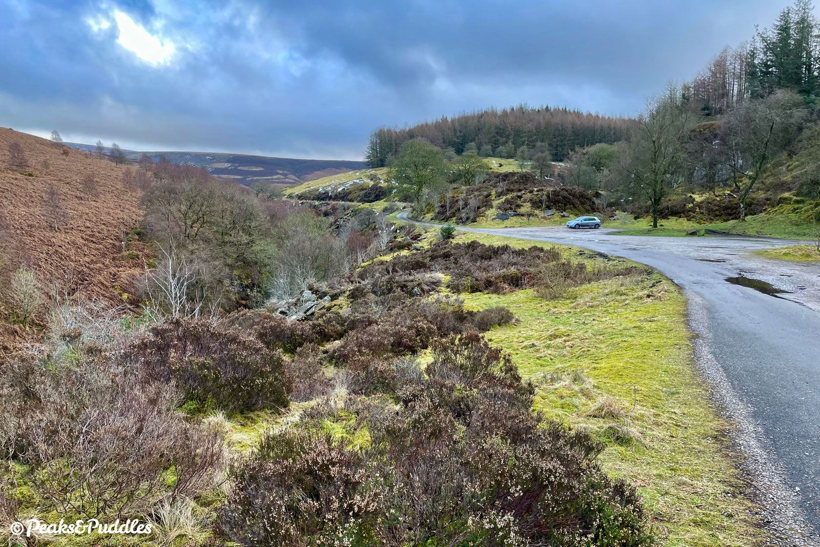
The much narrower, hairier road beyond the packhorse bridge, just an easily walkable or wheel-able 1.2 miles between car parks, would then be a protected traffic-free oasis, with access maintained for emergency and maintenance vehicles when necessary — like these works just announced.
As well as permanently removing the noise, damage and danger of impatient through motor vehicles from the very special upper valley, this would finally return a vital two-way cycle route that has been taken away from us for 40 years — an amazing new Peak District cycle link at almost zero cost.