My Peaks & Puddles Pocket Guides condense each route into handy downloadable and printable booklets, like a mini e-book for your phone or a two-page cheat sheet for your back pocket.
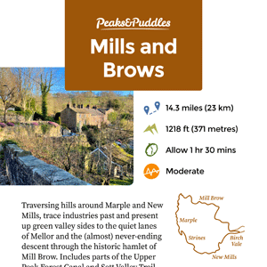
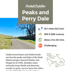
Each one includes a custom-designed map and simplified turn-by-turn directions for the route, split into logical stages. I’ve also thrown in a few fun facts and sights to see where possible.
See below for tips on how to download, view or print the guides.
These first launched a couple of years ago and I’m really grateful for the support with them. I’ve paused on creating any new editions for now to focus on other things. They’re so time-consuming to create (especially when I then decide to change routes or designs afterwards), but it’s an idea I’d like to return to and complete with a fresh mind and hopefully more efficient process in future.
Complete Collection

All the Pocket Guides in a single .zip folder.
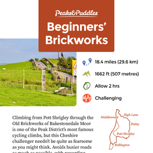
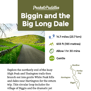
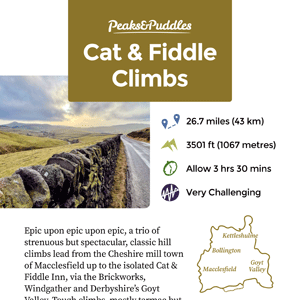
The Guides

How to Use
Mobile guides: I strongly recommend saving the files to your actual phone rather than just having them open in a browser, in case they’re lost mid-route somewhere without signal!
On a phone, it’s usually a long-press of the link above then select “download linked file” or similar, which will save to your Files.
You can also open the PDF then select the share icon (square with an arrow) to save to an app such as Books, which may be better to organise and view the guides.
Print guides: select double-sided (aka duplex) printing if possible and print to 100% size on A4 with no borders. If no double-sided option, print one page at a time. Fold twice for a neat pocket-sized guide. I’ve tried to make sure the maps are just as legible in black and white, but they will work better in colour. After you’ve used the guide, why not pass it onto a friend?
Be sure to save the link to this page: you can return here anytime to download the guides again.