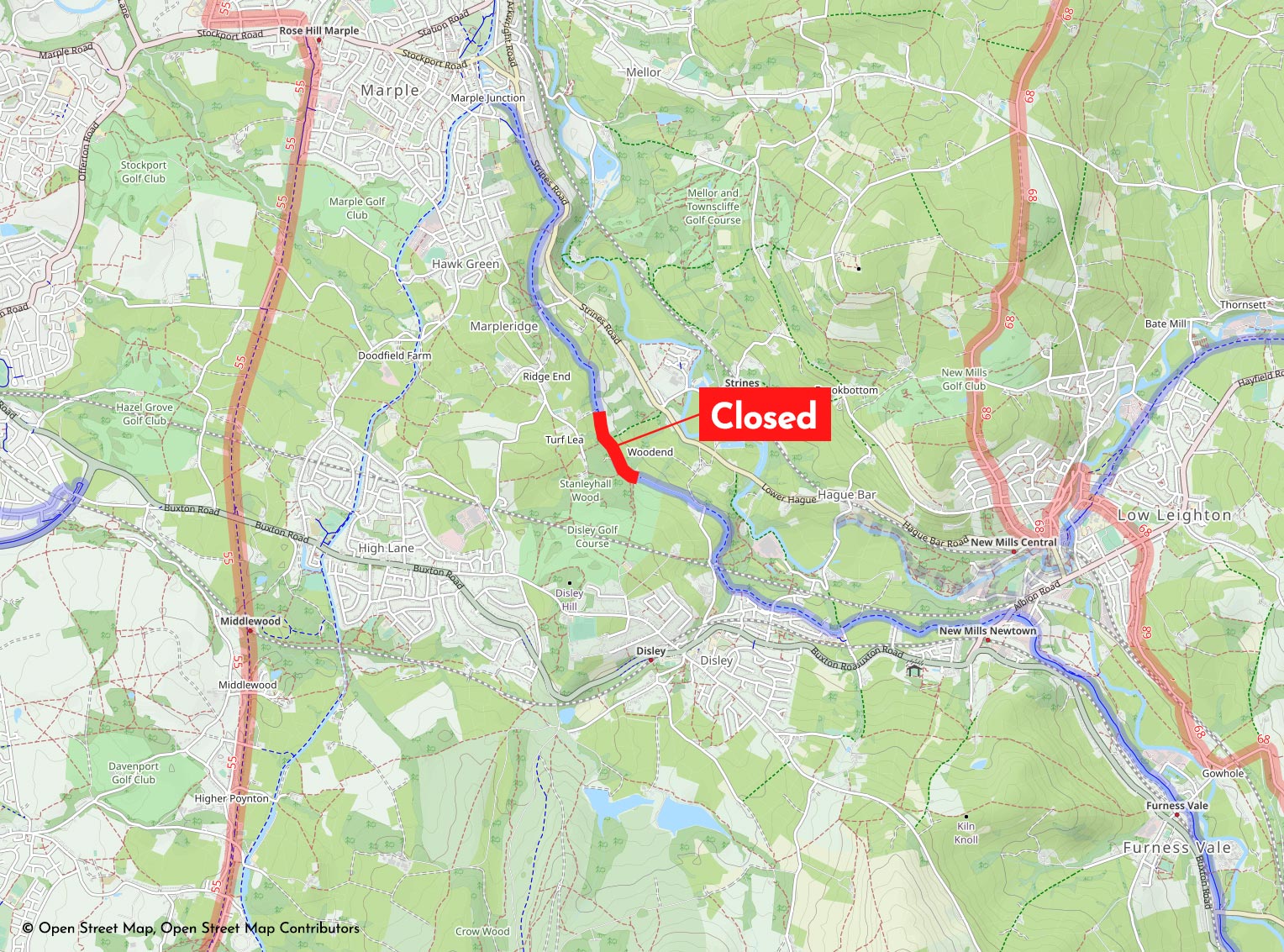
A complete closure of the Peak Forest Canal towpath south of Marple is in place for many weeks ahead, blocking a vital safe route for cycling between Stockport, Cheshire East and the High Peak.
• Follow me on Bluesky for the latest on this story
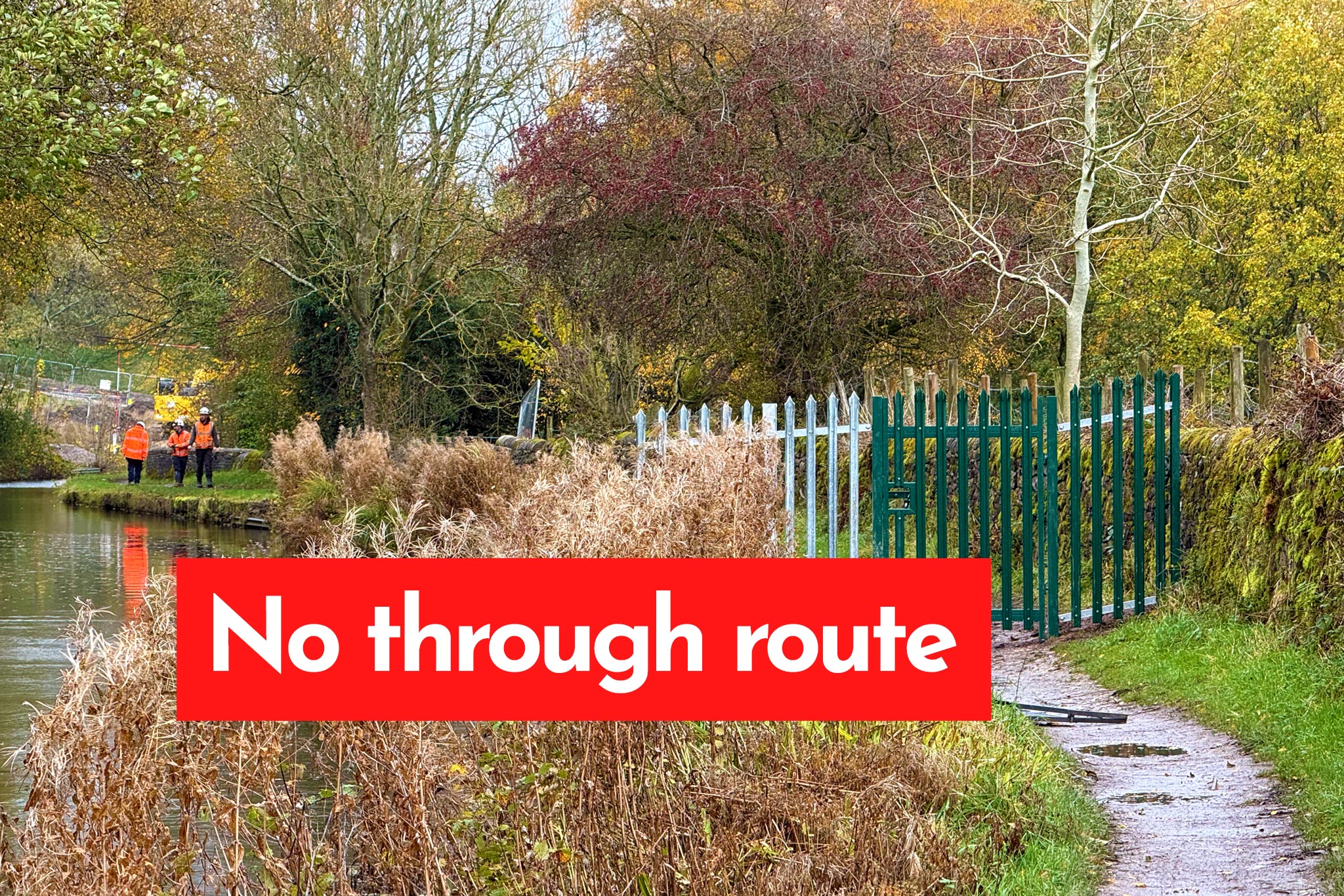
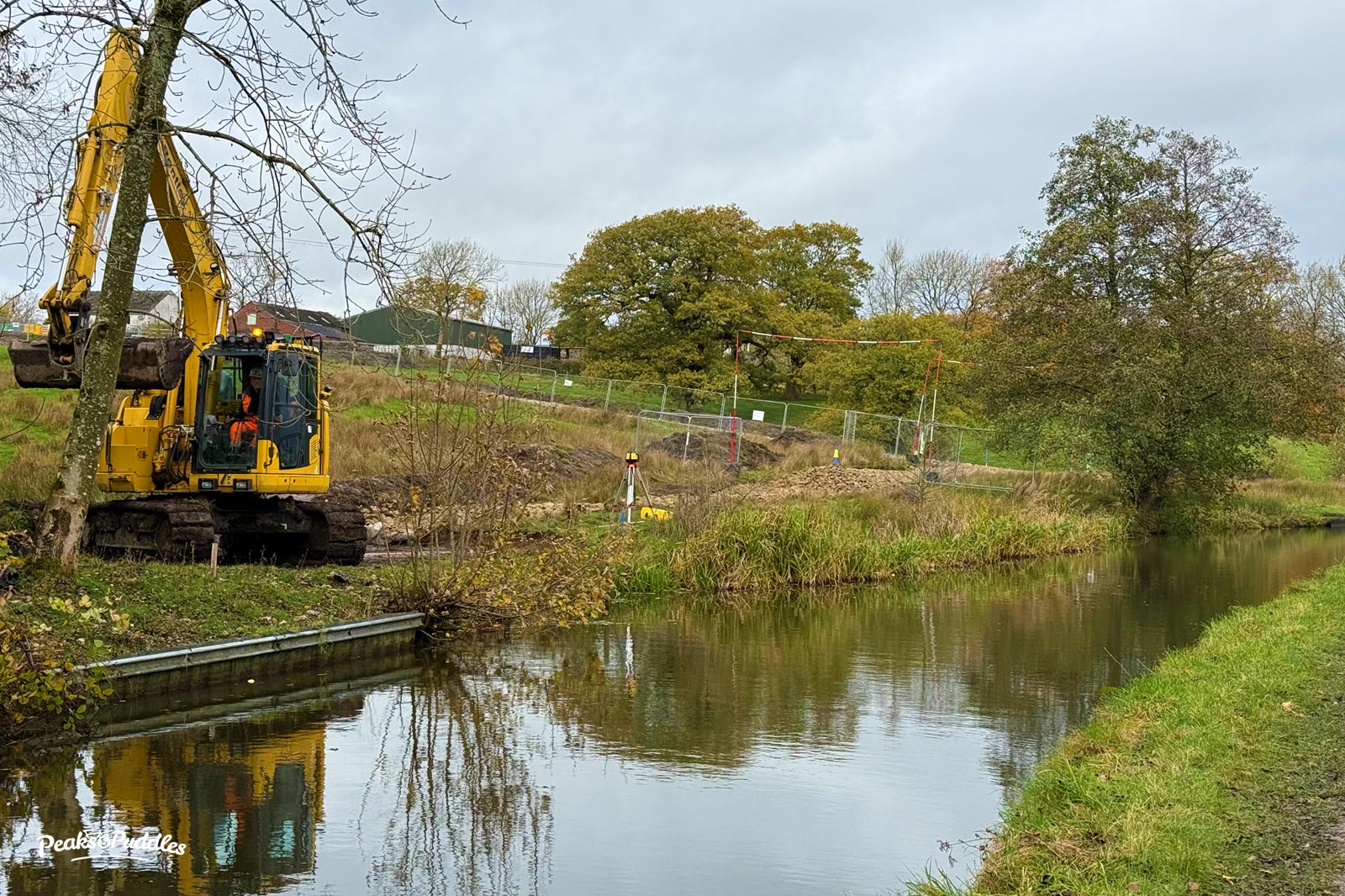
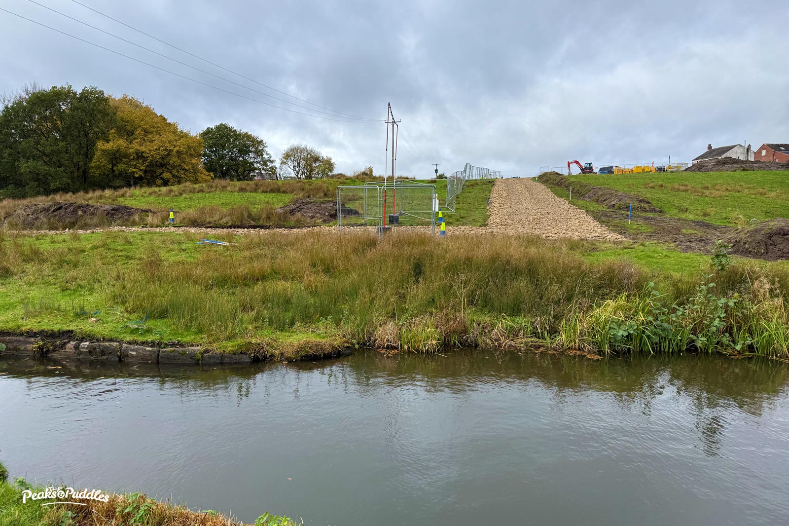
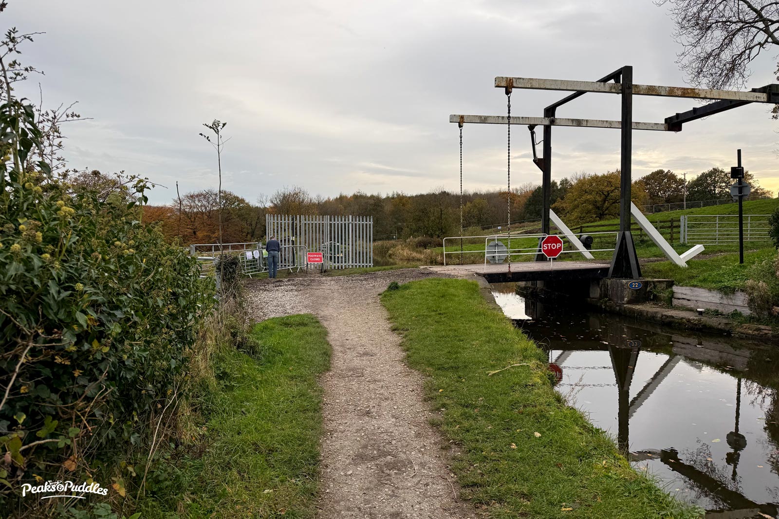
Canal & River Trust closed the towpath between bridges 22 and 23 at Turf Lea, above Strines, on 27th October to enable the start of major culvert and bridge repairs. On Monday, 3rd November they blocked it completely with gated metal fencing. There is now no good, off-road route between Marple and Disley and due to the topography of the area, a serious inconvenience for cycling in particular.
The Canal & River Trust stoppage notice has an end date of 19th December, meaning the towpath would be closed for eight weeks in total. I contacted them for clarification, as the wording isn’t clear if this also applies to the towpath or if this is even the full extent of the works required.
All they could say is that it’s 19th December “as far as we know” based on that same web page.
Both Stockport and Cheshire East councils have issued the unhelpful standard six-month footpath closure notices, with Cheshire East’s for some reason stating an expected completion date of February. There is no other signage from Canal & River Trust on site to explain the closure or provide reopening dates.
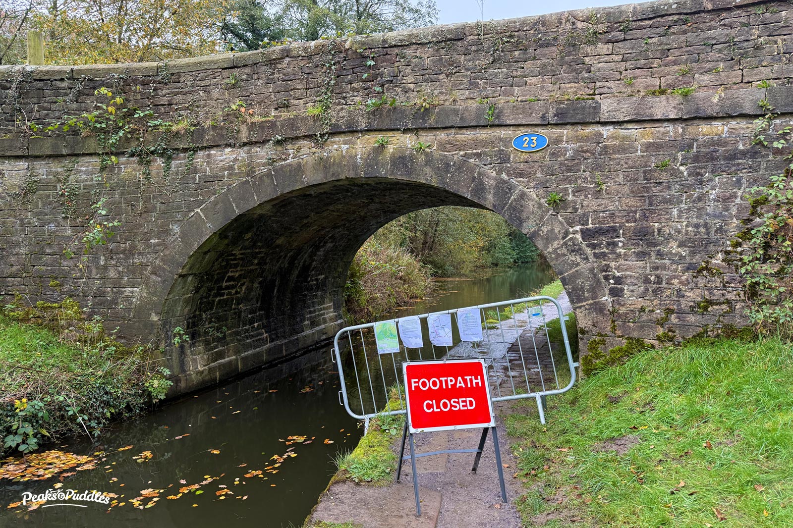
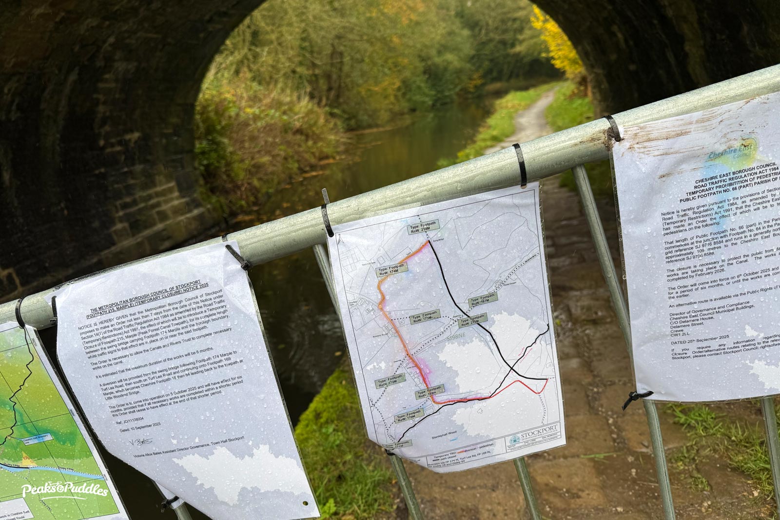
Over a week in, still no warning signage whatsoever is in place any further back along the towpath before the closure itself, allowing people to make an earlier diversion. This week I’ve seen numerous people on cycle and foot approaching oblivious and then confused by the tiny diversion map. No wider publicity about the closure (barring the statutory closure notices hidden away on council websites) has been posted elsewhere, such as online social channels, by either the Trust or councils.
The work taking place we can all understand, but not adequately informing people any further back along the path is an absurd omission by the project team and just creates frustration and more inconvenience. A few extra laminated sheets of A4, is it that hard?
A few years ago, the adjacent Strines Road was closed for culvert works (possibly the same watercourse!), preceded by months of advance warning, letters to residents and multiple giant electronic signs placed miles away either way. Truly, those of us using rights of way for transport count for nothing.
Many of us rely on this towpath as an essential transport route for getting to work, family, shops and so on: this being entirely due to the councils (Stockport, Cheshire East and Derbyshire) never having provided any good, safe cycle infrastructure in this busy A6/B6101/Goyt Valley corridor.
The trio are all so happy to lean on the struggling, underfunded, historic canal for a just-about-OK permissive cycling route when it works for them but then dump us with no help when it breaks. For me it’s a vital route to shops and services and to visit family, so in the run up to Christmas this couldn’t come at a more inconvenient time, especially if I might want to be cycling back after dark.
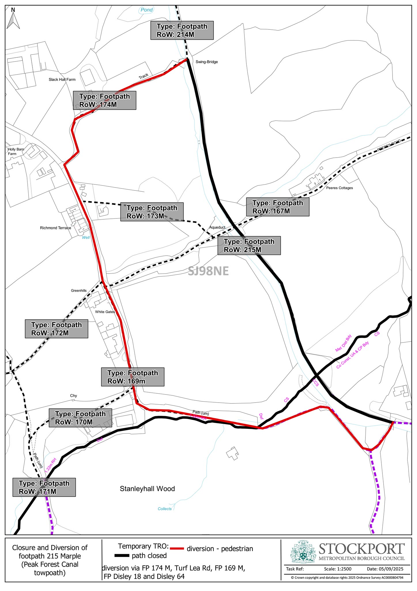
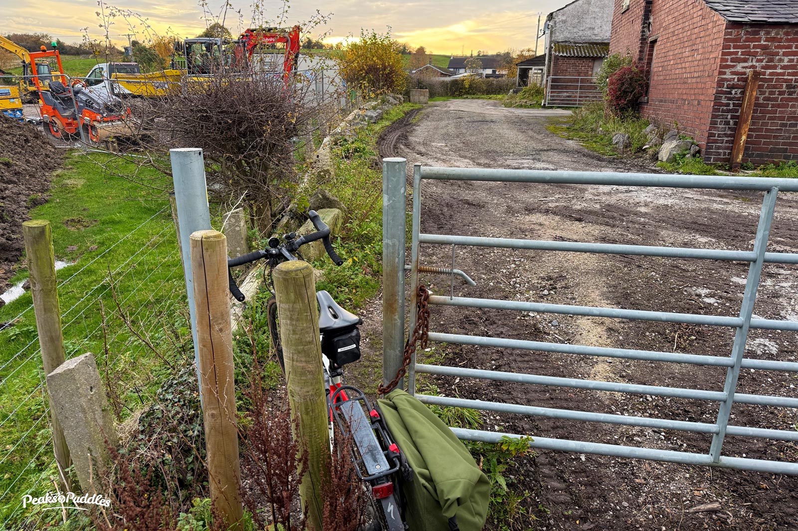
The convoluted footpath-only diversion agreed by Stockport and Cheshire East councils is unsuitable for cycling and indeed anyone using a pushchair or mobility aid, or even not particularly sure-footed. It is just possible to lug a light bike, if you are able to, patient enough and not bothered about getting very muddy shoes nor tripping down a slippy slope. Nor carrying a heavy pannier. Nor travelling after dark. No one has thought to add signage en route (again compare to a road closure), so if you’re not familiar with the area make sure you memorise it.
From Stockport to Cheshire East, the diversion includes: a steep climb up a muddy farm track, a very narrow squeeze around one (if not two) locked farm gates, another muddy track, a very narrow and muddy slope down into woods which is almost stepped but only thanks to a tricky surface of wet rocks and tree roots, a woodland path crumbling in three places which then reaches a wet bog, a muddy and slippy grass slope, and finally a very high wooden stile with slippy and broken steps.
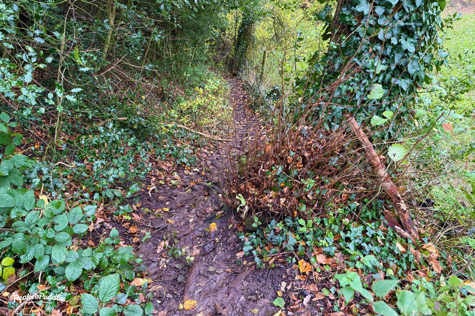
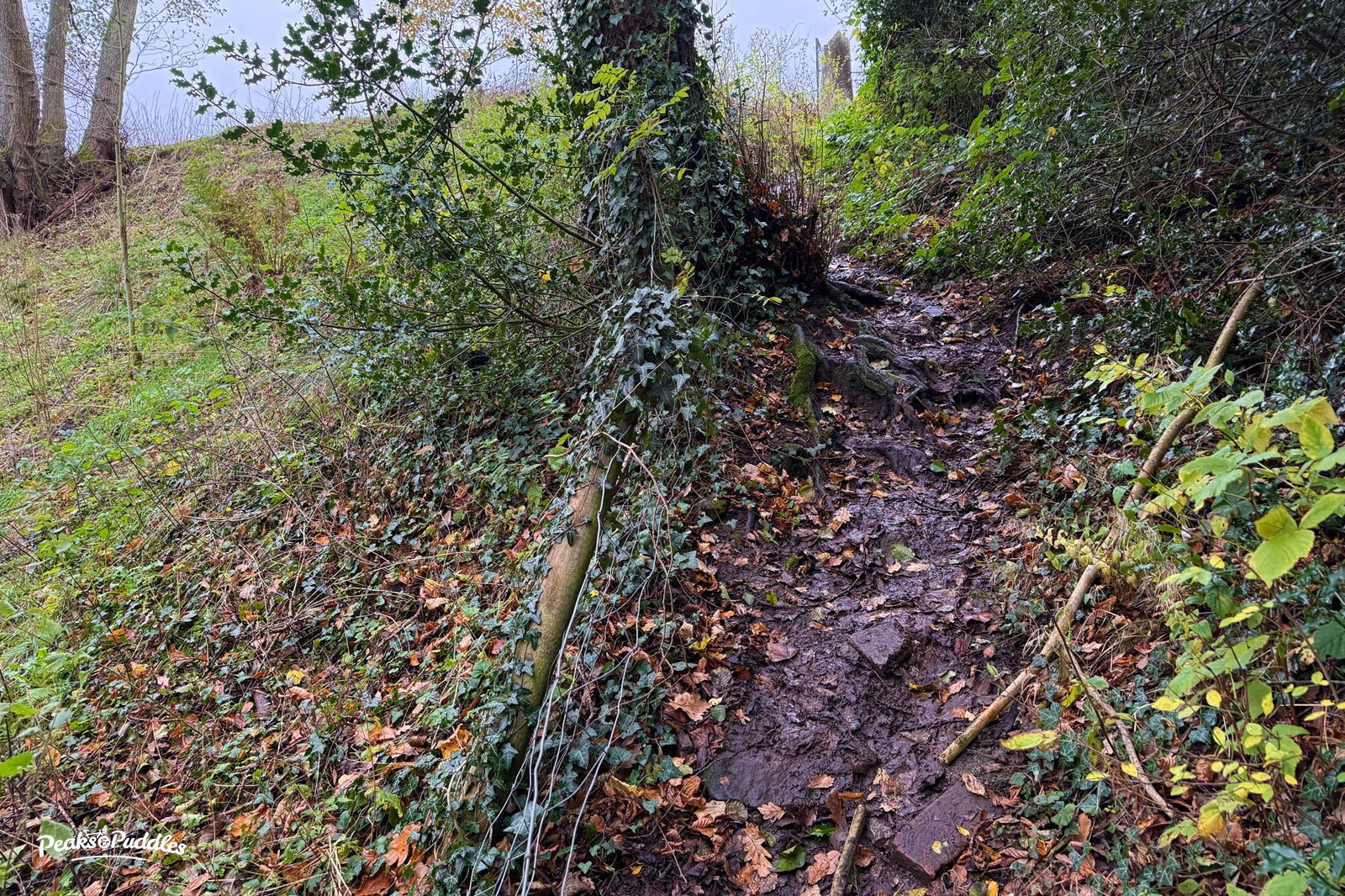
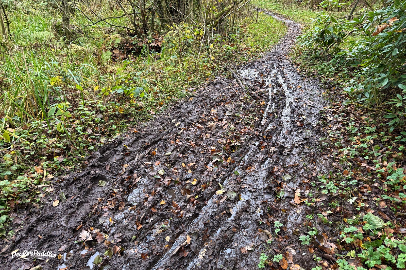
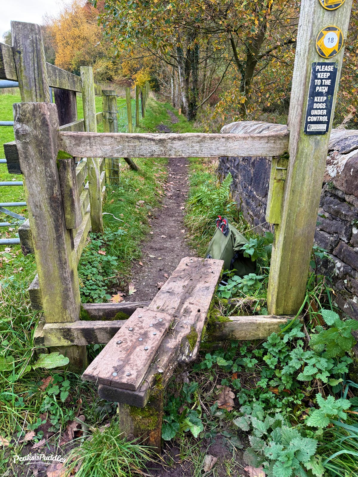
No work has been done whatsoever by either council to inspect or improve the longstanding poor condition of these rights of way in advance of them being a diversion for such a key route. Of course it is a ‘footpath’ (one I actually always enjoy when I’m not trying to hike a bike over it), and the accepted standards of those can vary wildly, so perhaps the main point here is that it’s unacceptable not to at least make people aware when setting out on the diversion that it is nowhere near as accessible as the flat towpath. (Maybe I’ll just take a pen and write that on the signs myself.)
If cycling, there are of course other, but longer and far more strenuous road alternatives of varying enjoyment and hostility levels, sometimes depending on the time of day. Even a Stockport council officer has already admitted to me they’re “not ideal” (apparently without thinking to suggest to their Highways colleagues that temporary measures ought to be put in place to protect vulnerable cyclists now pushed onto them).
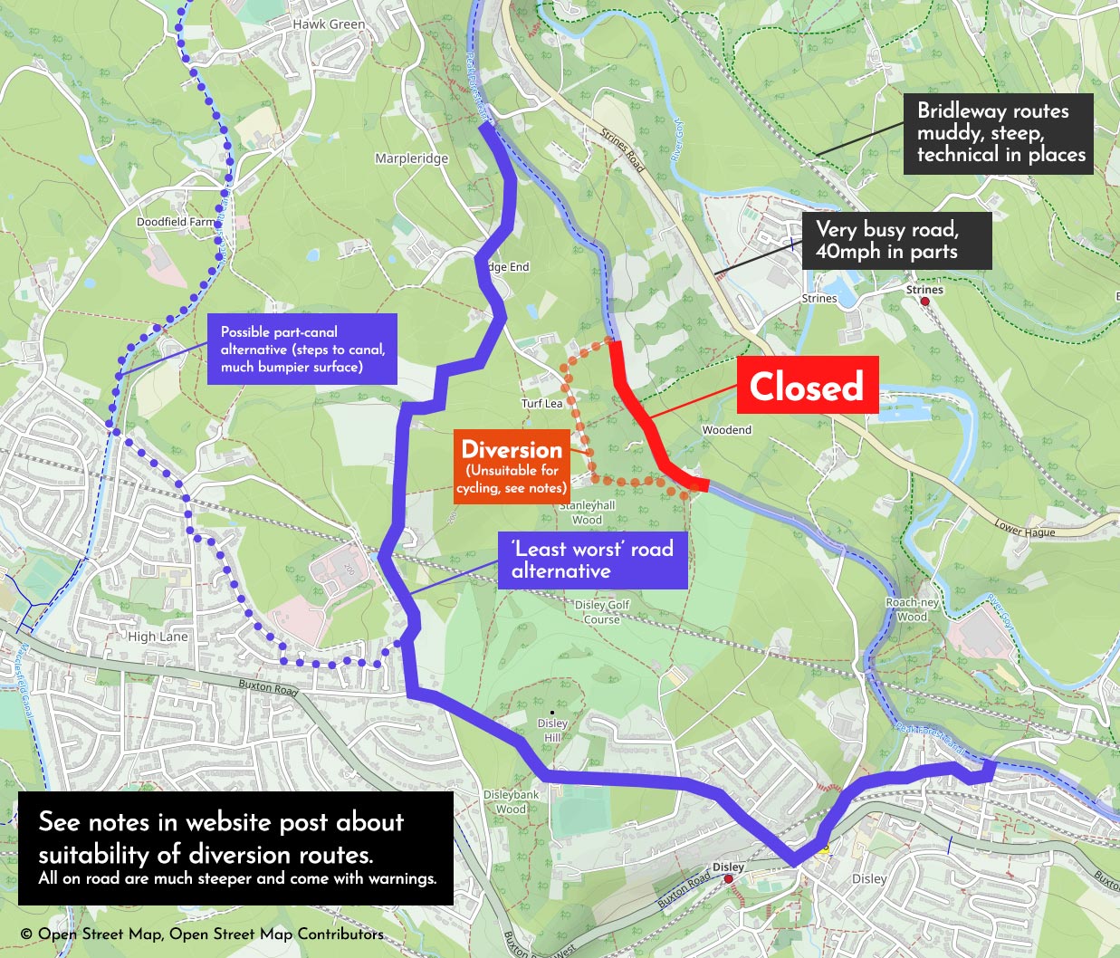
The least worst (but still a rat run) is probably The Ridge-Wybersley Road-Jacksons Edge Road, but even this then requires a short hop on the thundering A6 at Disley and is seriously more hilly and strenuous than the flat towpath.
Leaving Marple south, you can either stay until Turf Lea (noting the mud and narrow squeeze above) or leave the canal earlier at Plucksbridge (Bridge 21) to cross over and climb the very steep but clean and unobstructed tarmac Hollinwood Road. If heading north from Disley, don’t put yourself in the middle of the A6 turning right onto Jacksons Edge, go left just before the traffic lights around the fountain, then right and straight over.
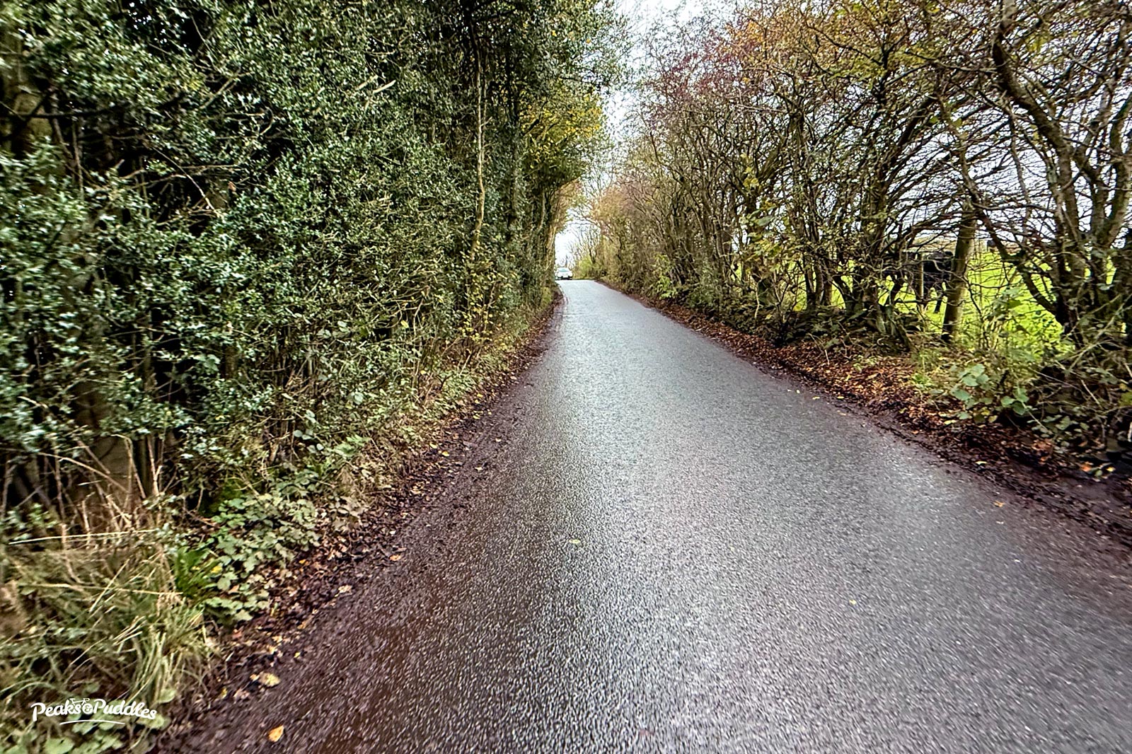
I tried asking Stockport Council to place a temporary speed limit and warning signage on these roads (The Ridge and Wybersley), which are narrow, winding and unrestricted speed. A no-HGV-through-route, it now even has the added thrill of heavy tipper trucks accessing the canal works site, to coincide with the increase in displaced pedestrians and cycles (and regular horse riders). Today I had a reply which managed to completely avoid addressing the actual request while telling me “it is up to the user to decide how they wish to make their journeys in the area if their route is impacted by a closure”.
I’ve now raised the poor handling of the closure with all of the Canal & River Trust, Stockport and Cheshire East councils. None have so far actually committed to improve anything. Not even an extra little sign as you leave Marple or Disley.
I don’t want to be a lone voice so you’d like to contact them to echo these thoughts or explain how the closure is impacting you, please do:
- Stockport Council: carl.amos@stockport.gov.uk, rightsofway@stockport.gov.uk and stockportwalkcycle@stockport.gov.uk, or Cllr Grace Baynham or local Marple South and High Lane councillors
- Cheshire East: prow@cheshireeast.gov.uk or local Disley councillor or ActiveTravel@cheshireeast.gov.uk
- Canal & River Trust: enquiries.northwest@canalrivertrust.org.uk or here
Even if nothing changes by the end of the closure, it’s worth making a point in the hope any future closures won’t be handled quite as poorly as this again.
I’ll post more updates here if I get chance but do see my post on Bluesky for more and follow Peaks & Puddles on Bluesky for further updates.
Peaks & Puddles routes: this closure affects Lyme Loop and Mills and Brows.
For Lyme Loop, you could leave Lyme via the main A6 gate and cross over to Light Alders Lane (following the Lyme Lanes road route over Marple Ridge), rejoining the canal by descending Hollinwood Road if you wish.
For Mills and Brows it entirely ruins the start unless you’re happy slogging over The Ridge and quite unappealing Jacksons Edge Road to Disley. I’d actually rather combine the two routes: go around Middlewood and Lyme, then follow Hollinwood Road at Disley to join the canal from Redhouse Lane or off the end of Duddy Road. Complete a hearty loop all the way back around Mill Brow to Marple.
If you’d like to support what I do with Peaks & Puddles and enable me to keep writing posts like this, a small one-off contribution also gives you permanent access to recommended cycle loops. (At least when they’re not all obstructed by leaking canals and collapsing roads.)