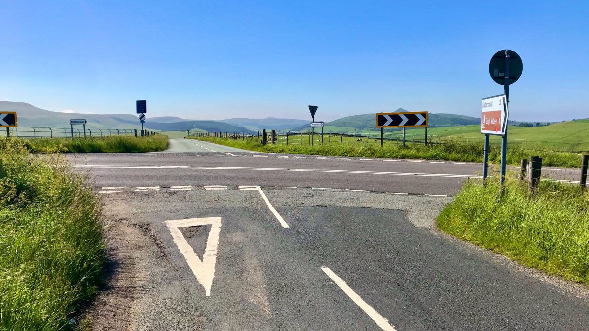
Crest awe-inspiring Peak District summits and descend beautiful quiet lanes on a mountainous ride of climbing endurance around Cheshire’s wilder side. Ticking off the Blaze Hill and Lamaload climbs of the Cheshire Cycleway, a diversion out from the isolated Wildboarclough to Wincle rewards with stunning ridge views.
Route details
- Distance
 23.6 miles / 38 km
 - Elevation Gain
 910 m / 2987 ft
 - Time allow 3 hours
- Difficulty
 Very Challenging
 - Suited to
 All Bikes
  Gravel Bikes
 - Notes Other Bikes: route is accessible to all however, being fully on-road with long climbs, may not be best-suited to other types. Non-Standard Cycles: technically accessible, though steep climbs and very narrow lanes may prove tricky.
- Suggested Start SK10 5DS SJ 9270 7648
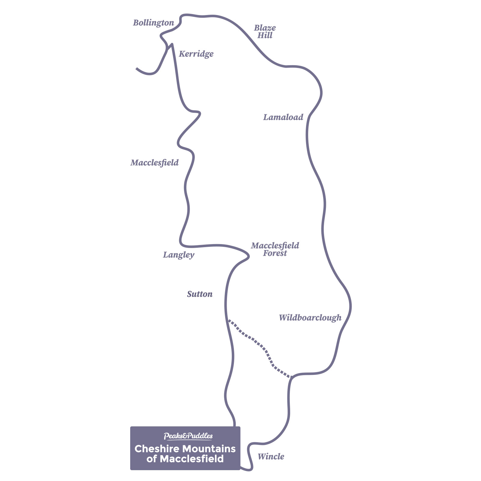
- Places Bollington, Cat and Fiddle, Cheshire, Cheshire East, Kerridge, Langley, Macclesfield, Macclesfield Forest, Rainow, Shutlingsloe, Sutton, Tegg’s Nose, Wildboarclough, Wincle
- Attributes Accessible by train, Car parking, Circular loop, Ideal for electric bikes, Moors, National Cycle Network, Pubs and cafés, Reservoirs, Rural heritage, Steep climbs, Towns and villages, Views of hills and peaks, Views of open countryside, Views of towns and cities, Woodlands and forests
Preview map
How to unlock
To unlock just this route and the in-depth website guide, buy the Cheshire Mountains of Macclesfield Pocket Guide & GPX, or see below to unlock the whole collection for a one-off contribution.
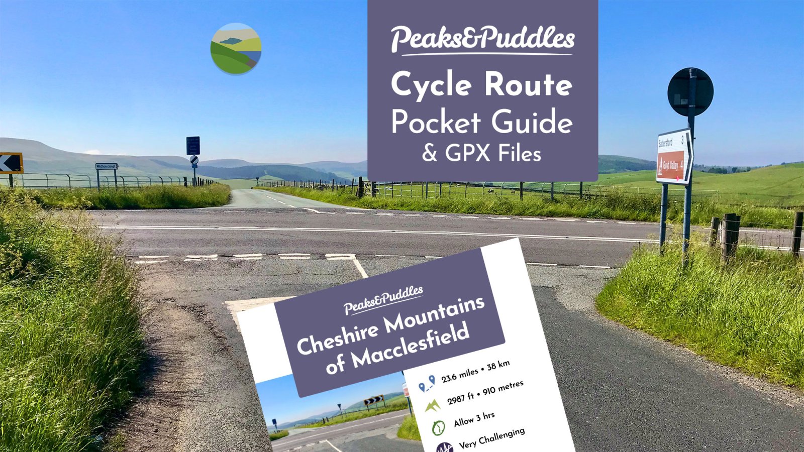
Pocket Guide & GPX
• Downloadable PDF route guides in both phone and printer-friendly formats – includes turn-by-turn directions, a custom-designed map, photos and points of interest
• Navigation files in GPX, TCX and FIT format
• Access to this website route guide
Support the website for £12 to access everything…
Become a Peaks & Puddles Plus supporter for a one-off contribution and you’ll get access to all these exclusive extra pages — plus downloadable, phone-friendly Pocket Guides and over 70 GPX navigation files to take along for the ride.
Peaks & Puddles Plus
• All Plus route pages
• GPX Collection: over 70 navigation files
• Pocket Guides: 10 downloadable, printable guides to the most popular routes
A one-off contribution, supporting my work and website running costs.
What you’ll receive
You’ll be provided immediately with the link to a hidden page where all these extra downloads and guides (marked Plus) can be accessed. Return any time to access new and updated content just thanks to that single contribution. As an extra bonus, I’ve made sure Plus guide pages are completely ad-free.
Thanks for your support!
I’m reserving these original routes and extra pages exclusively for supporters. The one-off contribution supports my work and website costs, with miles of cycling inspiration in return. This online guidebook is still growing, I’m nowhere near done yet, so it’s a great investment in my future plans. Thank you!
Anthony
Original photography, words and design by Anthony Sheridan unless indicated otherwise. Found this guide helpful? Buy me a coffee to help keep the wheels turning!
The all-important disclaimer: While great care and attention has been put into gathering these routes, ensuring details are accurate and determining their suitability, all information should be used as a guide only and is not a replacement for using your own judgement or research when setting out on new adventures. Peaks & Puddles/the author cannot be held responsible for any issues that may arise from the riders own decision to ride a section of indicated route.
Always ensure your equipment is safe and legal for use and that you are well prepared, carrying everything necessary including access to a good map. Follow the Highway Code and the Countryside Code at all times. Respect the landscape, the wildlife and the people you encounter. And after all that, have fun!